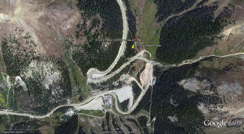
 CODOS Update for Grizzly Peak:
visited March 15, 2012
Summary | Snowpack | Melt Rate | Forecast | Earlier Updates | pdf
Summary
Dust layer D4 (March 6) was observed, with its characteristic brown/pink color, at the surface of the snowcover at our Grizzly Peak CODOS site and on surrounding terrain, where snowcover was present. The very large proportion of exposed bare ground in the Front Range is also likely contributing some additional “local” dust and vegetation material to adjoining snow covered terrain during wind events. Melt-freeze effects on the snowpack were limited to the surface and the snowpack retains cold content. Since our site visit, a new D5 event (March 18) has landed on the D4 surface, entrained in just a few inches of new snow (dust was also reported in Boulder on Sunday, March 18). Dust-enhanced radiative forcing of snowpack warming will resume later this week as D5/D4 re-emerge.
SnowPack Discussion
Total snow depth in this snow profile (pdf) was 41” and mean density of the snowpack was 290 kg/m3 (29.0% water content). Diurnal melt-freeze cycles had produced a strong melt-freeze crust at the surface but the remainder of the snowpack consisted of dry and generally weak “depth hoar” grains. The coldest snow temperature was -10.0° C, four inches below the surface, and the mean snow temperature was -4.6° C. D4 was found in concentrated deposits at the snow surface at this site and in surrounding terrain, where it had deposited in depressions or patches. An additional dust layer, perhaps corresponding to event D1, was clearly discernible six inches above the ground. Another potential dust layer was located 16” above the ground.


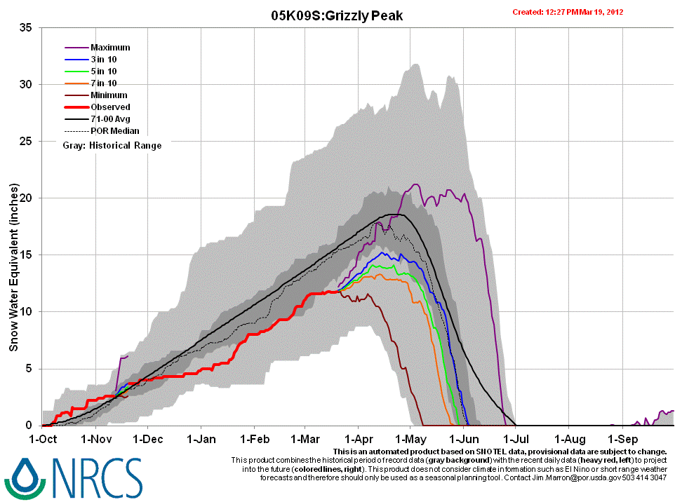
Melt Rate
Grizzly Peak Snotel has reported virtually static SWE since the D4 event, March 6, and tallied only a trace of new SWE on Sunday, March 18, in association with D5. If D5 was deposited with new snow, that D5 snow will rapidly settle and enable D5 dust to merge with D4, enhance radiative forcing, and accelerate the warming of the snowcover to isothermal. At that time, snowmelt rates and SWE losses would also accelerate, given that D5/D4 remains exposed at the snowpack surface.
Forecast
The National Weather Service expects sunny skies and unseasonably warm temperatures to return soon after the current storm clears (Tuesday, March 20). Under the combination of strong solar radiation and warm air temperatures later this week, settlement of any new snow containing D5 will be very rapid and D5 will quickly merge with the D4 layer. Where snowpacks in this locale are at or near isothermal temperatures, solar energy absorbed by the emerging D4/D5 dust will begin and/or accelerate snowmelt rates and SWE losses. Where the snowpack retains cold content, energy absorbed by that D5/D4 dust will continue to accelerate warming of the snowcover.