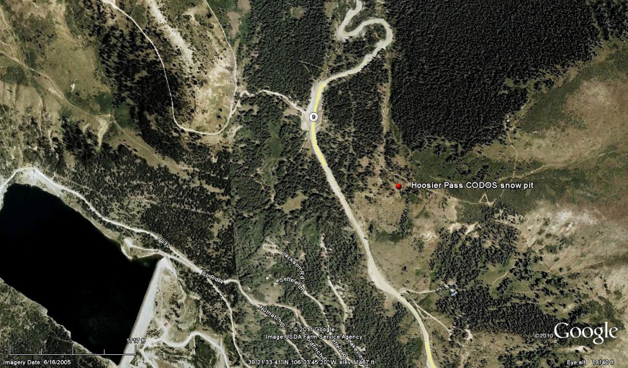
 CODOS Update for Hoosier Pass site:
visited March 18, 2013
Summary | Snowpack | Melt Rate | Forecast
Summary
This field session at Hoosier Pass, our first of the WY 2013 season, found very similar conditions observed to those observed a year earlier. The snowpack still retains cold content and will require additional warming to become isothermal. No clearly discernible dust was observed in the snow profile.
SnowPack Discussion
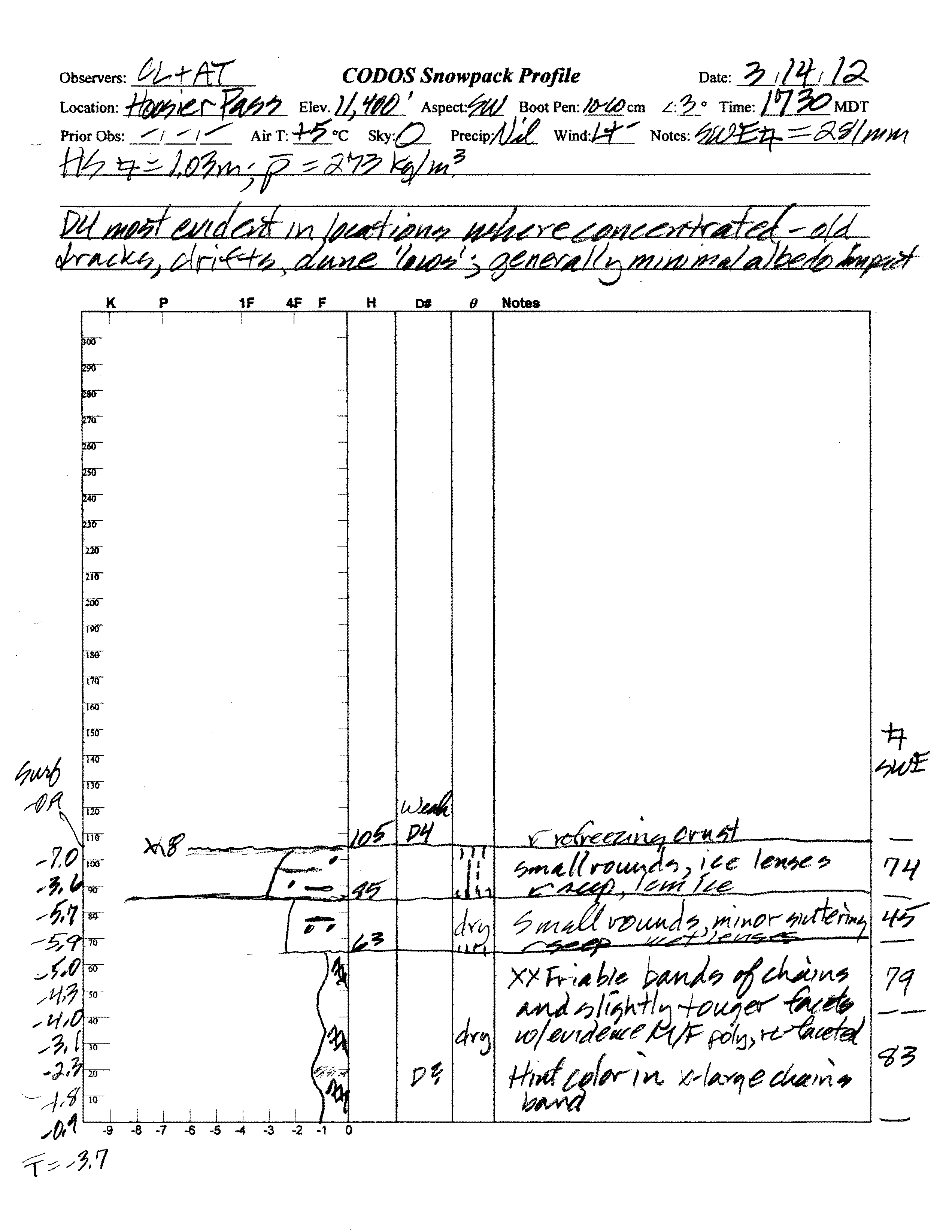
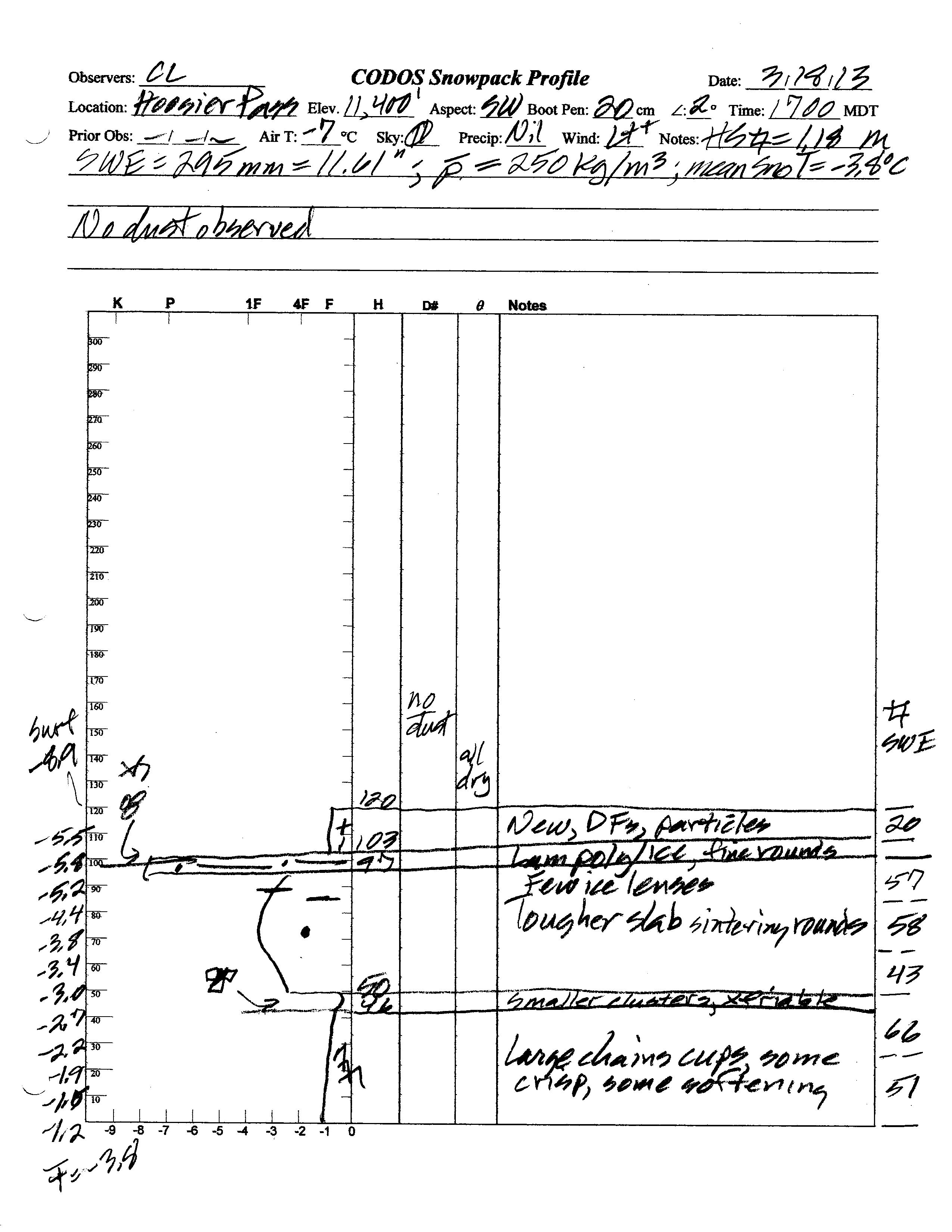
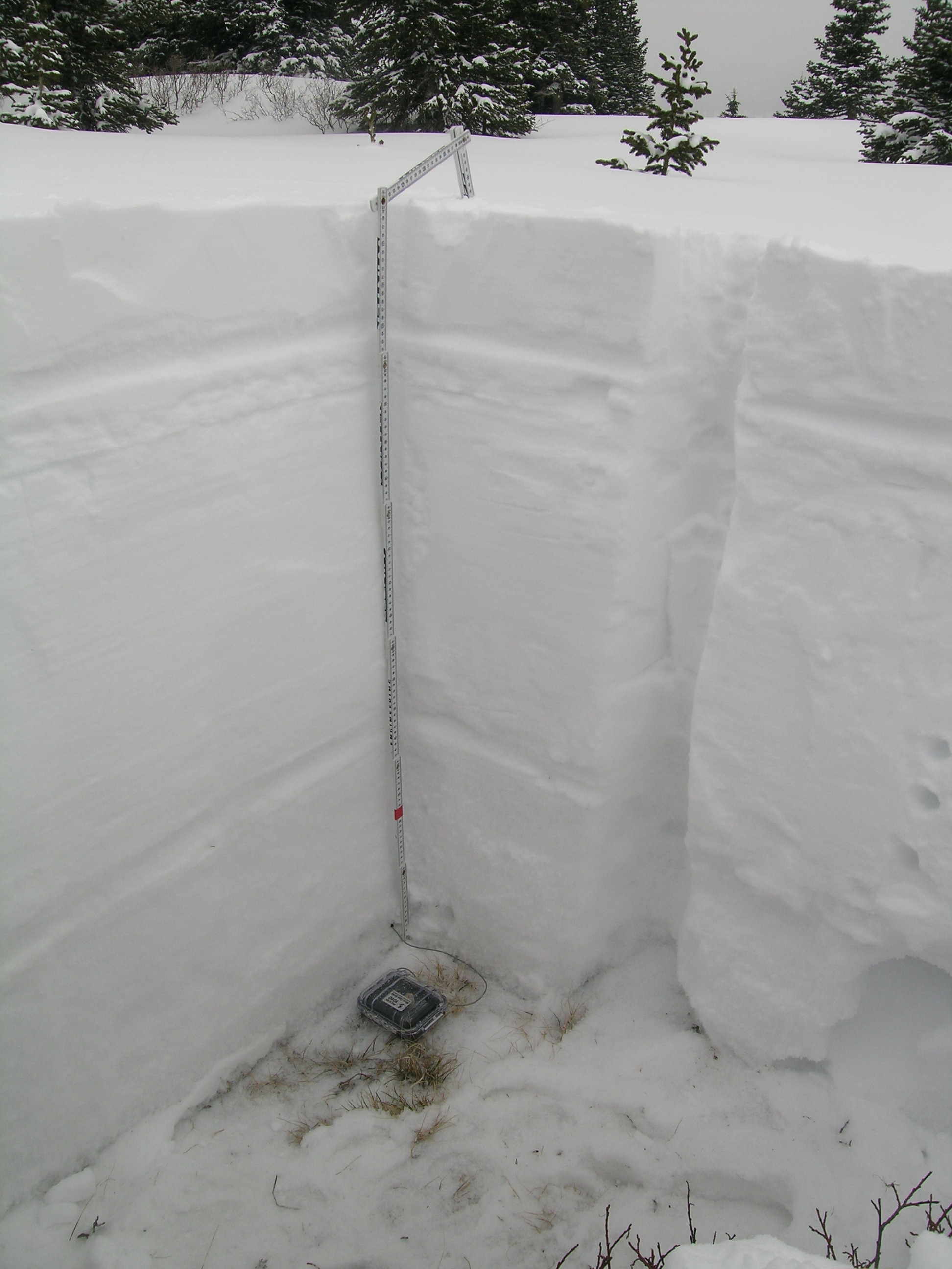
Total snow depth in our March 18, 2013 snow profile was 47”, 6” deeper than a year before. However, mean density of the snowpack was 250 kg/m3 (25.0% water content), a little lower than a year before. Melt-freeze had occurred in the upper snowpack in preceding days, then refrozen, and the entire snowpack was once again dry and cold. Mean snowpack temperature in this profile was -3.8° C, nearly identical to that observed a year earlier. No clearly discernible dust-on-snow layers were observed in the snowpack during this visit. Dust was observed in the air on very strong W’ly winds in the Montrose and lower Gunnison valley earlier in the day (logged as event D4-WY2013 at Senator Beck Basin), but no dust was seen in the air in the Arkansas Valley or South Park that afternoon. Snow showers and blowing snow obscured the sky while at the Hoosier Pass CODOS site. Although no new dust was observed while at the site, it is possible that a very weak D4 layer was deposited later in the day, entrained in new snow.
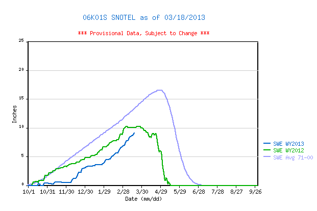
Hoosier Pass Snotel data for WY 2013 place current SWE in the low end of the lowest quartile of values for the period of record and somewhat behind same-date values in WY 2012, albeit well below the 1971-2010 30-year mean.
 |
 |
|
| 2012 Pit Profile | 2013 Pit Profile |
 |
 |
|
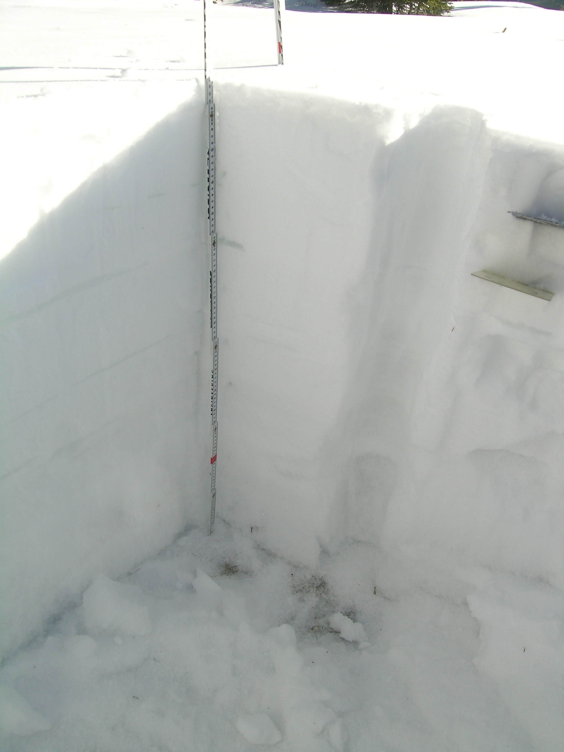
| 2012 Pit Photo | 2013 Pit Photo |
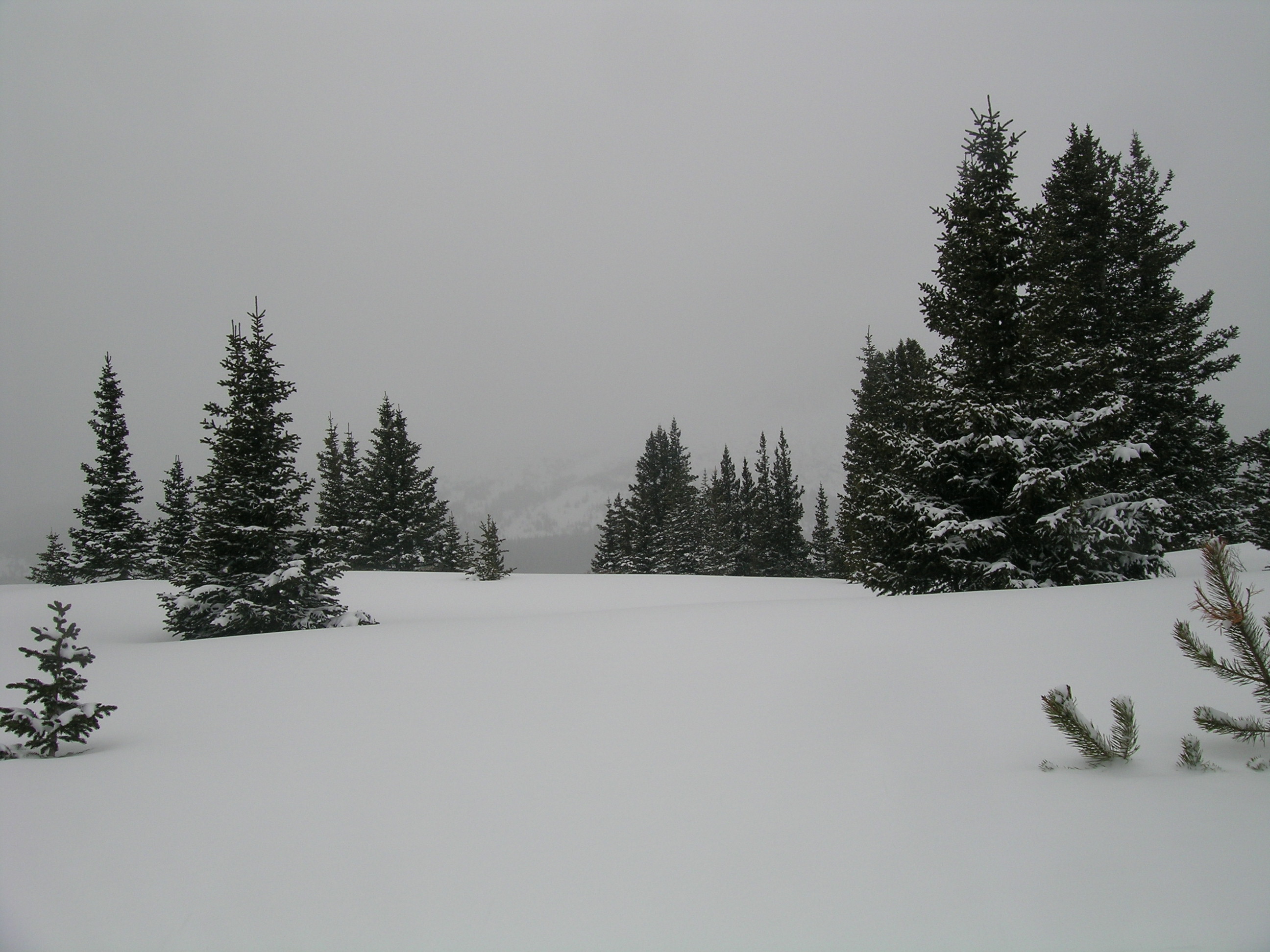 |
Looking west from the CODOS Hoosier Pass site at evening snow showers over Mount Lincoln and Montgomery Reservoir. Time for lunch |
Melt Rate
The Hoosier Pass Snotel site continues to accumulate SWE and shows no significant losses of SWE to-date. Surface melt had recently occurred in the snowpack at our slightly southwest-facing CODOS snow profile site, but no melt water exited the snowpack as runoff during that episode.

Forecast
Barring any D4-WY2013 dust deposition in the Hoosier Pass locale (not observed the morning of March 19, en route to Grizzly Peak), snowmelt processes at the Hoosier Pass CODOS site and Mosquito and Ten Mile Range locales could proceed without significant dust-on-snow enhancement of radiative forcing until/unless subsequent dust is deposited. The National Weather Service anticipates continued W’ly winds shifting to NW leading into the weekend of March 23/24, with additional snowfalls favoring the northern mountains.
As of March 18, 2013 only the least probable projection of future snowpack accumulation would result in a near-median value for peak SWE at the Hoosier Pass Snotel site. NRCS projects only a 3 in 10 chance that complete snowcover ablation (snow all gone, or SAG) will occur near the median date, and higher probabilities that SAG will be earlier than the median date.