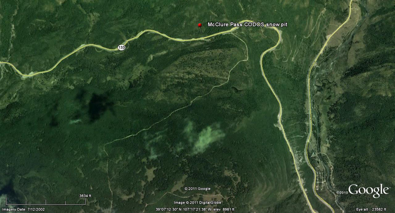
 CODOS Update for McClure Pass site:
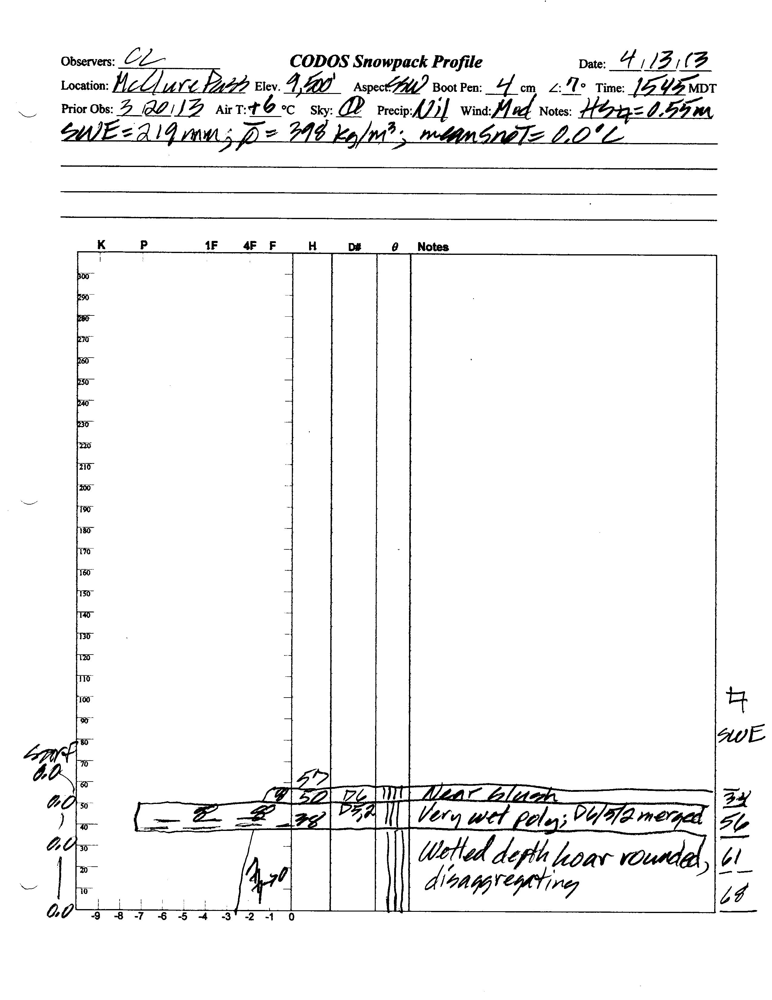
visited April 13, 2013
Summary | Snowpack | Melt Rate | Stream Flow | Forecast
Summary
Merged dust-in-snow layers D6 (April 8), D5 (March 21-22) and D2 (February 8) were found in the snowpack surface at the McClure Pass CODOS site on April 13, 2013, substantially reducing snowcover albedo. Active snowmelt runoff was underway in the fully isothermal and wet snowpack. Snowpack SWE decreased by almost 2.5” at the CODOS site since our prior March 19, 2013 visit but the snowpack had fully melted by the same time a year earlier, on April 11, 2012. (Another winter storm immediately followed this site visit and yet another significant storm is predicted as of this writing, Monday, April 15.)
SnowPack Discussion
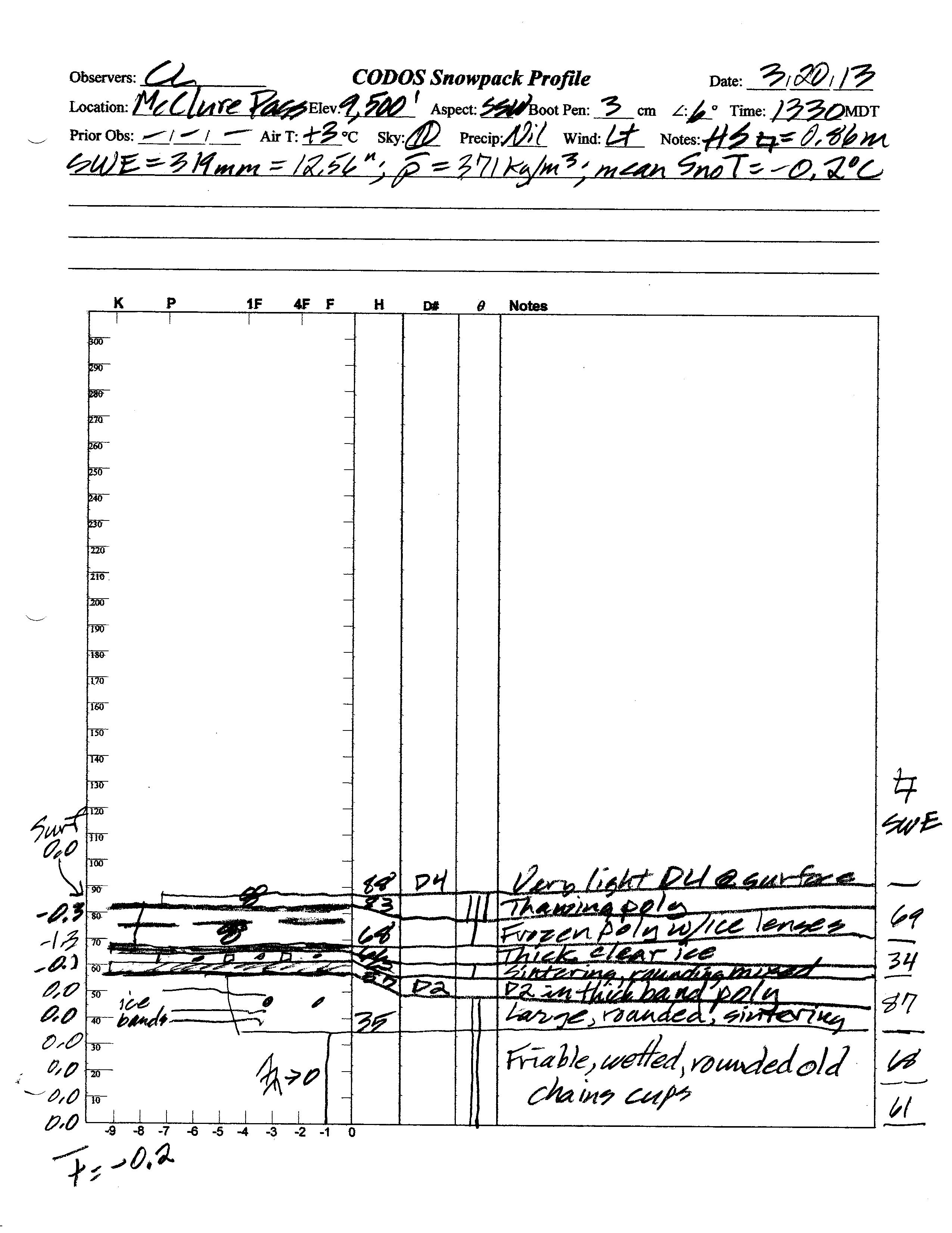
Snowcover at the McClure Pass CODOS site was fully isothermal and undergoing active snowmelt and runoff during the April 13, 2013 site visit. Total snow depth in the snow profile was only 22”, almost 12” less than observed at the site on March 19, 2013. Total SWE on April 13, 2013 was also reduced to 8.6”, down 4” of SWE since March 19, 2013, and mean density was 398 kg/m3 (39.8% water content), up slightly from 371 kg/m3 on March 19, 2013. In contrast, this site had reached “snow all gone” (SAG) by April 11, 2012.
Dust layers D6, D5, and D2 were merged just beneath the snowpack surface, substantially darkening the snowcover and reducing snow albedo. Slush was present on the snow surface. The basal layer in the snowpack was composed of very wet, disintegrating chains of large depth hoar grains. The snowpack was isothermal at 0.0° C throughout.
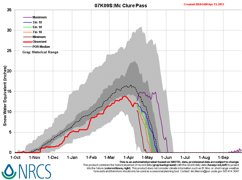
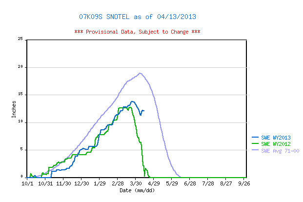
April 13, 2013 McClure Pass Snotel data reports current SWE having approached the top of the lower quartile of SWE values for the period of record but has since begun to decline. Although Peak SWE was slightly higher than recorded in WY 2012, SWE at this Snotel site is still well below the 1971-2000 mean. However, thanks to March and April 2013 precipitation, the McClure Pass Snotel nearly reported 10” more SWE on April 13, 2013 than was present about year earlier, on April 10, 2012.
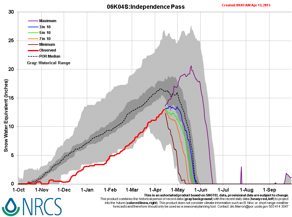
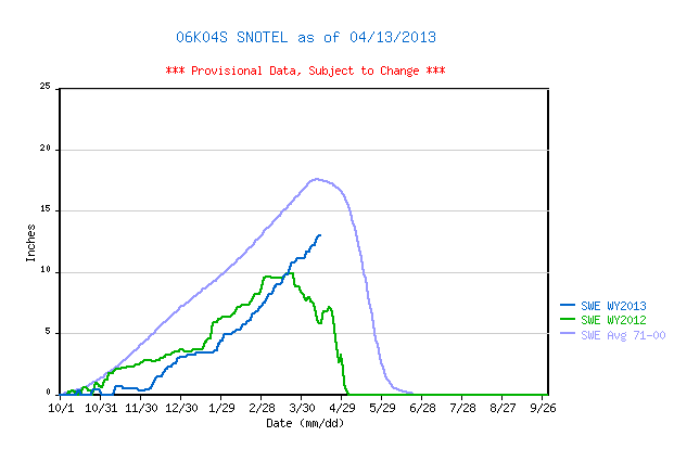
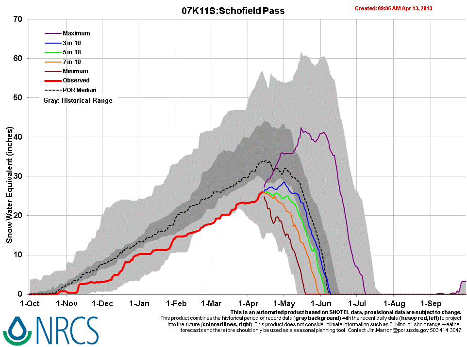
In higher, alpine terrain elsewhere in the Elk Mountains, the Schofield Pass and Independence Pass Snotel sites report ongoing accumulation of SWE, without significant losses to-date, as compared to rapidly declining SWE values a year earlier. SWE values at those sites also remain within the lower quartile of values.
| March 20th Pit Profile | April 13th Pit Profile | |
 |
 |
|
 |

|
|
| March 20, 2013 |
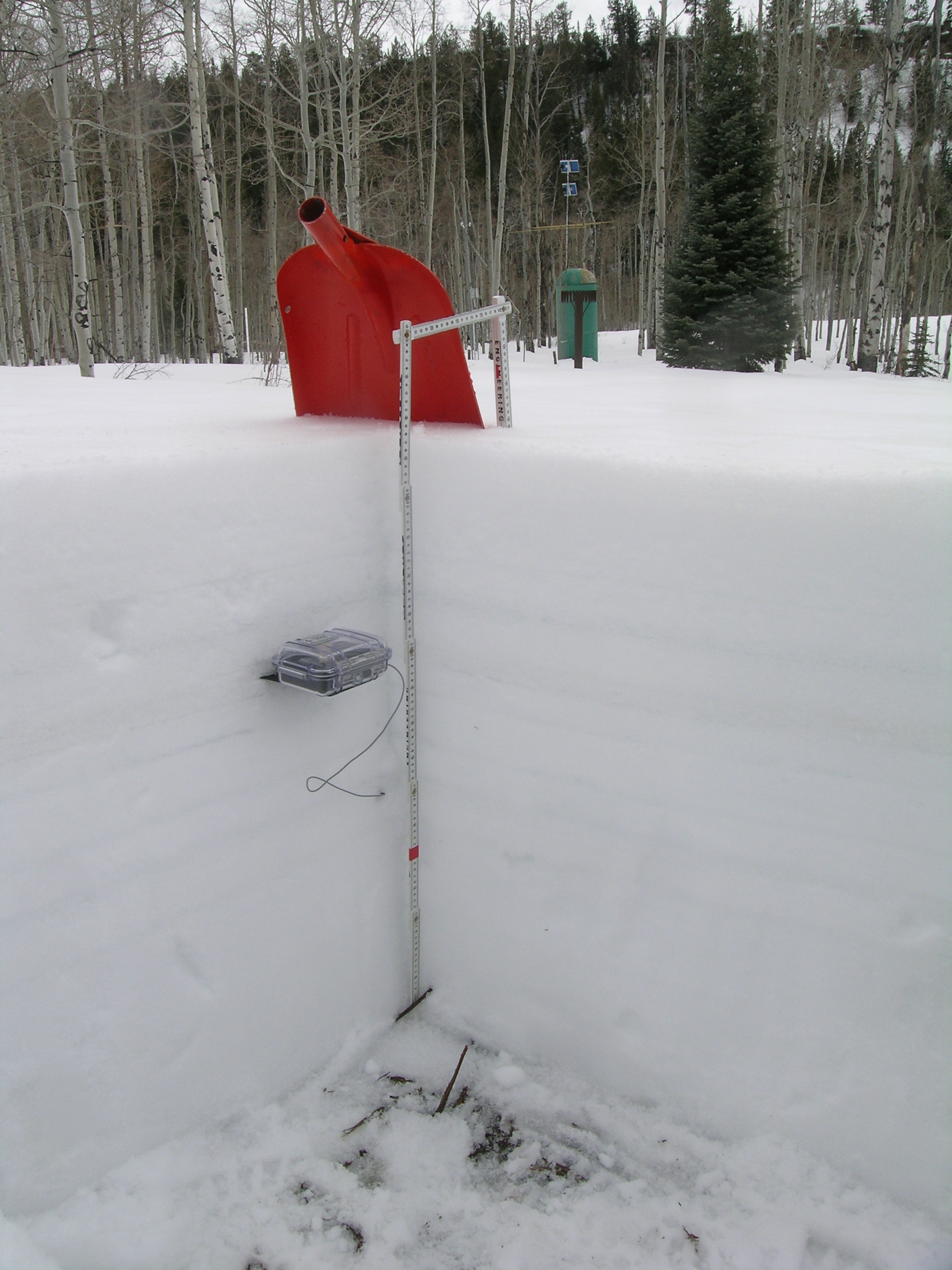
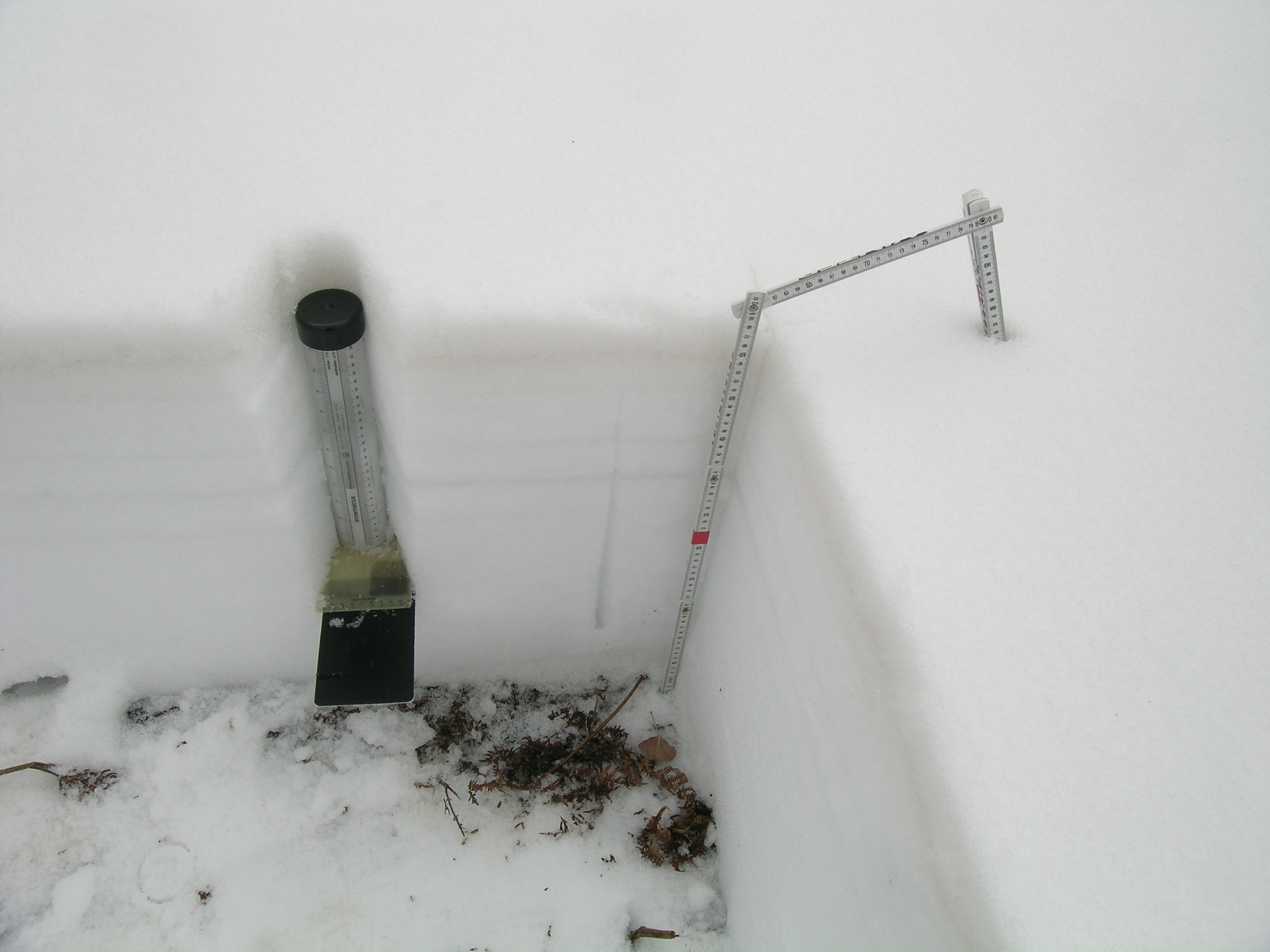
The April 13, 2013 McClure Pass snowpit showing the merged D6/D5/D2 dust layer a few inches below the surface, and just above the thermometer case in the pit corner. The McClure Pass Snotel site is seen in the background. |
|
 |
 |
|
SWE measurements are performed in all CODOS snowpits using a continuous series of ‘tube samples’. Those data are shown on the right margin of the snowpack profile, in units of mm of water, usually by layer, and noted above as a total. These measurements are made “normal” (perpendicular) to the snowpack. The “normal” height (depth) of snow at the sampling location is then used, with the total SWE value, to calculate the mean density of the snowpack. |
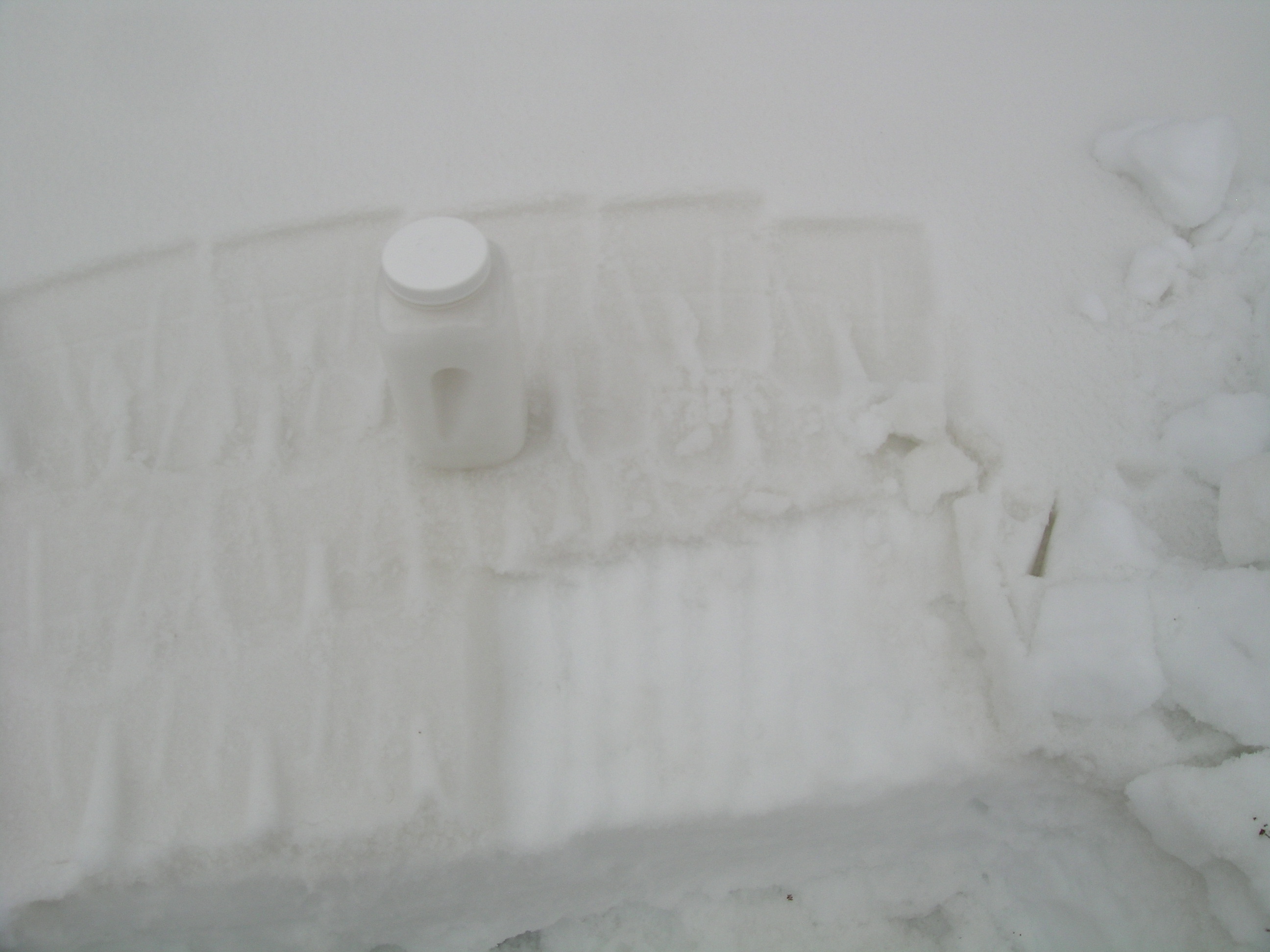
This season, CODOS is collecting “all layers merged” dust samples at each CODOS site, as feasible, for chemical analysis by the USGS American Drylands project we’re working with and the team led by Rich Reynolds, in Denver. This photo shows the contrast between the surface containing merged D6/D5/D2 that was sampled compared to the underlying, ‘clean’ snowpack. A second container of the merged dust was also collected. Some very fine dust is lost to leaching, but the bulk of dust remains in the snowpack surface until SAG. |
|
 |
 |
|
| March 20, 2013 | April 13, 2013 |
Melt Rate
The McClure Pass Snotel reported steadily declining or ‘flat’ SWE values since late March, under the influence of dust layer D5 (March 21-22). At times, the Snotel was losing 0.4” of SWE per day, during that period. Since the site visit, the McClure Pass locale has received another layer of fresh snow that will, once again, restore a higher snow albedo and delay the emergence and impact of dust layers D6 and D5 on snow albedo. As and when merged layers D6/D5/D2 do more-or-less fully emerge, and remain exposed for some days, snowmelt rates will accelerate rapidly in the McClure Pass locale. The sustained exposure of merged dust layers D6/D5/D2 could result in SWE loss rates matching the >1” losses per day observed in spring 2012. Ablation of this season’s sub-par McClure Pass snowcover to “snow all gone” (SAG) will also be significantly advanced by merged layers D6/D5/D2, as and when those (and/or additional dust layers) remain exposed for sustained periods.

Stream Flow
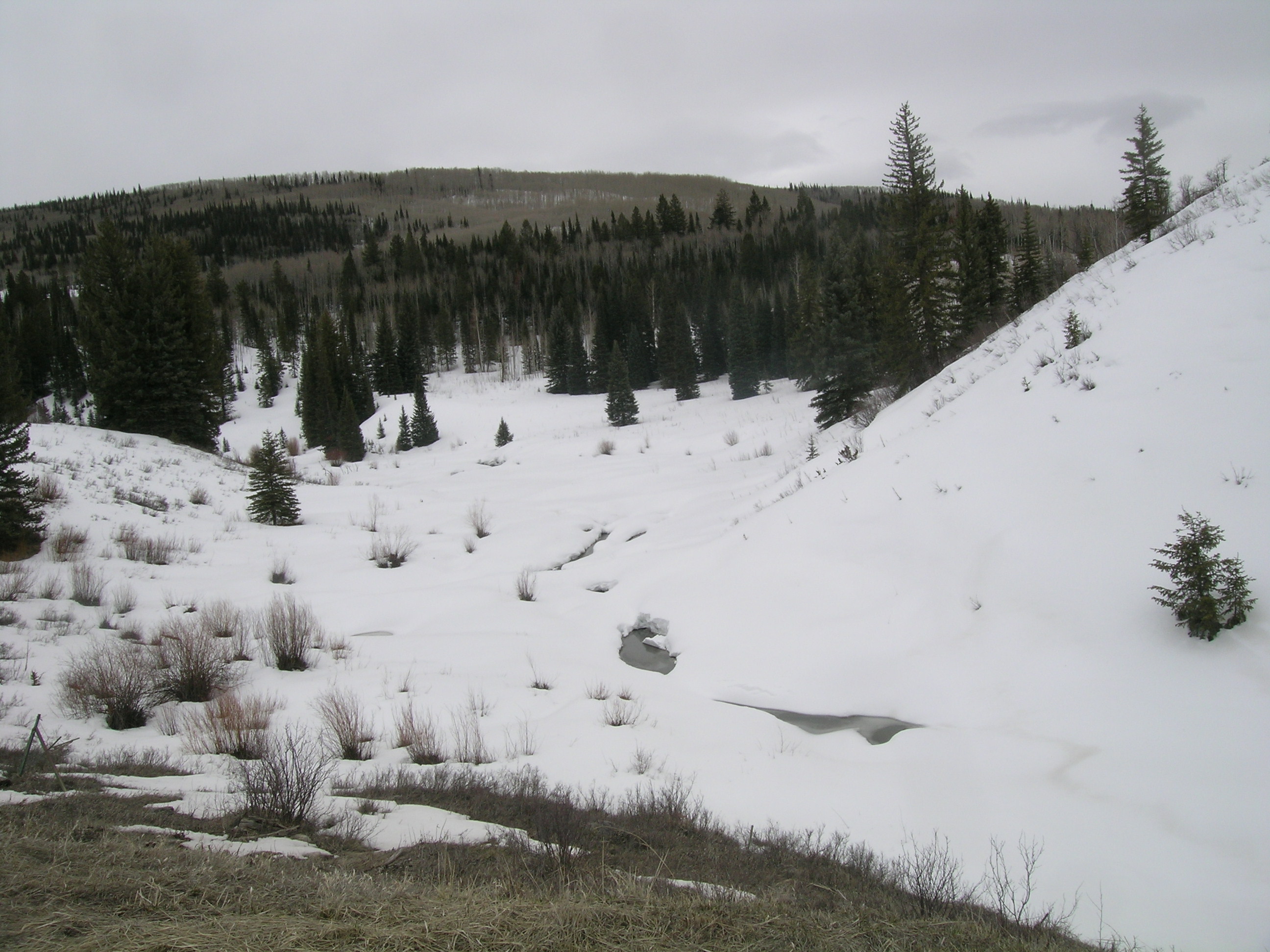
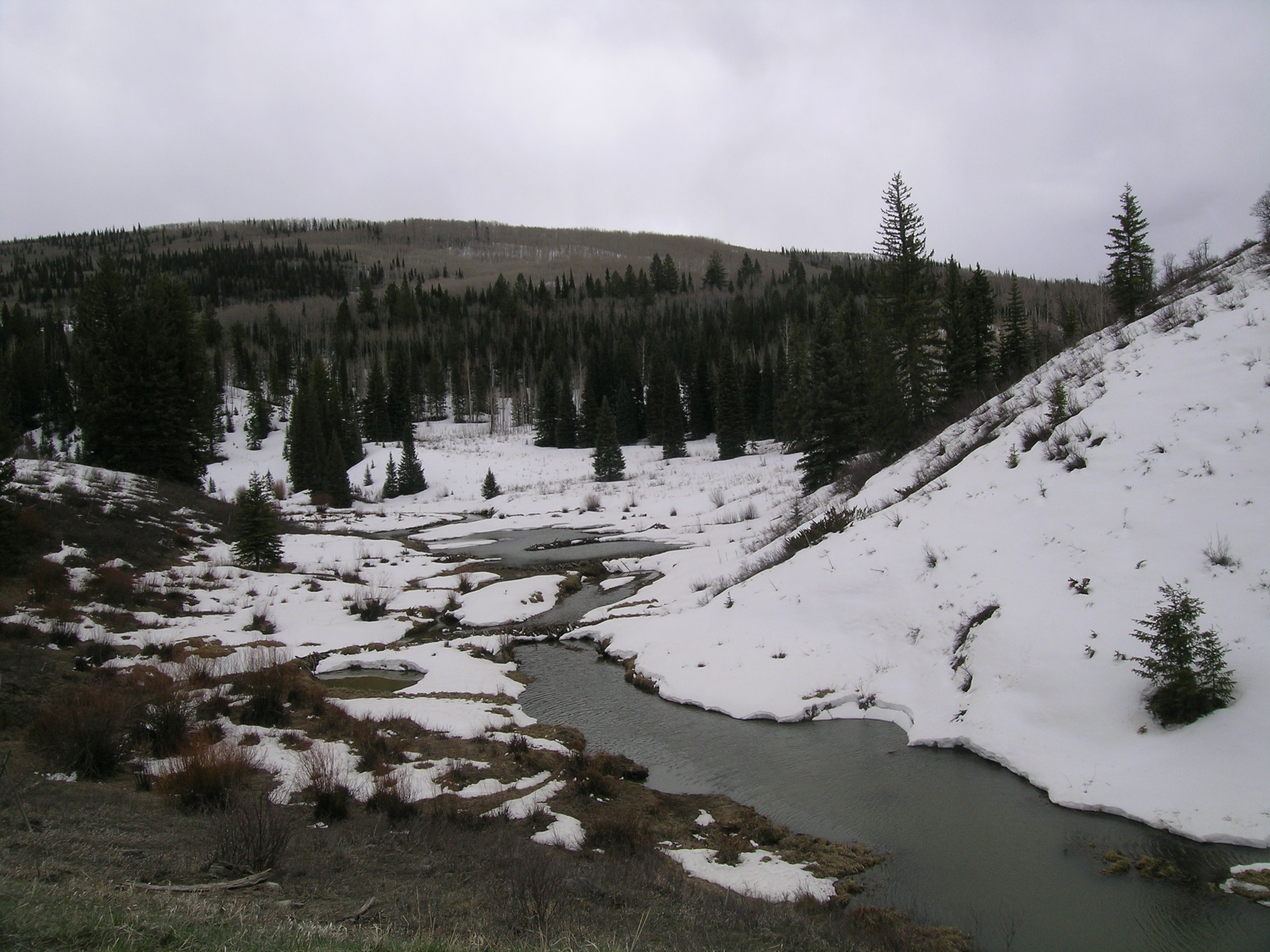
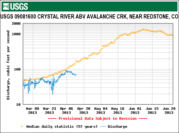
Streamflow data from the USGS Crystal River Above Avalanche Creek and North Fork Gunnison River Near Somerset gauges show some surging in late March and early April, to near-average levels, likely enhanced by the impact of dust layer D5 on lower elevation snowcover. Subsequent to those minor surges, flows declined as the new snow and winter weather delivering dust layer D6 restored a higher albedo to the snowcover in those headwaters and halted that snowmelt episode. Data from the Muddy Creek gauge show contrasting ‘flat’ (below average) flows, likely due to the scant remaining snowpack in the generally west-facing and lower elevation watershed. Snowcover ablation is much more advanced in the Muddy Creek watershed than in nearby, higher alpine headwaters. Direct observations of the Crystal River saw modest flow levels with clear water, whereas Muddy Creek was flowing at a higher level, for the channel, and in its characteristic bright red color. Streamflows on the Crystal River and main stem of the North Fork of the Gunnison will surge substantially as and when dust layers D5/D6, and eventually D2 merge and remain at the surface for extended periods. Snowmelt runoff duration may be shortened, however, as the sub-par snowpack melts at a substantially increased rate.


Forecast
As of Monday, April 15, the National Weather Service expects unsettled weather to continue through most of the week of April 14-20. A significant weather system is expected to arrive today (Monday, April 15) with strong S and SW’ly winds. A Winter Storm Watch anticipates 8-14” of new snow, or more, in the Elk Mountains. Partly sunny weather may return to the McClure Pass locale by Friday, but no prolonged drying is anticipated at this time as the weather remains “progressive”, with an another potential system shaping up for next Saturday.
Given additional new snowfall during the week of April 14-20, and without further dust-on-snow, the emergence of dust layers D6/D5/D2 will be aspect and elevation driven, with earliest exposure at lowest snow-covered elevations, but perhaps quickly followed at Pass elevations. Wind stripping may also continue to reveal patches of dust-in-snow in exposed, alpine locations. Even on mostly cloudy days, sufficient radiation may reach the snowpack to penetrate new snow and reaching the D6/D5/D2 layers below and accelerating the ablation of the new snow.