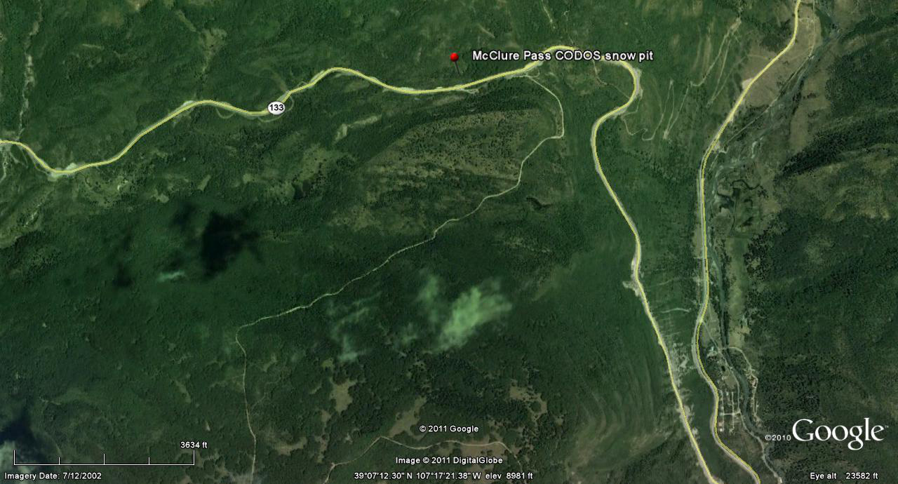
 CODOS Update for McClure Pass site:
visited March 20, 2013
Summary | Snowpack | Melt Rate | Forecast
Summary
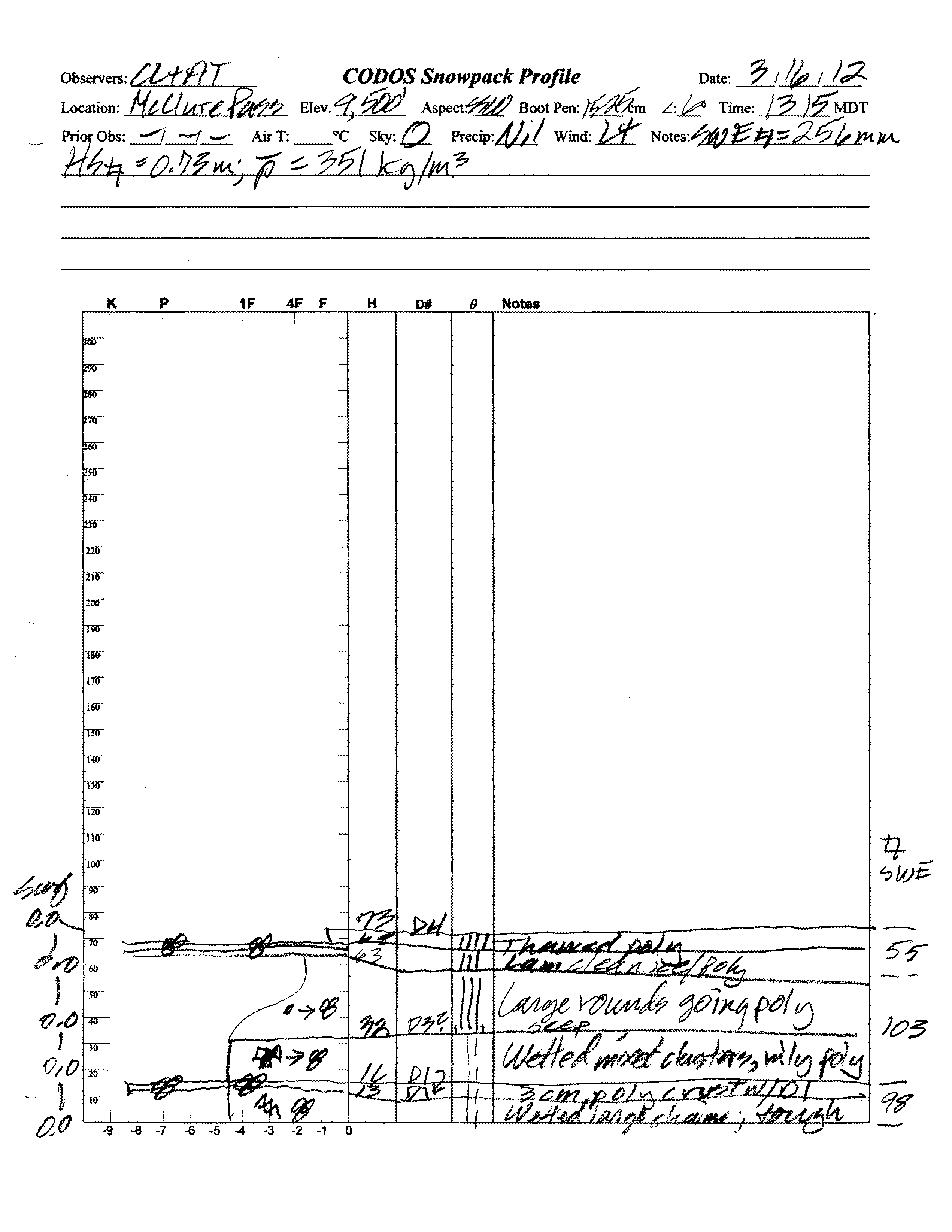
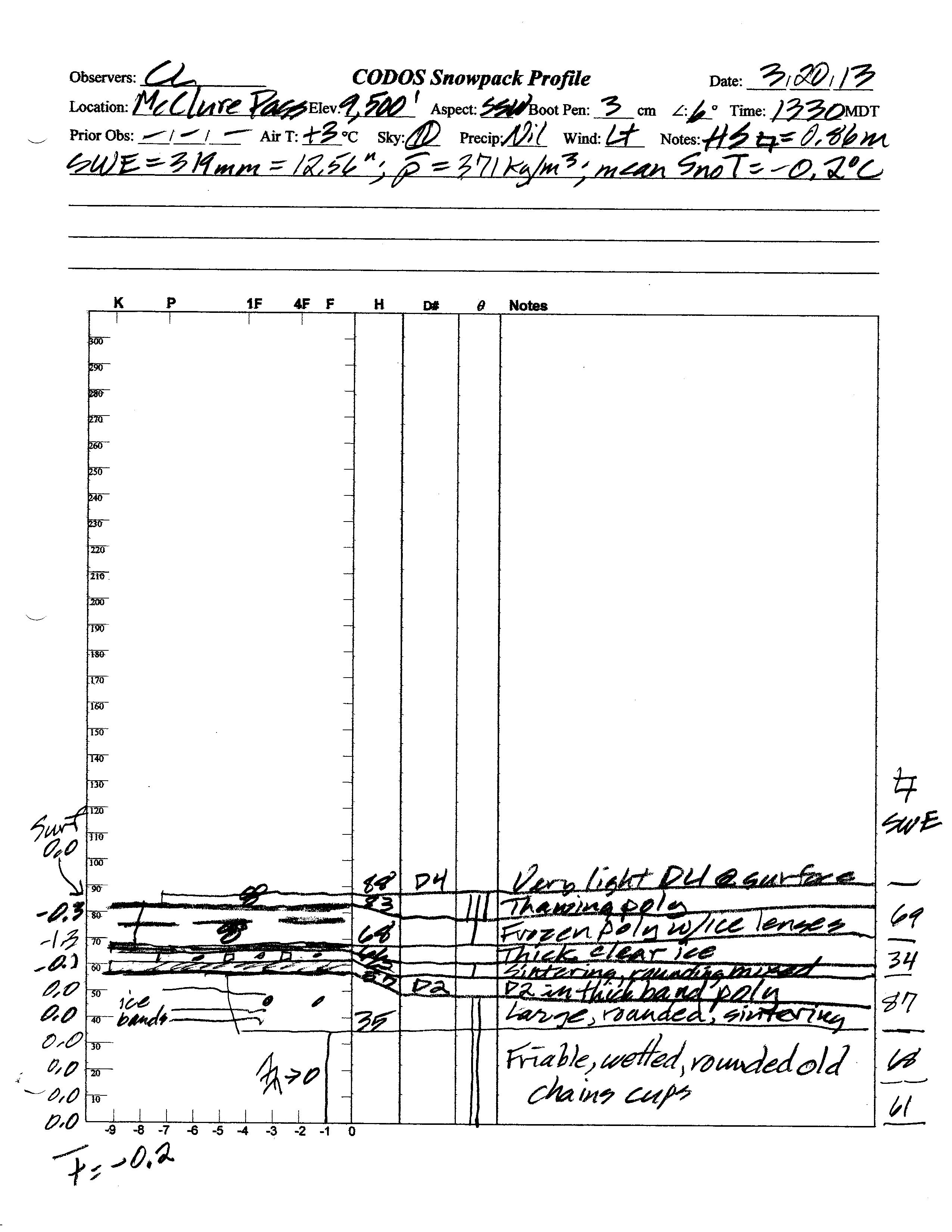
This field session at the McClure Pass CODOS site, our first of the WY 2013 season, found very similar snowpack conditions to those observed a year earlier, and still sub-par water content. Dust event D4 was present at the snowpack surface, and dust layer D2 was present in the middle of the snowpack. The snowpack was effectively isothermal and wet throughout, with snowmelt enhanced by dust layer D4 on this slightly sloping, south-facing site.
SnowPack Discussion
Total snow depth in our March 19, 2013 McClure Pass snow profile was 35”, 6” deeper than a year before. Total SWE in this profile was 12.6”, fully 2.5” more total SWE than measured a year earlier. Mean density of this snowpack was 371 kg/m3 (37.1% water content), versus 351 kg/m3 a year before. Significant melt-freeze had occurred in the upper one-half of the snowpack in preceding days and weeks, then refrozen as thick and thin crusts. Much of the snowpack remained at 0.0° C and mean snowpack temperature in this profile was just -0.2° C, effectively isothermal. The snowcover exhibited various degrees of wetness throughout. Dust-on-snow layer D4 was present at the snowpack surface and layer D2 (February 8) was observed in a thick melt/freeze crust near the center of the snowpack.
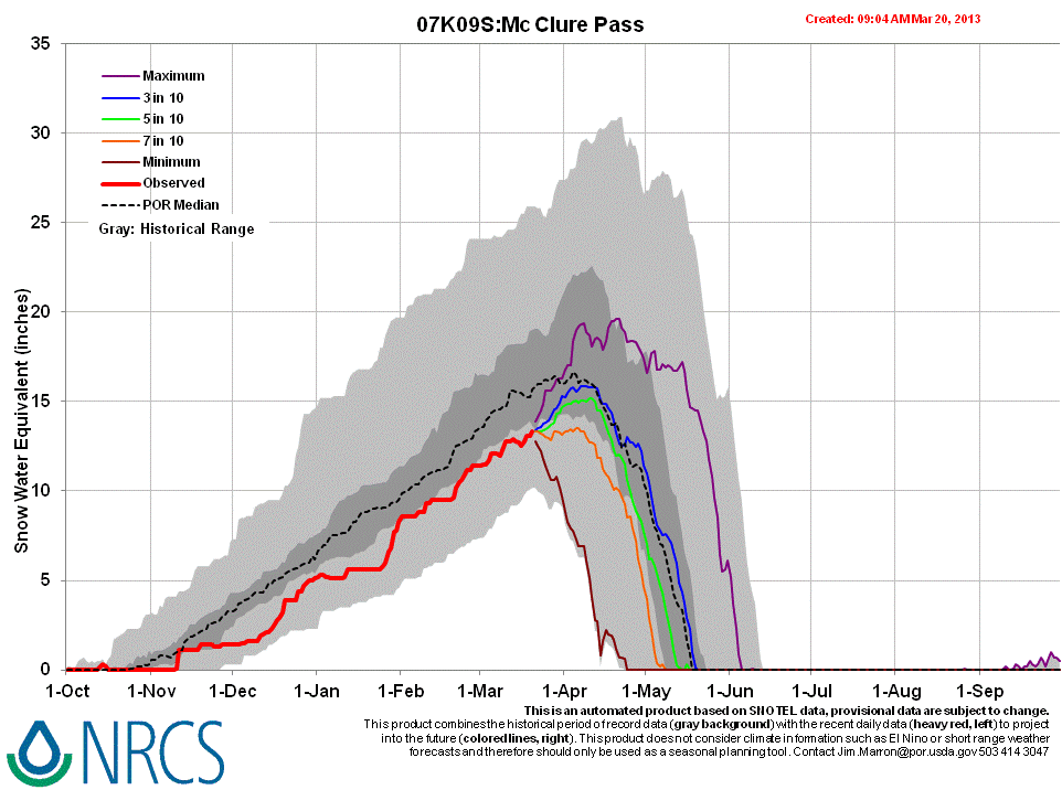
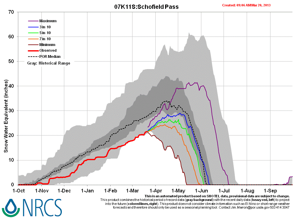
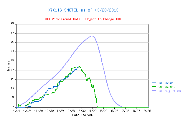
McClure Pass Snotel data for WY 2013 place current SWE still within the lowest quartile of values for the period of record but somewhat higher than the same-date values recorded in WY 2012, albeit still well below the 1971-2010 30-year mean. Elsewhere in the Elk Mountains, the Schofield Pass and Independence Pass Snotel sites report SWE at near-record low levels, very similar to those observed at the same-date in WY 2012.
 |
 |
|
| 2012 Pit Profile | 2013 Pit Profile |
 |
 |
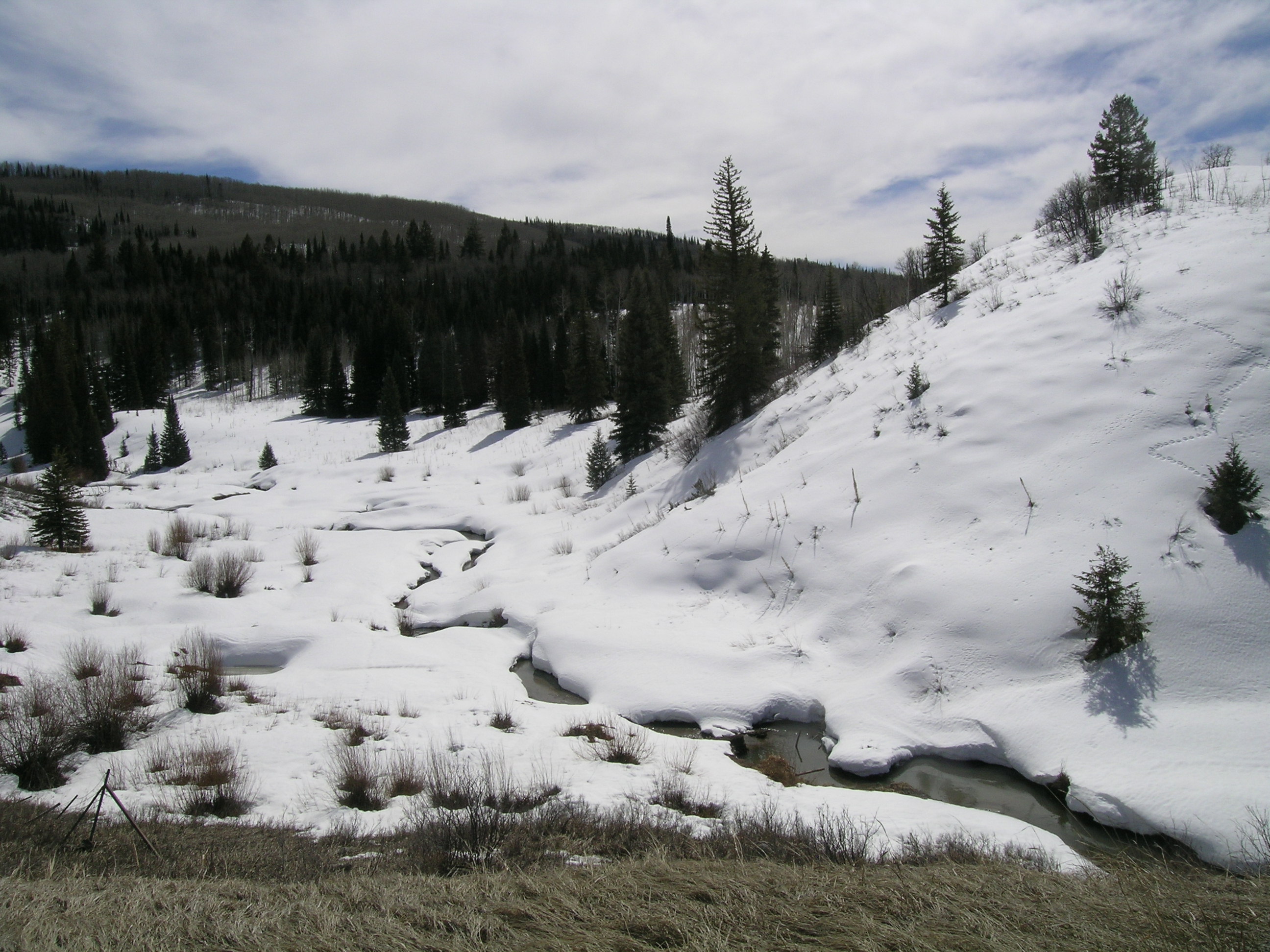 |
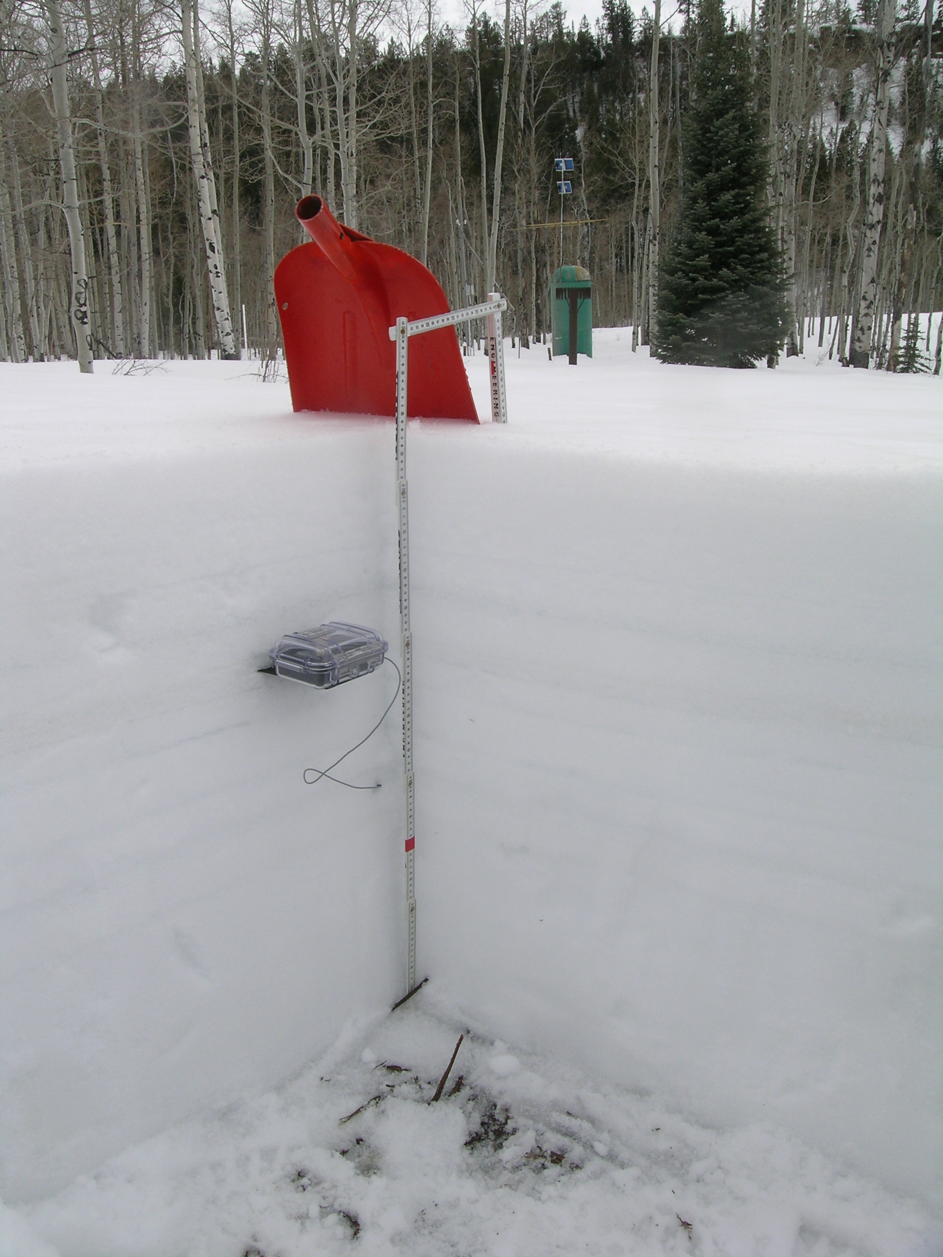
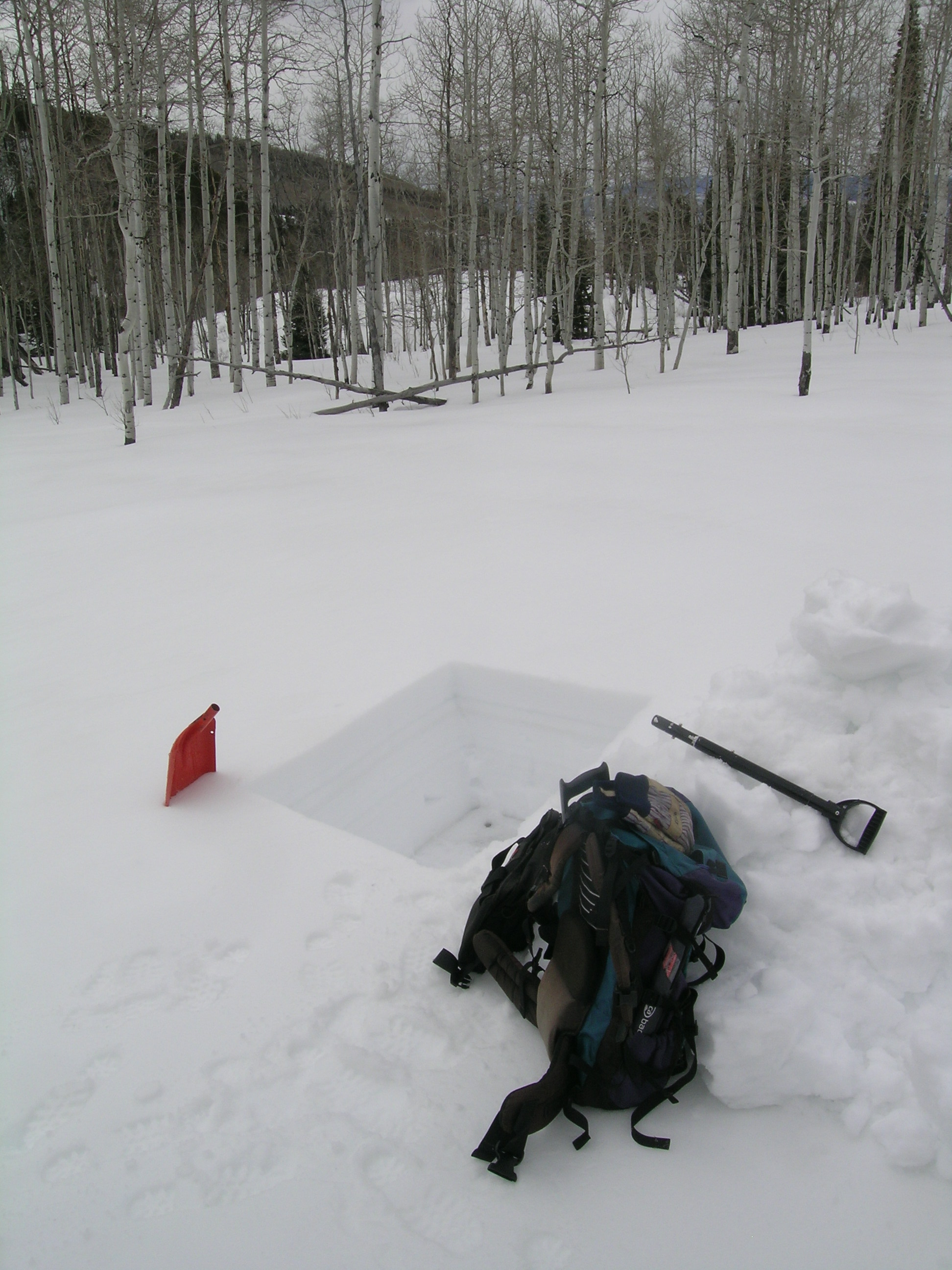
| The McClure Pass CODOS snow profile site is on an open slope very near the Snotel site, seen in the background. The temperature sensor case is resting on a crystal card inserted into the D2 dust layer. Layer D4 is barely visible at the snowpack surface in this photo, at this viewing angle. | Snowpit upon excavation. Dust layer D4 is faintly visible at the snow surface in this photo, but layer D2 is more plainly visible as the lower of two darker bands near the middle of the snowpack. | The iconic beaver pond scene on the west side of McClure Pass, where CODOS began a time series of dust-on-snow photos in spring 2009. Coincidentally, the same view taken on March 16, 2012 also revealed a D4 layer at the snow surface and, not surprisingly, a similarly scant snowcover. |
Melt Rate
Total snow depth in our March 19, 2013 McClure Pass snow profile was 35”, 6” deeper than a year before. Total SWE in this profile was 12.6”, fully 2.5” more total SWE than measured a year earlier. Mean density of this snowpack was 371 kg/m3 (37.1% water content), versus 351 kg/m3 a year before. Significant melt-freeze had occurred in the upper one-half of the snowpack in preceding days and weeks, then refrozen as thick and thin crusts. Much of the snowpack remained at 0.0° C and mean snowpack temperature in this profile was just -0.2° C, effectively isothermal. The snowcover exhibited various degrees of wetness throughout. Dust-on-snow layer D4 was present at the snowpack surface and layer D2 (February 8) was observed in a thick melt/freeze crust near the center of the snowpack.
McClure Pass Snotel data for WY 2013 place current SWE still within the lowest quartile of values for the period of record but somewhat higher than the same-date values recorded in WY 2012, albeit still well below the 1971-2010 30-year mean. Elsewhere in the Elk Mountains, the Schofield Pass and Independence Pass Snotel sites report SWE at near-record low levels, very similar to those observed at the same-date in WY 2012.


Forecast
Given the observed D4 and D2 dust-on-snow layers, snowmelt processes at the McClure Pass CODOS site and locale will experience significant dust-enhanced radiative forcing of snowmelt as those layers are exposed at or near the snowpack surface. The National Weather Service anticipates continued W’ly winds shifting to NW leading into the weekend of March 23/24, with only 2-5 inches of fresh snow accumulation at McClure Pass by Monday, March 25. Dust layer D4 may rapidly re-emerge in the coming week. At mid-snowpack, dust layer D2 was covered by some 10” of wet snow containing 4” of SWE on March 20. Dry and sunny weather during the last week of March could result in D4 enhanced melt rates of up to 0.5” of SWE per day on sunny aspects in the McClure Pass and upper Crystal River basin locale, perhaps revealing the much darker layer D2 by April 1. At that time melt rates would accelerate and approach rates observed in spring 2012.
As of March 20, 2013 only NRCS’s “maximum” projection of future snowpack accumulation would result in peak SWE at/above the median at the McClure Pass Snotel site. NRCS projects only a 3 in 10 chance that complete snowcover ablation (snow all gone, or SAG) will occur near the median date, and higher probabilities that SAG will be earlier than the median date. Those forecasts are made based on historical snowpack behavior and without direct, season-specific consideration of potential dust enhancement of snowmelt rates.