 CODOS Update for Senator Beck Basin:
Visited March 26-27, 2012
Summary | Snowpack | Melt Rate | Stream Flows | Forecast |
Wind Behavior | Previous Update | pdf
Summary
Colorado’s substantially sub-par reservoir of SWE now contains two significant (D5 and D4) and one minor (D6) dust layers at/near the snowpack surface statewide, and is vulnerable to continued prolonged periods of dry, sunny weather combined with reduced snow albedo. This Update presents site-by-site and summary analyses of snowmelt rates at CODOS and other Snotel sites for Water Years 2006-2011.
Senator Beck Basin snowpack conditions are mixed, with cold content persisting in the alpine terrain at the same time that isothermal snow in the subalpine portion of the Basin has begun releasing snowmelt runoff. The Red Mountain Pass Snotel site near Senator Beck Basin has shown small recent declines in SWE but the nearby Lizard Head Pass Snotel site is experiencing more rapid loss of SWE. The Senator Beck Basin stream gauge shows two recent surges associated with reduced snow albedo. Should dry weather continue to dominate this spring season, and dust-enhanced snowmelt rates approach the average or maximum rates discussed below, snow all gone (SAG) may occur early at Senator Beck Basin and throughout the western San Juan Mountains producing early peak streamflows, early passage of runoff center of mass, and steep descending limbs on hydrographs.
SnowPack Discussion
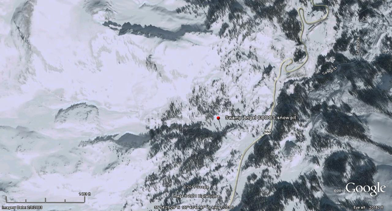
Two recent snowpits were performed in Senator Beck Basin, one at Swamp Angel Study Plot on Monday, March 26, 2012 (pdf) and the other at Senator Beck Study Plot on Tuesday, March 27, 2012 (pdf). As of March 26th, dust layer D5 was rapidly emerging on all aspects of Senator Beck Basin and merging with layer D4. By the afternoon of March 26th a new, albeit minor dust-on-snow event (D6-WY2012) was underway and fell on either exposed D5 or on a thin layer of cleaner snow just above D5, as seen in the March 27th profile at Senator Beck Study Plot.
The sub-alpine Swamp Angel snowpack, at 11,060’, is virtually isothermal, just shy of 0° C throughout, whereas the snowpack at the alpine Senator Beck Study Plot (12,186’) still retains cold content with a mean temperature of -3.7° C and will require many more days of radiative forcing in the D6/5/4 dust at the surface to warm the pack to 0° C. Total snow depth, total SWE, and therefore mean snowpack density were very similar at the two sites – a rarity that reflects the severe redistribution of snow in the alpine terrain this season. The Swamp Angel Study Plot retains about 21” of SWE, about 95% of the precipitation that site has received since October 1.


Melt Rate
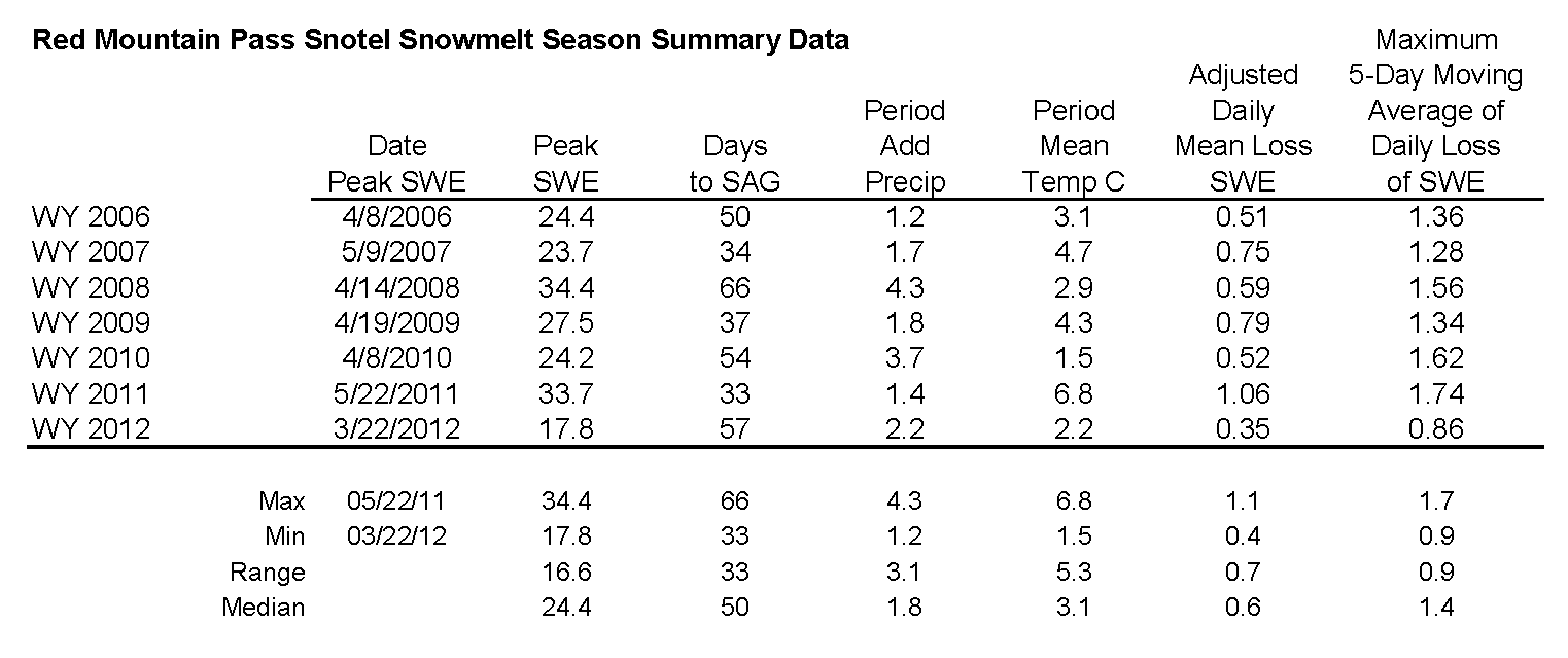
The table below presents Water Year analyses of snowmelt behavior at the Snotel station adjoining this CODOS site beginning with WY 2006. The date of Peak SWE and subsequent number of days to “snow all gone” (SAG) are shown for each Water Year. Then, the amount of additional SWE received after the date of Peak SWE is added to Peak SWE to calculate an “adjusted daily mean loss [of] SWE” rate during the snowmelt season that Year. Finally, the mean air temperature during the period from Peak SWE to SAG, as measured at the Snotel site, is shown for each Water Year. A current Snotel plot is presented below the table.
As of Tuesday, March 27, 2012, the nearby Red Mountain Pass Snotel, located just 2 km south of Swamp Angel Study Plot, has lost 0.5” SWE (total) since March 21, following the substantial upward bump in SWE produced by the March 18 snowstorm that delivered D5. This recent melt rate falls well short of the mean daily loss rates shown in the table below, and very far short of the maximum SWE loss rate last Spring of 1.74” per day, over a 5-day period ending June 17, 2011.
Further, although we do not routinely visit the site, the Lizard Head Pass Snotel data (see snowmelt analysis table and SNOTEL graph) also reflect western San Juan Mountains melt behavior, and the D6/5/4 dust layers present at Senator Beck Basin are also present at Lizard Head Pass. As of March 27, this Snotel reports a loss of 1.5” since March 21st, a rate of 0.2” per day, well short of the mean daily loss rates shown in the table below, and very far short of the maximum SWE loss rate last Spring of 1.40” per day, over a 5-day period ending May 31, 2011.

Stream Flows
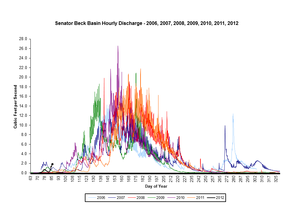
Senator Beck Stream Gauge data show two small surges in flows to-date, peaking at 2.0 cfs. These small surges and the brief decline between them correspond to reduction of snow albedo by D4 and very warm temperatures from March 7-17, a restoration of higher snow albedo (with cooler weather) on March 18 for a brief period, and then the subsequent warmup and further reduction in snow albedo as D5 emerged and merged with D4 (and D6 made its minor contribution). Given the snowpack temperatures in much of the alpine terrain in Senator Beck Basin, this measured runoff is being largely generated by the lowest elevation, south-facing slopes in Senator Beck Basin, which are recently beginning to show some bare ground.
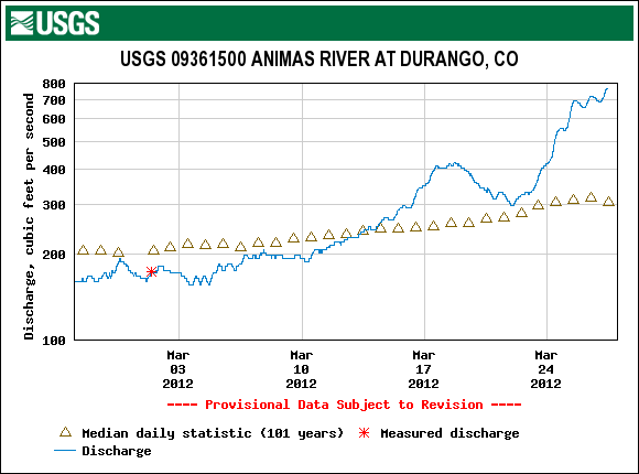
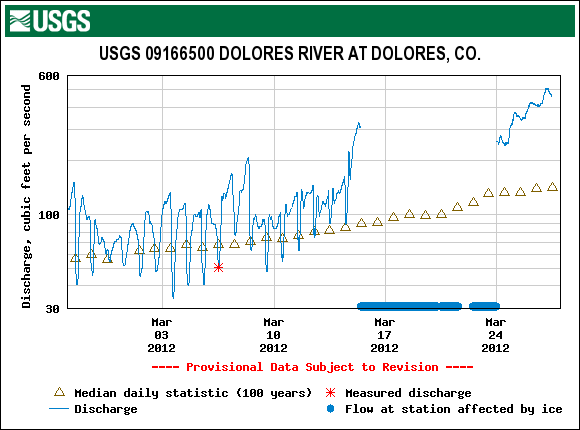
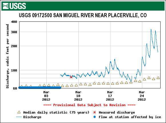
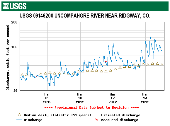
Similar patterns in runoff behavior are seen in the following regional hydrographs of the last 10 days: Animas near Durango, Dolores, San Miguel near Placerville, and the Uncompahgre near Ridgway.
Wind Behavior
The following graphs show wind behavior during the Water Year 2012 dust-on-snow events at our Putney Study Plot (best wind data for Senator Beck Basin Study Area and Red Mountain Pass). We have estimated beginning and end times of each event based on observations from Silverton, CO. For more on this wind analysis, see the CODOS dust log and wind rose table.
D1: Nov 5, 2011 |
D2: Nov 13, 2011 |
D3: Dec 3, 2011 |
 |
 |
 |
D4: March 6, 2012 |
D5: March 18, 2012 |
D6: March 26, 2012 |
 |
 |
 |
Forecast
As of Tuesday afternoon forecasters at the Grand Junction National Weather Service anticipate continued warm and generally dry weather through the remainder of this week, with the warmest temperatures of the week on Saturday. The northern mountains may experience some light showers and more cloudiness than the southern half of the state. Snowmelt rates are likely to continue to increase through Saturday.
By Saturday afternoon an approaching trough and associated cold front are expected to generate another episode of strong pre-frontal SW’ly winds for the State. Winds will sustain and become W’ly on Sunday. Dust source areas in the Colorado Plateau may yield to these SW’ly and W’ly winds and produce another dust event beginning Saturday afternoon. This weekend’s cold front may, once again, not deliver a significant winter storm. However, a return to cooler, more seasonable temperatures by Sunday/Monday does seem likely. In the absence of new snow with this weekend cold front, a dry D7 event, should it occur, would generally fall directly onto already exposed and merged D6/D5/D4 dust, further reducing snowpack albedo throughout the Colorado mountains.