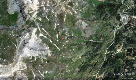
 CODOS Update for Senator Beck Basin Study Area:
Visited May 5-6, 2013
CODOS Update for Senator Beck Basin Study Area:
Visited May 5-6, 2013
Summary | Snowpack | Melt Rate | Stream Flow | Wind | Forecast
Summary
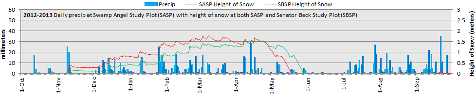
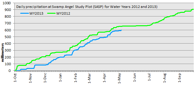
Divergence in snowcover conditions continued in the Colorado mountains in early May 2013, with the northern and Front Range mountains gaining SWE while the southern mountains were rapidly losing snowpack and dust layers D8/D7/D6/D5 continued their progressive emergence to higher elevations and cooler aspects. Recent fieldwork in Senator Beck Basin, and repeat photography, provided stunning visual evidence of the intensity of dust deposition in WY 2013, rivaling and perhaps ultimately exceeding the dust effects observed in spring 2009. A thin veneer of fresh, clean snow (Storm #22) has temporarily restored a higher snow albedo to the western San Juans, but that condition will be short lived as solar inputs return later in the week.
SnowPack Discussion
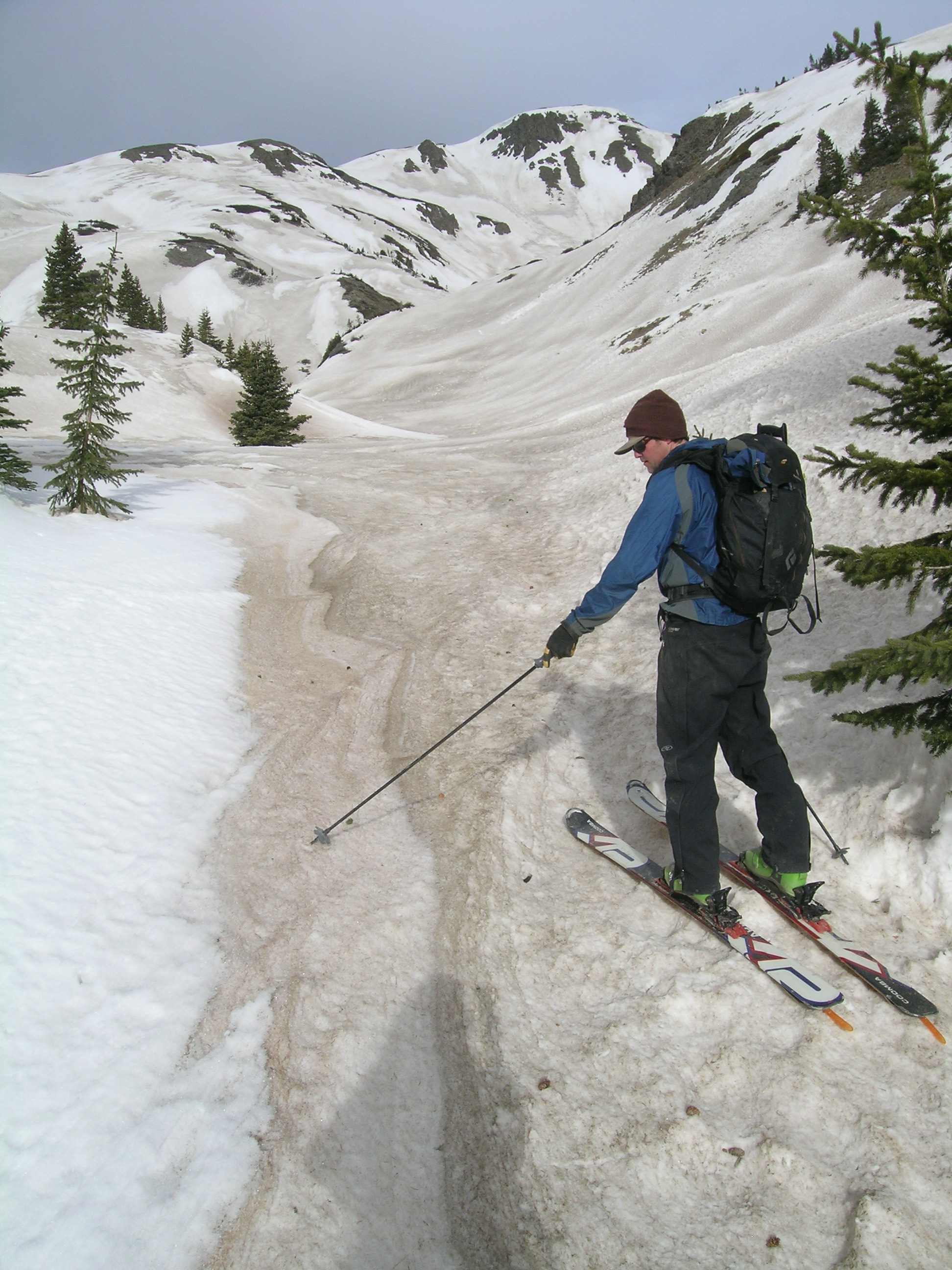
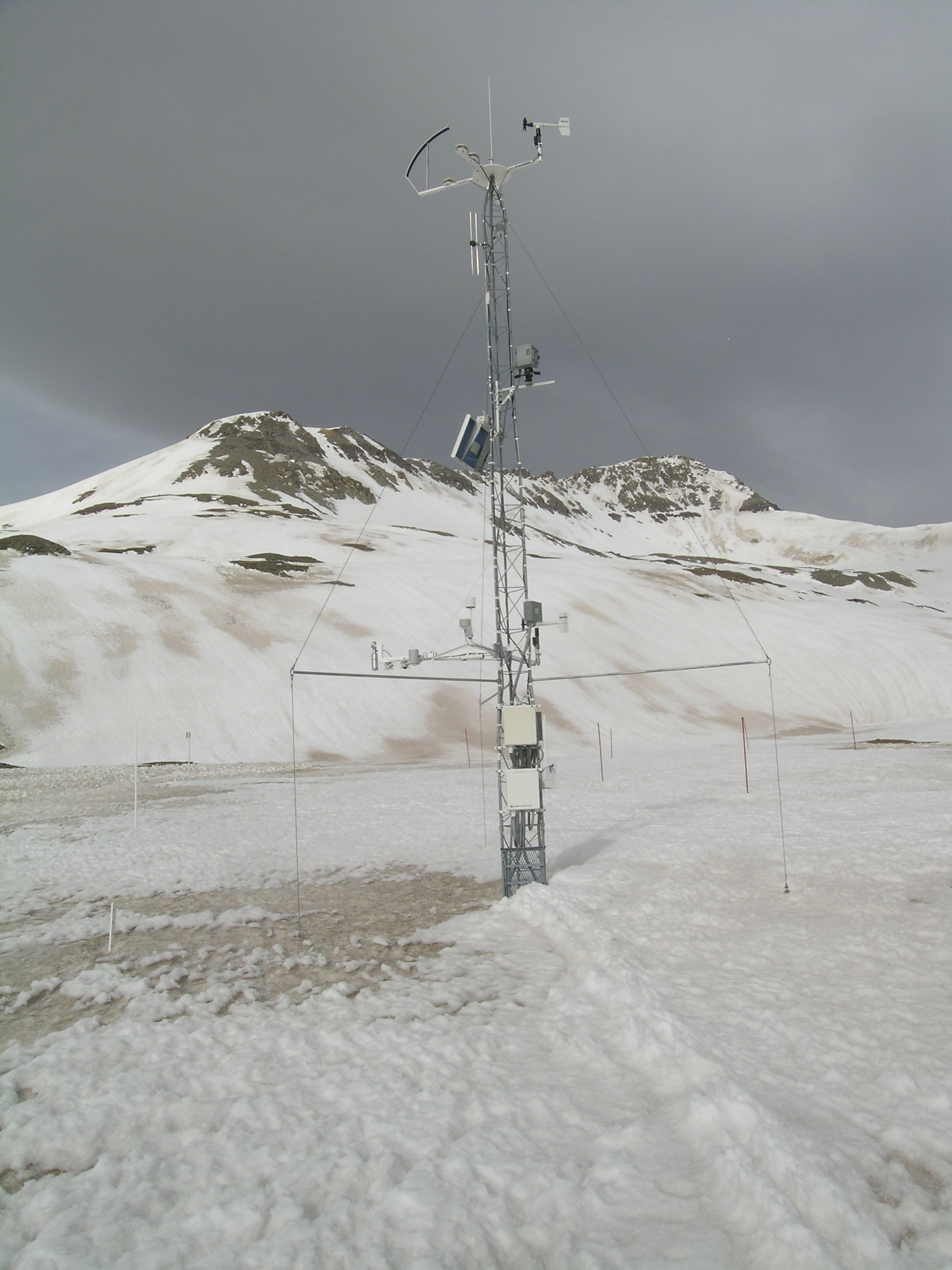
Snowcover is now effectively isothermal throughout most of the Senator Beck Basin Study Area. Recent snow profiles and snow depth data show rapid snowpack ablation at both Swamp Angel Study Plot, at 11,060’, and at Senator Beck Study Plot, at 12,180’. Virtually all dust layers had merged (except D2) and were exposed at the snowpack surface at Swamp Angel Study Plot by May 5. Snow albedo was very low as a result, in the low 30% range. Emergence of those layers was seen in progress at higher elevations in Senator Beck Basin, where considerable variation in snow surface albedo was observed on May 5. Merged layers D8/D7/D6 were just becoming widely exposed underneath the Senator Beck Study Plot tower on May 5, but comparatively clean patches of snow were still present nearby. Those cleaner patches belied the heavy concentrations of D8/D7/D6 that were, per our observations, deposited throughout the basin, and all terrain within site. Although emergence of D8/D7/D6 is far from complete, repeat photos looking to the west from Peak 13,510’ at the top of Senator Beck Basin, taken on May 5, 2013 and May 12, 2009, reveal the intensity of WY 2013 dust deposition in the Western San Juan mountains.
 |
 |
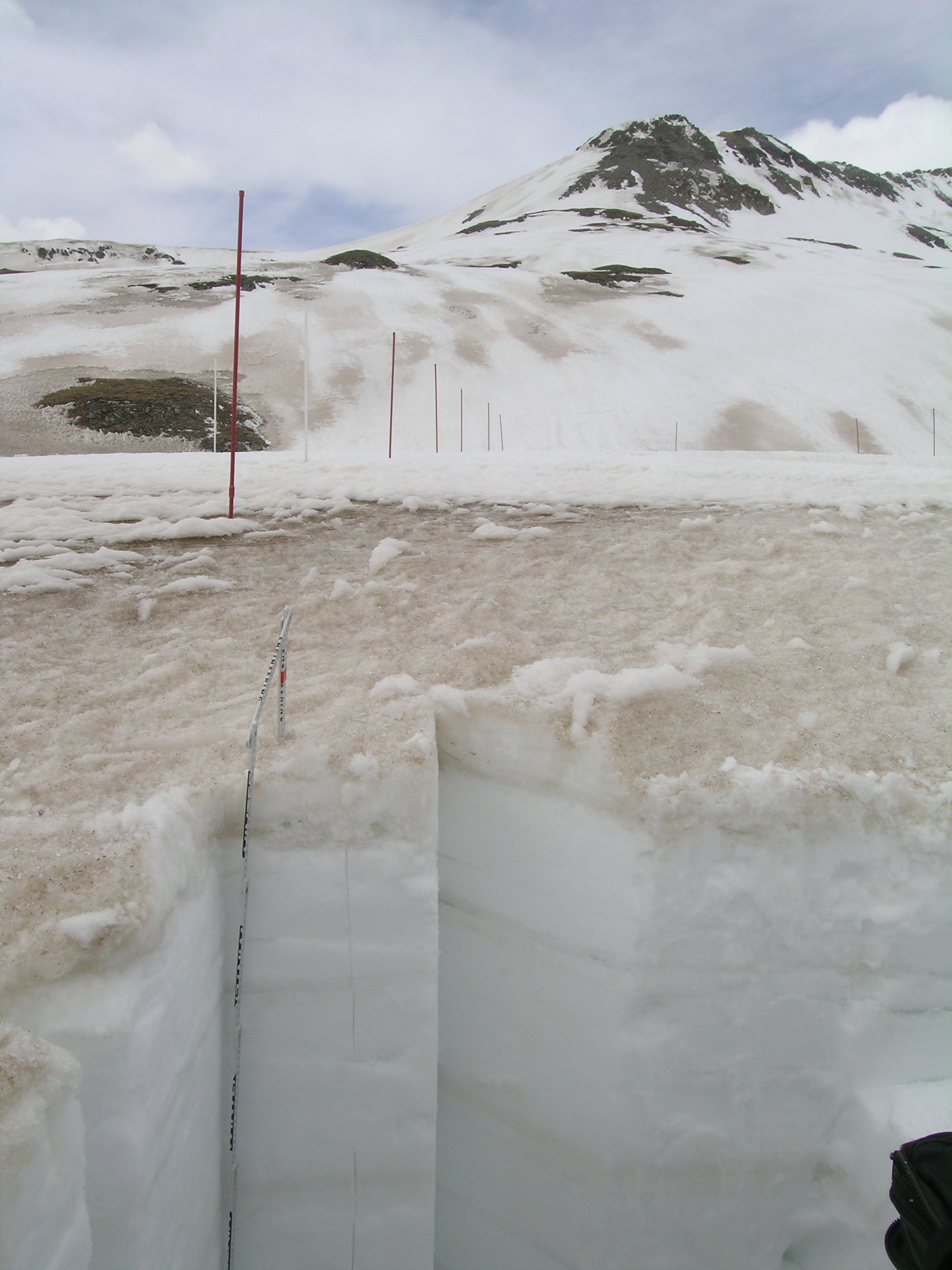 |
| Andrew Temple points out the gradations in dust color at the edge of a patch of clean snow on the shady side of a small gully. Andrew is standing on merged layers D8/D7/D6, with the extremely heavy and dark D6 layer dominating. He’s pointing to the fringe of redder, D8 dust just emerging from beneath the cleaner snow that fell over D8. Layer D7 was also distinguishable, as “iced tea” colored, at some locations. | Merged dust layers D8/D7/D6 were appearing underneath the Senator Beck Study Plot (SBSP) mast on May 5, visible to the downlooking radiometers. Such patches of dirty snow rapidly expand. Dust layers D8/D7/D6 are present, in significant concentration, underneath the comparatively clean patches of snow, where wind drifting added additional thickness to the snow layers separating those dust events. | Merged dust layers D8/D7/D6 were present in the snow surface at the snow profile plot at SBSP on May 5 and that snow was fully thawed an very wet at the time of the profile, despite increasing cloud cover. Dust layer D2 remains well buried at that site, in the middle of the snowpack. Examples of virtually all stages of dust emergence and snowpack ablation can be seen in the distance, on generally northeast-facing terrain. Bare ground is already exposed on terrain features that were likely wind stripped throughout the winter, never accumulating a thick snowcover and subject to earlier “snow all gone” under the effects of D8/D7/D6. |
 |
 |
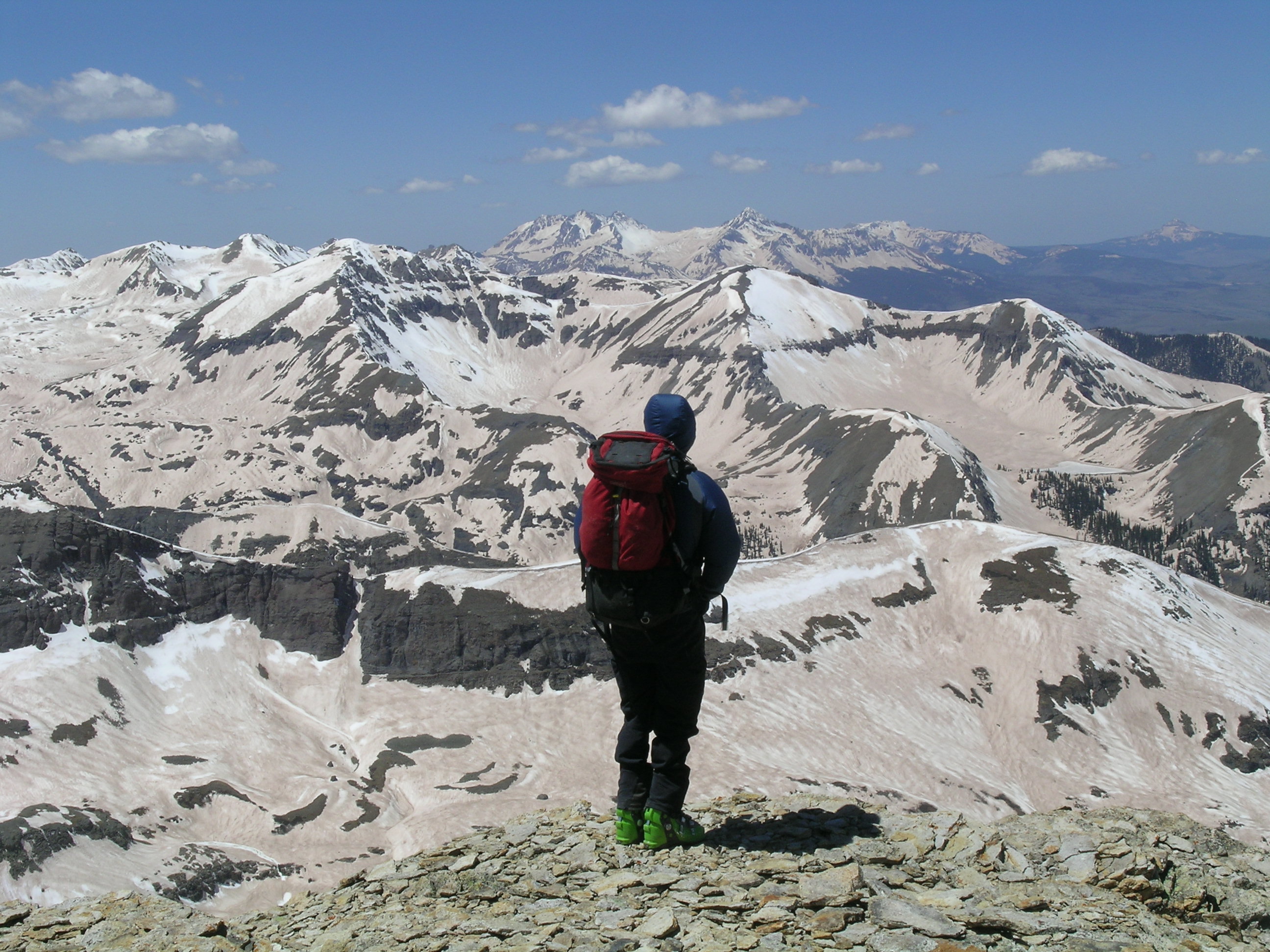
| Andrew Temple looking southwest from Peak 13,510’ at the top of Senator Beck Basin on May 12, 2009, with all twelve WY 2009 dust layers merged and almost entirely emerged. | Andrew Temple looking southwest from Peak 13,510’ at the top of Senator Beck Basin on May 5, 2013, with dust layers D8, D7, and D6 in various stages of partial emergence and merger, but with a considerable fraction of cleaner areas where their emergence had not yet begun. |
Panorama photography further documents the degree of snow albedo reductions extant on May 5, even with incomplete dust emergence. As they say, a picture is worth 1,000 words, but no picture can capture the surreal impact of these scenes, in person. (Expand these to 100%, for maximum impact).
A panorama from the Senator Beck Study Plot ranging from east, on the far left, to west, on the far right, showing much of the Red Mountain Pass locale. Trico Peak is seen above SBSP. Peak 13,510’, at the top of Senator Beck Basin, is just out of view on the far right. Dust layers D8/D7/D6 are seen in varying degrees of emergence and merger throughout the terrain.
The above panorama from Peak 13,510’ looks from southwest, at the far left, to northwest, at the far right. Ingram Basin is directly beneath Peak 13,510’, immediately above Telluride. Mount Sneffels (14,150’) is the high point to the right of Telluride.
Melt Rate
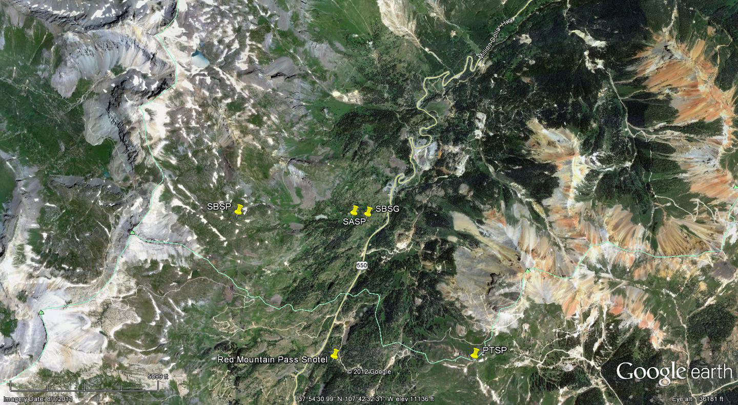
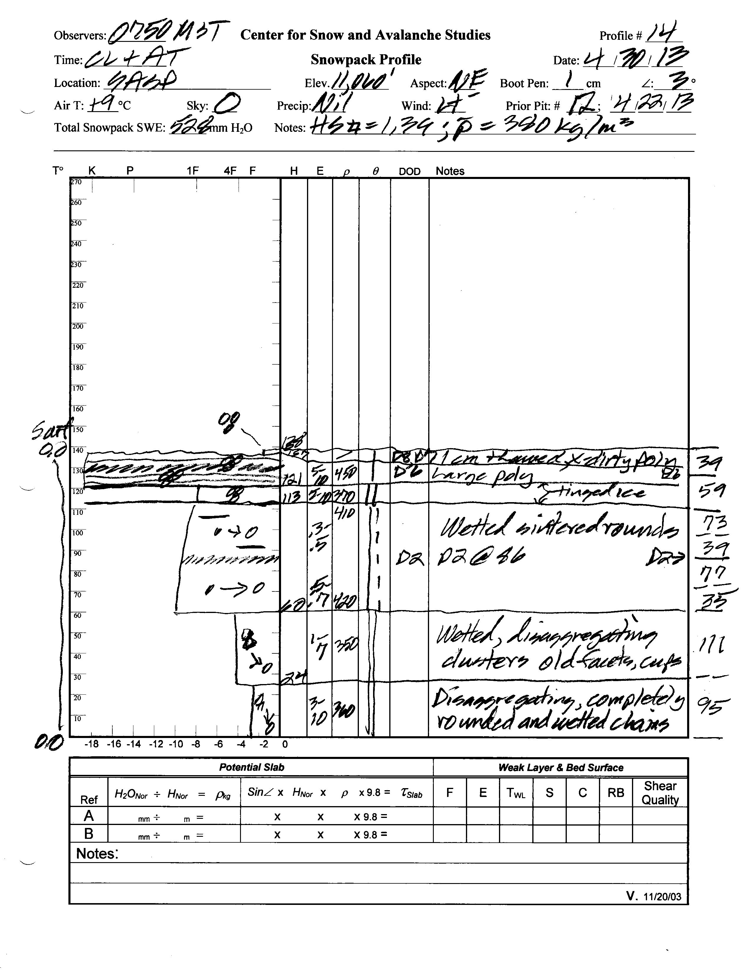
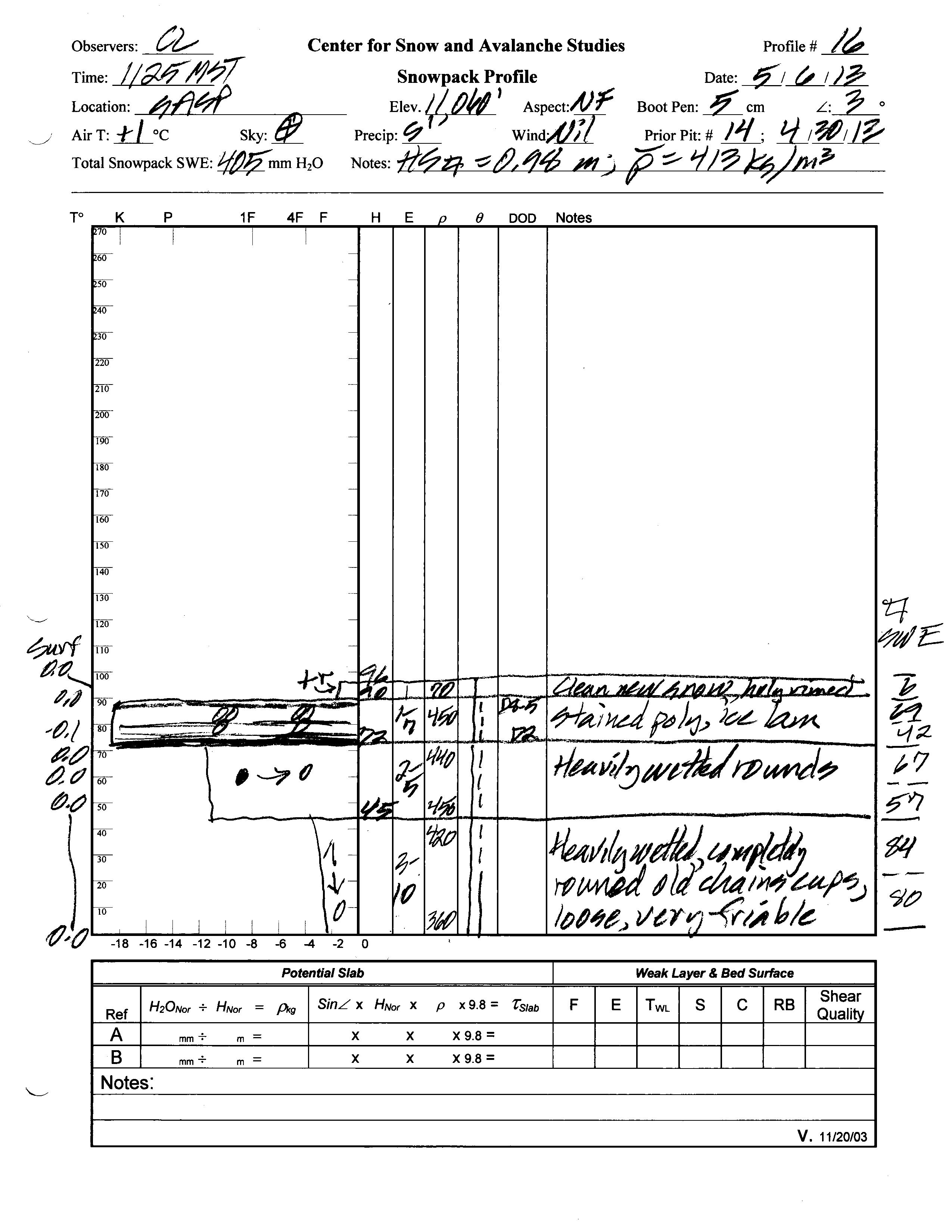
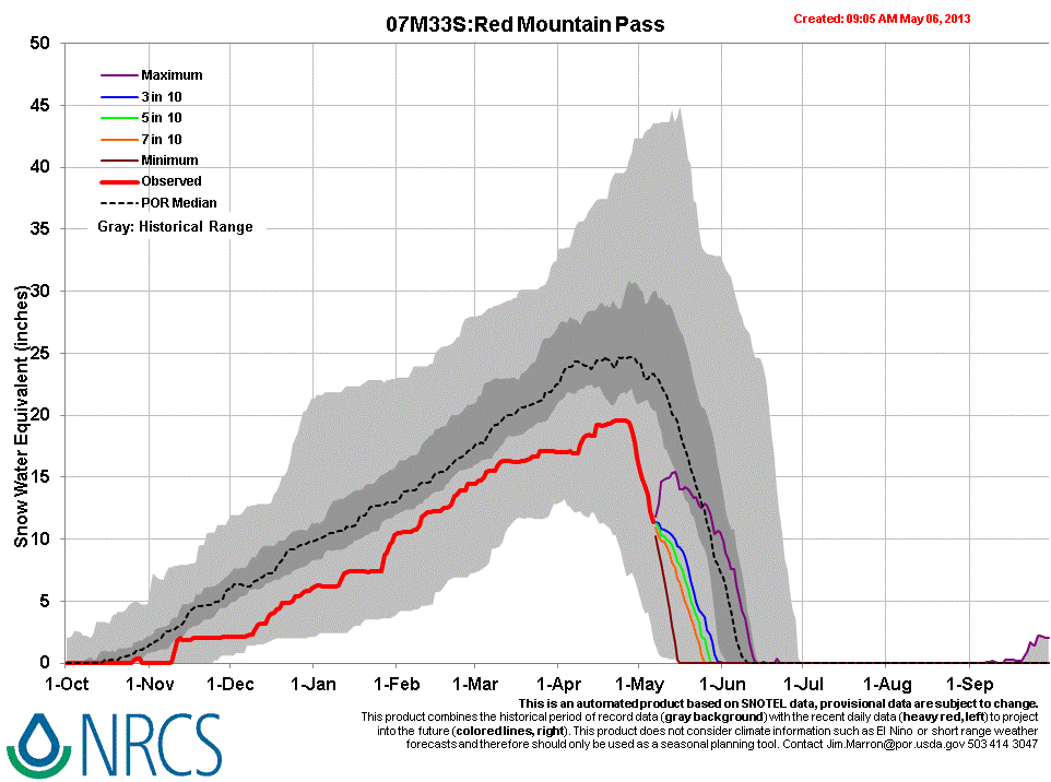
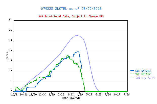
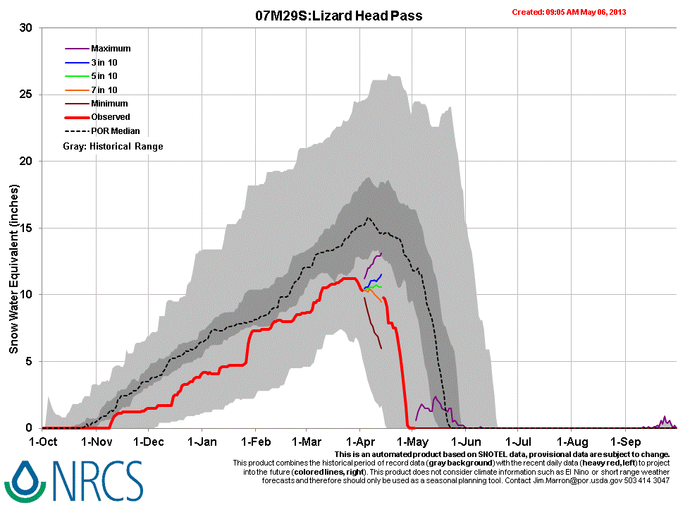
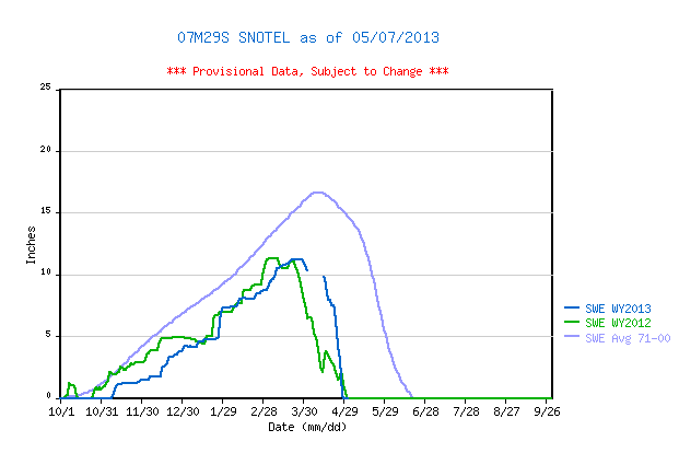
A total of 4.8” of snowpack SWE were lost over the week between our two most recent snow profiles at Swamp Angel Study Plot (SASP). Nearby, the Red Mountain Pass Snotel lost 5.2” SWE during the same period. The Lizard Head Pass Snotel lost all snowcover on/about April 29, 2013. Melt rates were clearly accelerating at SASP at the time of the most recent profile, but have subsequently slowed as solar inputs were reduced under cloudy weather and fresh snow.
Higher in Senator Beck Basin, the isothermal May 5, 2013 profile found some 2” less SWE than the April 24 profile (which was not isothermal). Standing water was present at the ground in the May 5 profile and meltwater had permeated the snowcover. Throughout the basin, freshets of snowmelt runoff were seen running over bare ground or heard running just underneath the snowpack during our May 5 and May 6 fieldwork.
| Senator Beck April 24, 2013 Snow Profile | Senator Beck May 6, 2013 Snow Profile |
 |
 |
| Swamp Angel April 30, 2013 Snow Profile | Swamp Angel May 7, 2013 Snow Profile |
 |
 |

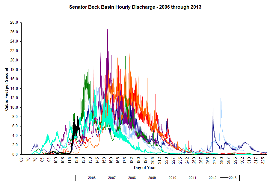
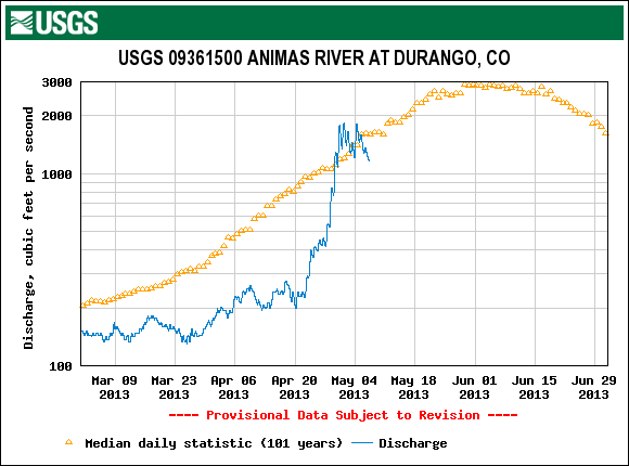
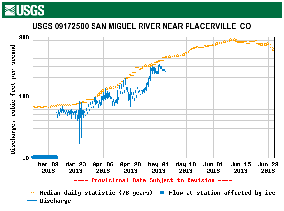
Stream Flow
Following the late April surging under dry and sunny weather that was previously reported, streamflows stalled and became more erratic, falling and then rebounding under variable weather conditions. Dolores River flows may now be on the descending limb of the WY 2013 hydrograph. However, given a return of sunny conditions over a prolonged period additional and perhaps high-rate surging may still occur on the Animas, San Miguel, and Uncompahgre rivers, driven by higher elevation snowmelt. Cumulative SBB discharge is still quite low with the vast majority of runoff volume still to come.


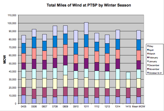
Wind Behavior
Winter 2012/2013, through April, has produced the lowest total cumulative “miles of wind” (MOW) in our 9 year period of record (if only by some 400 miles), with every month except October producing below average total MOW. Interestingly, winter 2008/2009 produced 86,719 MOW through April, 11,934 more MOW than the 74,785 total MOW through April 2013. We will provide additional MOW analyses in our final Season Summary report.
Forecast
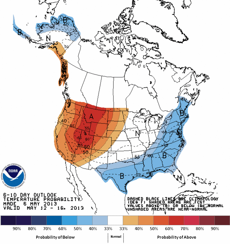
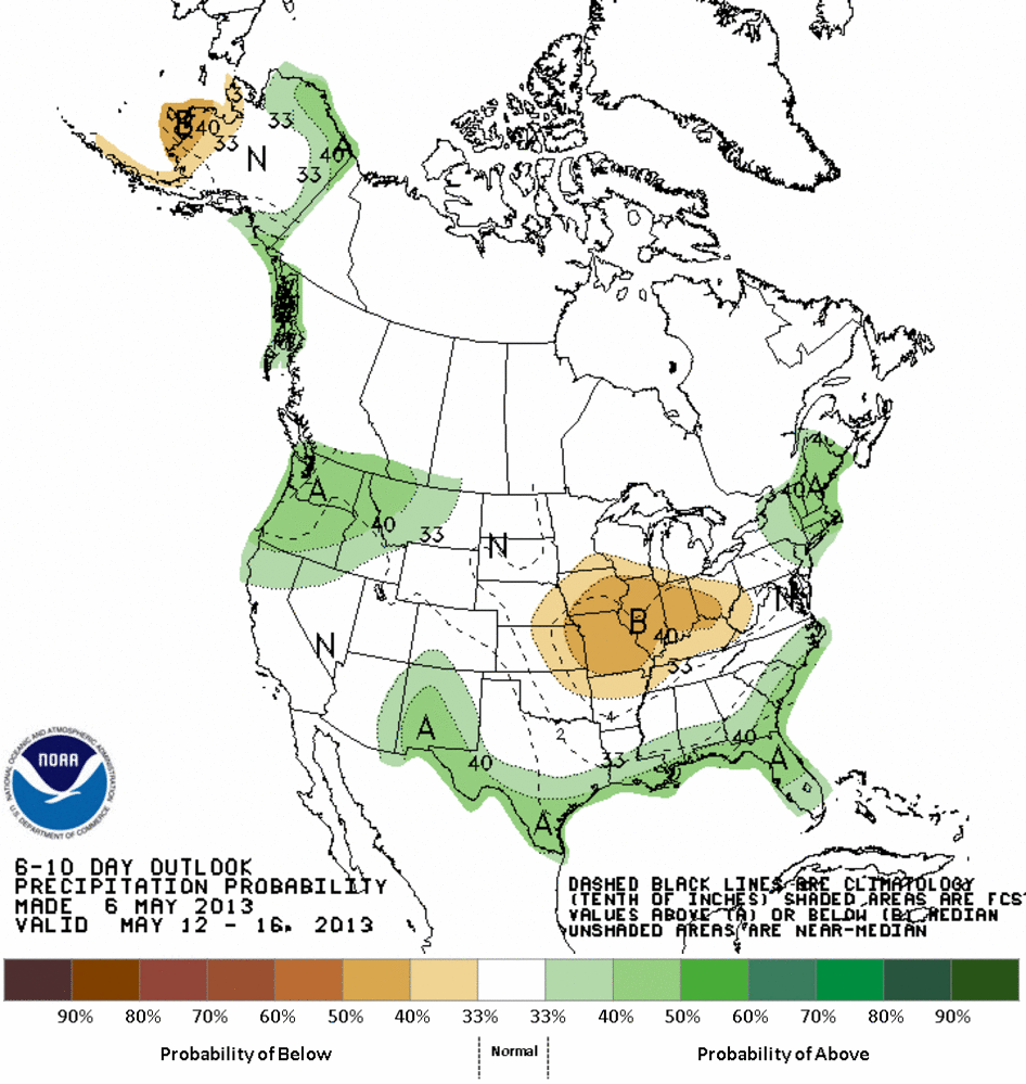
As of this writing, Tuesday, May 7, 2013 the National Weather Service expects continued unsettled weather for the western San Juan Mountains into the weekend, with snow and rain showers and mostly cloudy skies. A return to high pressure conditions begins Saturday as a ridge begins coming on shore in California and the current low pressure regime shifts eastward. Although some convective potential may remain over the western mountains, warmer and sunnier weather is likely to return to western Colorado early next week. With any return of the sun, recent fresh snows will rapidly “burn off” of underlying dirty snow and rapid snowmelt will resume at all snow covered elevations. The NWS Climate Prediction Center anticipates above average probabilities for warm weather and normal or slightly better probability for average precipitation for the May 12-16 period.