 CODOS Update for Spring Creek Pass site:
visited March 23, 2013
Summary | Snowpack | Melt Rate | Forecast
Summary
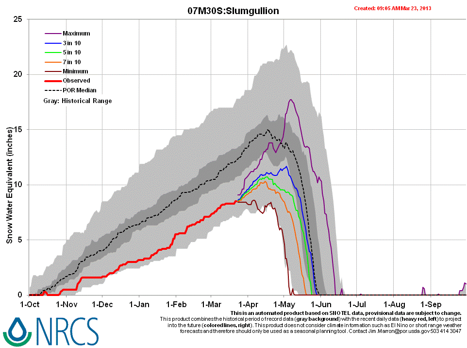
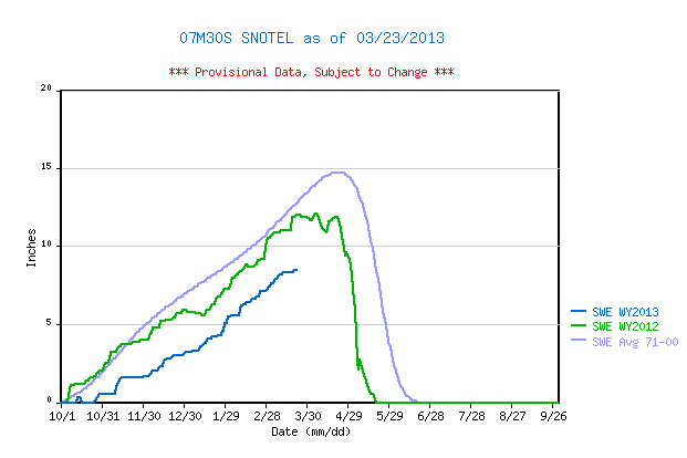
This field session at the Willow Creek Pass CODOS site, our first of the WY 2013 season, found less SWE than observed a year earlier, in slightly less snowcover. Fresh and blowing snow at the site largely obscured a fresh dust layer just beneath the surface (event D5), but dust layer D2 was clearly evident within the snowpack. The snowpack still retains considerable cold content and will require additional warming to become isothermal, but dust layer D5 will very quickly emerge and accelerate snowpack warming in coming days. Our CODOS Spring Creek Pass snow profile data show markedly lower total SWE than the nearby Slumgullion Pass Snotel site.
SnowPack Discussion
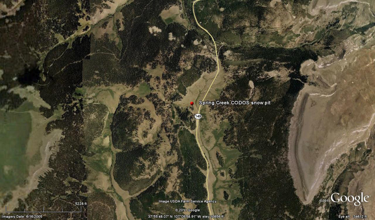
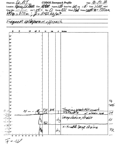
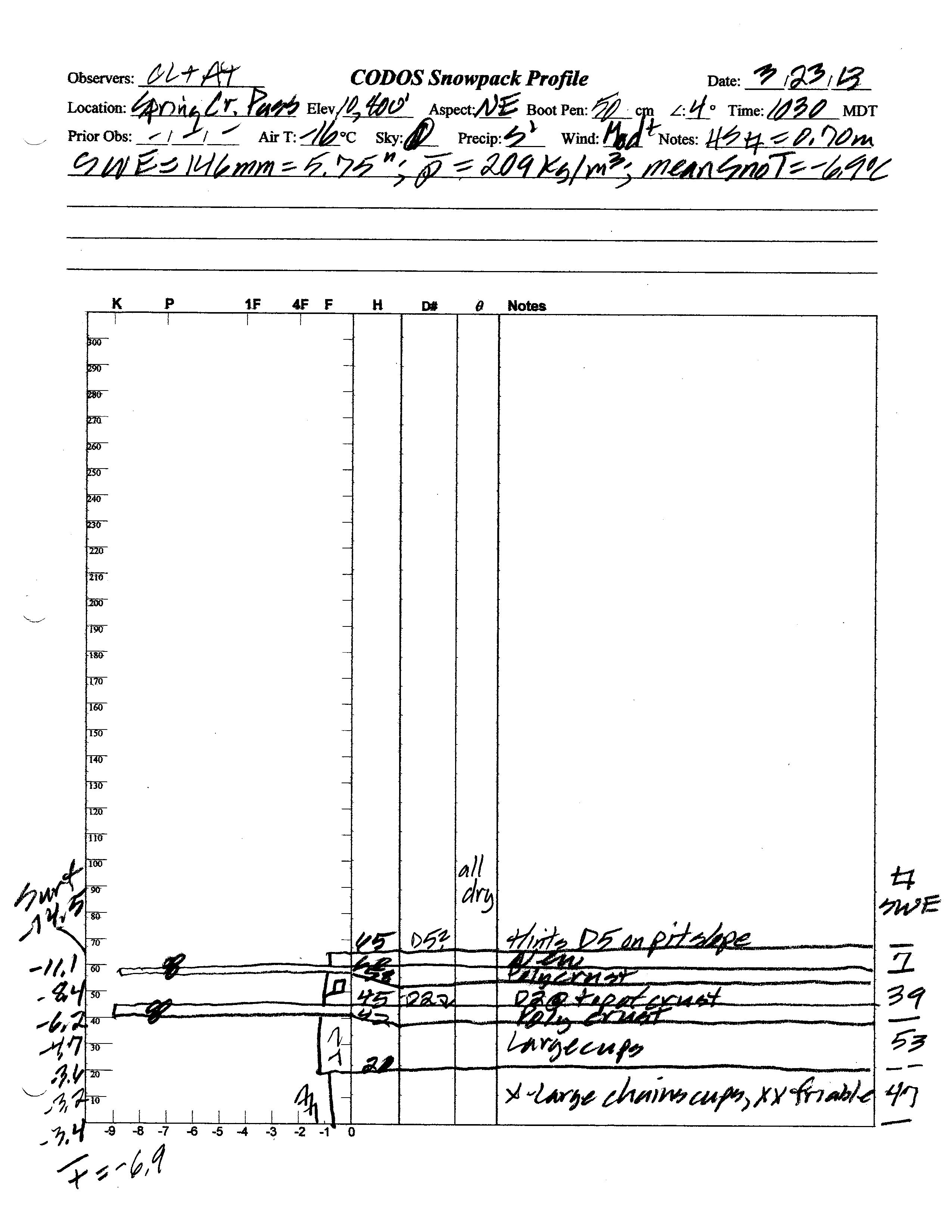
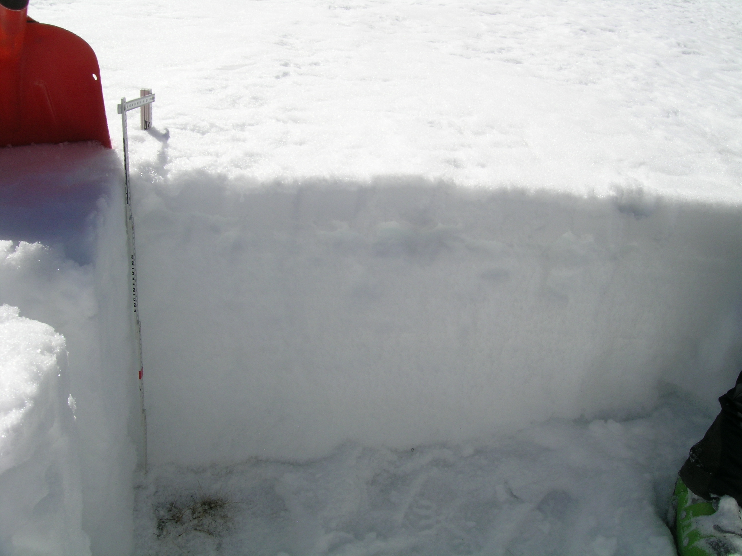
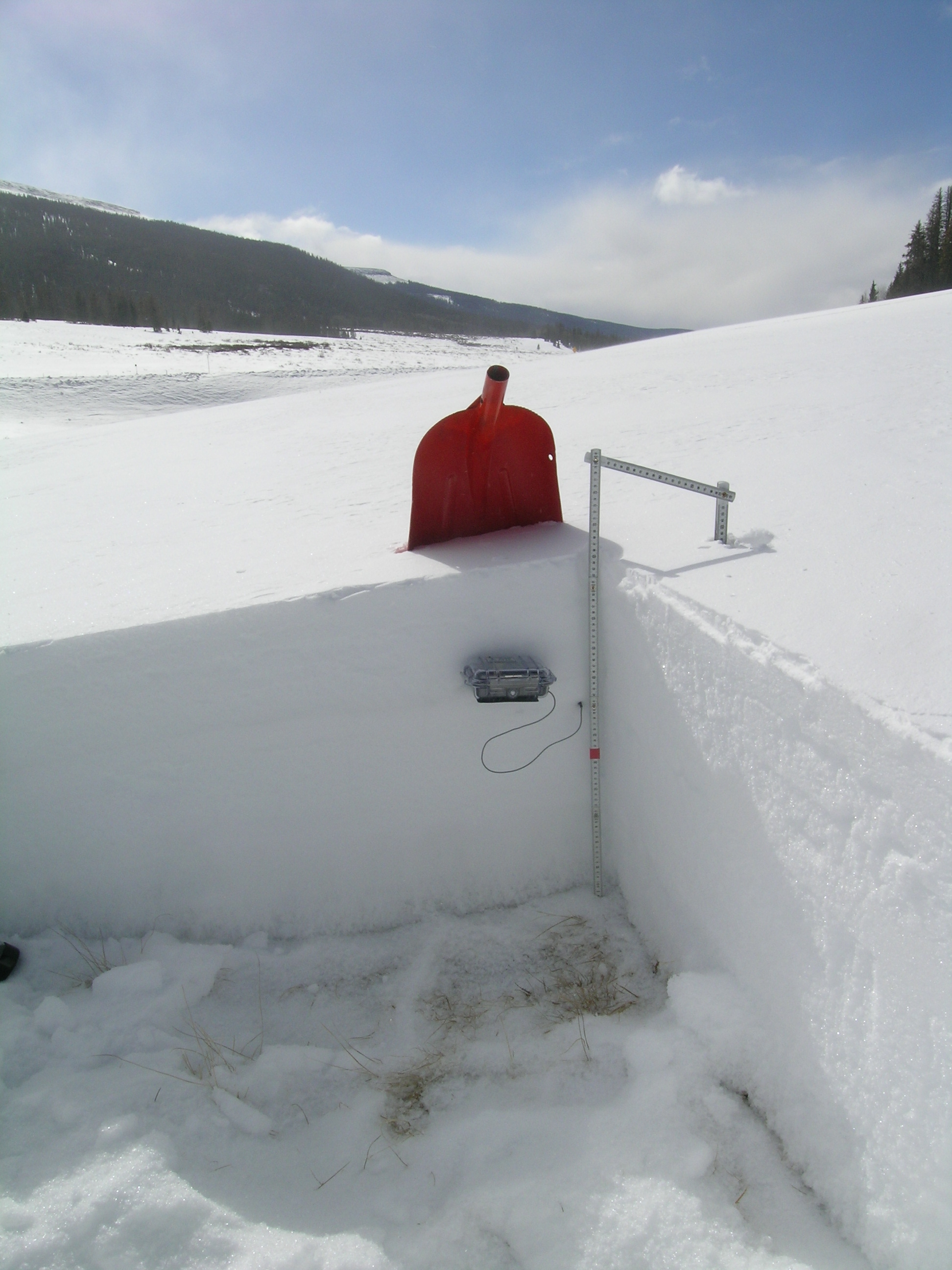
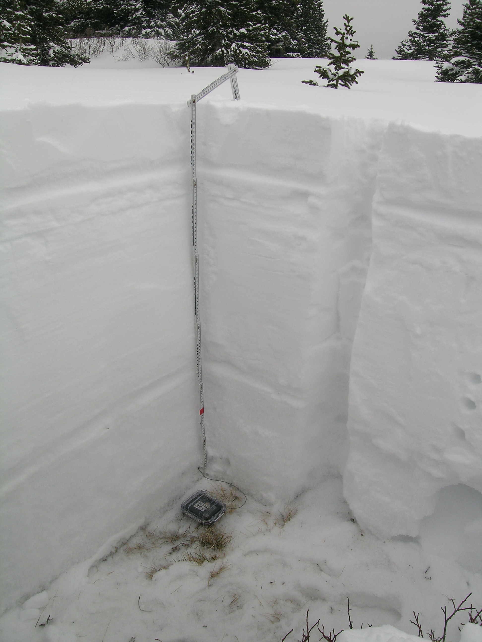
Total snow depth in our March 23, 2013 Spring Creek Pass CODOS site snow profile was 26”, 2” less than observed at the site a year before, on March 17, 2012. Total SWE in this profile was only 5.75”, or 1” less SWE than measured a year earlier. Mean density of this snowpack was very low at 209 kg/m3 (20.9% water content), versus 242 kg/m3 a year before and, as is usual for this site, we plunged to the ground as soon as we stepped out of our skis. The CODOS snow profile site is located in an open meadow west of the Spring Creek corrals turnoff on State Hwy 149 (see photo below) and several miles southeast of the Slumgullion Pass Snotel site, the nearest Snotel. That well-shaded, slightly north-facing Snotel site reported 8.5” of SWE on the morning of March 22 (the most recent data available), almost 2.8” more SWE than we measured at the CODOS site. Wind effects at the open and exposed CODOS snow profile site may account for some of those differences in SWE and the well-shaded Snotel site may have retained snowcover that melted off the CODOS site in early winter.
In contradiction to the brisk 3° F air temperature at the time of our visit, some melt had occurred in the upper snowpack at the Spring Creek Pass CODOS site earlier in March and in February (associated with dust layer D2), then refrozen as thin crusts composed of “polycrystals”. However, on March 23 the snowpack was once again completely dry and quite cold. Mean snowpack temperature in this profile was -6.9° C, as compared to -1.6° C a year earlier. Temperatures in the lowest snowpack and at the snow/soil interface were also unusually cold, probably the result of very thin (or no) snowcover in December and in January (as observed by CSAS staff). Soils here may be frozen unusually deeply.
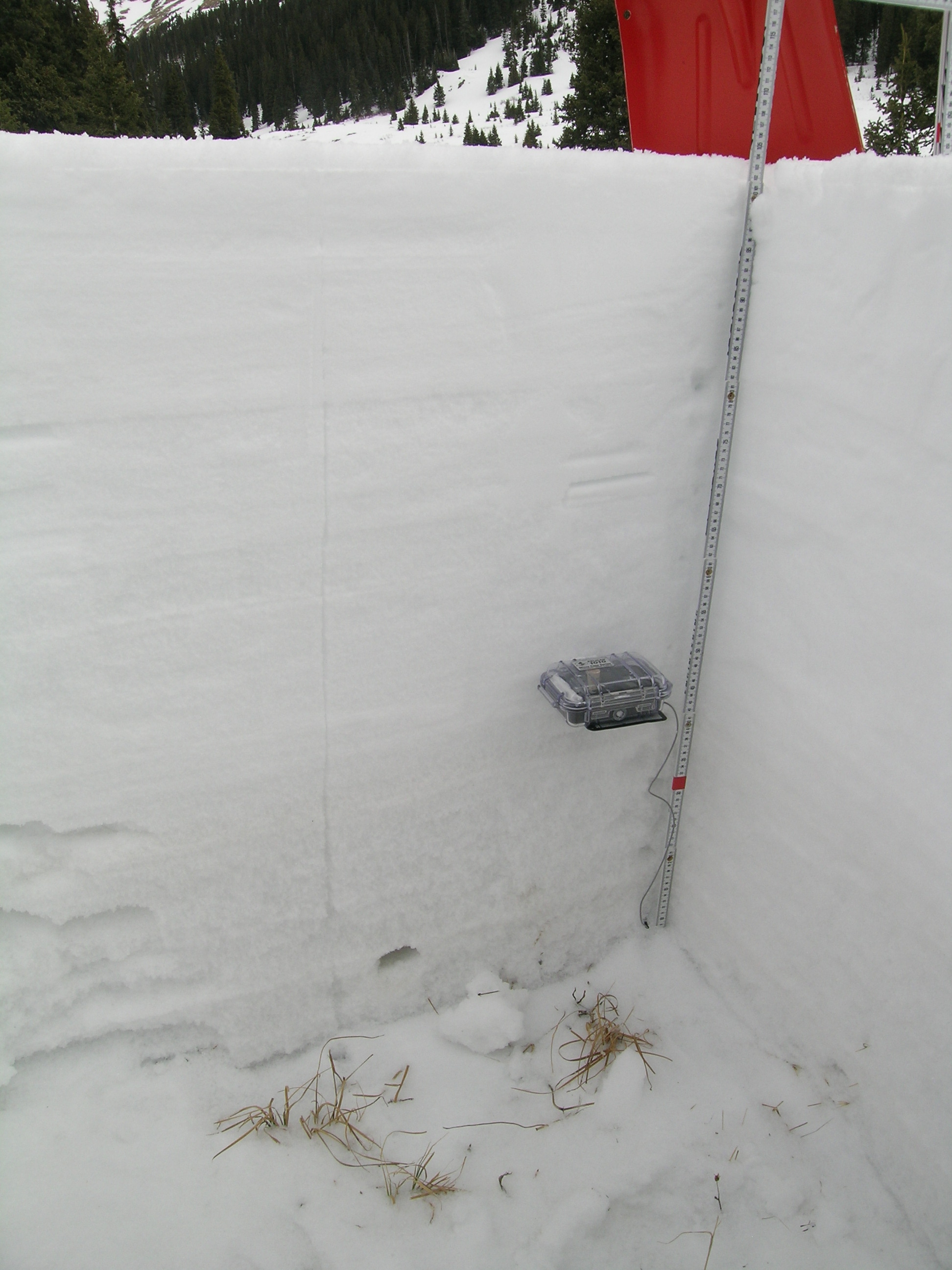
Dust-on-snow layer D2-WY2013 (February 8) was plainly evident within the snowpack and the recent D5 dust (March 21 event) was faintly seen in the new snow at the surface. D5 dust was much more clearly evident further down the valley, where less new snow had accumulated on the D5-dusted snow surface (see photo below).
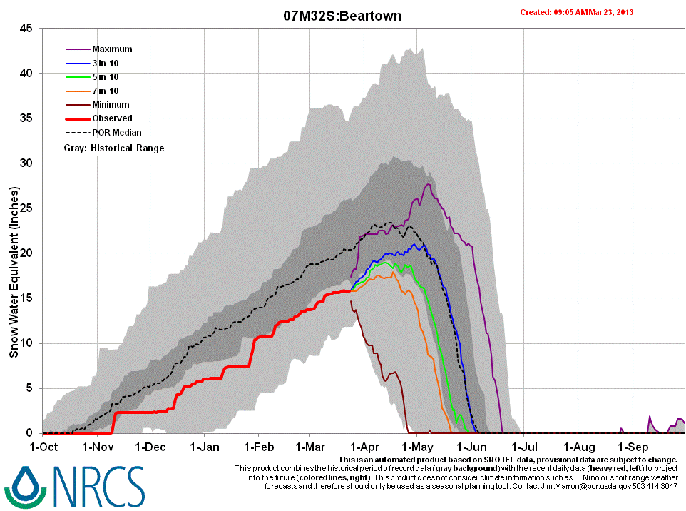
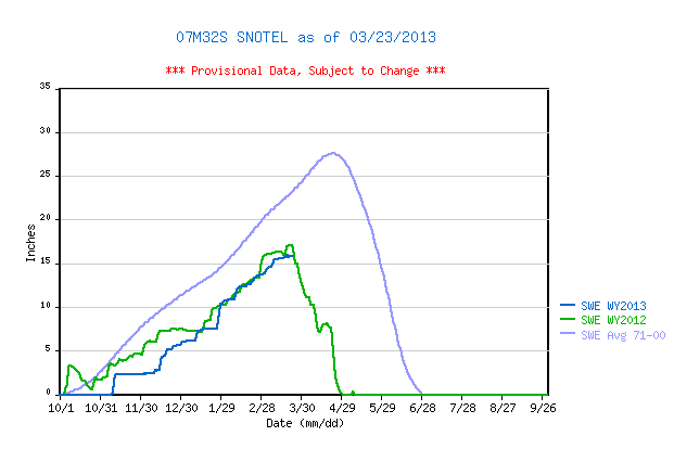
Even with more snowpack than we observed at our Spring Creek Pass CODOS site, the Slumgullion Pass Snotel data for WY 2013 places current SWE near the bottom of the lower quartile of SWE values for the period of record and well below the same-date values recorded in WY 2012. The Beartown Snotel currently reports SWE values closer to the top of the lower quartile of the period of record, and closer to the values reported in late March 2012.
 |
 |
|
| 2012 Pit Profile | 2013 Pit Profile |
 |
 |
|
| 2012 Pit Photo | 2013 Pit Photo |
 |
 |
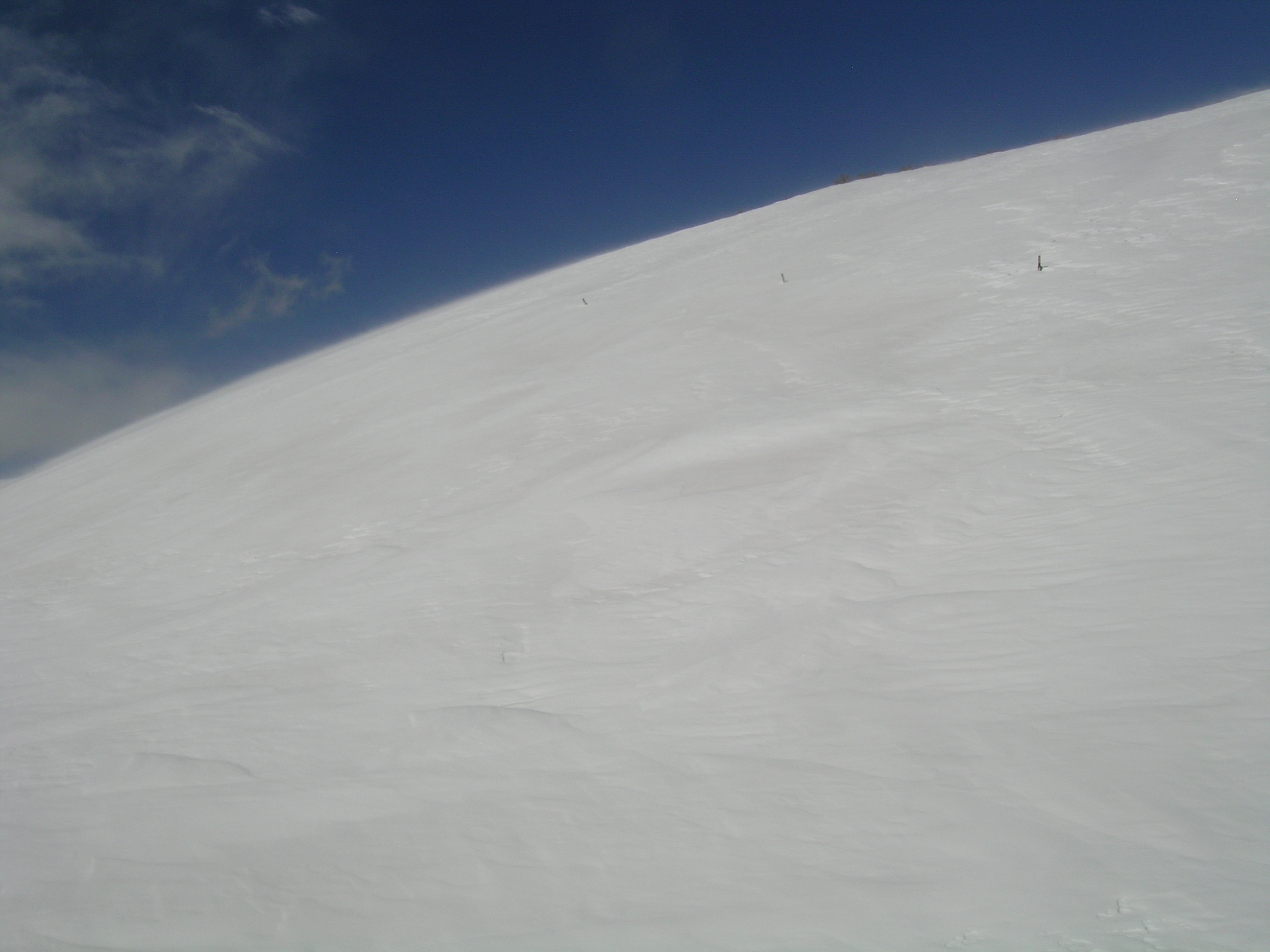 |
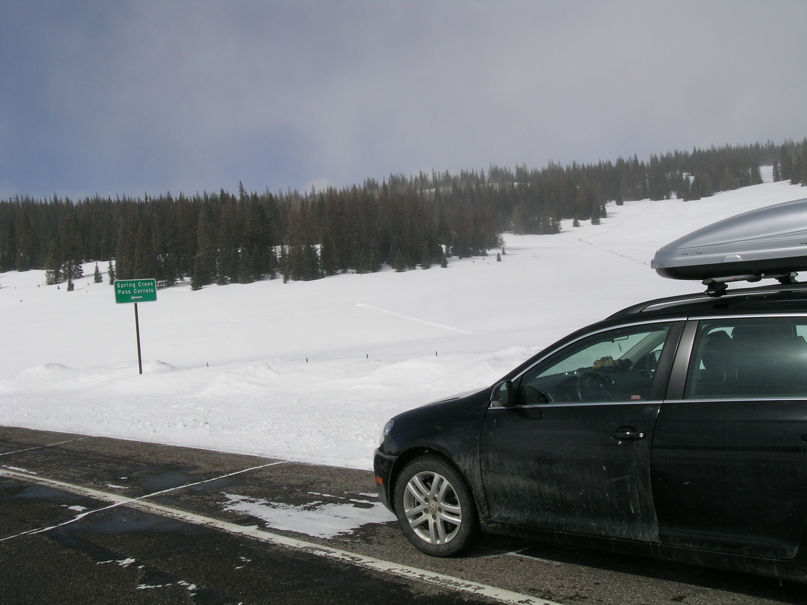
| CSAS field assistant Andrew Temple preparing the March 23, 2013 snow pit at the Spring Creek Pass CODOS site, with peak Baldy Cinco (13,383’) in the distance. | Tracks lead to the Spring Creek Pass CODOS snowpit site, as seen after returning to State Hwy 149. | Down valley from the CODOS site, just before descending to the Rio Grande valley floor, dust layer D5 was exposed in patches on the snow surface, where wind had stripped away new snow. |
Melt Rate
The Slumgullion Pass Snotel site continues to accumulate SWE and reports no significant losses of SWE, to-date. Surface snowmelt had occurred in the snowpack at the northeast-facing CODOS snow profile site but we observed no indications that free water had yet percolated to the bottom of and exited the snowpack, as runoff. Upon renewed surface melt conditions, cold snow temperatures within the snowpack will refreeze percolating free water, as ice layers and “flow fingers”. Nonetheless, that process, enhanced by dust layer D5 (and eventually by the merger of D5 with D2), will consume cold content and accelerate snowpack warming. Lower in the Rio Grande watershed, solar energy absorbed by D5 (perhaps already merged with D2) will quickly bring the much thinner snowcover still present at those elevations to isothermal and result in snowmelt runoff (or absorption into soils).
Forecast
The National Weather Service anticipates mostly sunny weather in the Rio Grande headwaters for most of the remainder of March, and seasonably warm temperatures in the 40’s. Given the observed D5 dust-on-snow layer at/near the snowpack surface, and the minimal accumulations of new snow since our site visit, the Spring Creek Pass CODOS site is experiencing reduced snow albedo and additional, dust-enhanced absorption of solar energy. Initially, that extra increment of absorbed solar energy will accelerate snowpack warming, but it will likely require a prolonged period of sunny and/or very warm conditions to “ripen” this snowpack to isothermal, at 0° C throughout. Once isothermal, and as/when layers D5 and D2 merge and remain exposed, snowmelt runoff (or absorption by soils) will commence and snowpack ablation will accelerate. At the lowest snowcovered elevations of the upper Rio Grande watershed those snowmelt processes are more advanced, in much thinner snowcover, and D5 (perhaps already merged with D2) will accelerate snowcover ablation, to “snow all gone” (SAG).
As of March 23, 2013 only NRCS’s “maximum” projection of future snowpack accumulation would result in peak SWE at/above the median at either the Slumgullion Pass or Beartown Snotel sites. NRCS projects only a 3 in 10 chance that complete snowcover ablation (snow all gone, or SAG) will occur near the median date at either site, and higher probabilities that SAG will be earlier than the median date. Those projections are made based on historical snowpack behavior but without direct, season-specific estimations of dust enhanced snowmelt rates.