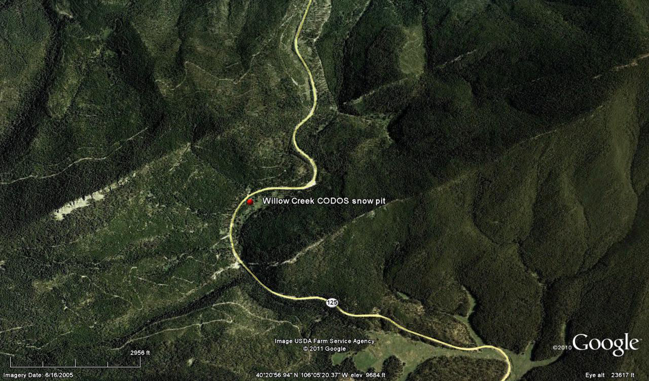
 CODOS Update for Willow Creek site:
visited April 12, 2013
Summary | Snowpack | Melt Rate | Stream Flow | Forecast
Summary
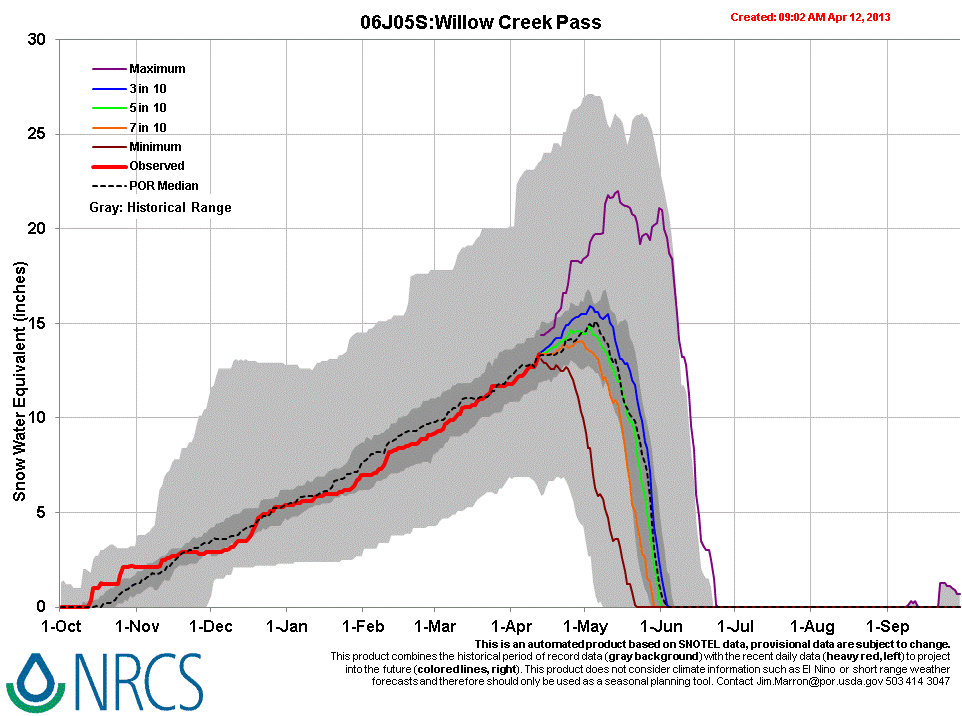
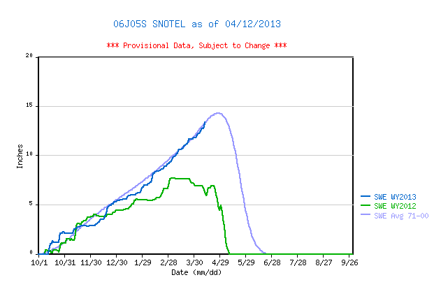
Dust layer D6 (April 8) and/or D5 are present in the Willow Creek snowpack, but at much lower magnitude of deposition than observed at Senator Beck Basin. As a result of dust enhanced surface snowmelt in late March and early April, snowcover at the Willow Creek Pass CODOS site was effectively isothermal on April 12, 2013. Snowpack SWE has increased slightly at the CODOS site since our prior visit, but some SWE loss has also occurred with melt water reaching the base of the snowpack and underlying wetland. The SWE total measured in the CODOS snowpit on April 12 was just 59% of the SWE total being reported at the nearby Willow Creek Pass Snotel. Snowcover rapidly diminished while descending the Willow Creek watershed toward Granby. (Another winter storm followed this site visit and yet another significant storm is predicted as of this writing, Sunday, April 14.)
SnowPack Discussion
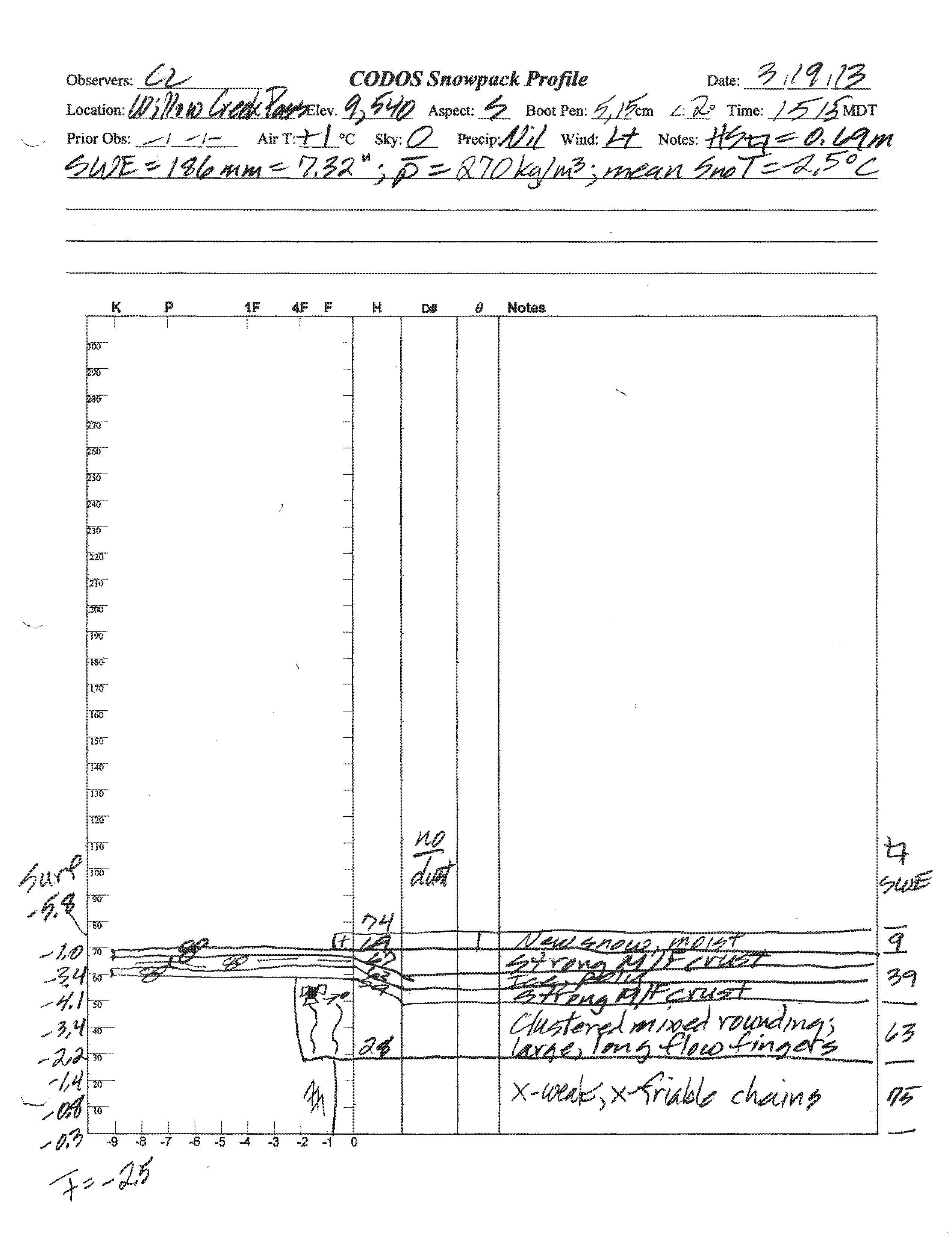
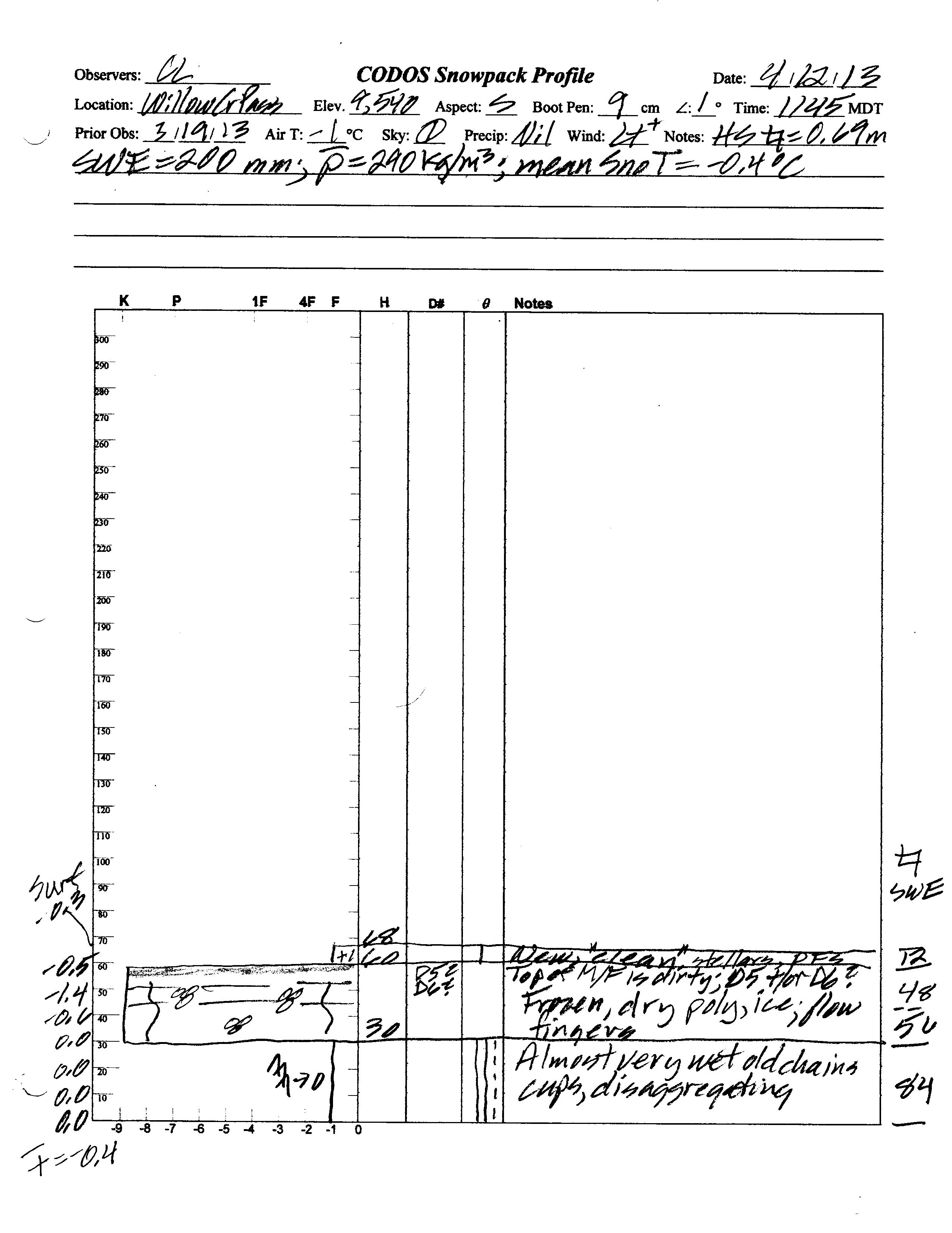
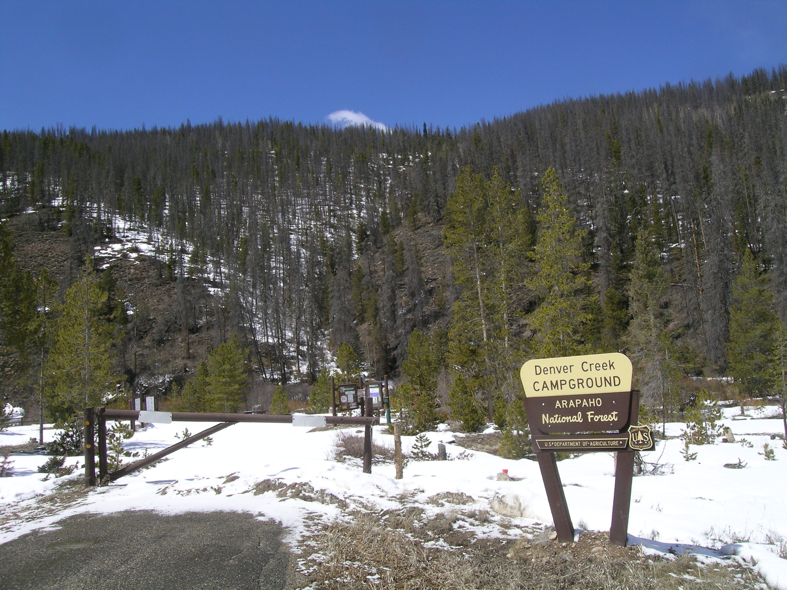
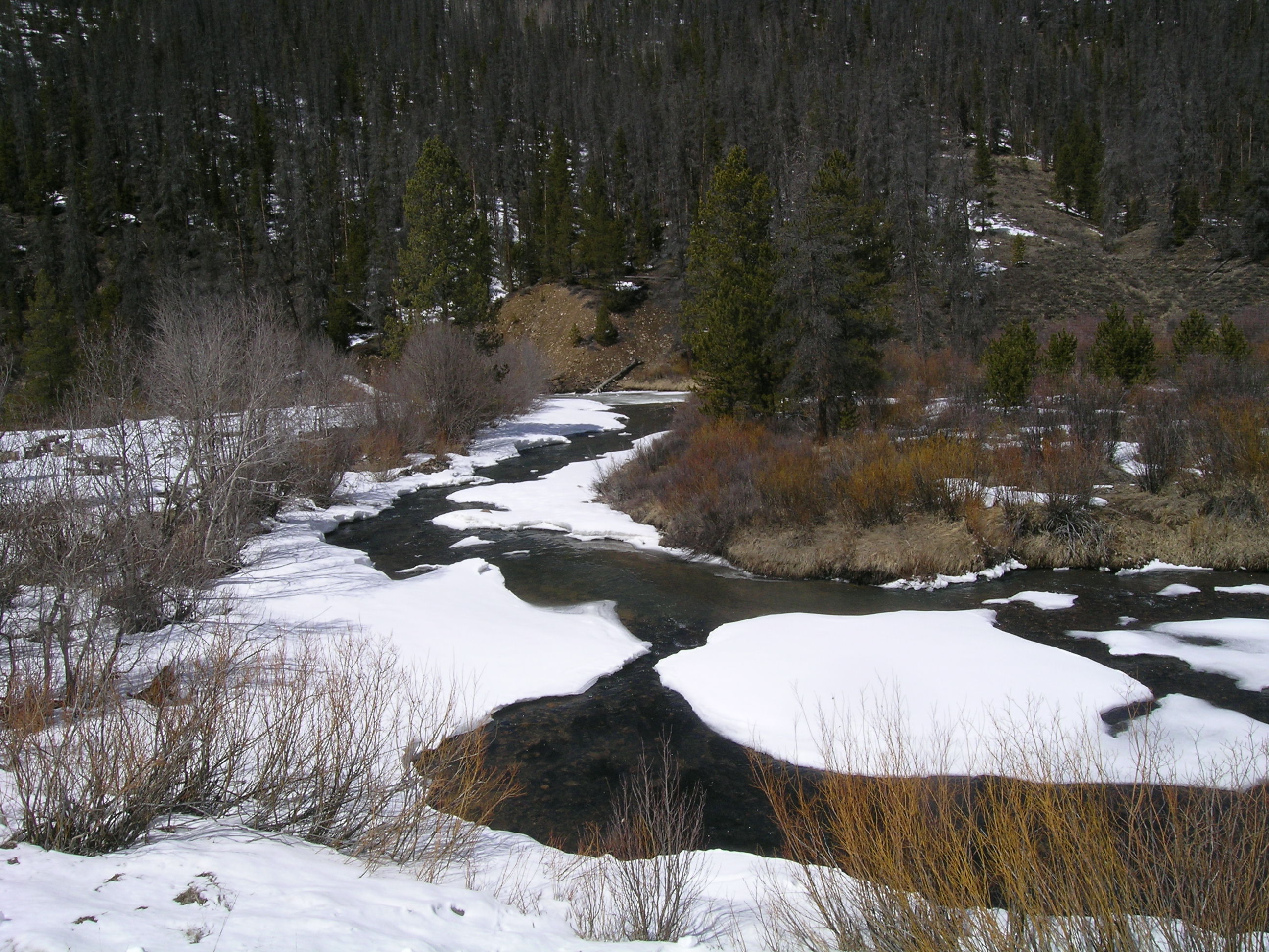
Total snow depth in the April 12, 2013 Willow Creek Pass snow profile was 27”, 2” less than observed at the site on March 19, 2013. Total SWE on April 12 was 7.9” and mean density of the snowpack was 290 kg/m3 (29.0% water content) versus 7.3” SWE and 270 kg/m3 mean density (27.0% water content) on March 20, 2013. As noted earlier in the season, at 13.3”, very near the median value for the period of record, the nearby Willow Creek Snotel reported substantially more SWE, on April 12 than our CODOS site contained. No additional insight was obtained, during this visit, which could explain that large discrepancy in total SWE. As the photo below shows, snowcover diminishes substantially with elevation and is gone on south aspects by mid-valley, near the Denver Creek Campground.
The top 3” of the snowpack on April 12, 2013 consisted of clean, new snow. If present at all, dust-on-snow event D6-WY2013 (April 8) fell directly onto and merged with a thick band of re-frozen melt-freeze polycrystals, interspersed with layers of ice, capped by the D5 (March 20-21) dust event that apparently followed the March 20 site visit. Whether consisting of one or both of those dust events, this comparatively minor (and merged?) dust layer did, nonetheless, enhance recent surface melting. All layers showed evidence of recent wetting by percolation of free water from the surface, and the lower half of the snowpack remained very wet. Aside from refrozen snow just below the surface, most of the snowpack was isothermal at 0.0° C. Mean snowpack temperature in this profile of -0.4° C, as compared to -2.5° C on March 20, 2013.
| March 19th Pit Profile | April 12th Pit Profile | |
 |
 |
|
 |
 |
|
| March 19, 2013 Pit Photo |
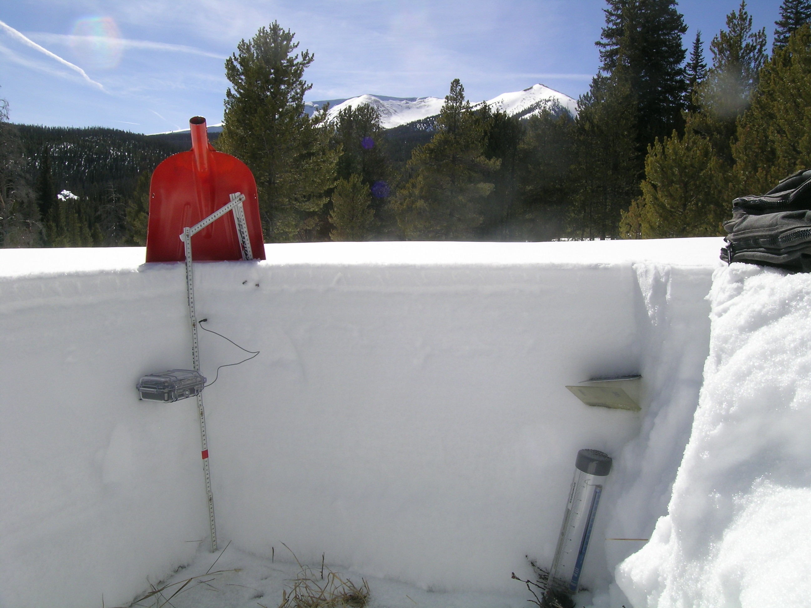
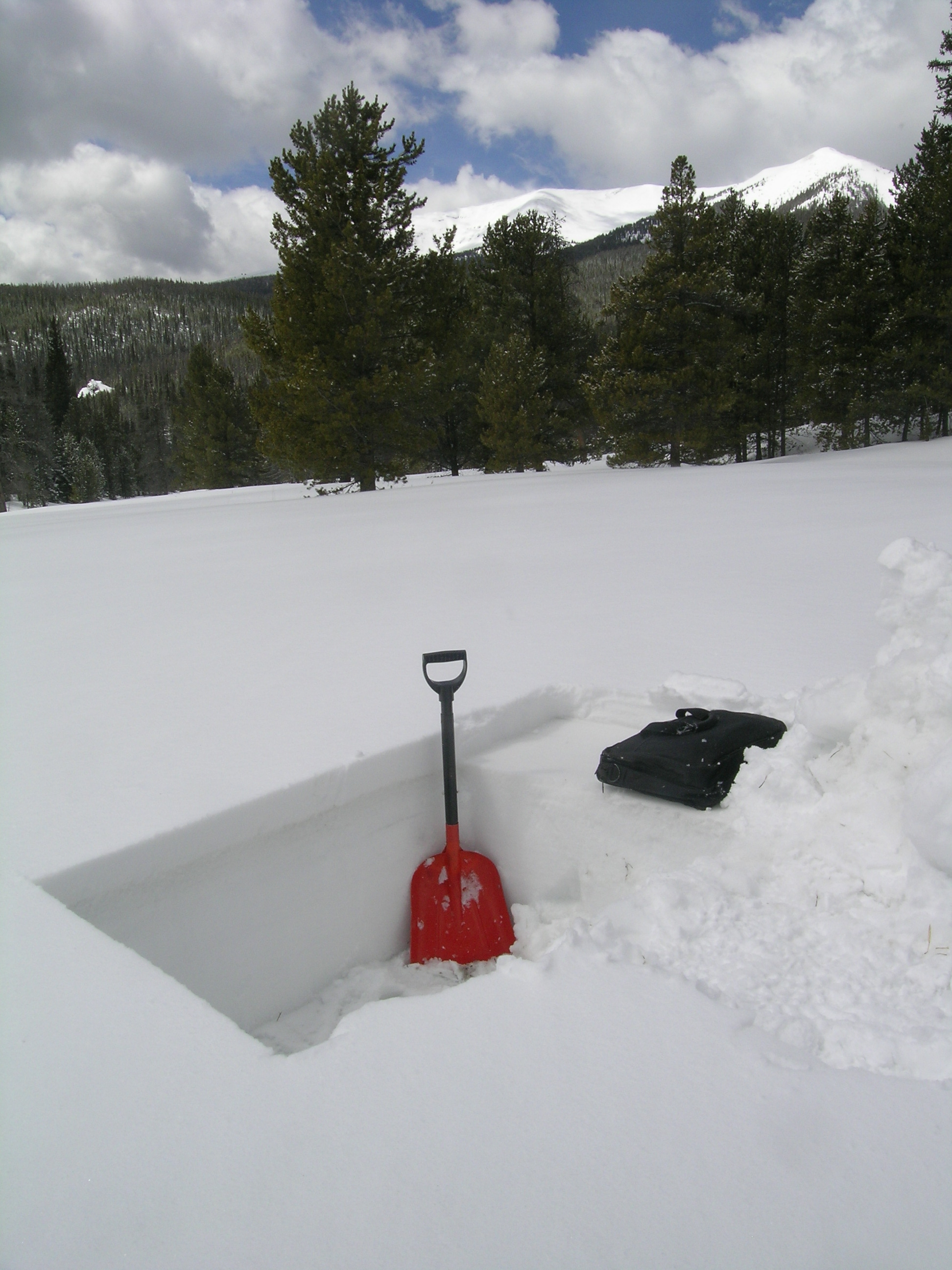
The upper April 12 snowpit showing the D5/D6 dust layer as a brown band just below the thin layer of new snow at the surface. Parkview Mountain (12,296’) is seen in the distance. |
|
 |
||
Snowcover was essentially gone in the valley bottom, at the Denver Creek Campground, |
||
Melt Rate
The Willow Creek Pass Snotel site continues to accumulate SWE and has not reported any significant SWE losses to-date. Despite also gaining 0.6” SWE, the Willow Creek Pass CODOS site also revealed that surface snowmelt, likely enhanced by dust event D5 (and perhaps D6), had occurred and that free water had percolated through and reached the base of the snowpack and soil. Since the site visit, the Willow Creek Pass locale has received another layer of fresh snow that will, once again, restore a higher snow albedo and delay the inevitable full emergence and impact of the D5 dust layer (and D6?) on snowmelt rates. As and when D5/D6 does more-or-less fully emerge, and remain exposed for some days, snowmelt rates will accelerate in the Willow Creek watershed. Ablation of this season’s snowpack at the CODOS site to “snow all gone” (SAG) will be quite rapid as merged layers D5 and D6 re-emerge and remain exposed.
Stream Flow
Streamflow data from the Willow Creek above Willow Creek Reservoir gauge are incomplete and no historical reference is provided. The photo of Willow Creek near the Denver Creek Campground indicates that flows remain low despite the extensive of snowcover ablation seen in the photo above and observed by us.
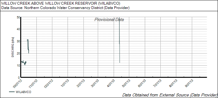
Streamflow at the Denver Creek Campground was quite low and
apparently
has never risen enough to erode snowcover from in-channel high points.
Forecast
As of Sunday, April 14, The National Weather Service expects unsettled weather to continue through most of the week of April 14-20, with snow levels dropping to higher valleys. A significant weather system is expected to arrive Monday, April 15 with strong SW’ly winds (Red Flag Warnings posted for southwestern valleys). A Winter Storm Watch anticipates 8-16” of new snow, or more, in the Willow Creek Pass locale and northern mountains. Partly sunny weather may return to the northern mountains by Sunday, but no prolonged drying is anticipated at this time as the weather remains unsettled through the week, perhaps slowly improving by the weekend.
Given additional new snowfall during the week of April 14-20, and without further dust-on-snow, the emergence of dust layer D5/D6 will be aspect and elevation driven, with earliest exposure at lowest snow-covered elevations, but perhaps quickly followed at Pass elevations. Even on mostly cloudy days early in the week, sufficient radiation may reach the snowpack to penetrate the new snow layer, reaching the D5/ D6 layer below and accelerating the ablation of the new snow. Given the predicted additional new snow amounts, Willow Creek streamflow data may not reflect the onset of D6-enhanced snowmelt until the following week, given drier and sunnier weather then.