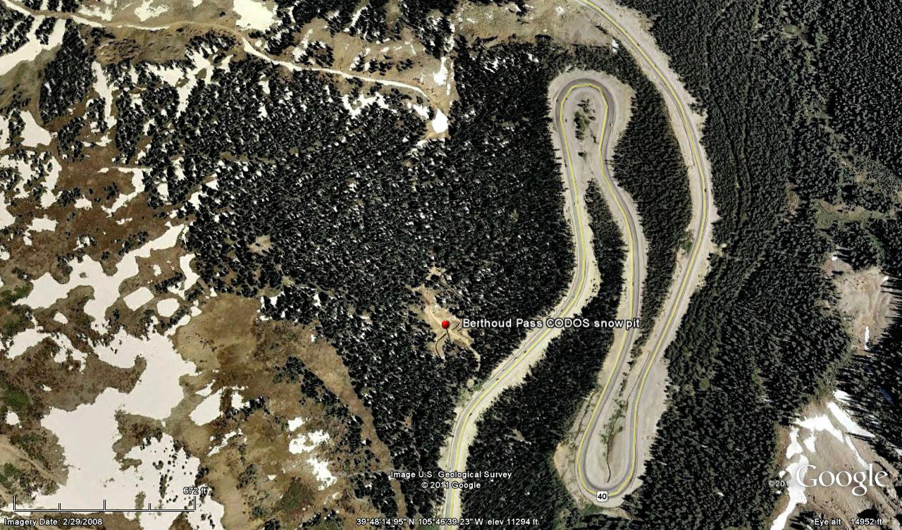
 CODOS Update for Berthoud Summit:
visited April 12, 2013
Summary | Snowpack | Melt Rate | Stream Flow | Forecast
Summary
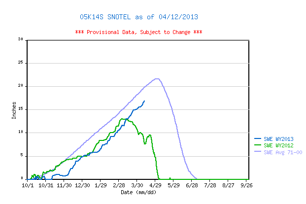
Among all CODOS sites, Berthoud Summit exhibited perhaps the least dust affected snowpack during the recent circuit, containing only very weak D5 and D6 layers. Snowpack SWE has increased by almost 4” at the CODOS site since our prior visit, but some SWE loss has also occurred with melt water reaching the base of the snowpack and soil. Winter storms in March and early April have resulted in the Berthoud Summit CODOS site retaining 39” more snowcover and 10.8” more SWE than was present on April 10, 2012. The adjoining Berthoud Summit Snotel data also show substantially more SWE on April 10, 2013 than on the same date in 2012. (Another winter storm followed this site visit and yet another significant storm is predicted as of this writing, Sunday, April 14.)
SnowPack Discussion
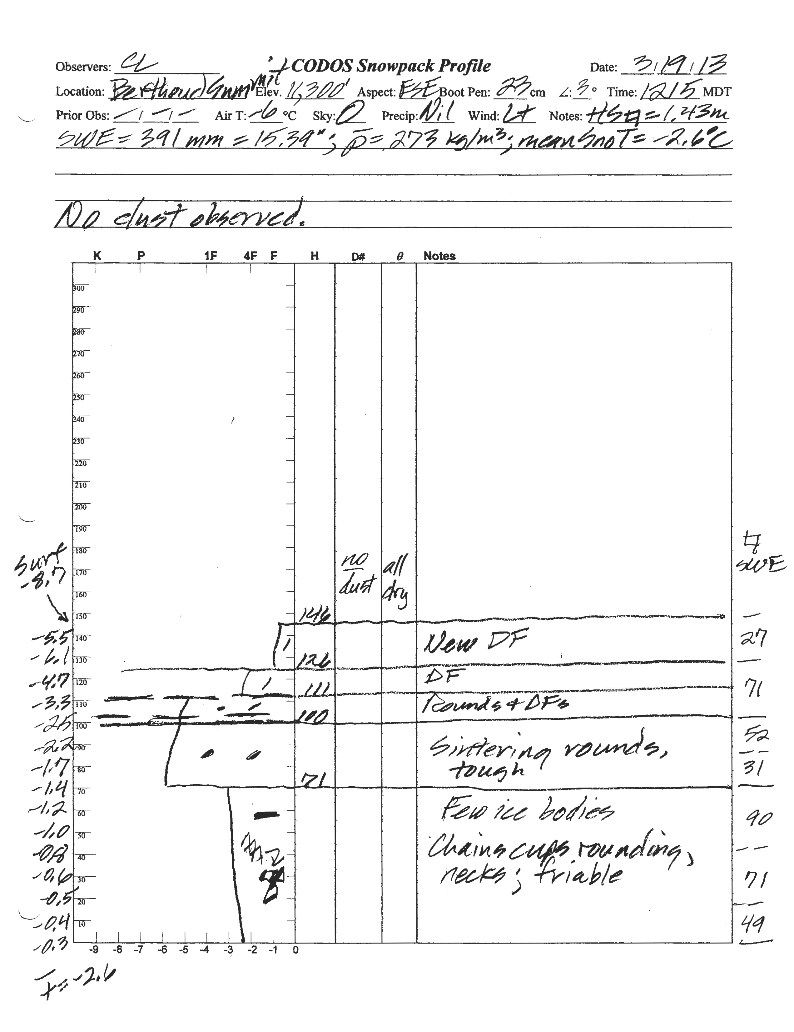
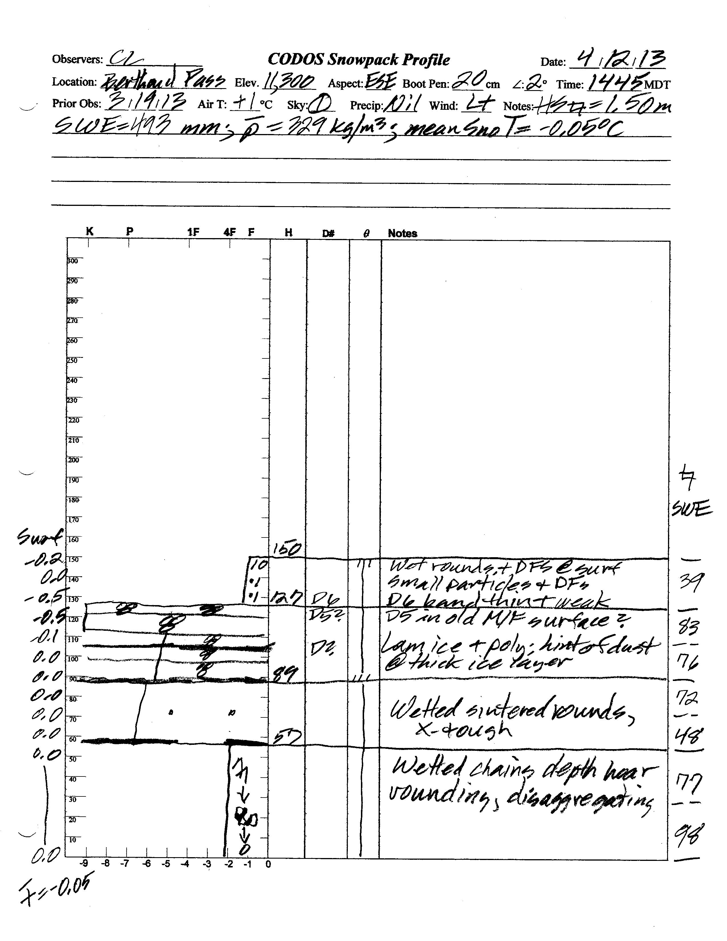
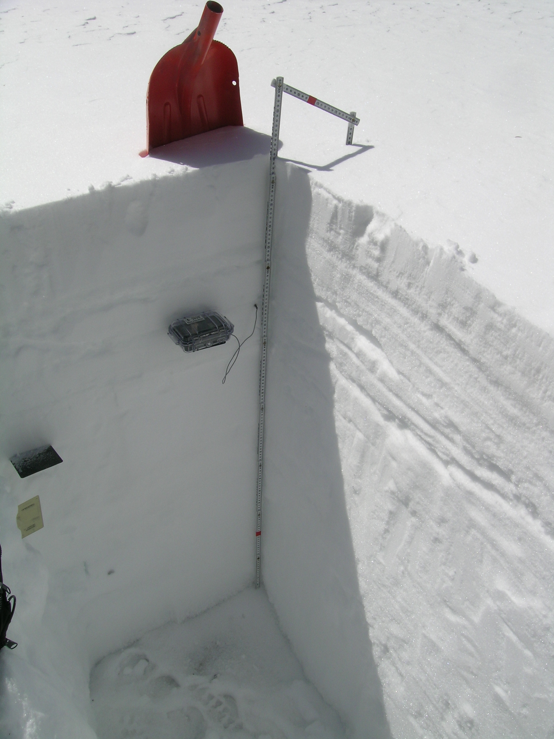
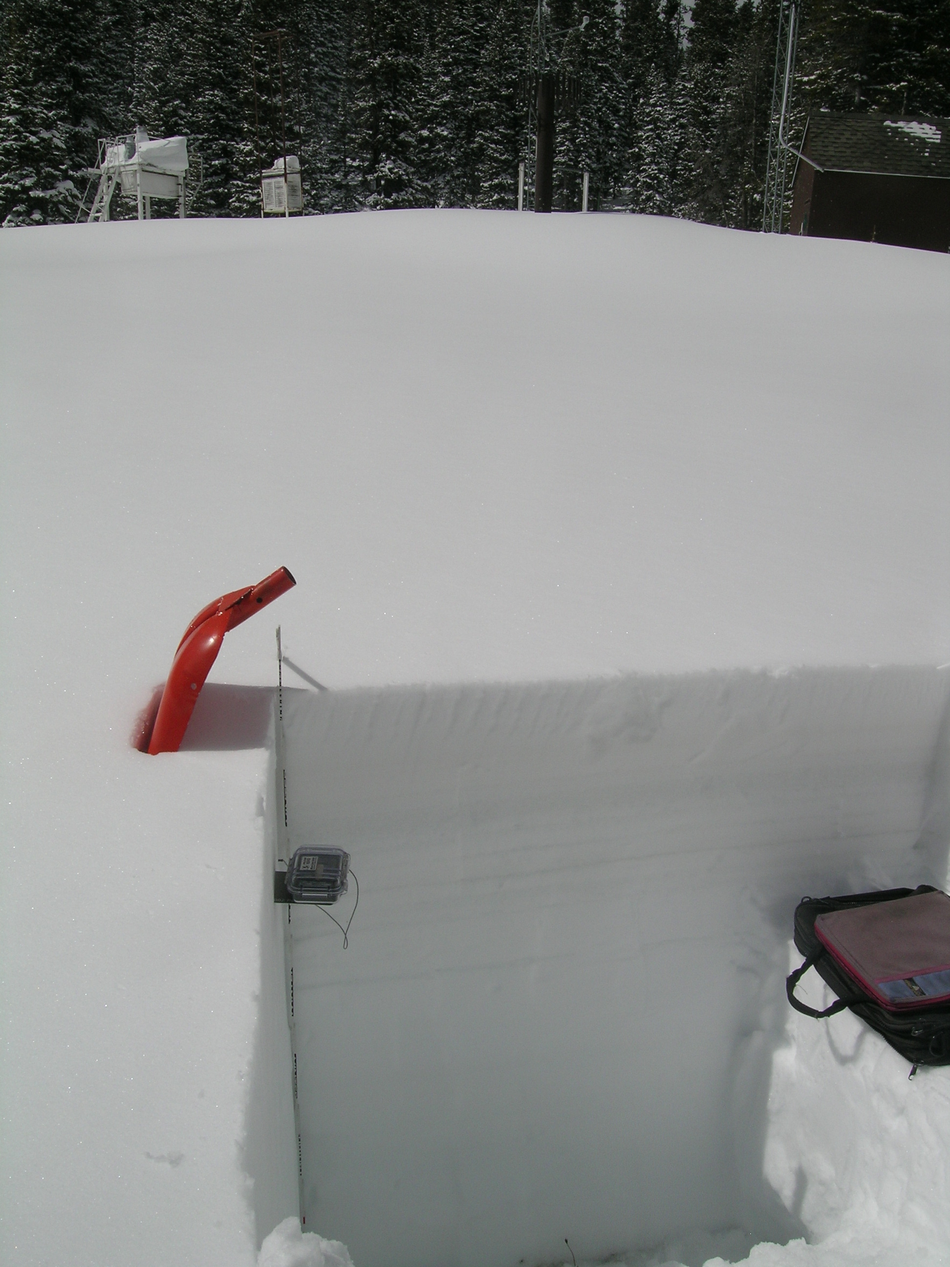
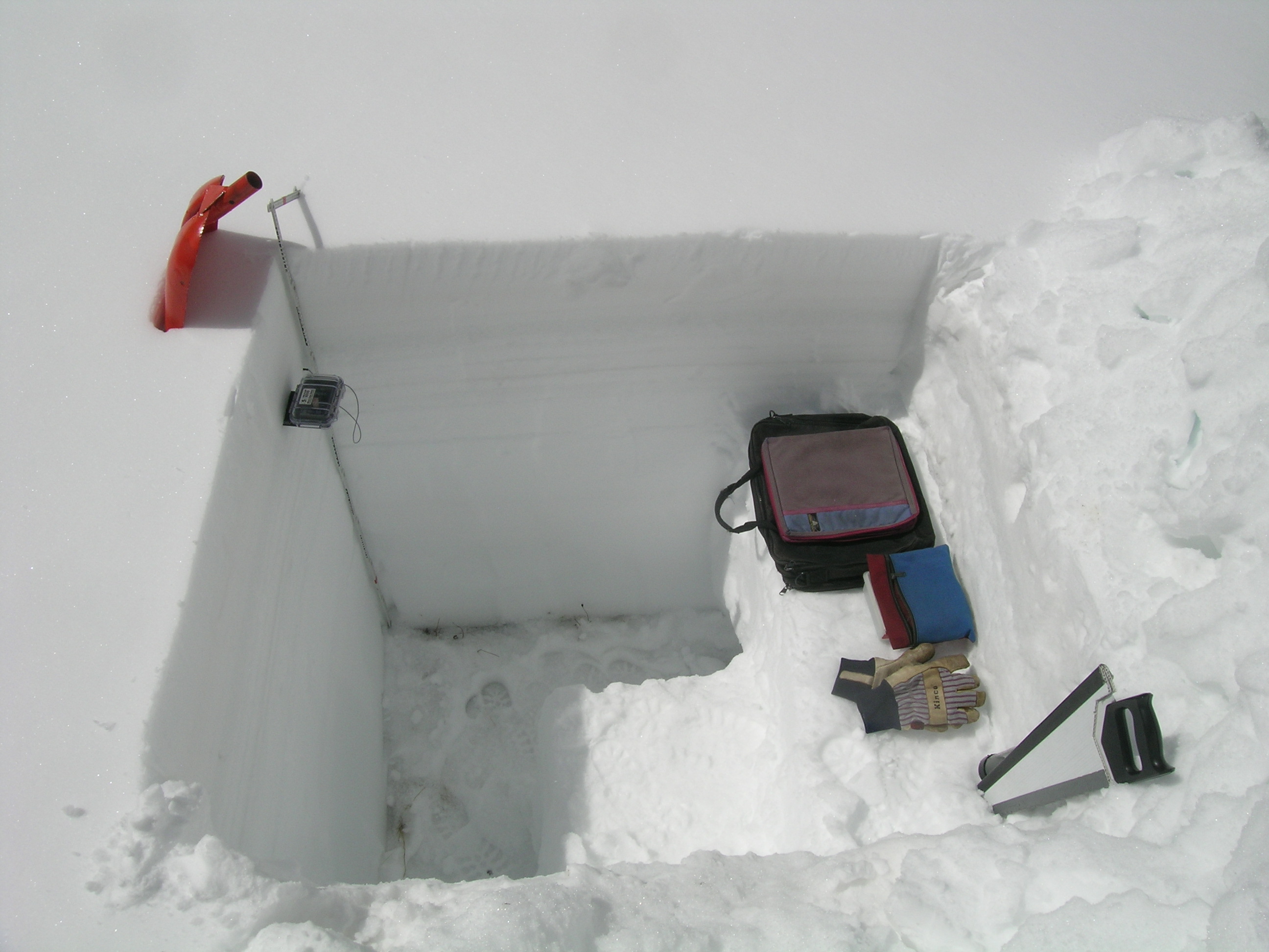
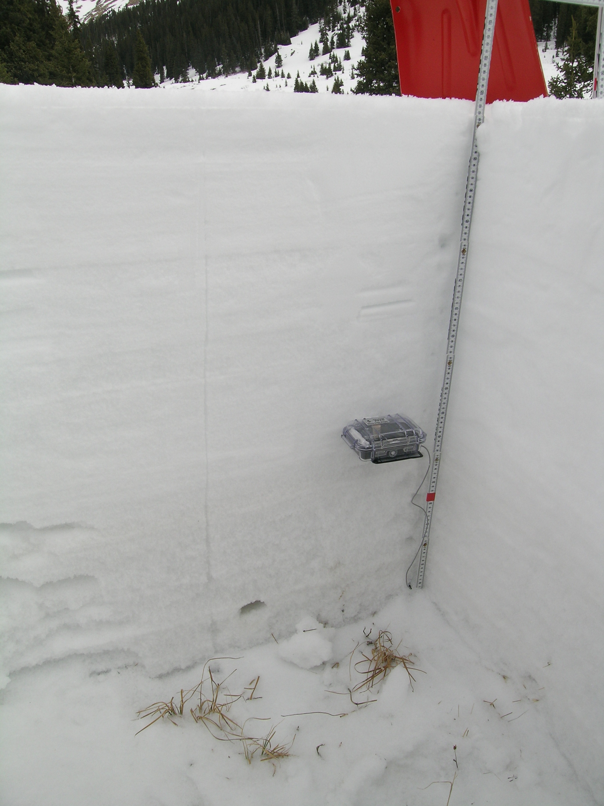
Total snow depth in the April 12, 2013 Berthoud Summit snow profile was 59”, 2” more than observed at the site on March 19, 2013. Total SWE on April 12 was 19.4” and mean density of the snowpack was 329 kg/m3 (32.9% water content) versus 15.4” SWE and 273 kg/m3 mean density (27.3% water content) on March 20, 2013.
The top 9” of the snowpack on April 12, 2013 consisted of recent snow containing a very weak deposition of dust-on-snow event D6-WY2013 (April 8). Underneath that layer a thick band of re-frozen melt-freeze polycrystal layers, interspersed with layers of ice, contained D6 dust merged with the D5 dust event that fell just after the March 19 site visit. Even in merged combination, the strength of these two layers will have lesser effects on snow albedo than at other CODOS sites. Nonetheless, D5 did enhance a recent, prolonged period of snowmelt at this sunny site, as evidenced by melt-freeze snow layering near the top of the snowpack. The snowpack was moist throughout and contained a thin band of near-slush mid-pack at the time of the site visit and all layers showed evidence of recent wetting, by percolation of free water from the surface. The snowpack was effectively isothermal at a mean snow temperature of -0.05° C, as compared to -2.6° C on March 19, 2013.
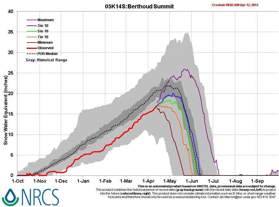
Winter storms in March and early April have resulted in the Berthoud Summit CODOS site retaining 39” more snowcover and 10.8” more SWE than was present on April 10, 2012. Despite those March and April storms, April 12, 2013 Berthoud Summit Snotel data still reports current SWE within the lower quartile of SWE values for the period of record.
| March 19th Pit Profile | April 12th Pit Profile | |
 |
 |
Melt Rate
The Berthoud Summit Snotel site continues to accumulate SWE and has reported no significant losses of SWE to-date. Despite gaining SWE, the April 12 snow profile at the Berthoud Summit CODOS site also found evidence that episodes of surface snowmelt, enhanced by dust event D5, had occurred and that free water had percolated through and reached the base of the snowpack. The weak dust layer D6 had not yet emerged from beneath the fresh snow that immediately followed its deposition. Layer D6 merged with layer D5 at the time of D6 deposition. Since the site visit, the Berthoud Pass locale has received another layer of fresh snow that will maintain higher snow albedo and delay the emergence and impact of dust layers D6/D5 on snow albedo. As and when D6/D5 does more-or-less fully emerge and remain exposed for some days, and in the absence of further dust deposition, snowmelt rates will accelerate somewhat but will be unlikely to match the rates observed in WY 2011. Nonetheless, ablation of this season’s snowpack to “snow all gone” (SAG) would be advanced by merged layers D5 and D6.
Stream Flow
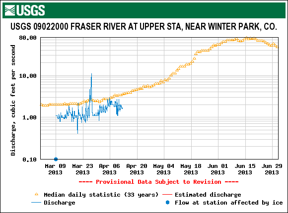
Streamflow data from the USGS Fraser River at Upper Station near Winter Park gauge show a brief late March surge in flows, likely enhanced by the event D5 (March 21-22) dust. This graph, captured on April 12, shows the dampening effect, on flows, of the storm and weather delivering dust layer D6 (April 8) and does not yet indicate the influence of event D6, since D6 (merged with D5) has yet to significantly emerge from beneath recent new snowfalls, and that emergence may be further delayed by additional snows (per NWS forecast).
Forecast
As of Monday, April 15, The National Weather Service expects unsettled weather to continue through most of the week of April 14-20. A significant weather system is expected to arrive Monday, April 15 with strong S and SW’ly winds. A Winter Weather Advisory anticipates 8-14” of new snow, or more, in the Front Range mountains. Partly sunny weather may return to the northern mountains by Friday, but no prolonged drying is anticipated at this time as the weather remains “progressive”, with an another potential system shaping up for next Saturday.
Given additional new snowfall during the week of April 14-20, and without further dust-on-snow, the emergence of dust layers D6/D5 will be aspect and elevation driven, with earliest exposure at lowest snow-covered elevations, but perhaps quickly followed at Pass elevations. Even on mostly cloudy days early in the week, sufficient radiation may reach the snowpack to penetrate the new snow layer, reaching the D6 layer below and accelerating the ablation of the new snow.