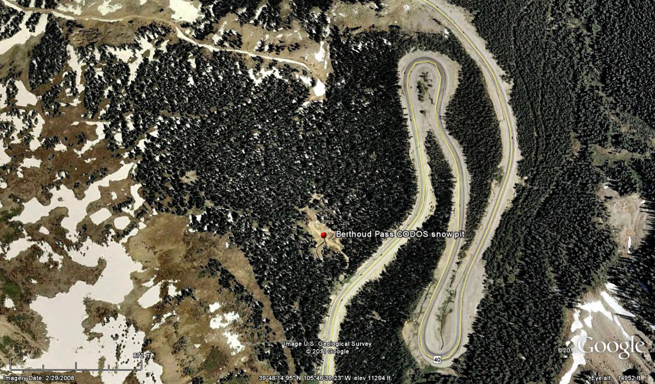
 CODOS Update for Berthoud Summit:
visited March 19, 2013
Summary | Snowpack | Melt Rate | Forecast
Summary
This field session at the Berthoud Summit CODOS site, our first of the WY 2013 season, found somewhat better snowpack conditions than those observed a year earlier, as well as the absence of any discernible dust in or on the snowpack. The snowpack still retains cold content and will require additional warming to become isothermal.
SnowPack Discussion
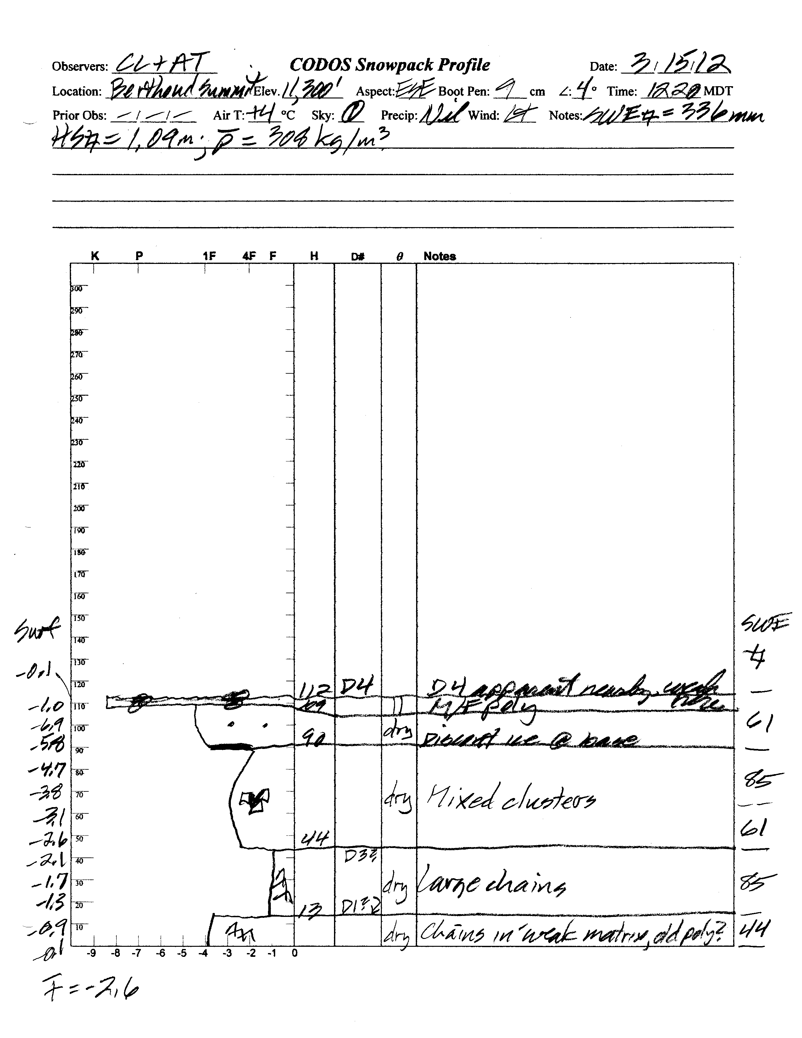
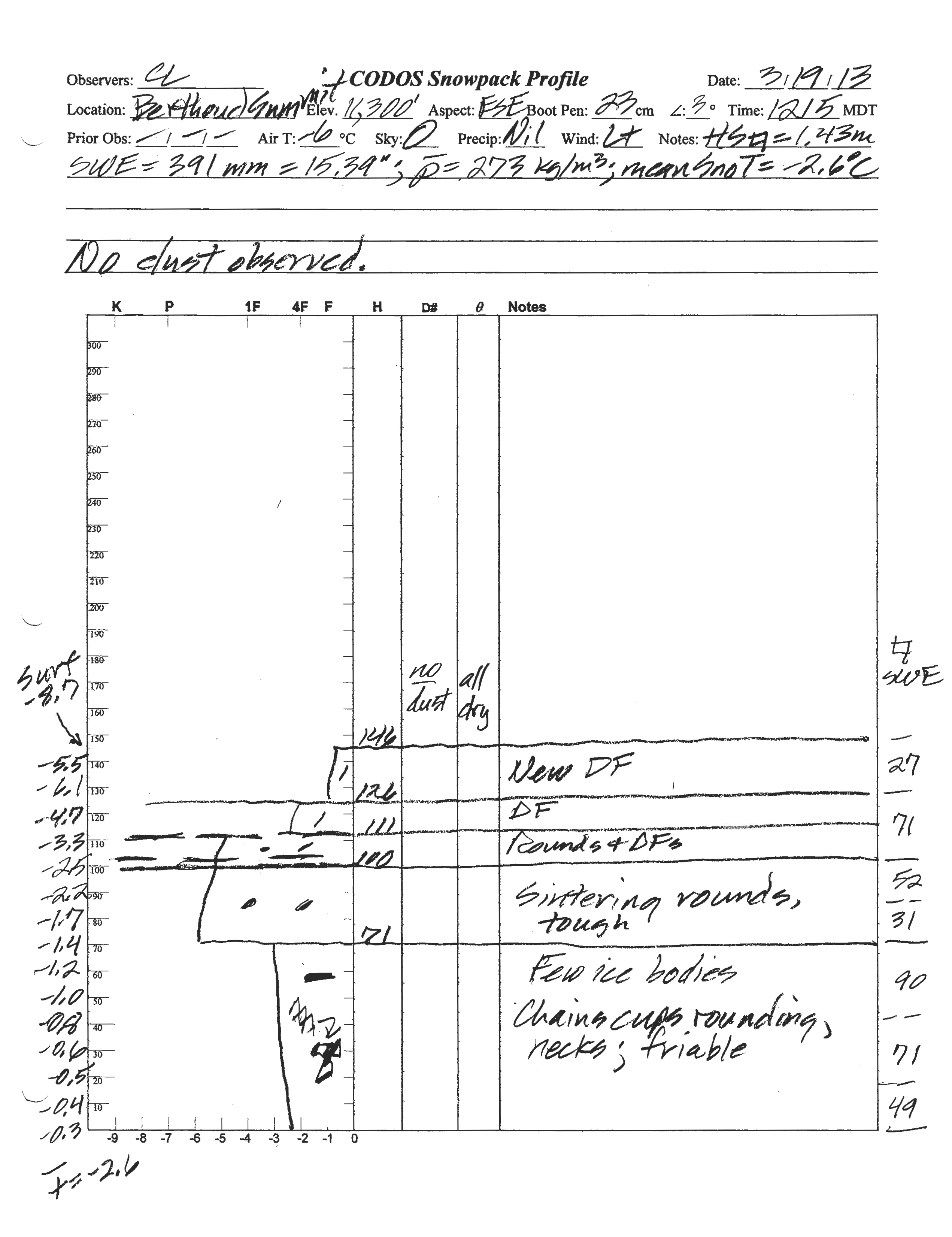
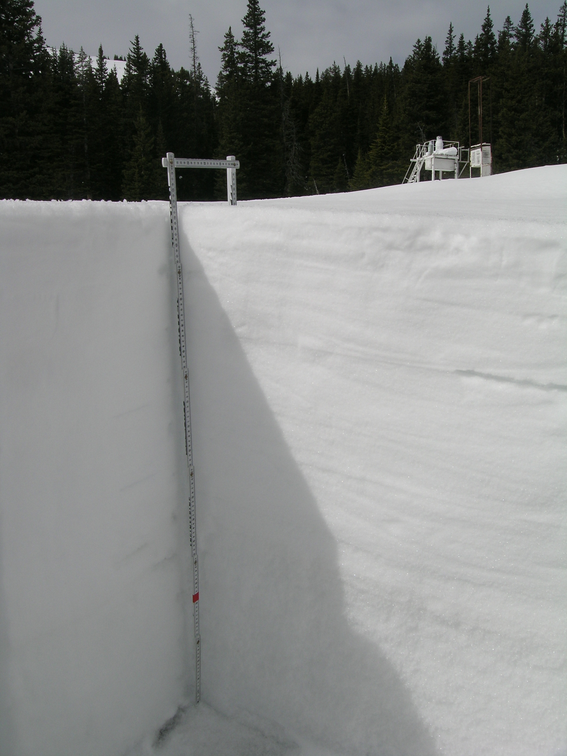
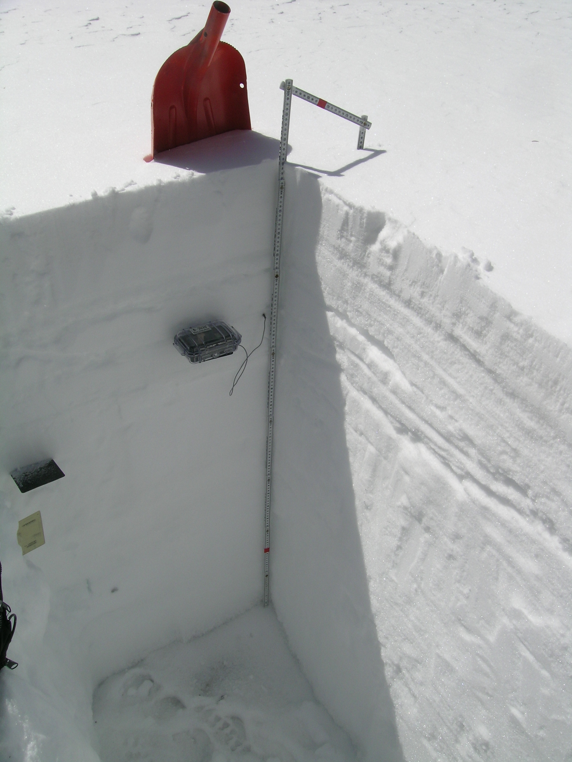
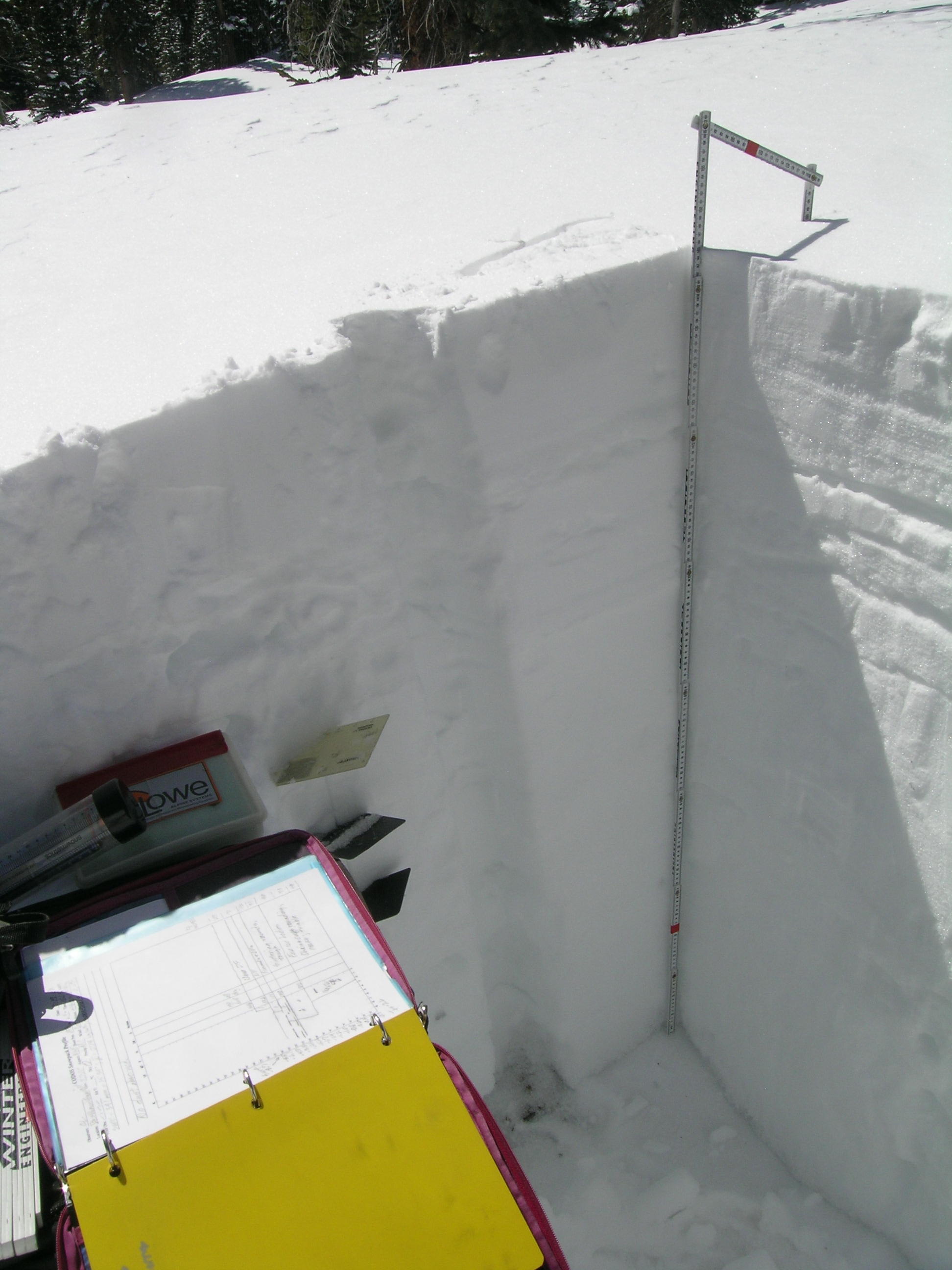
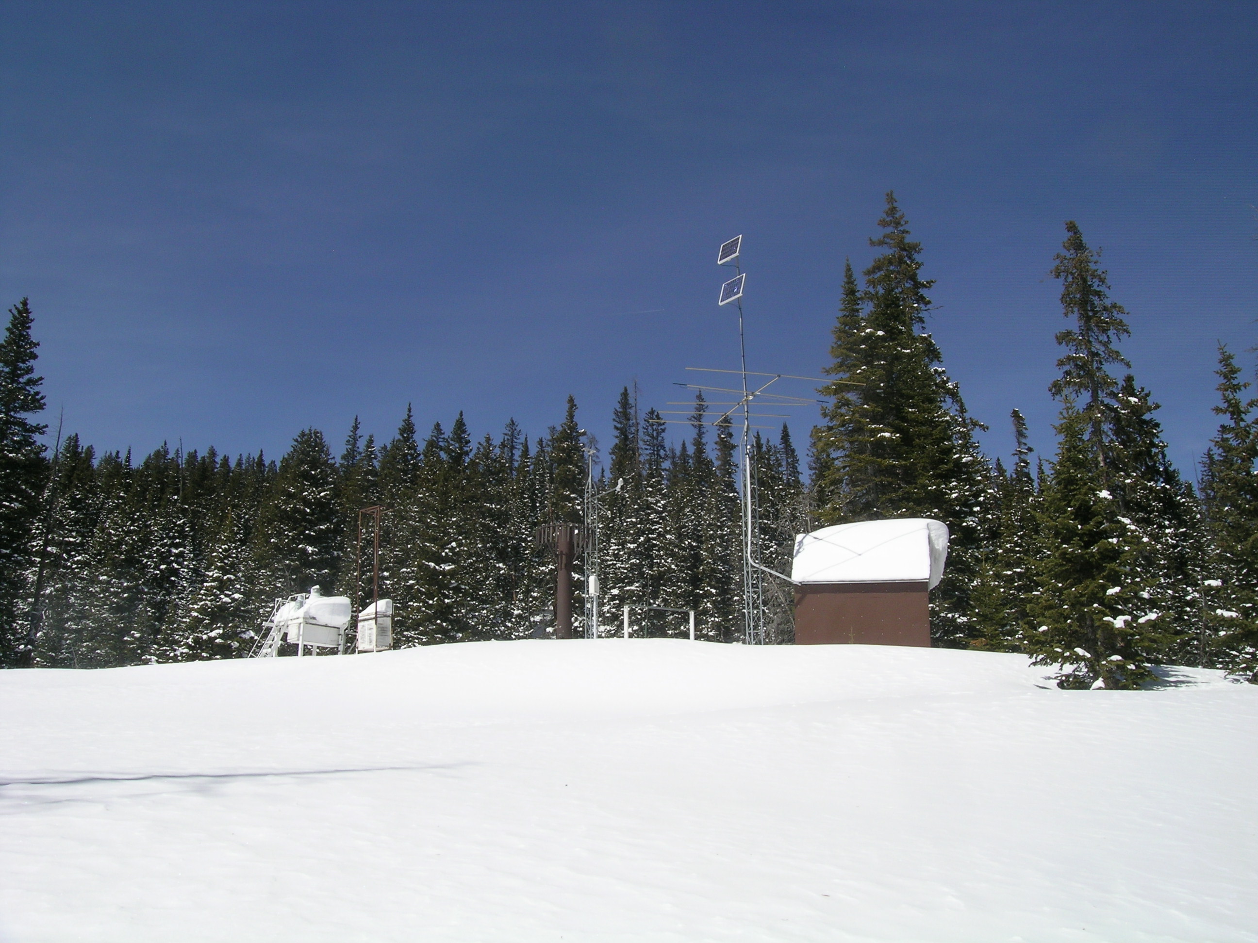
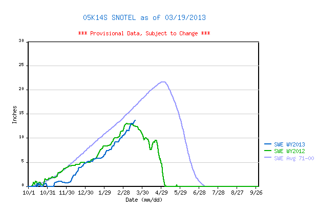
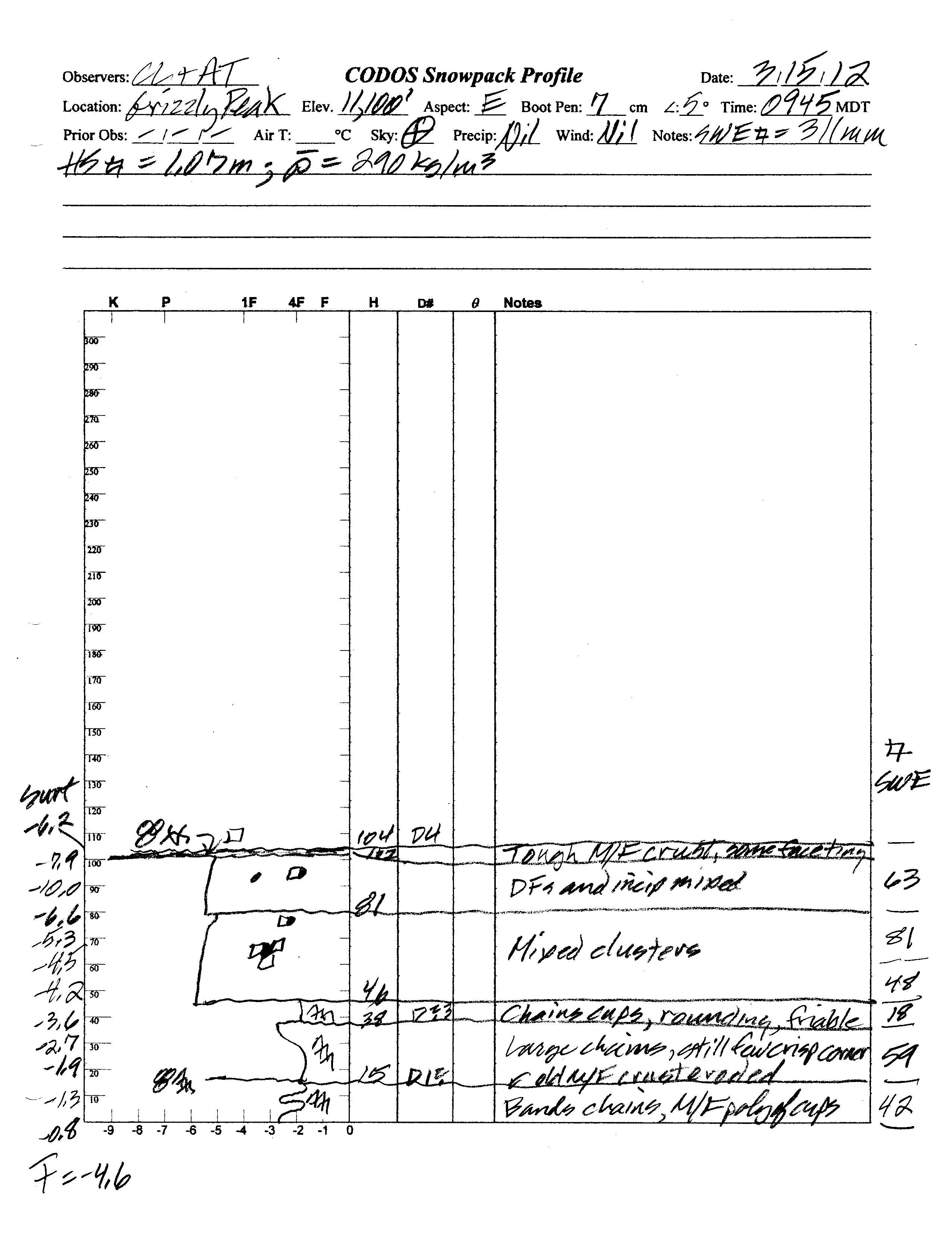
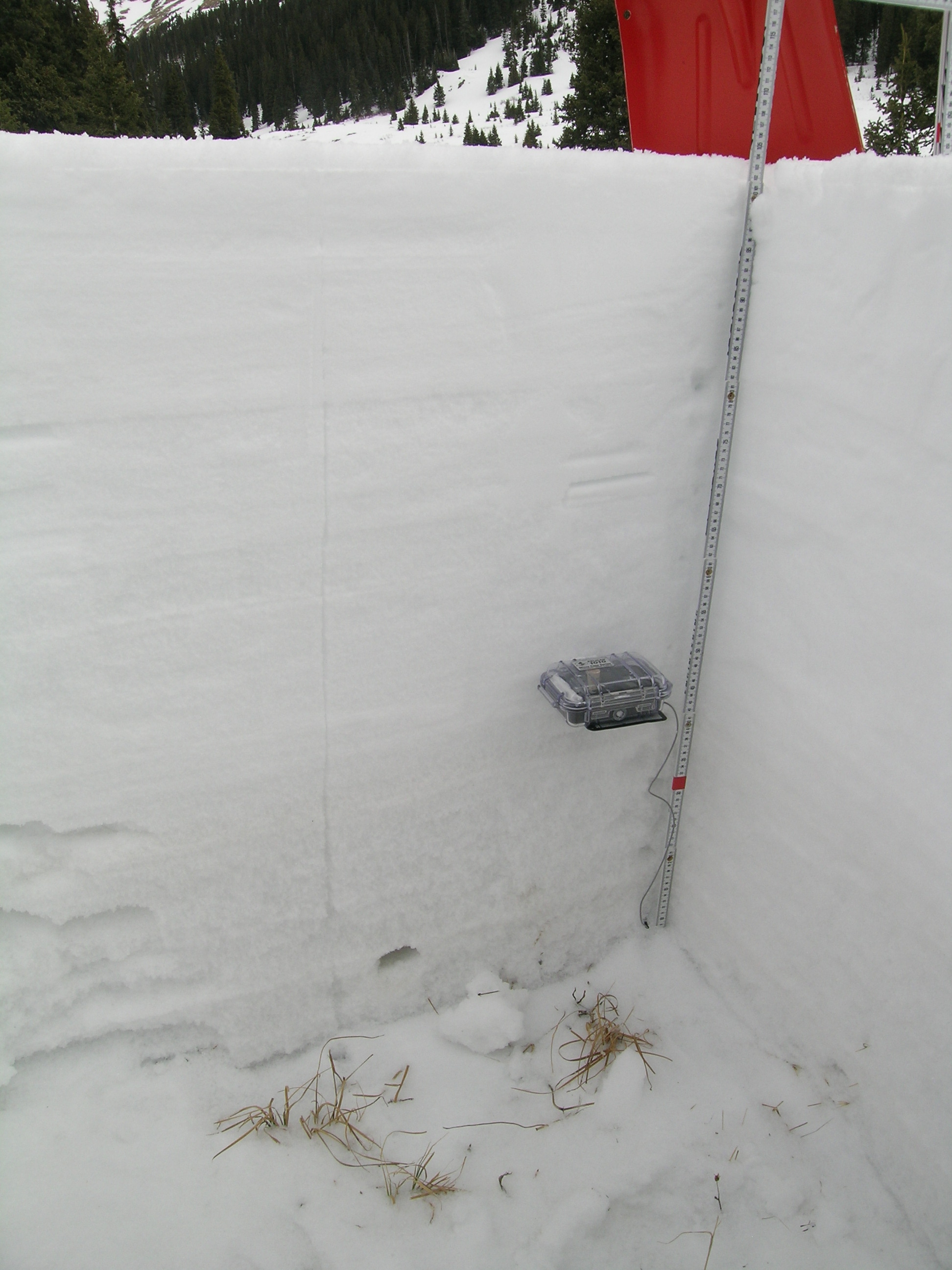
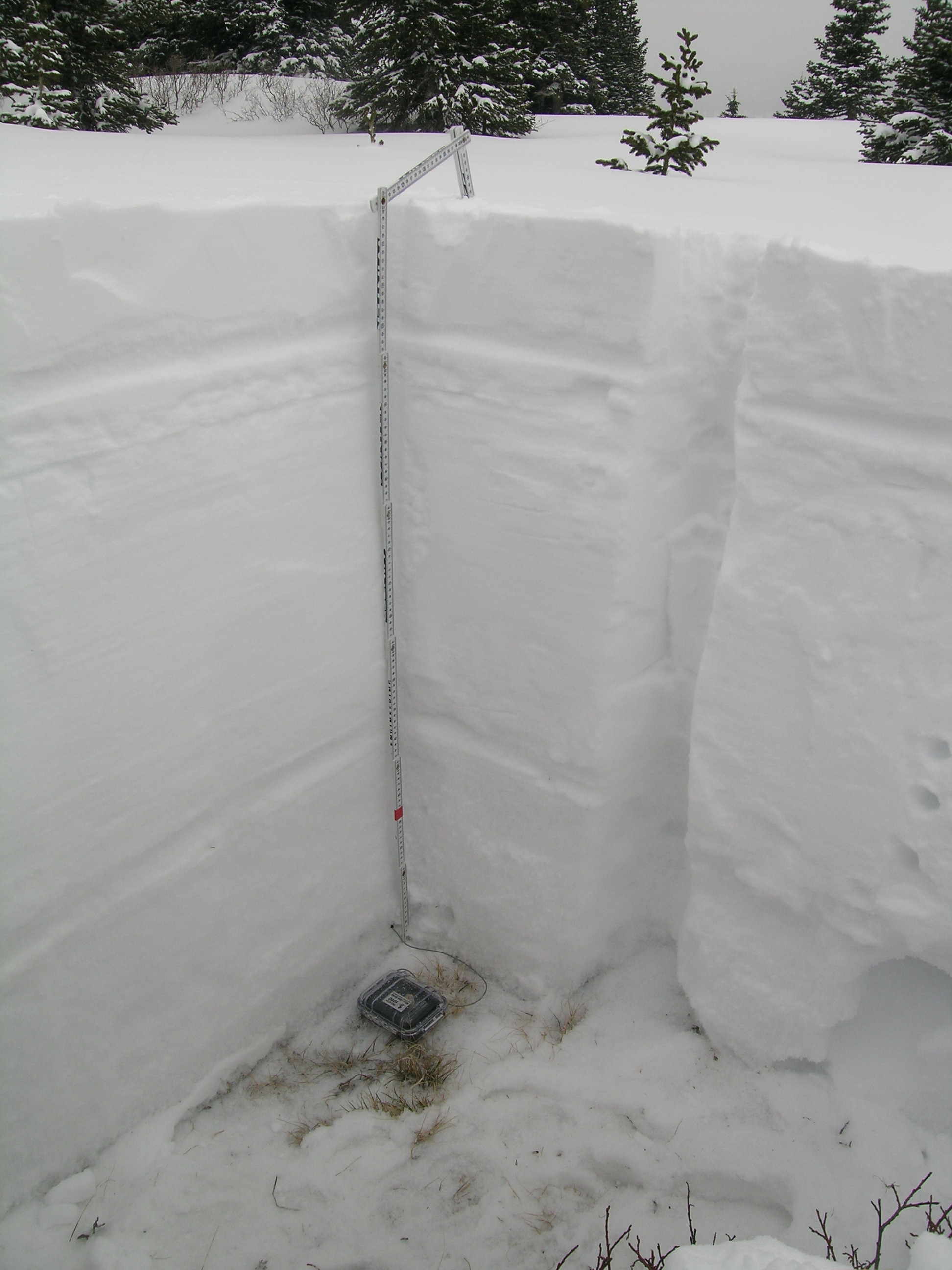
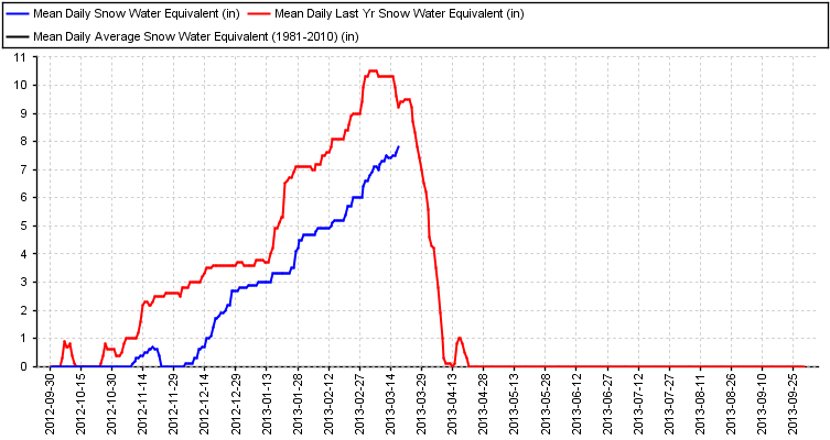
Total snow depth in our March 19, 2013 Berthoud Summit snow profile was 57.5”, 13” deeper than a year before. Total SWE in this profile was 15.4”, fully 2.2” more total SWE than measured a year earlier. With less settlement to-date, mean density of this snowpack was just 273 kg/m3 (27.3% water content), versus 308 kg/m3 a year before. The CODOS snow profile site is adjacent to the same-named Snotel site (see photo below), where 56” of snow containing 13.6” of SWE were reported on the morning of March 19th. Wind effects at this comparatively open and exposed Snotel site may account for some of that difference in total SWE. Some melt-freeze had occurred in the upper snowpack in preceding days and weeks, then refrozen as thin crusts, but the entire snowpack was once again completely dry and cold. Mean snowpack temperature in this profile was -2.6° C, identical to a year earlier. No discernible dust-on-snow layers were observed within the snowpack and no D4 dust (March 18 event) was observed in the new snow at the surface, or on the surface.
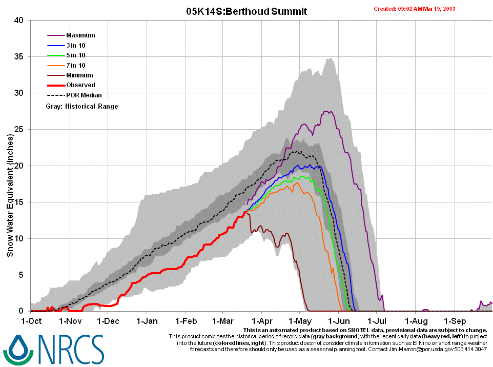
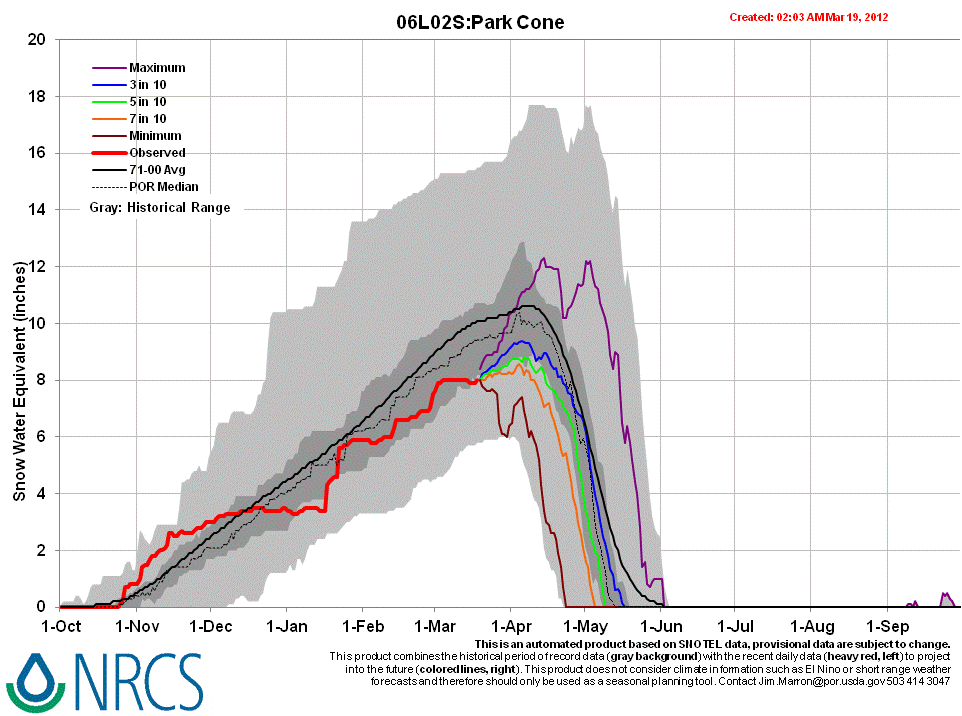
Berthoud Summit Snotel data for WY 2013 place current SWE within the lowest quartile of values for the period of record but somewhat higher than the same-date values recorded in WY 2012, albeit still well below the 1971-2010 30-year mean.
 |
 |
|
| 2012 Pit Profile | 2013 Pit Profile |
Melt Rate
The Berthoud Summit Snotel site continues to accumulate SWE and reports no significant losses of SWE, to-date. Surface snowmelt had recently occurred in the snowpack at the slightly east-facing CODOS snow profile site. This snow profile showed that melt water had reached the middle of the snowpack and then re-frozen, as small ice bodies, but no indications that free water had reached the bottom of and exited the snowpack, as runoff.
Forecast
Given the absence of observed dust-on-snow, snowmelt processes at the Berthoud Summit CODOS site and Berthoud Pass locale could proceed without significant dust-on-snow enhancement of radiative forcing until/unless subsequent dust is deposited later this spring. The National Weather Service anticipates continued W’ly winds shifting to NW leading into the weekend of March 23/24, with additional snowfalls favoring the northern mountains.
As of March 19, 2013 only NRCS’s “maximum” projection of future snowpack accumulation would result in peak SWE at/above the median at the Berthoud Summit Snotel site. NRCS projects only a 3 in 10 chance that complete snowcover ablation (snow all gone, or SAG) will occur near the median date, and higher probabilities that SAG will be earlier than the median date.