 CODOS Update for Hoosier Pass site:
visited April 13, 2013
Summary | Snowpack | Melt Rate | Stream Flow | Forecast
Summary
Although not yet apparent at the snowpack surface during the April 13 site visit, dust layer D6 (April 8) is now the principal dust-in-snow feature of the Hoosier Pass WY 2013 snowpack, albeit at a lower magnitude of deposition than observed at Senator Beck Basin. Snowcover at the Hoosier Pass CODOS site continues to retain cold content, and will require considerable warming to become isothermal. Snowpack SWE has increased by almost 3” at the CODOS site since our prior visit, but is only 1.2” higher than on April 9, 2012. (Another winter storm followed this site visit and yet another significant storm is predicted as of this writing, Monday, April 15.)
SnowPack Discussion
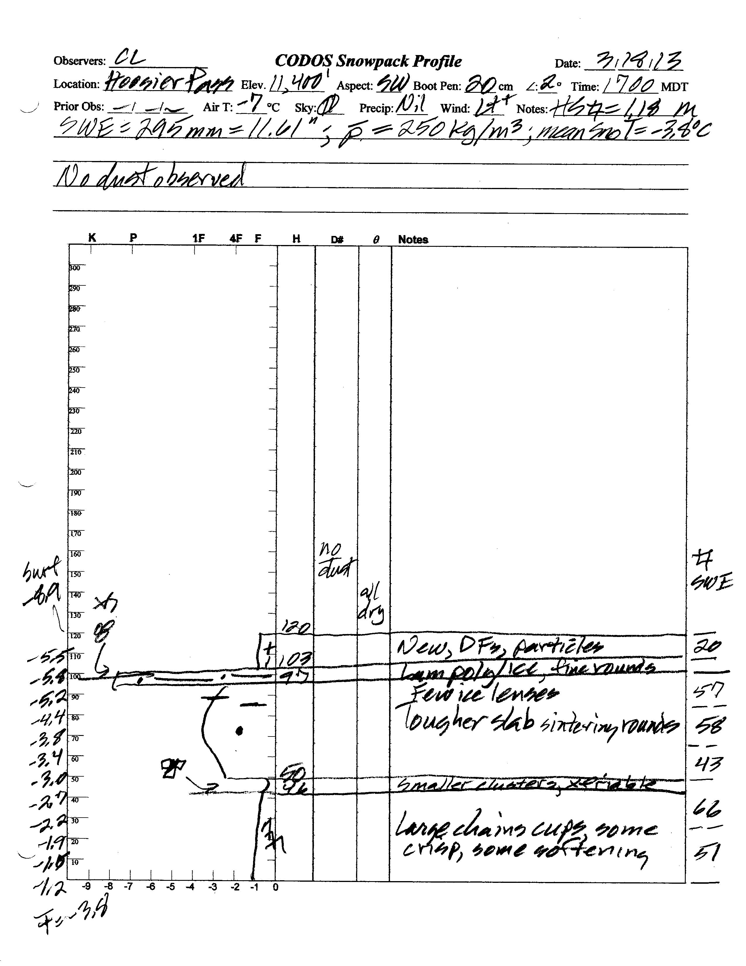
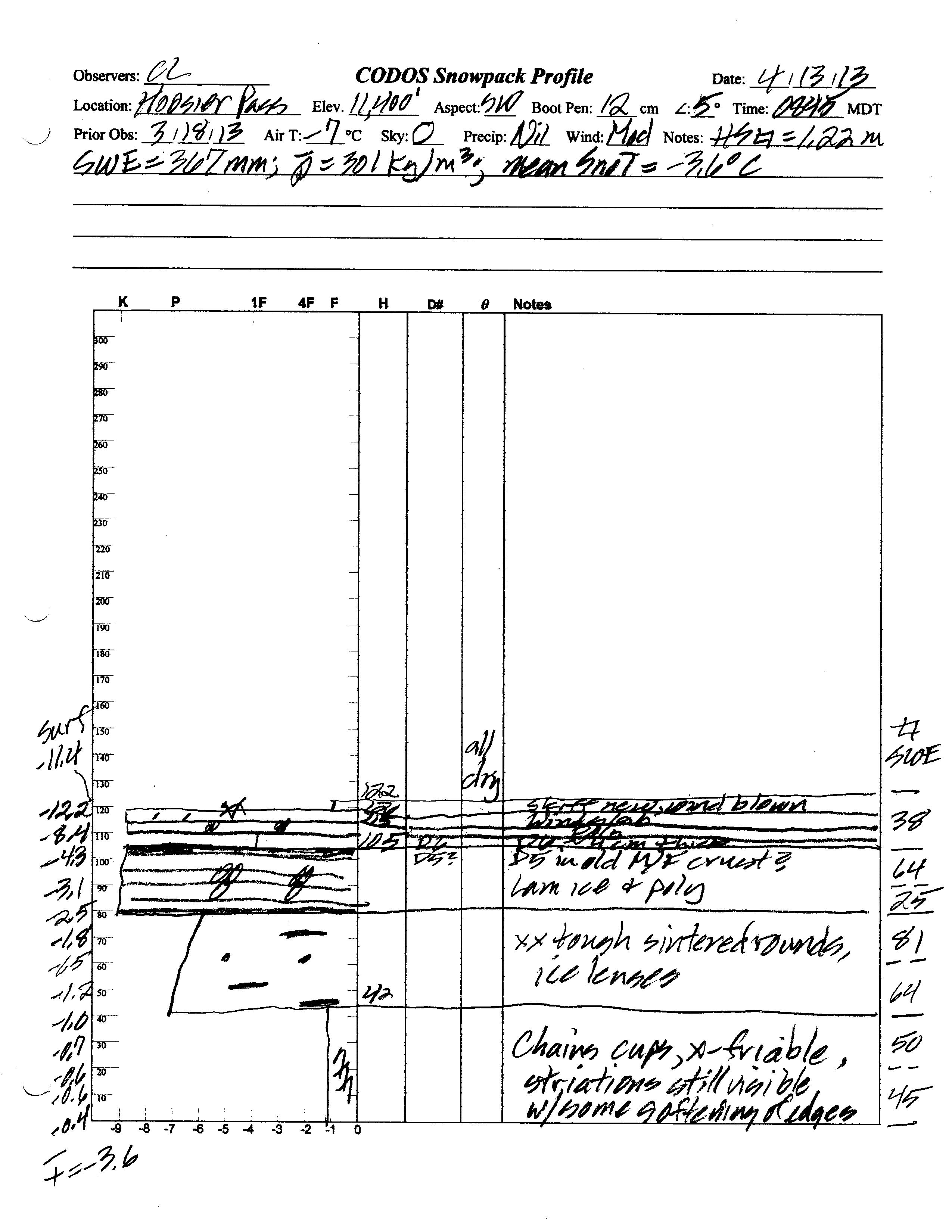
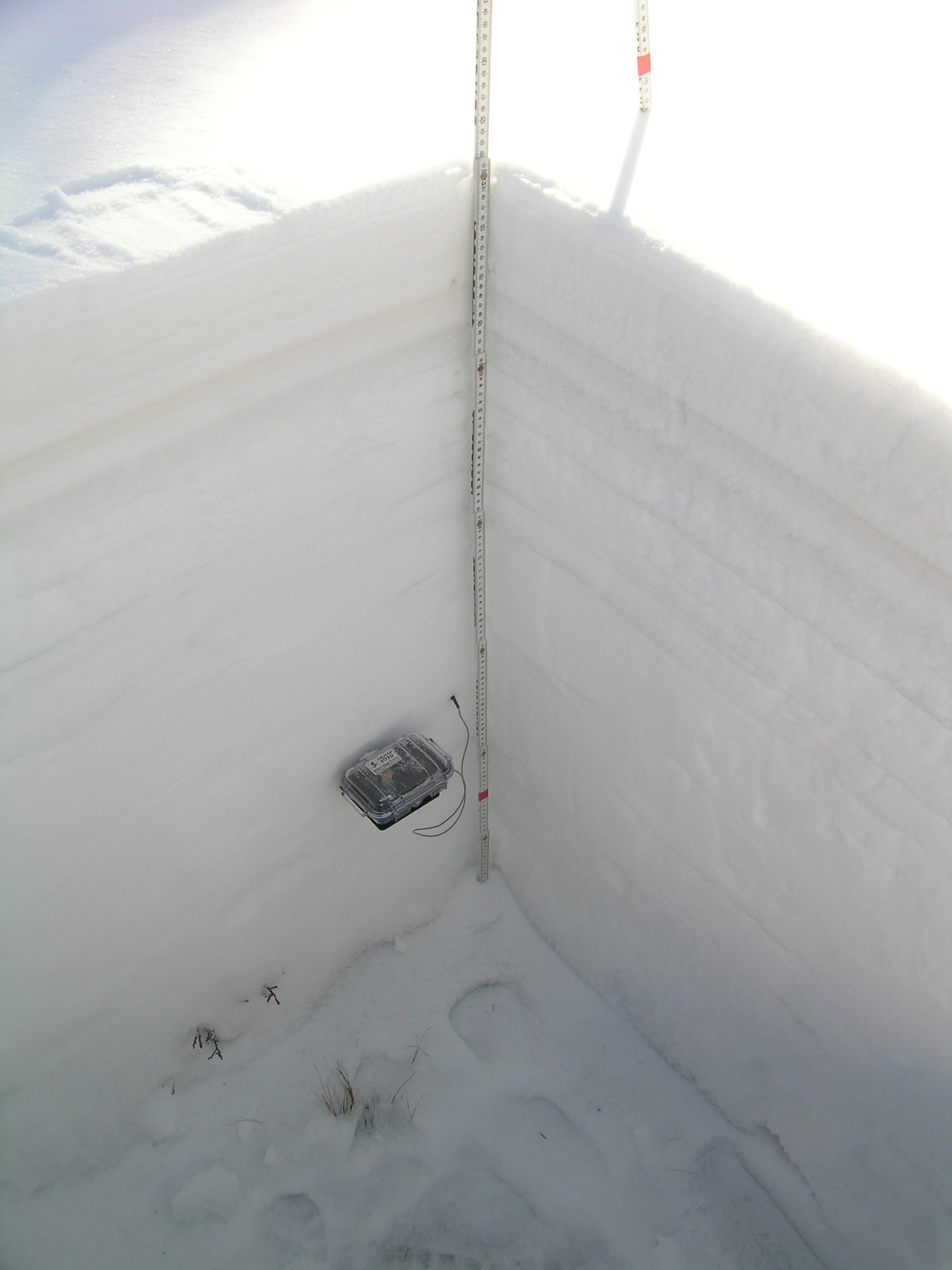
Total snow depth in the April 13, 2013 Hoosier Pass snow profile was 48”, only 1” more than observed at the site on March 18, 2013. However, total SWE on April 13 was 14.5”, so mean density of the snowpack was 301 kg/m3 (30.1% water content) versus 11.6” SWE and 250 kg/m3 mean density (25.0% water content) on March 18, 2013.
The top 7” of the snowpack on April 13, 2013 consisted of wind-effected snow capping a softer 2” band of recent snow containing dust-on-snow event D6-WY2013 (April 8). Underneath that layer a thick set of re-frozen melt-freeze polycrystal layers, interspersed with layers of ice, capped with weak D5 dust (March 21-22). Despite that evidence of a recent melt/freeze episode, there was no evidence of snowpack wetting in the lower half of the snow profile. Primarily because of the high elevation and this site (11,400’), snowpack temperatures were sub-freezing throughout the pack and mean snowpack temperature was -3.6° C, only 0.2° C warmer than measured on March 18, 2013 and still rather cool for mid-April. In contrast, the CODOS site’s snowpack was fully isothermal a year earlier, on April 9, 2012, with several merged dust layers exposed on the snow surface.
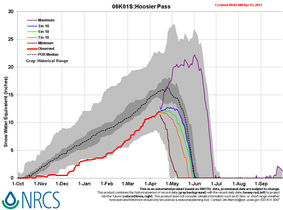
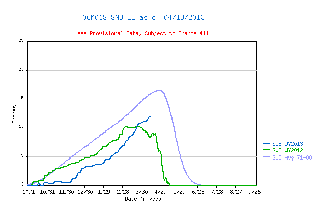
April 12, 2013 Hoosier Pass Snotel data reports current SWE within the lower quartile of SWE values for the period of record. Although higher than the same-date value recorded in WY 2012, SWE at this Snotel site is still well below the 1971-2000 mean. Despite March and April precipitation, the Hoosier Pass CODOS site retains only 16” more snowcover and 1.2” more SWE than was present on April 9, 2012.
| March 18th Pit Profile | April 13th Pit Profile | |
 |
 |
 |
 |
|
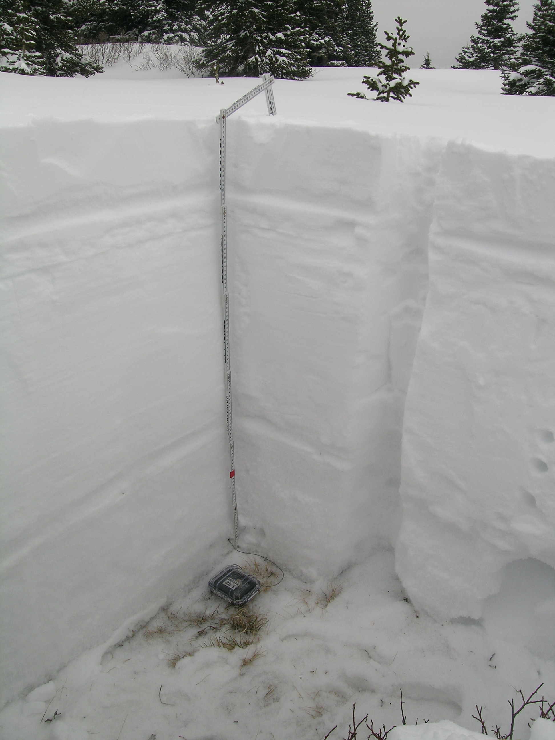
| March 18th Pit Photo |
The April 13, 2013 Hoosier Pass snowpit showing D6 entrained in recent snow as a distinct brown band a few inches below the surface, and the older D5 melt-freeze polycrystal crust just below that. No other dust layers were seen in this (or the preceding) profile. |
|
 |
 |
|
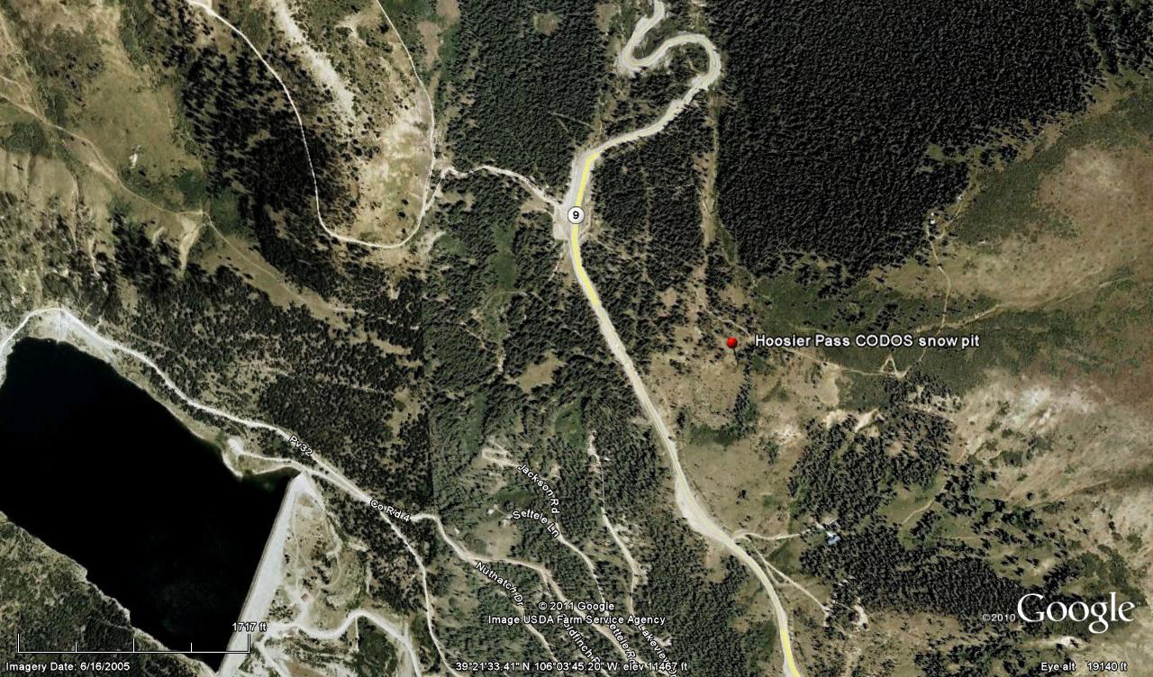
Hoosier Pass CODOS snow profiles are performed in comparatively open, exposed terrain, some 200 yards from the same-named Snotel. Wind effects on snowpack formation are considerable, in the Hoosier Pass locale, but this near-treeline site was selected for its comparatively uniform snowcover depths over an area large enough to perform a meaningful time series of snow profiles. |
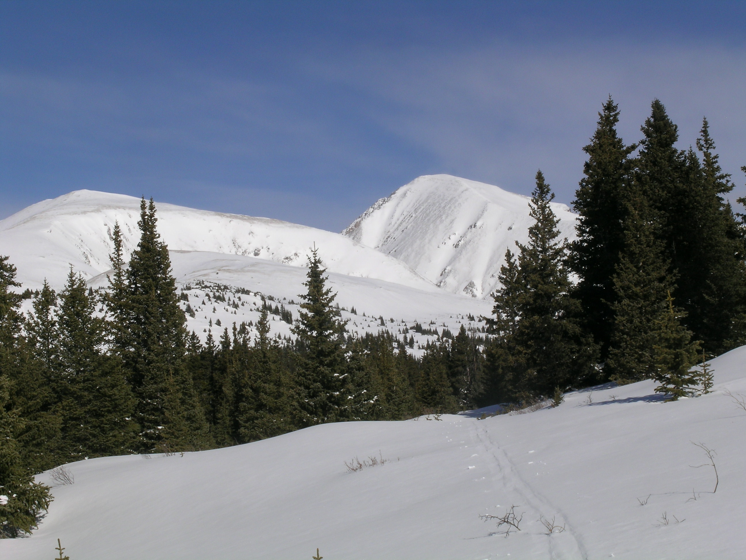
The view of Quandary Peak (14,265’) to the northwest |
Melt Rate
The Hoosier Pass Snotel site, heavily shaded in thick forest, continues to accumulate SWE and data show no significant losses of SWE to-date. The April 12 snow profile at the more open and exposed Hoosier CODOS site did present clear evidence that surface snowmelt, enhanced by dust event D5, had recently occurred. However, the snowpack retains considerable cold content and the lower snowpack showed no indications that free water had percolated through and reached the base of the snowpack. Dust layer D6 had not yet emerged or received enough radiation through the overlying snowcover to produce snowmelt in the snow containing D6. Since the site visit, the Hoosier Pass locale has received another layer of fresh snow that will, once again, restore a higher snow albedo and delay the emergence and impact of dust layer D6 on snow albedo. As and when D6 does more-or-less fully emerge, and remain exposed for some days, snowmelt rates will accelerate in the Hoosier Pass locale. The sustained exposure of merged dust layers D5 and D6 could result in SWE loss rates exceeding those observed in spring 2012 (when SAG arrived at the Hoosier Pass Snotel before any dust events comparable, in intensity, to D6). Ablation of this season’s Hoosier Pass snowpack to “snow all gone” (SAG) could also be significantly advanced by merged layers D5 and D6; all but the most recent new snow had already melted off the southerly slopes just below the CODOS site.
Stream Flow
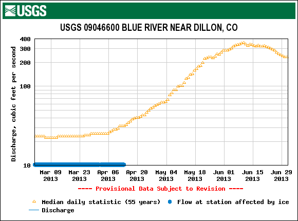
Valid streamflow data from the USGS Blue River Near Dillon gauge have not yet begun. Visual observation of the Blue River above Breckenridge and at the gauge itself found only low flows, with undisturbed snowcover still lying in much of the channel.
Forecast
As of Monday, April 15, The National Weather Service expects unsettled weather to continue through most of the week of April 14-20. A significant weather system is expected to arrive today (Monday, April 15) with strong S and SW’ly winds. A Winter Weather Advisory anticipates 8-14” of new snow, or more, in the Front Range mountains. Partly sunny weather may return to the Hoosier Pass locale by Friday, but no prolonged drying is anticipated at this time as the weather remains “progressive”, with an another potential system shaping up for next Saturday.
Given additional new snowfall during the week of April 14-20, and without further dust-on-snow, the emergence of dust layers D6/D5 will be largely aspect and elevation driven, with earliest exposure at lowest snow-covered elevations, but perhaps quickly followed at Pass elevations. Wind stripping may reveal patches of dust-in-snow in exposed, alpine locations. Even on mostly cloudy days early in the week, sufficient radiation may reach the snowpack to penetrate the new snow layer, reaching the D6 layer below and accelerating the ablation of the new snow.