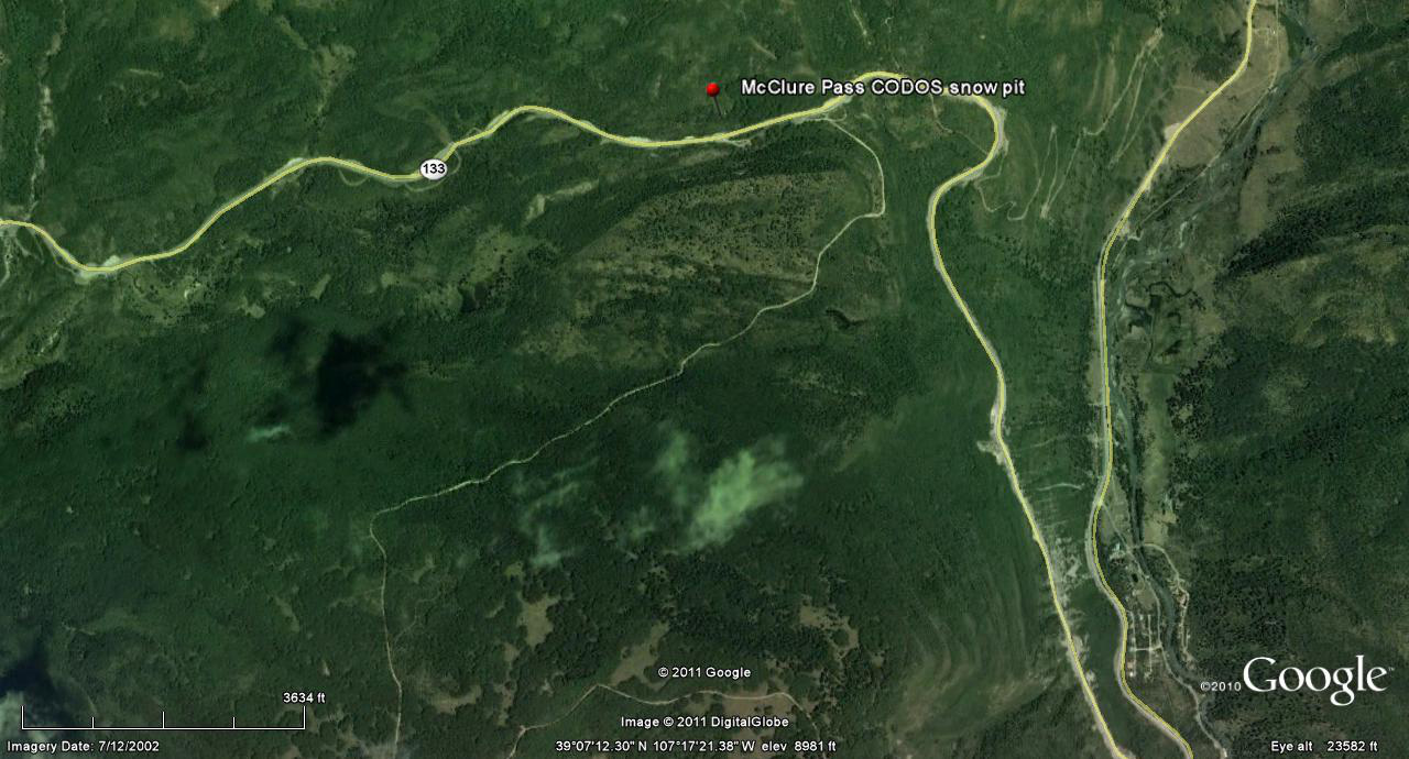
 CODOS Update for McClure Pass site:
visited April 30, 2013
Summary | Snowpack | Melt Rate | Stream Flow | Forecast
Summary
Our April 30, 2013 site visit to McClure Pass found snowcover effectively gone at the CODOS dust monitoring site, although shallow snowcover remained at the adjacent Snotel site. Dust layers D8, D7 and D6 and other were fully emerged at the snowpack surface, near the Snotel, and an “all layers merged” sample was collected for chemical analysis (by our USGS partners). Snowmelt runoff on Muddy Creek and reached median levels. Dust emergence is rapidly expanding to the highest elevations and coolest aspects of the upper Crystal River locale. A wind event subsequent to our site visit produced a very weak dust-on-snow event (D9) but had no significant effect on the already extremely dirty snow surface. No significant additional snow fell with that weather event and clear, sunny skies are returning, at least briefly, to the Elk and West Elk Mountains as of this writing.
SnowPack Discussion
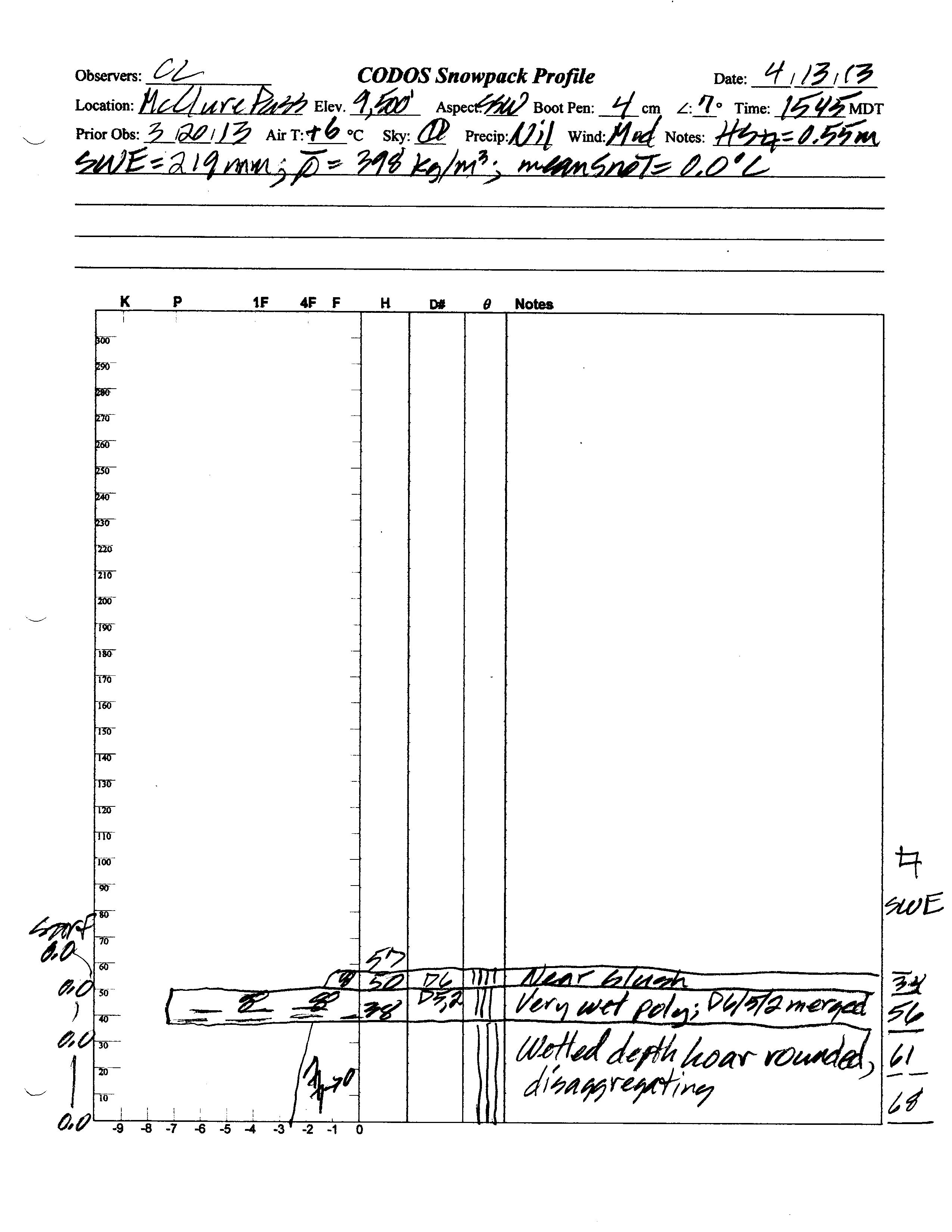
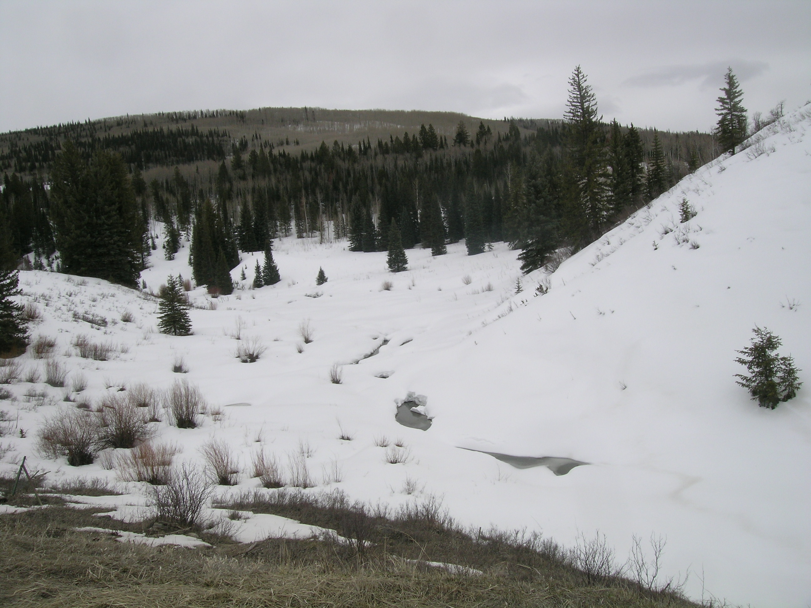
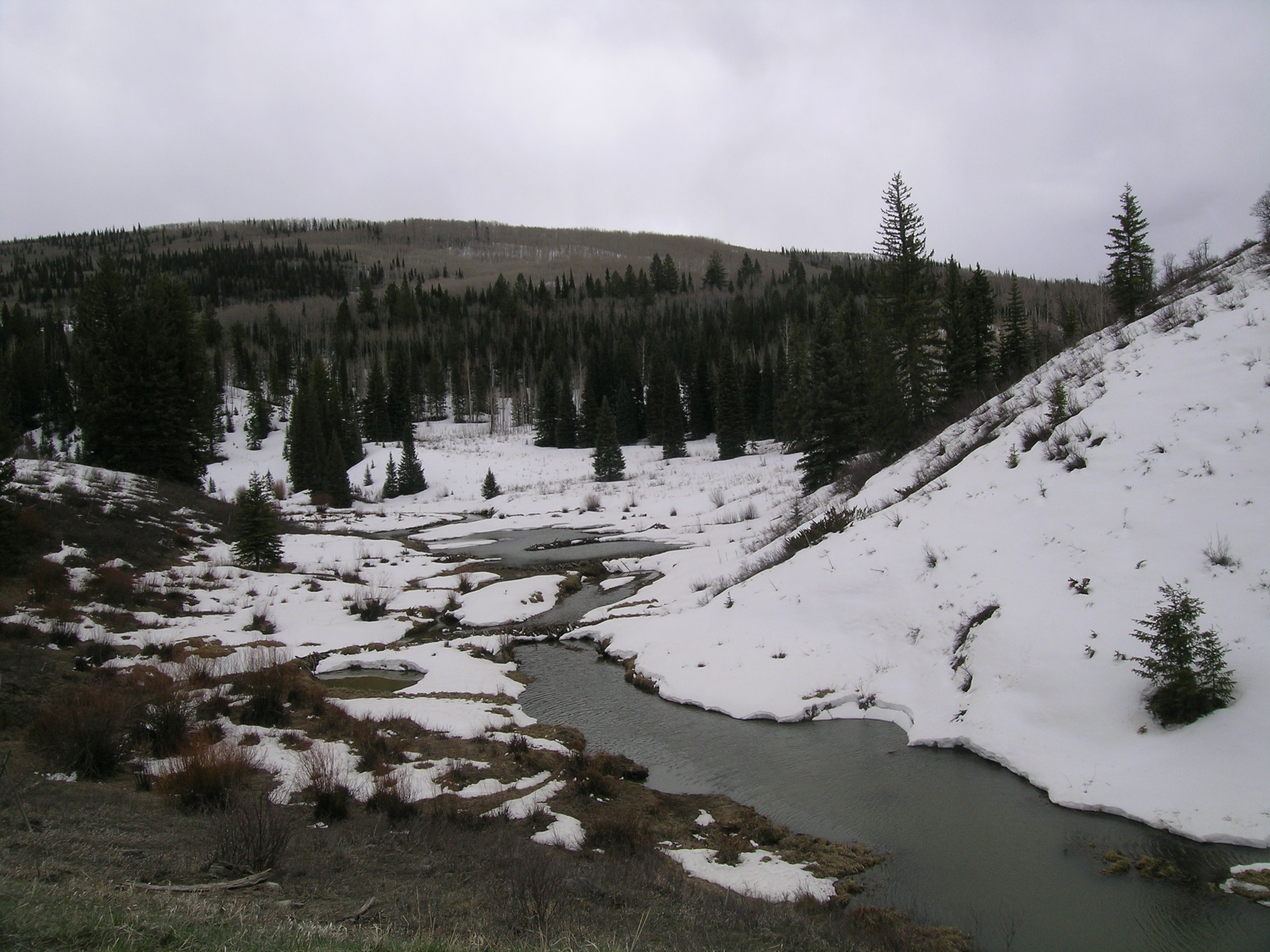
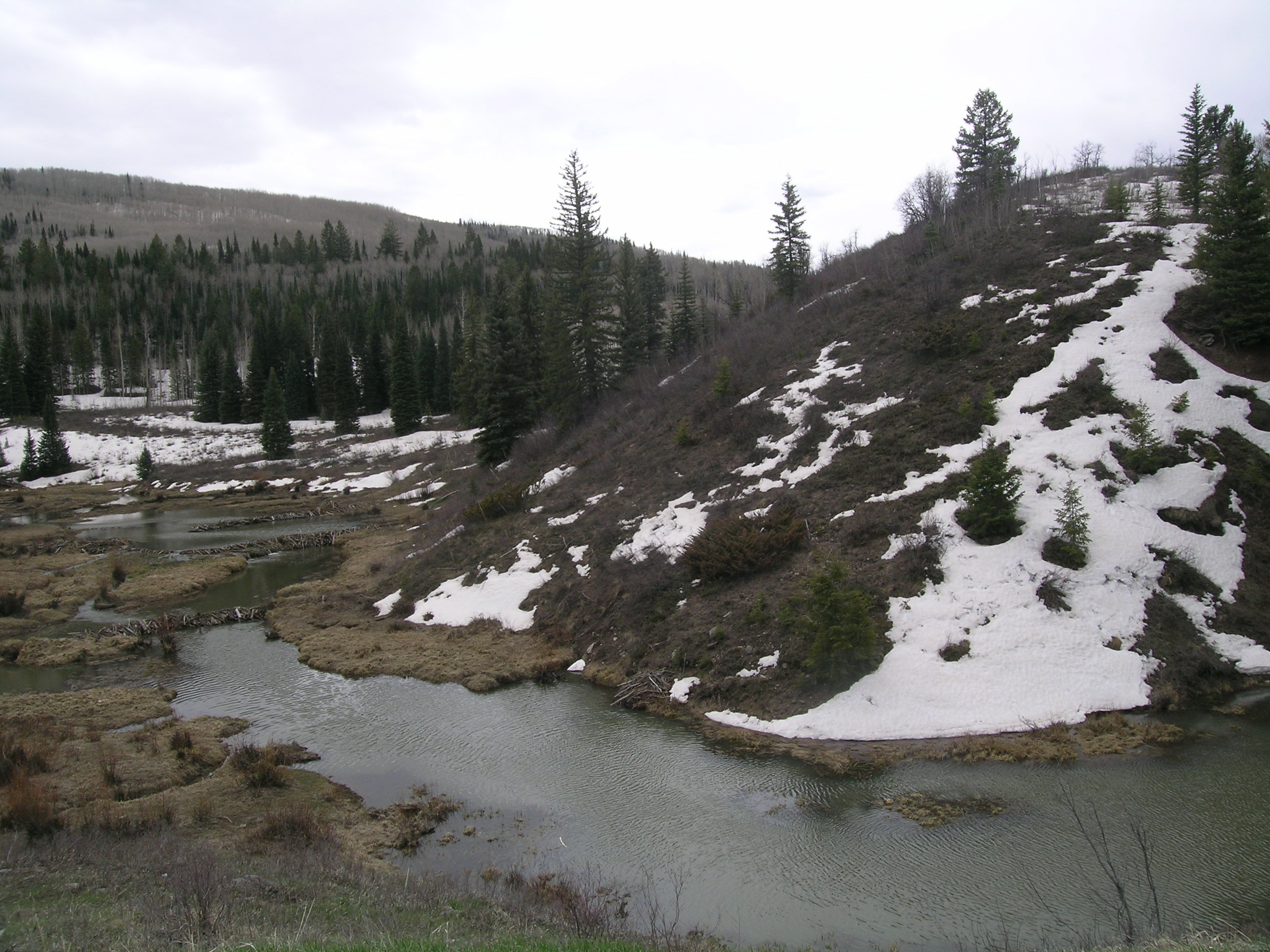
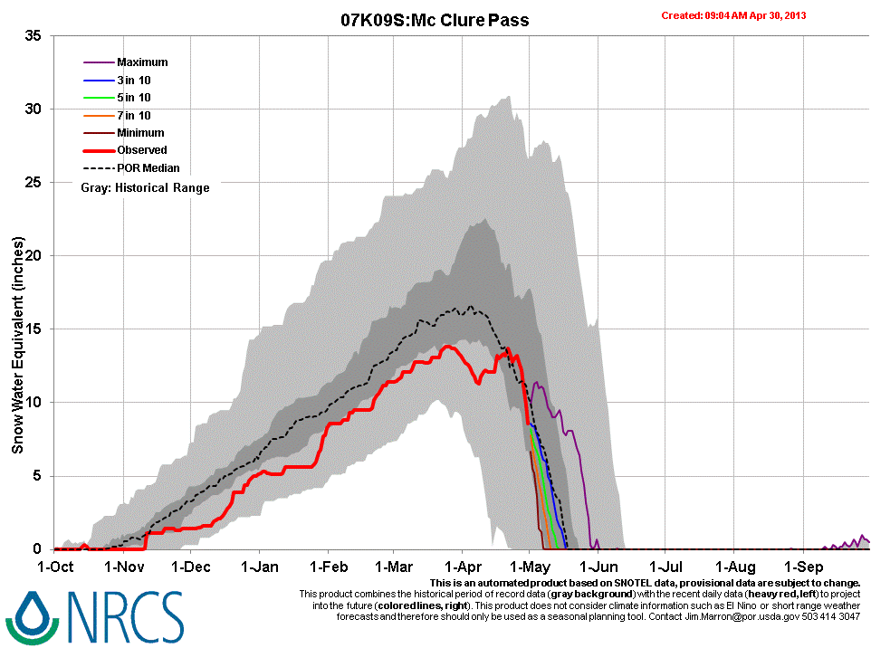
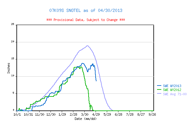
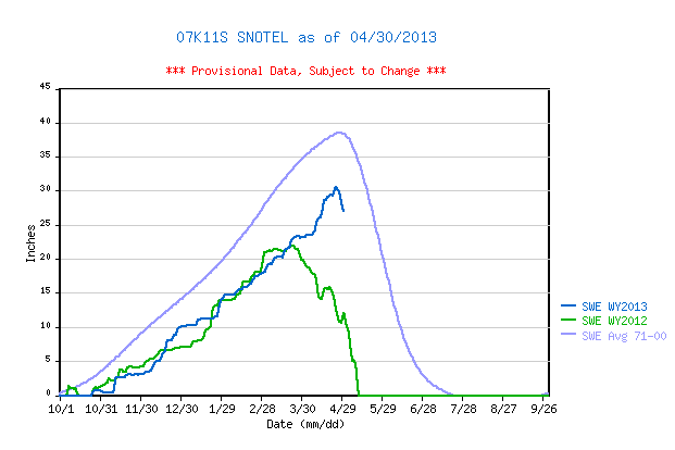
Our April 30, 2013 site visit to McClure Pass found snowcover effectively “all gone”, with large patches of open ground throughout the CODOS dust monitoring site; no snow profile was performed. According to the adjoining McClure Pass Snotel, snow cover SWE ‘peaked’ twice this season, at 13.8” SWE on March 25-26, and again at 13.7” SWE on April 21, following the several April snowstorms. That second ‘peak’ occurred well after the average date of Peak SWE but both ‘peaks’ fell well short of the 1971-2000 mean. Our last McClure Pass snow profile, on April 13, 2013 found a fresh D6 dust layer at the surface of a fully isothermal snowpack containing only 8.6” (219 mm) of SWE. Subsequently, dust events D7 and D8 were deposited, along with 2.4” of additional precipitation (perhaps as a mix of rain and snow). On April 30, the only remaining continuous snowcover, in the aspen forest near the Snotel, showed that all dust layers had merged in the snowpack surface and that rapid melt was underway. Northerly terrain in the upper Crystal River watershed, as seen from McClure Pass, revealed extensive exposure of (at least) D8 dust, all the way to high elevations. The McClure Pass Snotel reported a small increase in SWE the following day (May 1), as new snow, but that new snow layer will be quickly ablated under sunny skies today (Thursday, May 2) throughout that locale.
| April 13, 2013 Snow Profile | April 30, 2013 | |
 |
Snow All Gone by site visit April 30, 2013 | |
 |
 |
|
| The April 13, 2013 McClure Pass snowpit showing the merged D6/D5/D2 dust layer a few inches below the surface, and just above the thermometer case in the pit corner. The McClure Pass Snotel site is seen in the background. |
|
|
 |
 |
|
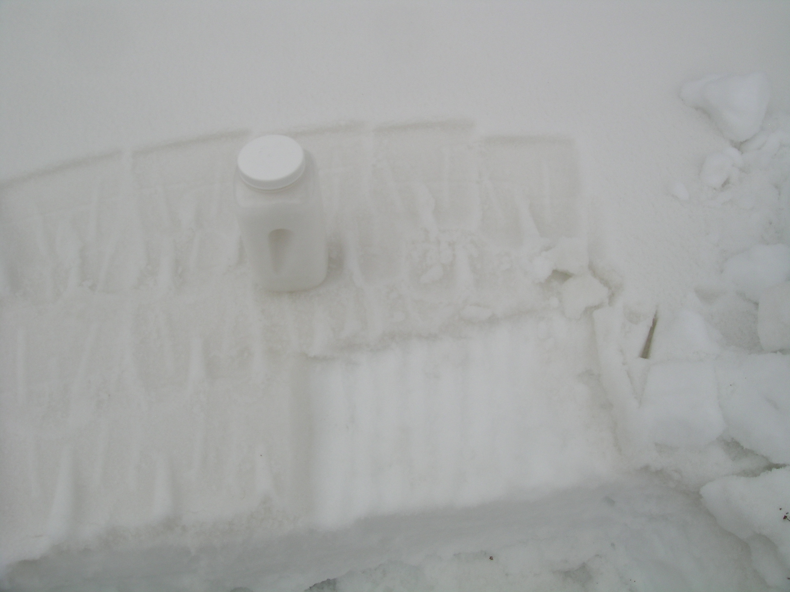
April 13, 2013 This season, CODOS is collecting “all layers merged” dust samples at each CODOS site, as feasible, for chemical analysis by the USGS American Drylands project we’re working with and the team led by Rich Reynolds, in Denver. This photo shows the contrast between the surface containing merged D6/D5/D2 that was sampled compared to the underlying, ‘clean’ snowpack. A second container of the merged dust was also collected. Some very fine dust is lost to leaching, but the bulk of dust remains in the snowpack surface until SAG. |
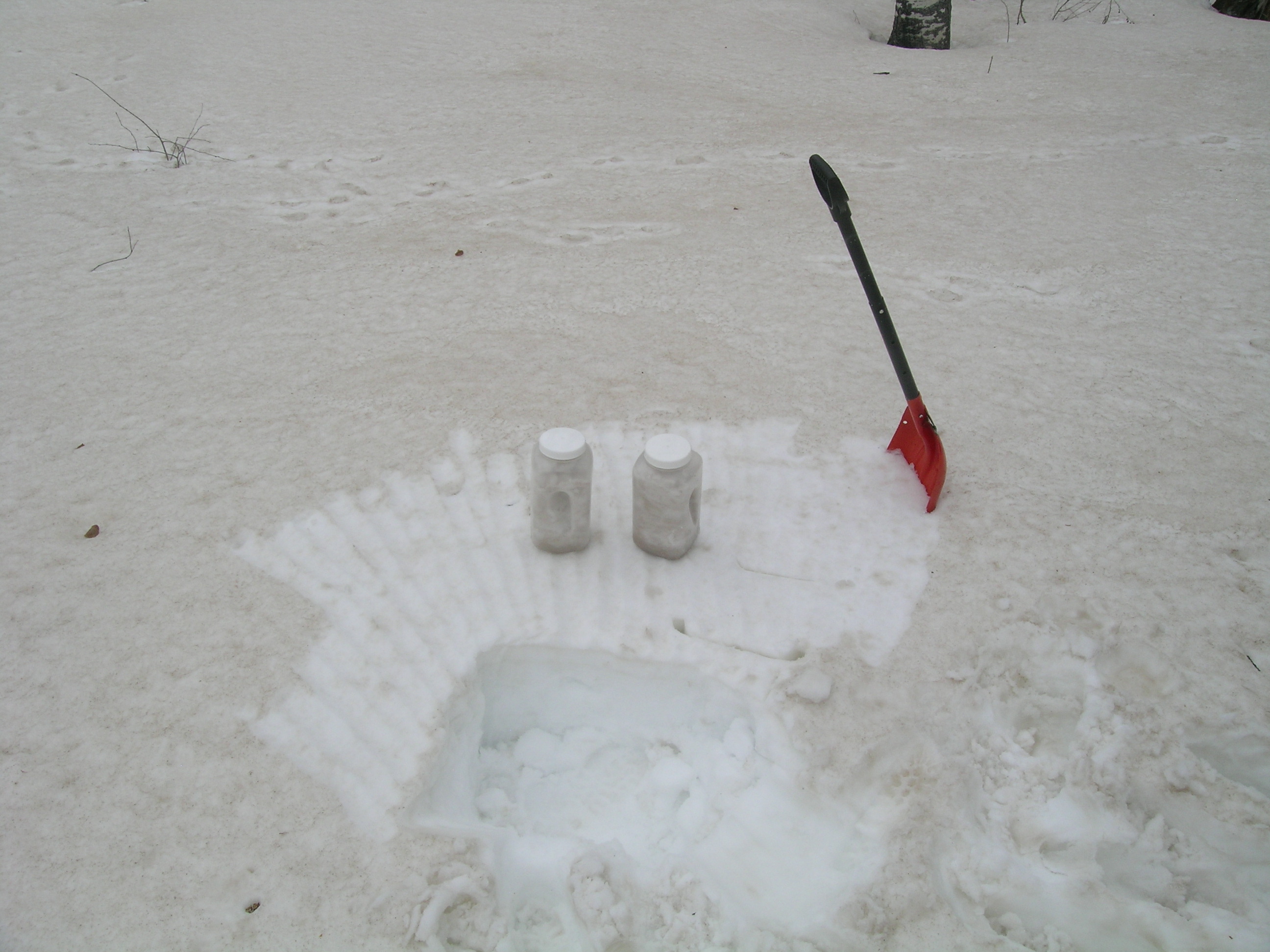
April 30, 2013 A fresh “all layers merged” sample was collected on April 30 in order to capture the D7 and D8 events. The contrast between the underlying snow in the scarped area and the “all layers merged” dust is clear, and the corresponding darkening of the snow surface by those merged dust layers was greater than the same-day effects at Swamp Angel Study Plot, where D6 had not yet widely emerged. |
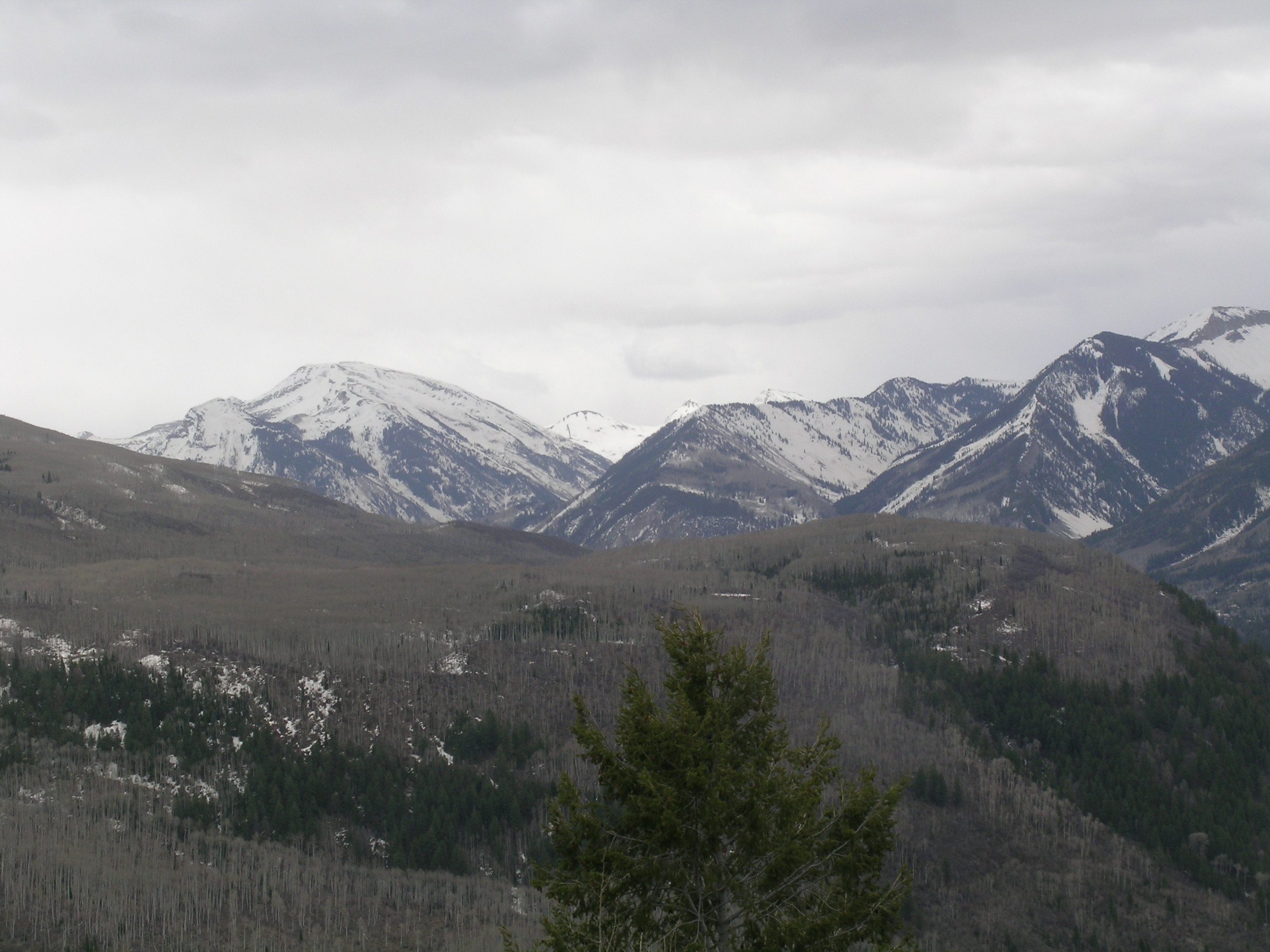
Significant D8 (at least) was easily seen on the distant peaks looking southeast from McClure Pass,
up the Crystal River valley toward its headwaters near and above Marble, Colorado.
 |
 |
 |
| March 20, 2013 | April 13, 2013 | April 30, 2013 |
Melt Rate
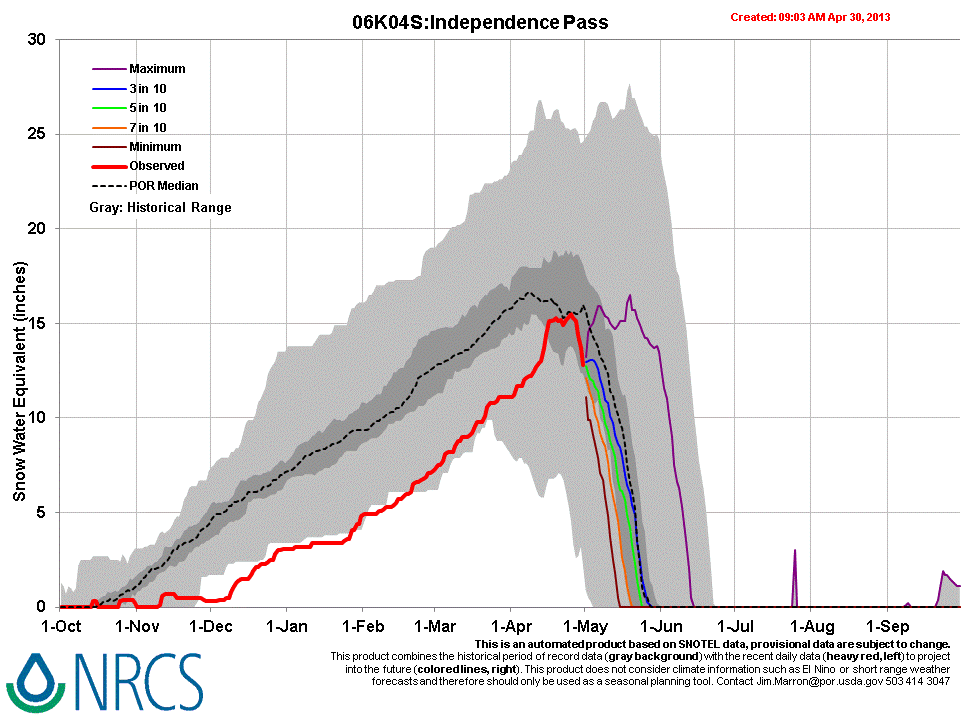
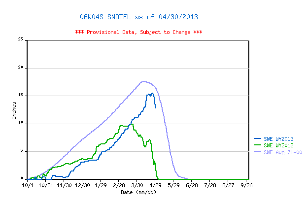
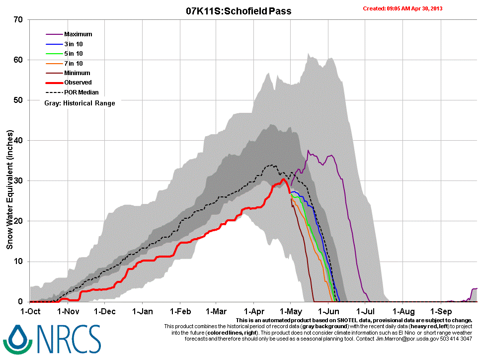
Snowmelt rates accelerated at the McClure Pass Snotel site as dust layers D8/D7/D6 emerged and merged in late April. Melt rates reached 1.3” SWE loss per day just prior to and on the day of our April 30 site visit. At the same time, other higher-elevation Snotel sites in the Elk Mountains (at Schofield Pass and Independence Pass) also recorded a rapid decline in SWE in the final days of April, likely enhanced by (at least) dust layer D8. Those Snotels currently retain a higher proportion of their Peak SWE than does McClure Pass.
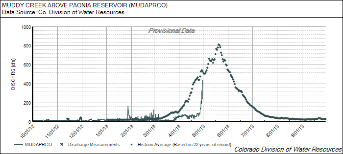
Stream Flow
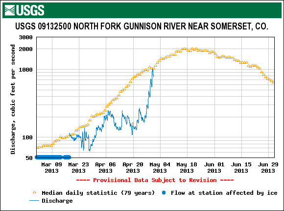
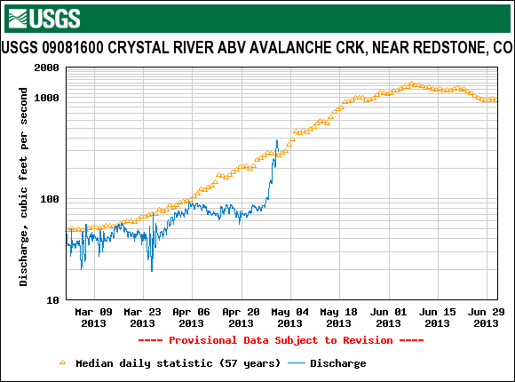
The rapid acceleration of snowmelt rates in the final days of April, as D8/D7/D6 rapidly emerged, helped produce significant surging in runoff on both sides of McClure Pass, in the Crystal River and North Fork of the Gunnison watersheds. All of those gauges were reporting much below-average discharge in mid-April, just before surging to or above median flow levels at the end of the month. Discharge on the North Fork of the Gunnison, as measured near Somerset, surged nearly ten-fold within ten days, rapidly reaching its median peak flow level. Muddy Creek, above Paonia Reservoir, also jumped quite rapidly, but did not reach its median level. The Crystal River, measured near Redstone, reached and slightly exceeded its median level (for the date). Curiously, both the North Fork and the Crystal rivers present a slight decrease in their historic, median flow rates in late April, concurrent with these April 2013 surges. As expected, the surges in streamflows depicted in these graphs were reversed by a subsequent change in weather, with reduced solar inputs, a few inches of new snow, and much colder overnight temperatures. Flows may quickly climb again under sunny skies today (Thursday, May 2) and Friday.
Forecast
As of this writing, Thursday, May 2, 2013 the National Weather Service expects clear, sunny skies and no chance of precipitation today or Friday. This return to maximum potential solar inputs, along with warming temperatures (especially overnight low temperatures) will enable a resumption of higher melt rates and streamflows. However, this return of the sun will be brief and may not result in a full restoration of the late April discharge rates. This weekend, increasing chances for afternoon snow/rain showers could reduce solar insolation to the snowcover somewhat, but NWS still expects partly sunny conditions and a continued slow rise in air temperatures (including overnight low temperatures). No significant accumulations of snow are anticipated; spring rains on snow always enhance snowmelt. Next week, atmospheric “blocking” to our east may result in a period of prolonged, unsettled weather for western Colorado, perhaps also resulting in reduced solar inputs to the snowpack.