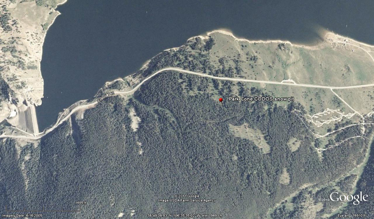
 CODOS Update for Park Cone site:
visited March 18, 2013
Summary | Snowpack | Melt Rate | Forecast
Summary
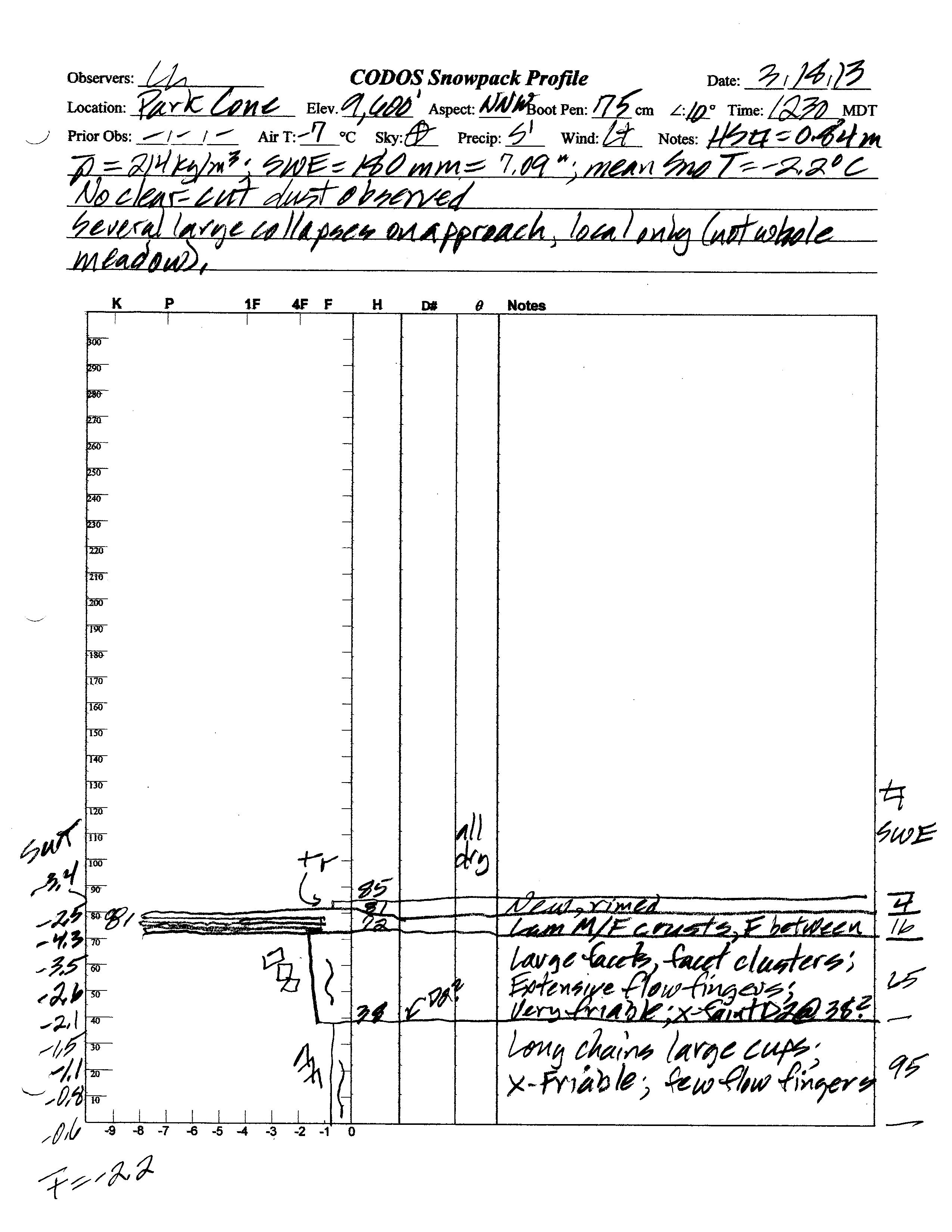
This field session and snow pit at Park Cone, our first of the WY 2013 season, found a virtual repeat of the sub-par snowpack depth and SWE conditions observed a year earlier. The snowpack still retains some cold content and will require additional warming to become isothermal. No clearly discernible dust was observed in the snow profile but faint dust was in the air, on very strong W’ly winds, lower in the Gunnison Valley during the morning. Strong winds and snow squalls at the Park Cone site may have deposited a weak D4 layer (with snow) later on March 18th, followed by additional snow later in the week.
SnowPack Discussion
Total snow depth in our March 18, 2013 snow profile was 33.5”, a little deeper than a year before, and most of the snowpack consisted of very weak “depth hoar” grains, as was also the case a year earlier. However, despite the greater depth, mean density of the snowpack was just 214 kg/m3 (21.4% water content), a little lower than a year before. Melt-freeze had occurred in the upper few inches of the snowpack but the snow surface was dry and cold at the time of this year’s snowpit. Overall, the mean snowpack temperature in this profile was -2.2° C, over a degree warmer than observed a year earlier. Although a very faint tinge was observed in the snow about 15” above the ground (too early in the season for event D2), no clearly discernible dust-on-snow layers were observed in the snowpack during this visit. However, dust was observed in the air on very strong W’ly winds in the Montrose and lower Gunnison valley while driving to Park Cone (logged as event D4-WY2013 at Senator Beck Basin), but snow showers and blowing snow obscured the sky at the site. Although no new dust was observed while at the site, it is possible that a weak D4 layer was deposited at Park Cone later in the day, entrained in new snow.
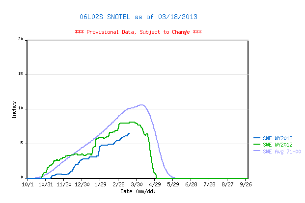
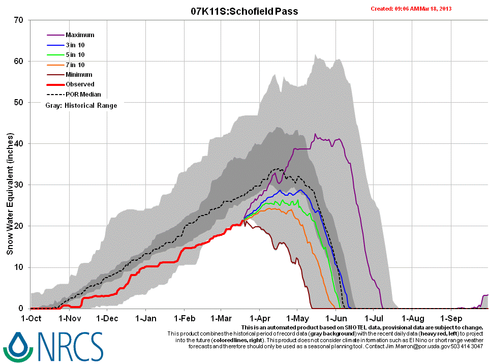
Park Cone Snotel data for WY 2013 place current SWE in the lower quartile of values for the period of record and substantially behind same-date values in WY 2012, well below the prior 1971-2010 30-year mean.
 |
 |
|
| 2012 Pit Profile | 2013 Pit Profile |
 |
 |
|
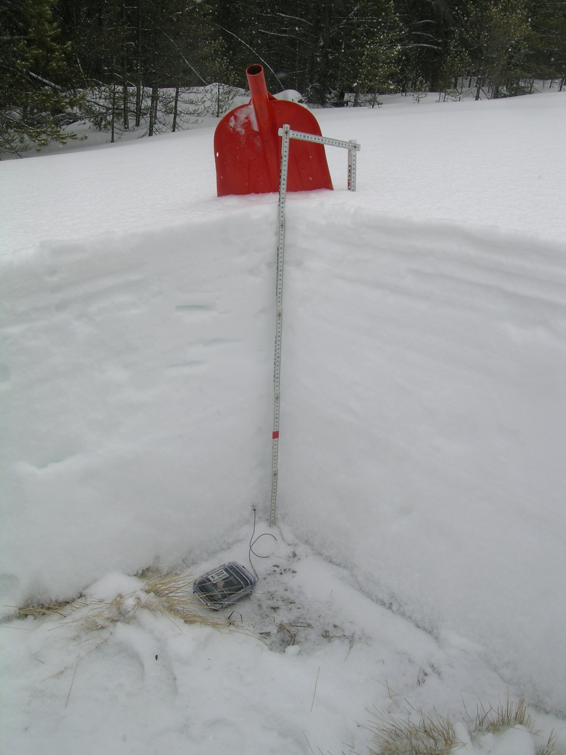
| 2012 Pit Photo | 2013 Pit Photo |
 |
| Blustery weather on the approach to Taylor Park Reservoir on March 18, 2013 |
Melt Rate
The Park Cone Snotel site continues to accumulate SWE and shows no significant losses of SWE to-date. Surface melt had occurred in the snowpack at our slightly north-facing CODOS snow profile site, in an open meadow adjoining the forested Snotel site, but little if any melt water exited the snowpack as runoff. Rather, that melt water re-froze as it encountered cold snow in the middle and lower snowpack, forming frozen, vertical “flow fingers” of clear ice (see profile).

 >
>
Forecast
Barring a significant D4-WY2013 dust deposition in the upper Gunnison basin on March 18, 2013, unlikely given the very minor amount of dust observed in the air during travel to the Park Cone site, snowmelt processes at the Park Cone site and Taylor Park locale could proceed without significant dust-on-snow enhancement of radiative forcing until/unless subsequent dust is deposited. The National Weather Service in Grand Junction anticipates continued W’ly winds shifting to NW leading into the weekend of March 23/24, with additional snowfalls favoring the northern mountains.
As of March 18, 2013 only the least probable projection of future snowpack accumulation would result in a median value for peak SWE. NRCS projects only a 3 in 10 chance that complete snowcover ablation (snow all gone, or SAG) will occur near the median date, and higher probabilities that SAG will be earlier than the median date.