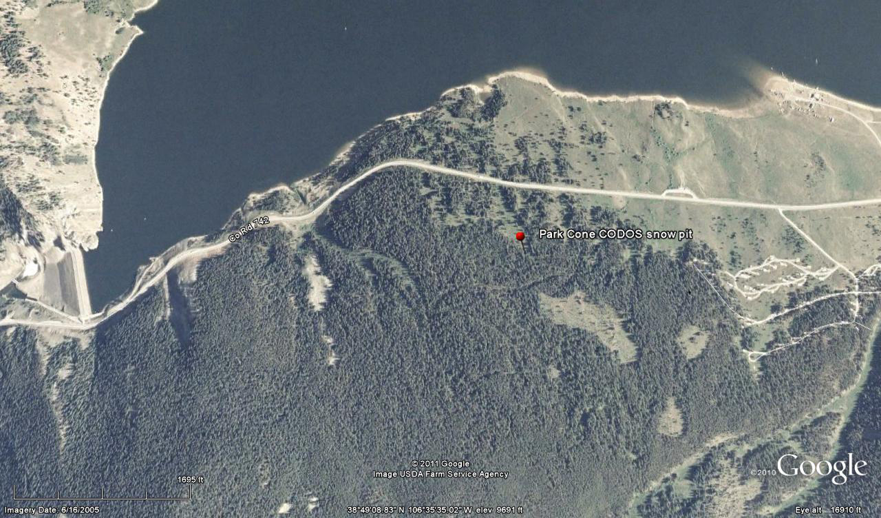
 CODOS Update for Park Cone site:
visited April 30, 2013
Summary | Snowpack | Melt Rate | Stream Flow | Forecast
Summary
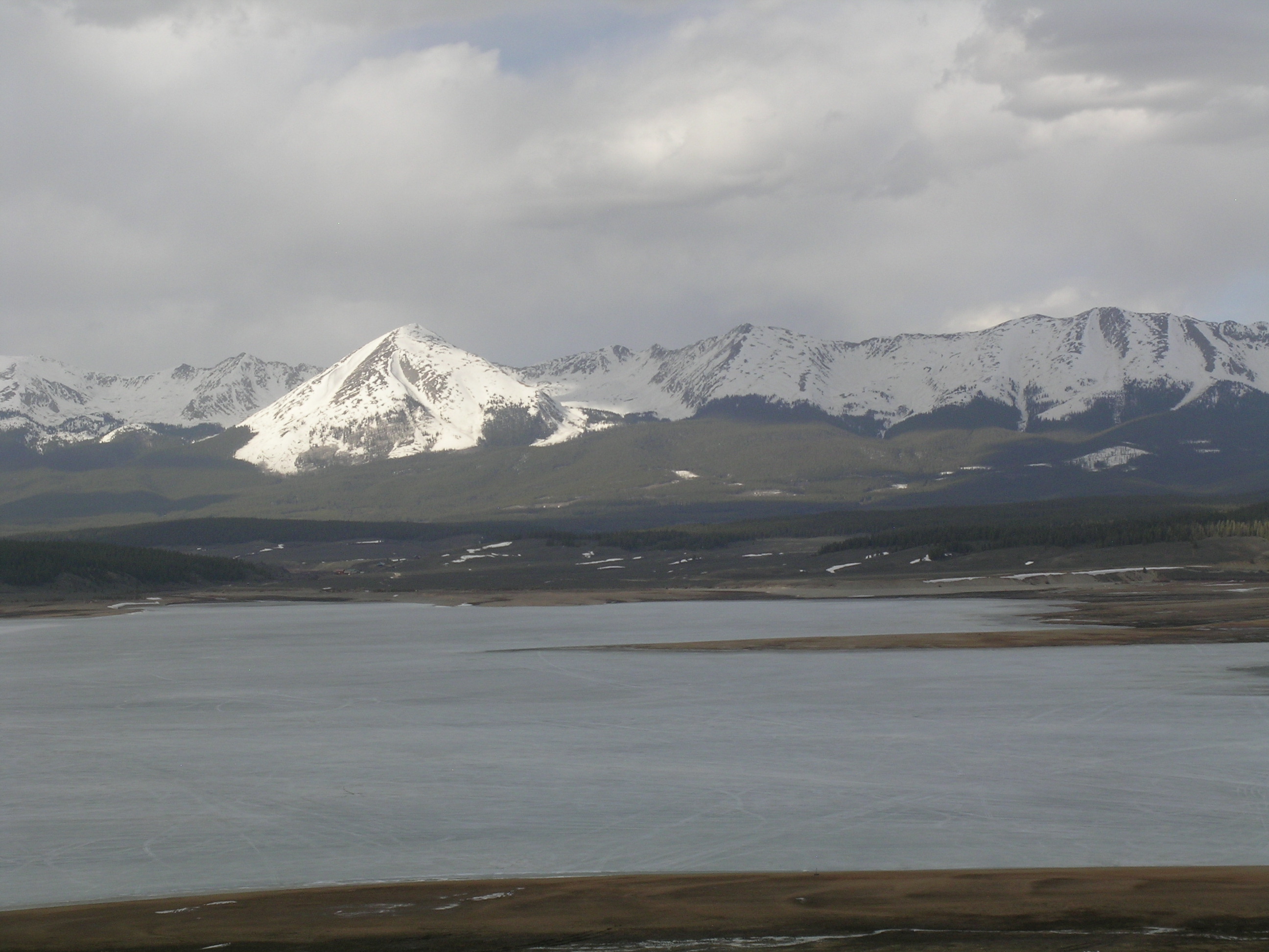
Our April 30, 2013 site visit to Taylor Park found snowcover effectively gone at the CODOS Park Cone dust monitoring site, although patches of shallow snowcover remained nearby, where shaded by forest. Snowcover was entirely gone on the Taylor Reservoir shorelines, and in the valley floor upstream. Substantial d was present at the snow surface, likely including layers D8, D7 and D6, and an “all layers merged” sample was collected for chemical analysis (by our USGS partners). Snowmelt runoff on the Taylor and East Fork rivers had recently surged from low levels and reached median values. Dust emergence is rapidly expanding to the highest elevations of the upper Taylor River locale. A wind event during our site visit produced a very weak dust-on-snow event (D9) but had no significant effect on the already extremely dirty snow surface. A trace of additional snow fell with that weather event and clear, sunny skies are returning, at least briefly, to the upper Gunnison watershed as of this writing.
SnowPack Discussion
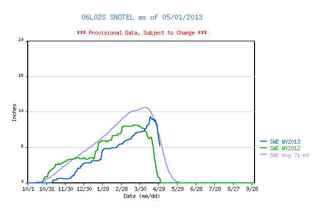
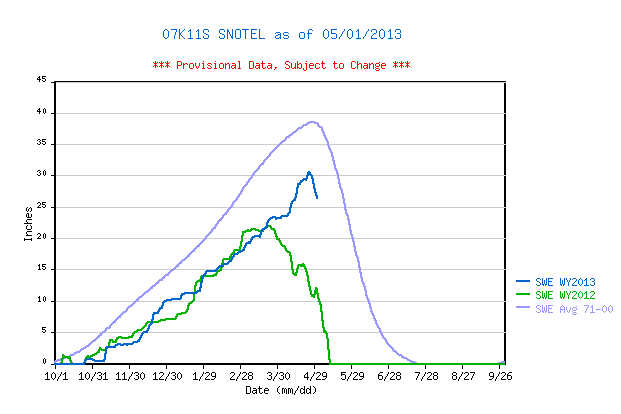
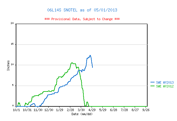
Our April 30, 2013 site visit to the Park Cone CODOS site at Taylor Reservoir found snowcover effectively “all gone”, with patches of open ground and bushes showing throughout the CODOS plot; no snow profile was performed. According to the adjoining Park Cone Snotel, snow cover SWE peaked at 9.2” SWE on April 16, shortly after the average date of Peak SWE, and not far short of the 1971-2000 mean. Both the Upper Taylor and Schofield Pass Snotel sites recorded much higher Peak SWE values than seen in WY 2012, but still fell short of their 1971-2000 means.
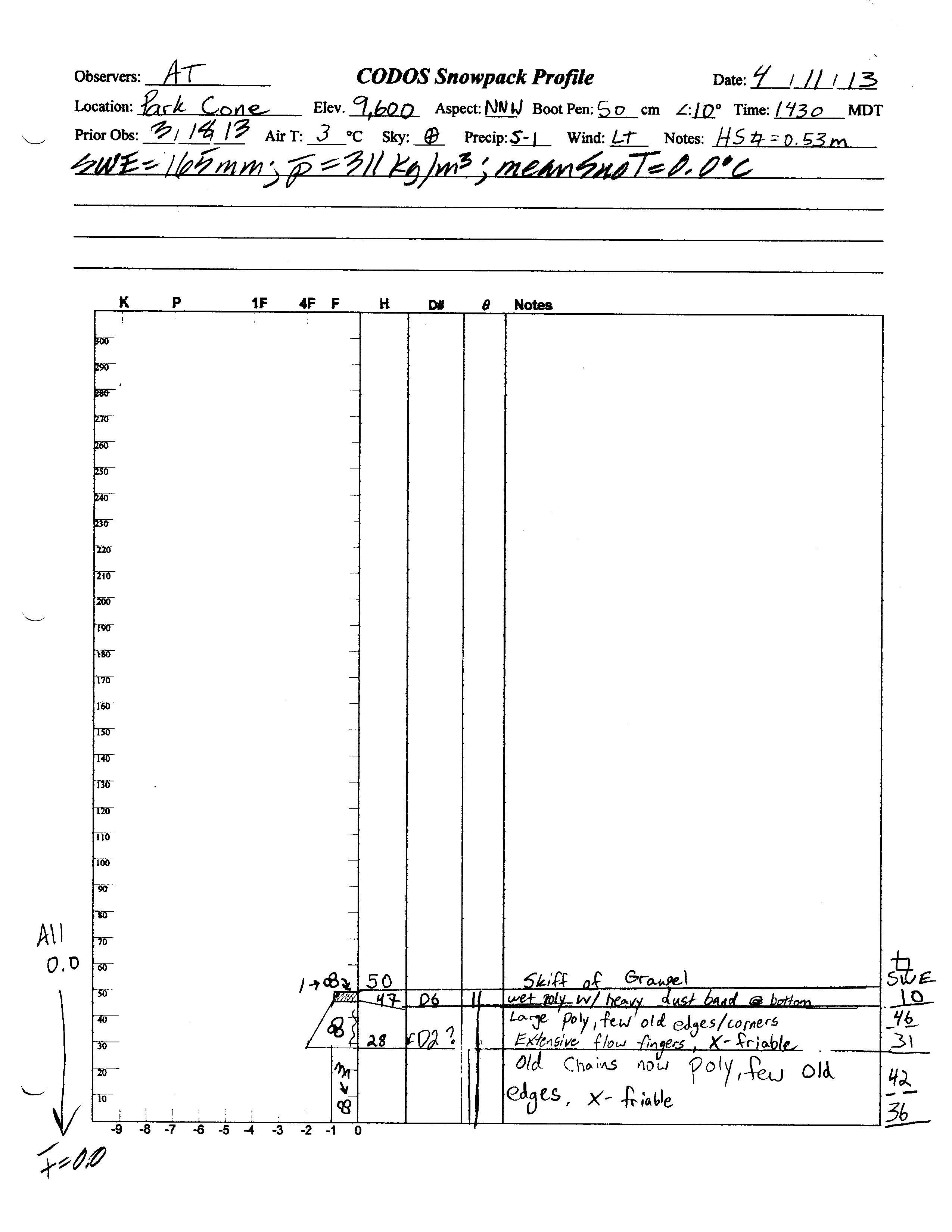
Our last Park Cone snow profile, on April 11, 2013 found a fresh D6 dust layer at the surface of a fully isothermal snowpack containing only 6.5” (165 mm) of SWE. Subsequently, dust events D7 and D8 were deposited, along with 0.9” of additional precipitation (perhaps as a mix of rain and snow). On April 30, the remaining patches of snowcover near the Snotel showed that all dust layers had merged in the snowpack surface and that rapid melt was underway.
Snowcover was essentially absent on the shores of Taylor Reservoir, and on the valley floor upstream of the reservoir. West aspects of Sawatch Range terrain in the upper Taylor River watershed, as seen from Taylor Reservoir, revealed extensive exposure of (at least) D8 dust, all the way to ridgelines, but snowcover quickly decreases below treeline. The Park Cone Snotel reported a small increase in snow depth the following on May 2 but that new snow layer will be quickly ablated under sunny skies today (Thursday, May 2) throughout that locale.
| April 11, 2013 Snow Profile | April 30, 2013 | |
 |
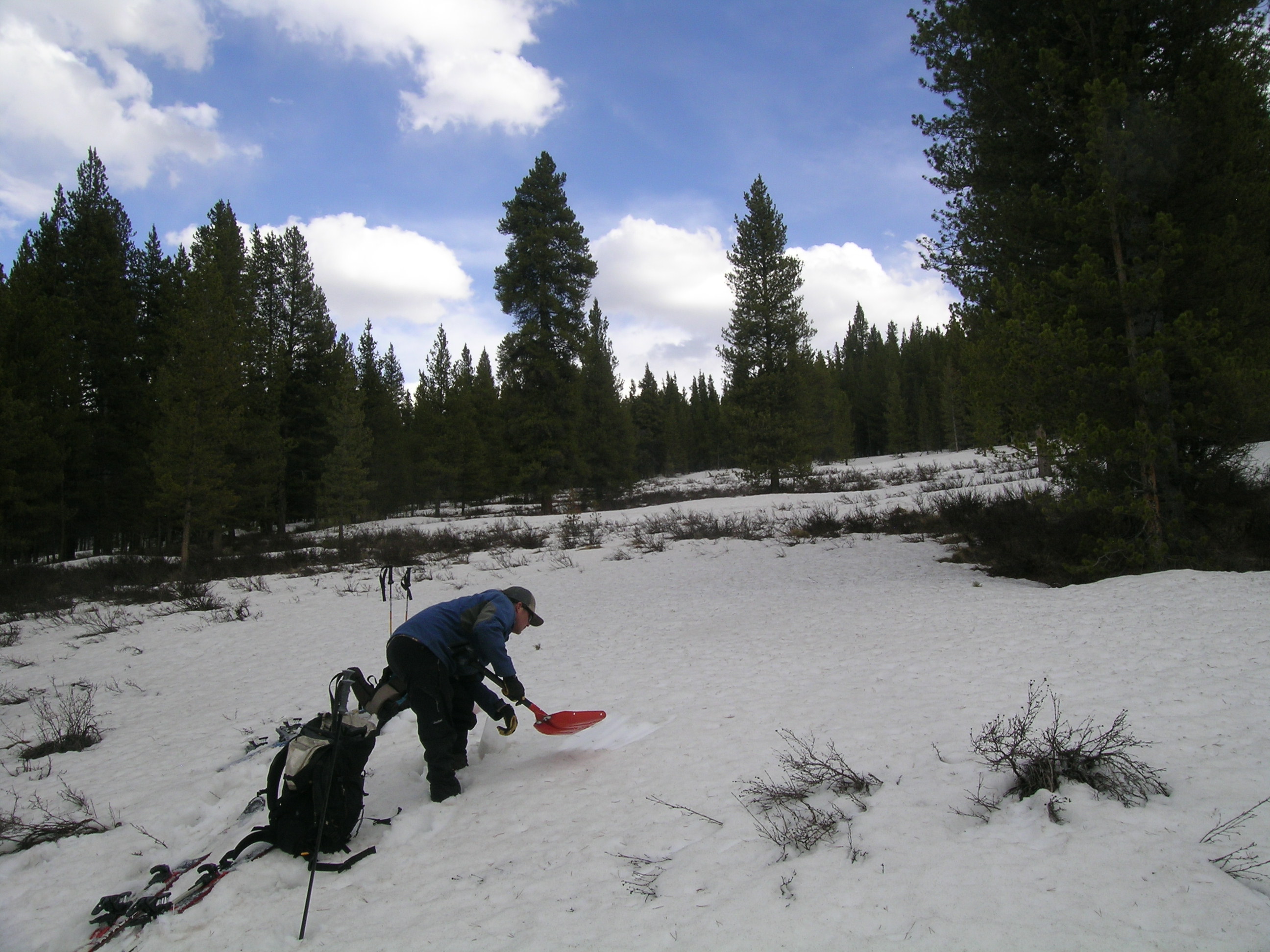
Snow All Gone by site visit April 30, 2013 |
 |
 |
|
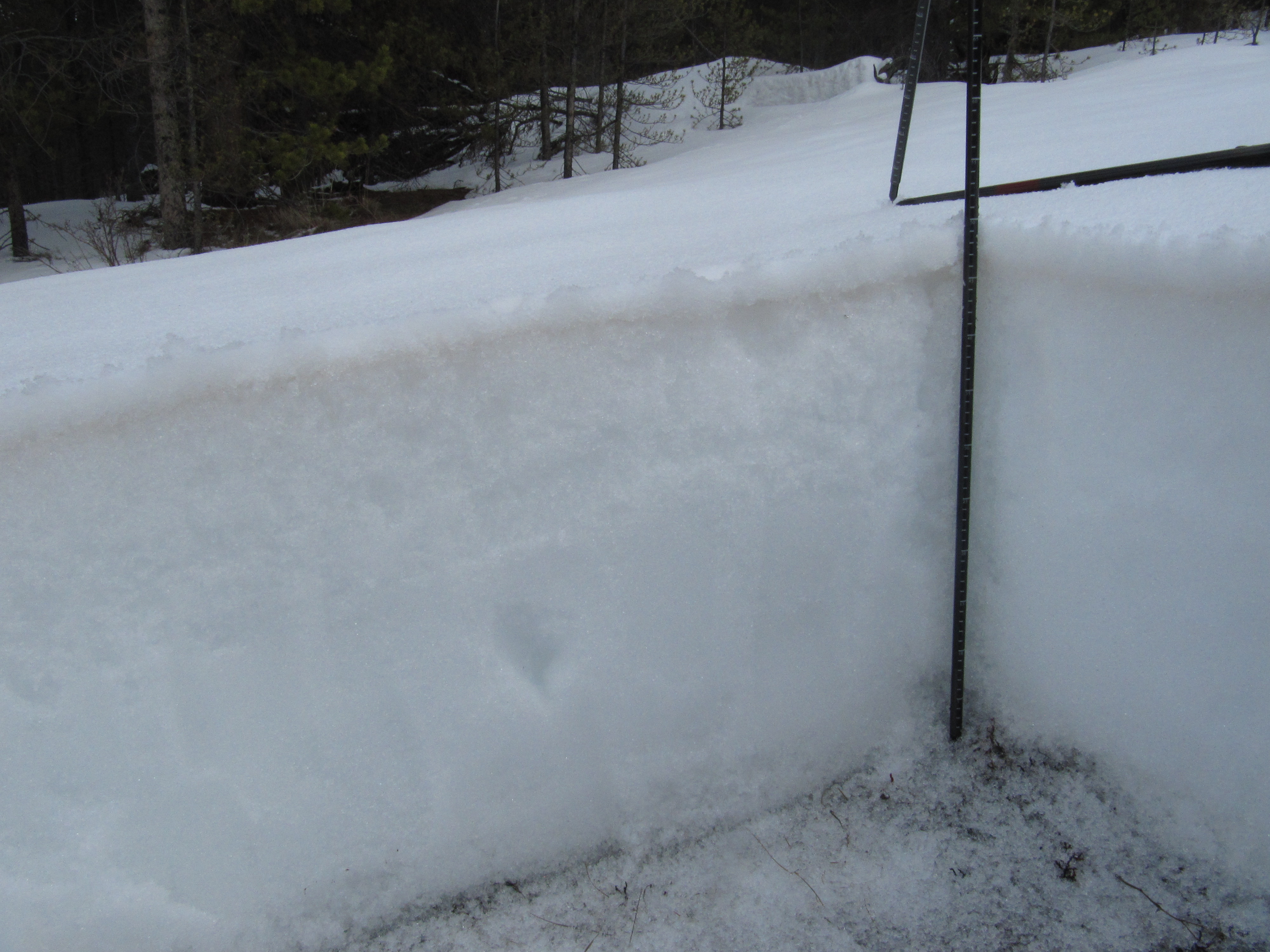
| The April 11, 2013 Park Cone snowpit showing the merged D6/D5 dust layer just below cleaner new snow at the surface. The Park Cone Snotel site is less than 50 yards away, in the forest seen in the background. | A fresh “all layers merged” sample was collected, in scattered trees below the CODOS site on April 30, to capture the D7 and D8 events merged with D6. |
 |
Significant D8 dust (at least) was easily seen on the west aspect of the Sawatch Range above |
Melt Rate
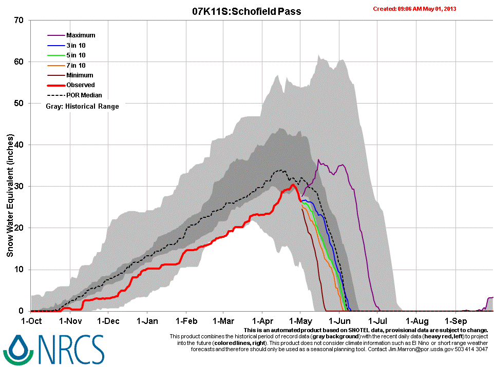
Snowmelt rates recently accelerated at the well-shaded, slightly north-facing Park Cone Snotel site as dust layers D8/D7/D6 emerged and merged in late April. Melt rates reached 0.8” SWE loss, per day, just prior to our April 30 site visit. Farther up the watershed, the Upper Taylor Snotel recorded SWE losses of 0.7” per day for three consecutive days prior to our site visit, and the Schofield Pass Snotel site also recorded a rapid decline in SWE in the final days of April, likely enhanced by (at least) dust layer D8. Those Snotels currently retain a higher proportion of their Peak SWE than does Park Cone.

Stream Flow
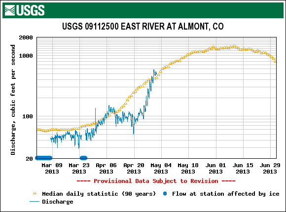
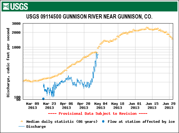
The rapid acceleration of snowmelt rates in the final days of April, as D8/D7/D6 rapidly emerged, helped produce significant surging in runoff at the East River at Almont and Gunnison River near Gunnison gauges. Those gauges were reporting much below-average discharge in mid-April, just before surging to or above median flow levels at the end of the month. As expected, the surges in streamflows depicted in these graphs were reversed by a subsequent change in weather, with reduced solar inputs, a few inches of new snow, and much colder overnight temperatures. Flows may quickly climb again under sunny skies today (Thursday, May 2) and Friday.
Forecast
As of this writing, Thursday, May 2, 2013 the National Weather Service expects clear, sunny skies and no chance of precipitation today or Friday. This return to maximum potential solar inputs, along with warming temperatures (especially overnight low temperatures) will enable a resumption of higher melt rates and streamflows. However, this return of the sun will be brief and may not result in a full restoration of the late April discharge rates. This weekend, increasing chances for afternoon snow/rain showers could reduce solar insolation to the snowcover somewhat, but NWS still expects partly sunny conditions and a continued slow rise in air temperatures (including overnight low temperatures). No significant accumulations of snow are anticipated; spring rains on snow always enhance snowmelt. Next week, atmospheric “blocking” to our east may result in a period of prolonged, unsettled weather for western Colorado, perhaps also resulting in reduced solar inputs to the snowpack.