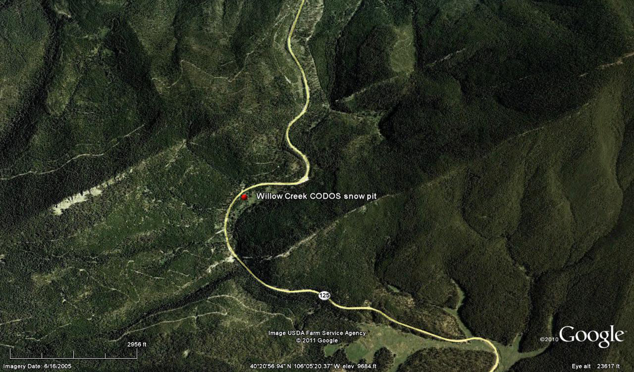
 CODOS Update for Willow Creek site:
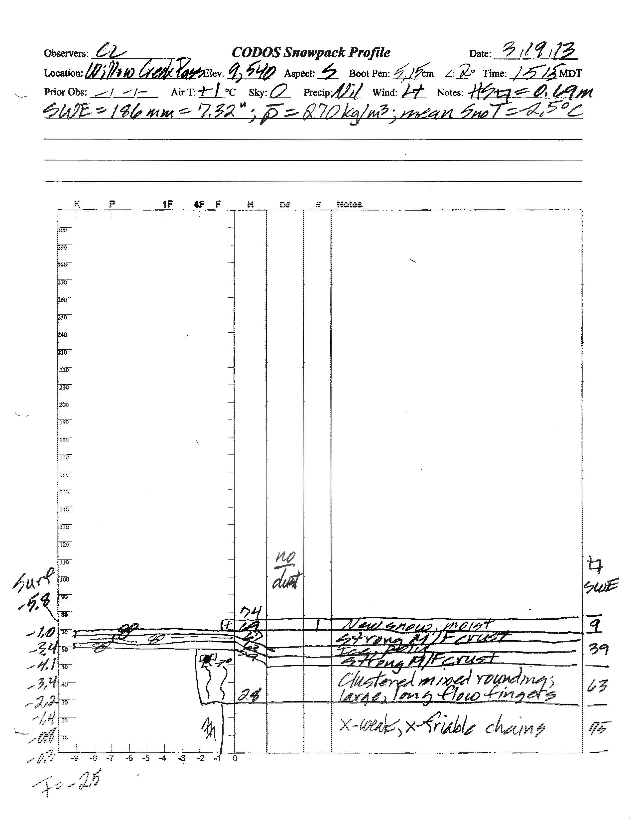
visited March 19, 2013
Summary | Snowpack | Melt Rate | Forecast
Summary
This field session at the Willow Creek Pass CODOS site, our first of the WY 2013 season, found an inch less SWE than observed a year earlier, despite exactly the same depth of snow, as well as an absence of discernible dust in or on the snowpack. The snowpack still retains cold content and will require additional warming to become isothermal. Our CODOS site snow profile data show markedly lower total snowcover and SWE than the nearby Willow Creek Pass Snotel site.
SnowPack Discussion
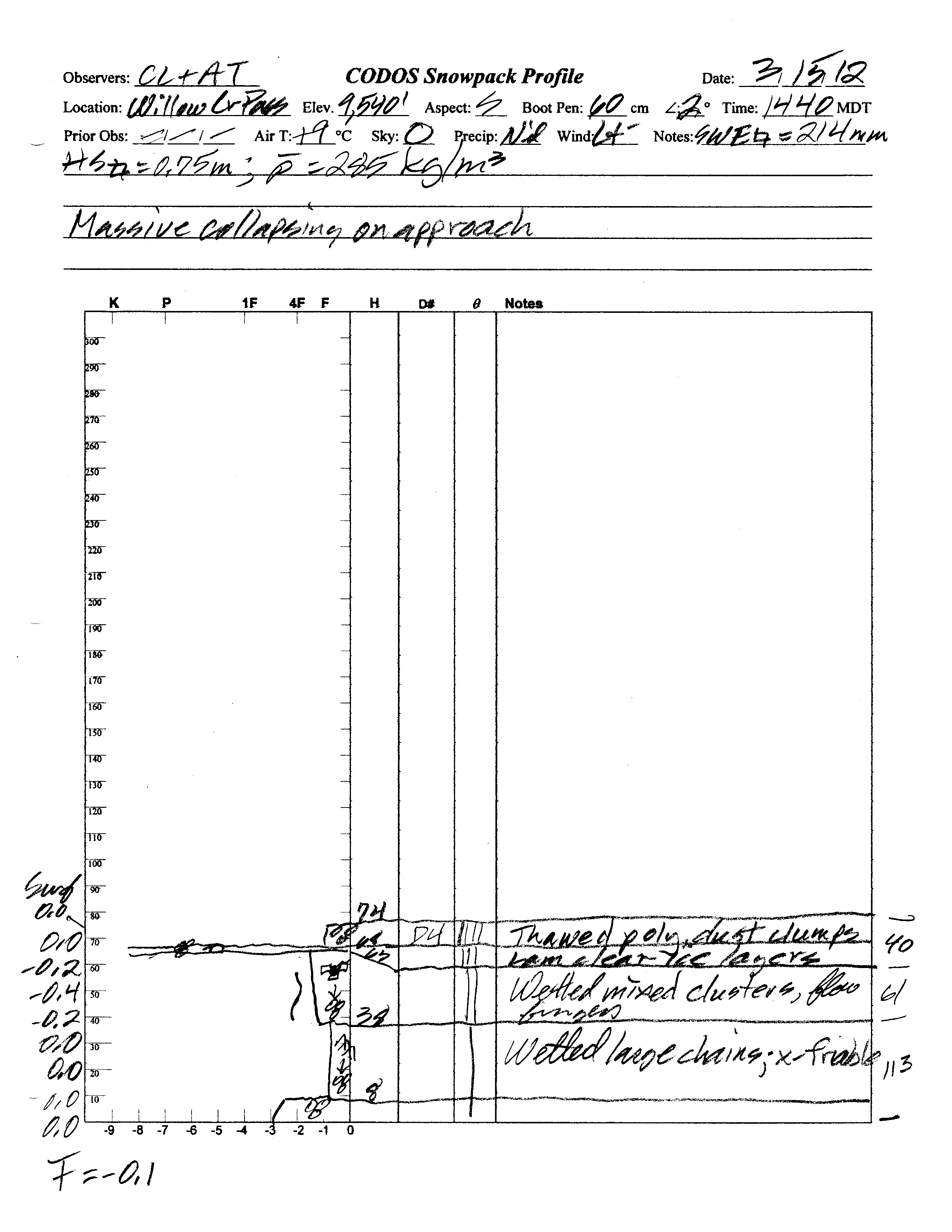
Total snow depth in our March 19, 2013 Willow Creek Pass CODOS site snow profile was 29”, exactly the same as a year before. Total SWE in this profile was 7.3”, or 1.1” less SWE than measured at the same site a year earlier. Mean density of this snowpack was 270 kg/m3 (27.0% water content), versus 285 kg/m3 a year before. The CODOS snow profile site is in an open meadow adjacent to the Willow Creek Pass Snotel site. That Snotel reported 42” of snow containing 11.0” of SWE on the morning of March 19th. Wind effects at this comparatively open and exposed CODOS snow profile site may account for some of those differences in total snow depth and SWE, but these are larger differences, with a different sign, than observed in prior seasons. On March 15, 2012 we measured 8.4” of total SWE at the CODOS site while the Willow Creek Pass Snotel was reporting 7.6” SWE (from 9.2” of total precipitation).
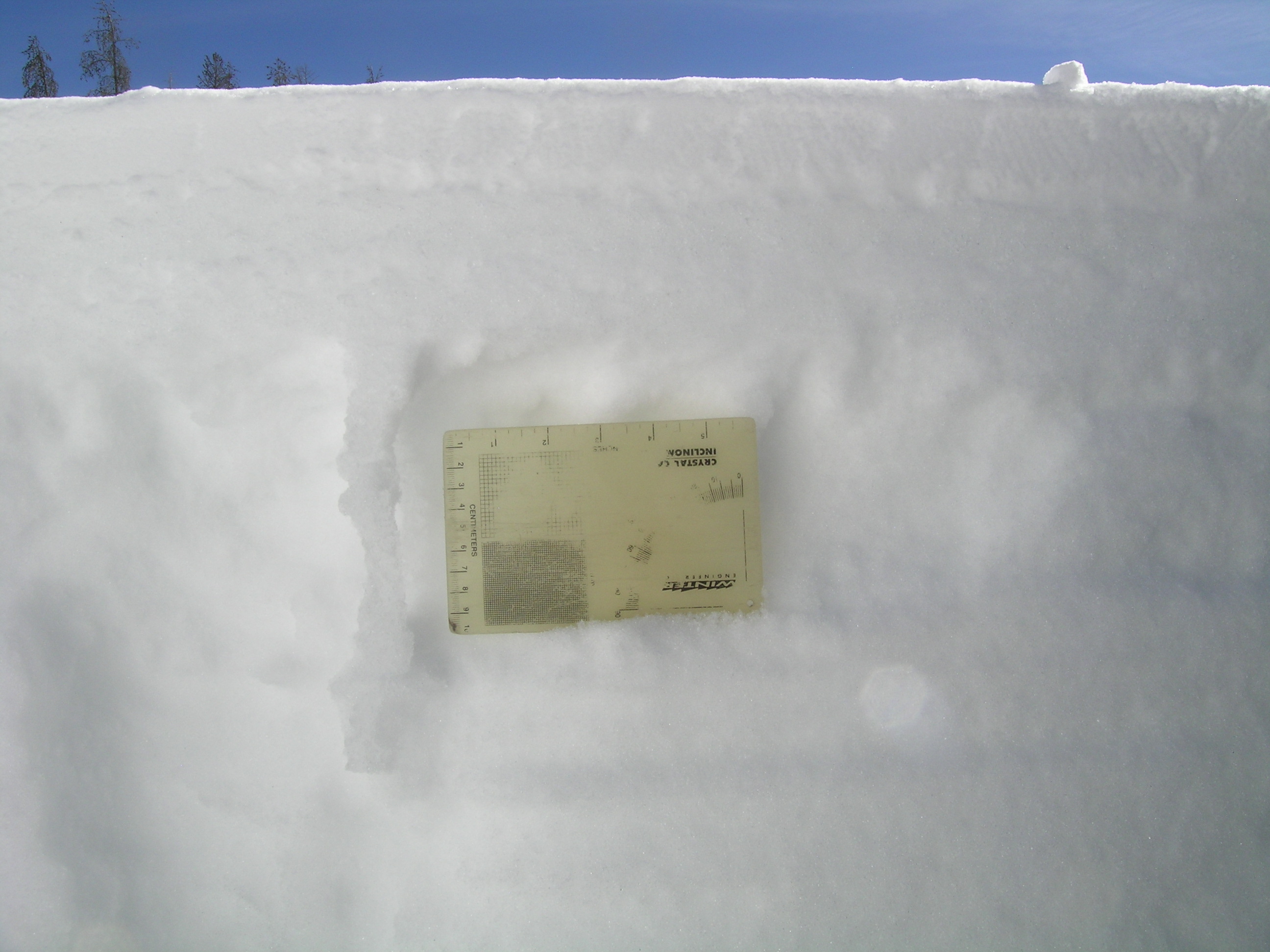
Significant melt-freeze had occurred in the upper snowpack at the CODOS site in preceding days and weeks, then refrozen as ice layers and vertical “flow fingers” of clear ice in the mid-pack (see photo below). On March 19, except for 2” of moist new snow at the surface, the remainder of the snowpack was once again completely dry and cold. Mean snowpack temperature in this profile was -2.5° C, versus -0.1° C (effectively isothermal) a year earlier. No dust-on-snow layers were observed within the snowpack and no discernible D4 dust (March 18 event) was seen in the new snow at the surface, or on the surface.
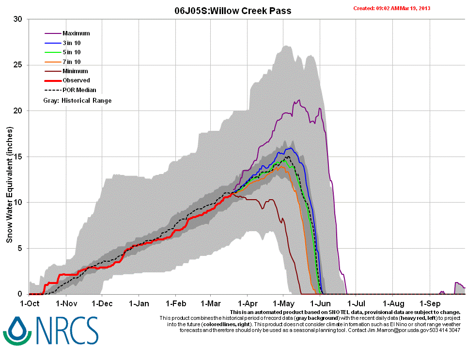
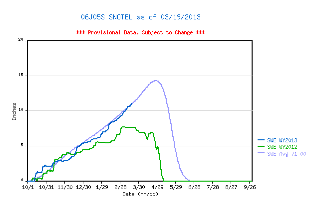
Given the substantially greater snowpack reported there, the Willow Creek Pass Snotel data for WY 2013 place current SWE very near median values for the period of record and substantially higher than the same-date values recorded in WY 2012.
 |
 |
|
| 2012 Pit Profile | 2013 Pit Profile |
 |
 |
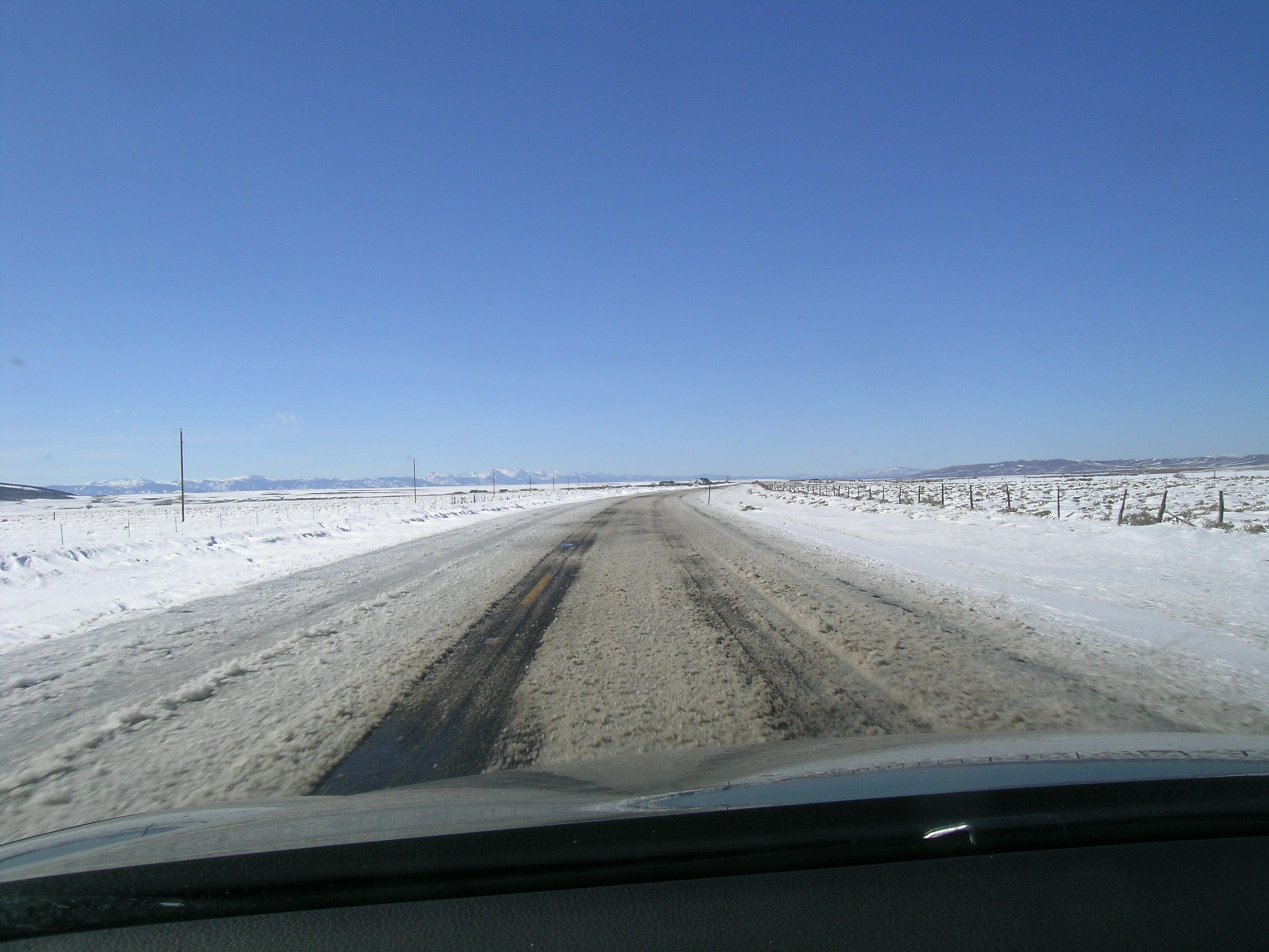 |
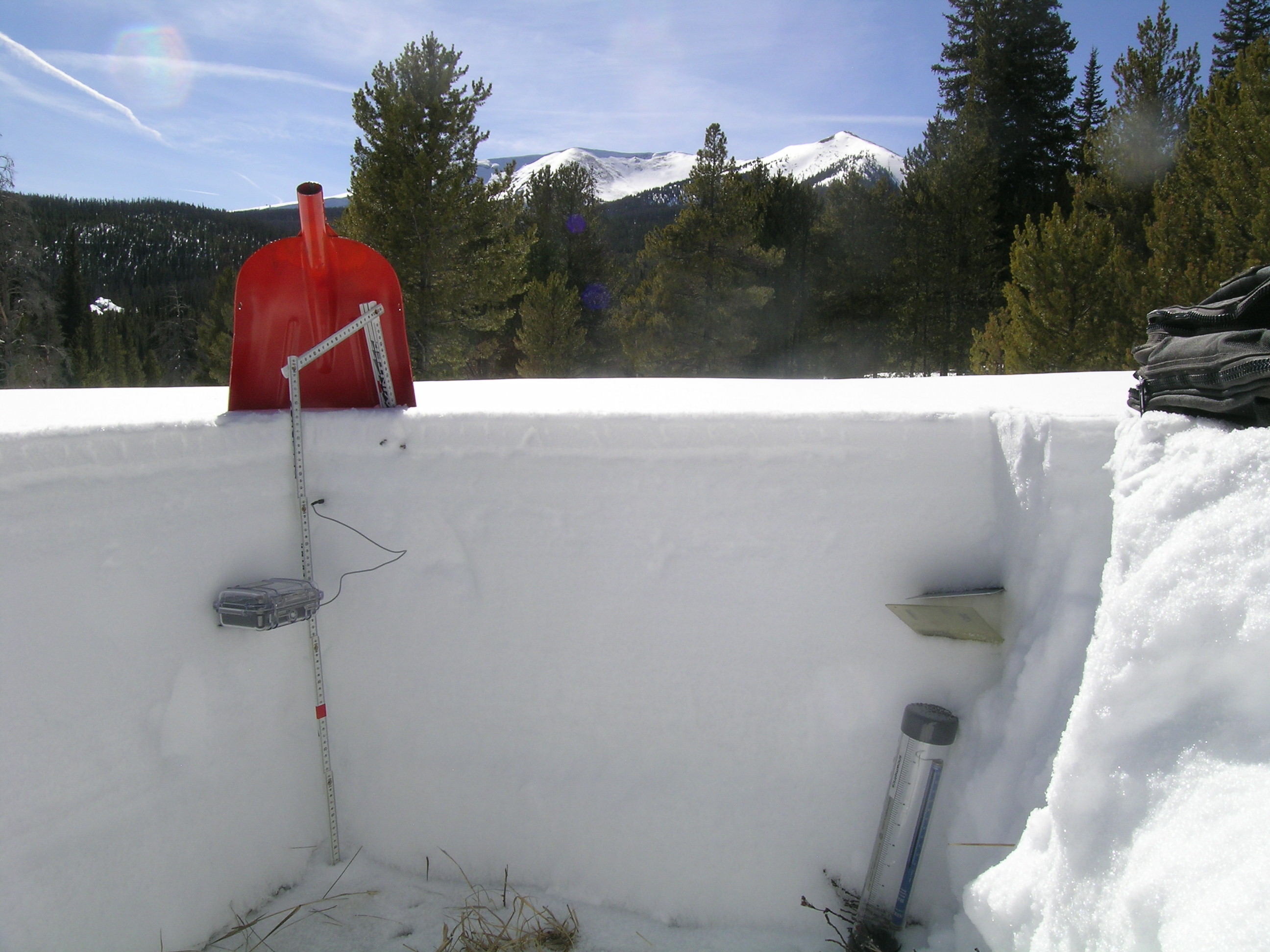
| The Willow Creek Pass snow pit with snow temperature measurements in progress in the shady corner. Parkview Mountain (12,296') is in the distance. Our SWE measuring tube is seen to the right, with its mm resolution scale inside. | The snowpit face has been brushed to reveal a re-frozen melt water "flow finger", with a 4" x 6" crystal card for scale. Free water from surface melt often establishes preferred, vertical flow paths through underlying layers. As that free water encounters significant snow density or porosity changes, at layer boundaries, water may move laterally until finding a weakness through which to penetrate into the next layer down. Or, free water may accumulate and lubricate at a layer boundary over wide areas, weakening layer-to-layer bonding and eventually releasing a wet avalanche. | Strong winds scoured hay fields along State Hwy 125, between Rand and Walden, depositing snow on the pavement and promptly creating deep slush. North Park contains extensive snow cover. |
Melt Rate
The Willow Creek Pass Snotel site continues to accumulate SWE and reports no significant losses of SWE, to-date. Surface snowmelt had recently occurred in the snowpack at the slightly south-facing CODOS snow profile site. This snow profile showed that melt water had reached the middle of the snowpack and then re-frozen, as “flow fingers” of clear ice, but no indications that free water had reached the bottom of and exited the snowpack, as runoff.
Forecast
Given the absence of observed dust-on-snow, snowmelt processes at the Willow Creek Pass CODOS site and locale could proceed without significant dust-on-snow enhancement of radiative forcing until/unless subsequent dust is deposited later this spring. The National Weather Service anticipates continued W’ly winds shifting to NW leading into the weekend of March 23/24, with additional snowfalls favoring the northern mountains.
As of March 19, 2013 NRCS’s “5 in 10” projection of future snowpack accumulation would result in peak SWE near the median at the Willow Creek Pass Snotel site, with complete snowcover ablation (snow all gone, or SAG) at or near the median date.