 CODOS Update for Wolf Creek Pass site:
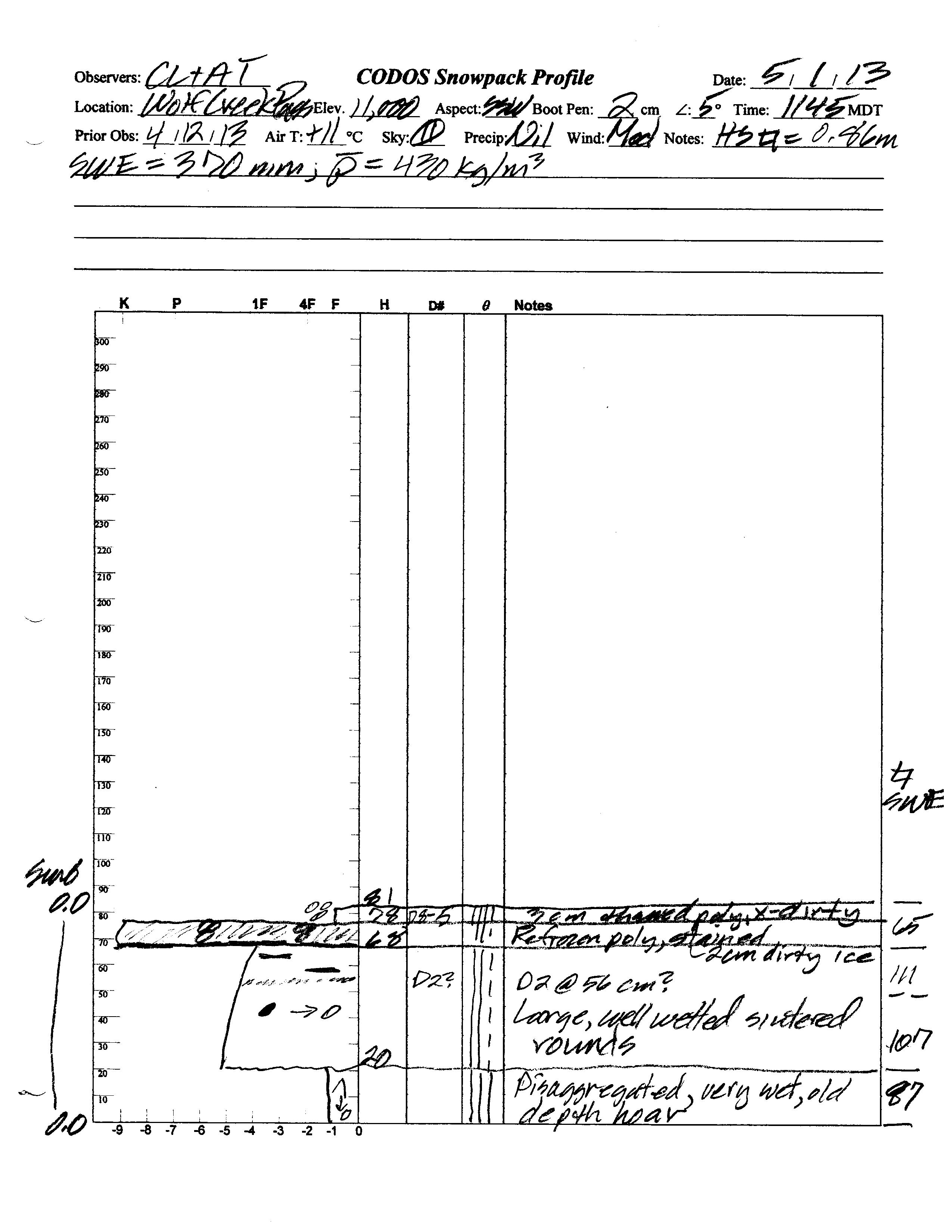
visited May 1, 2013
Summary | Snowpack | Melt Rate | Stream Flow | Forecast
Summary
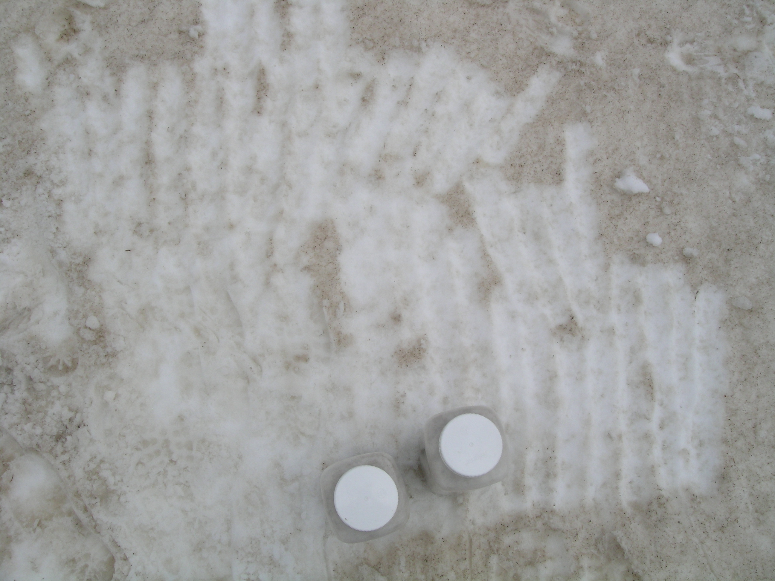
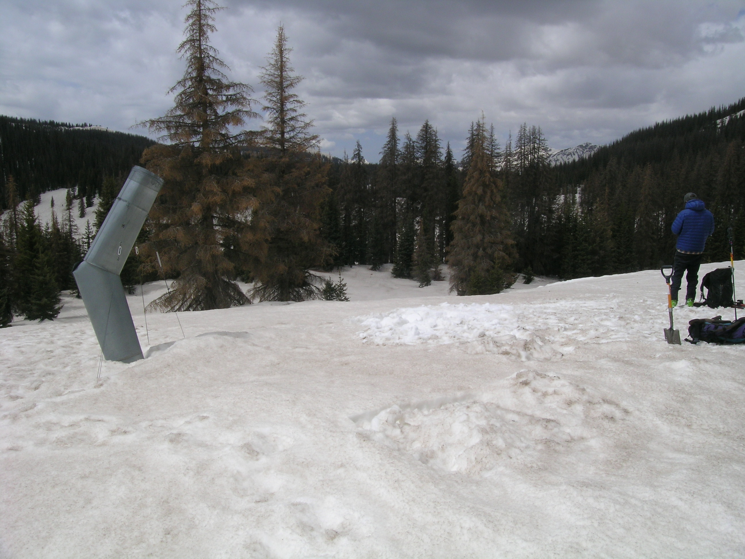
Our May 1, 2013 site visit to Wolf Creek Pass found scant snowcover on the flanks of the Pass but substantial snowcover remaining at the Pass proper and at the CODOS dust monitoring site. Heavy dust was darkening the snowpack surface, with all dust layers merged. Snowmelt runoff was in the process of surging in both the Rio Grande and San Juan River watersheds, from very low levels in mid-April to above-average values. A strong wind event the day before our site visit produced a very weak dust-on-snow deposition (event D9) but had no discernible effect on the already extremely dirty snow surface in the Wolf Creek Pass locale.
SnowPack Discussion
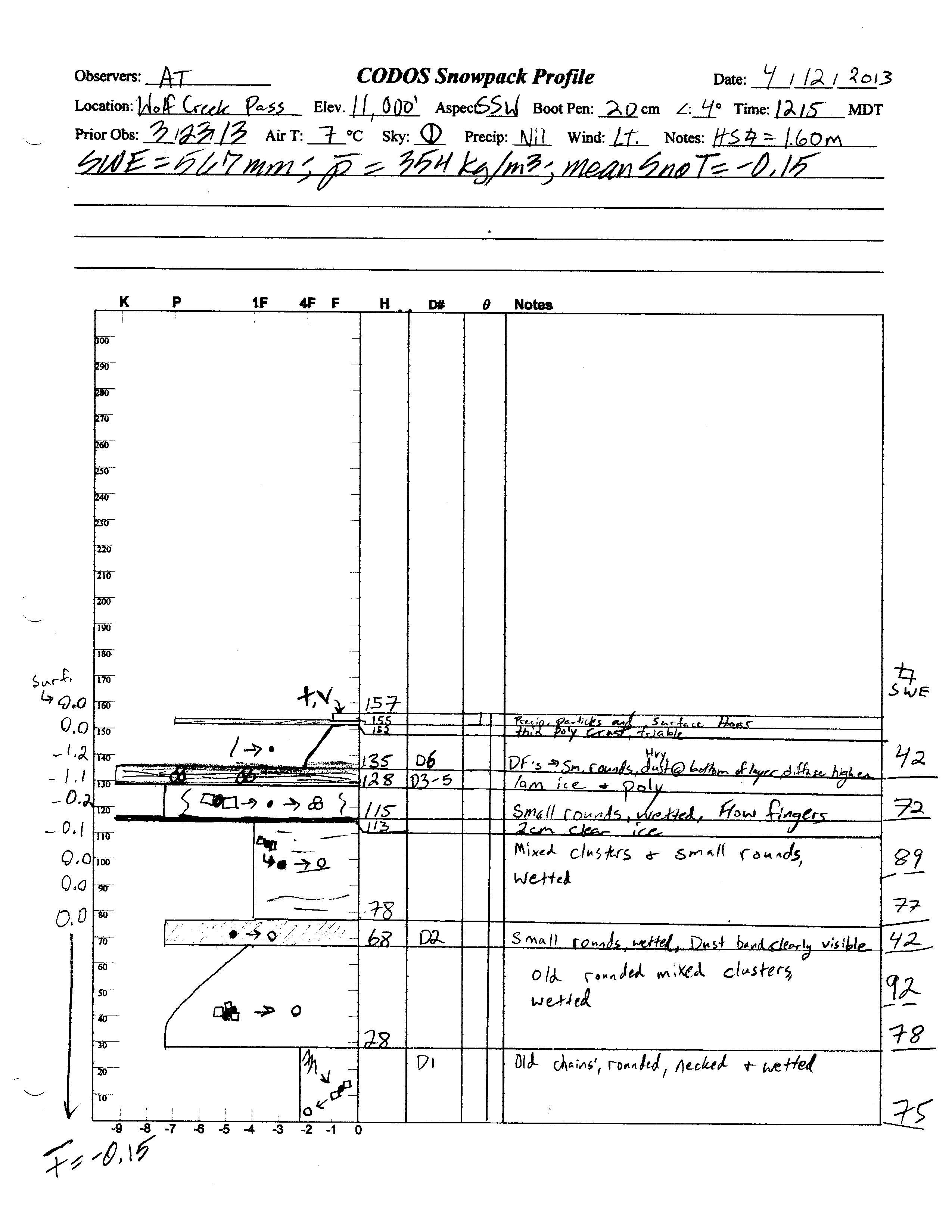
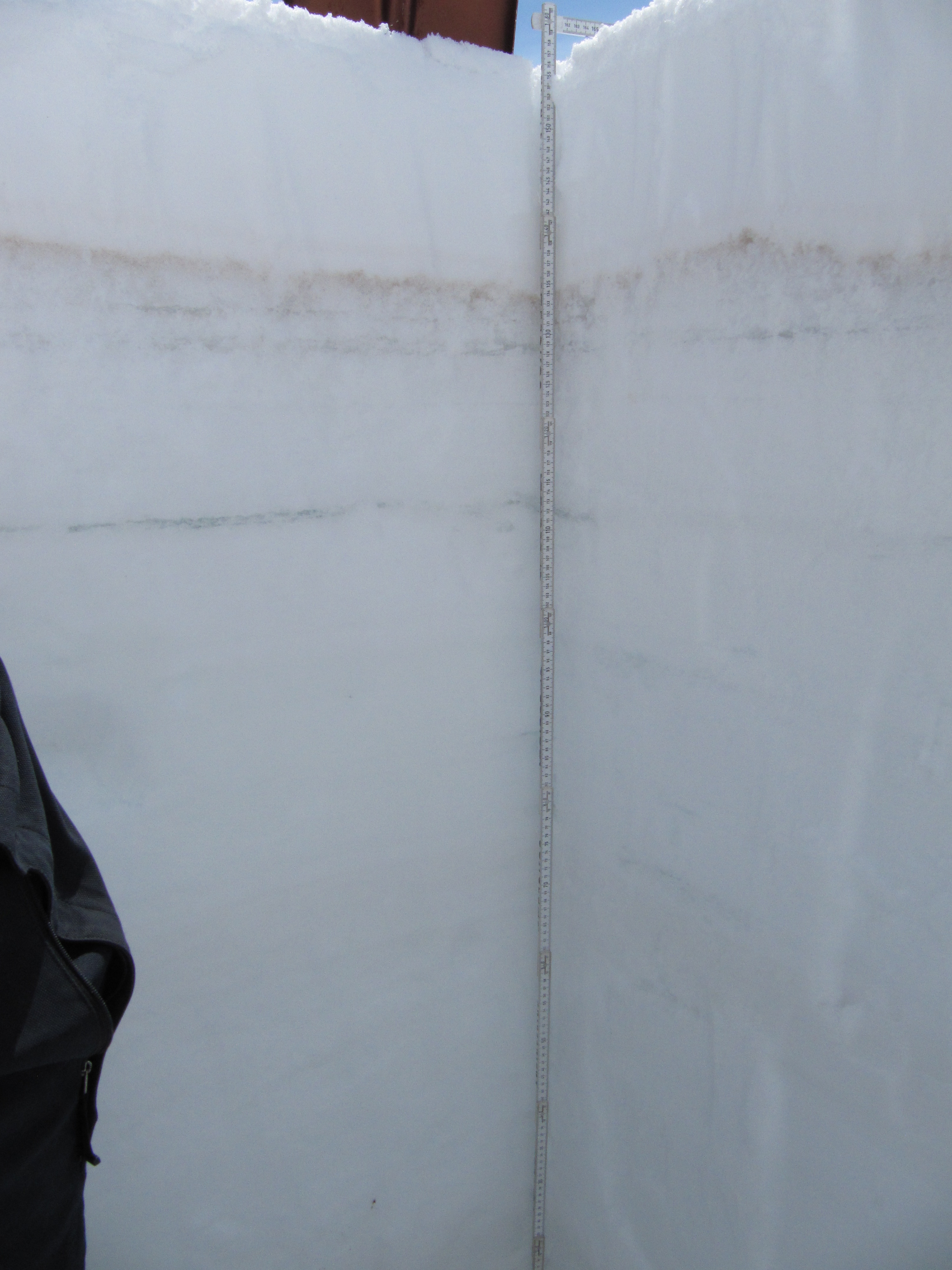
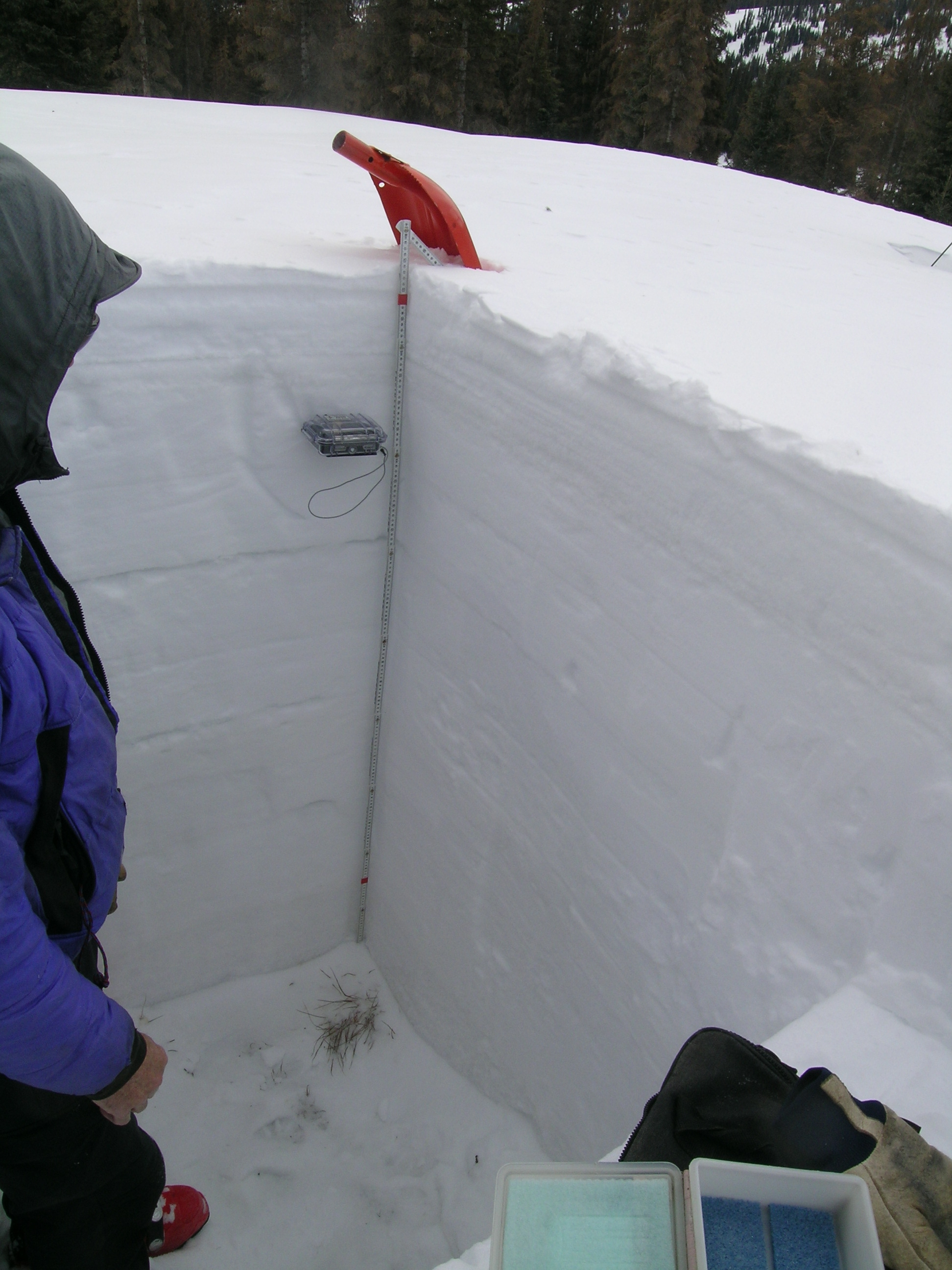
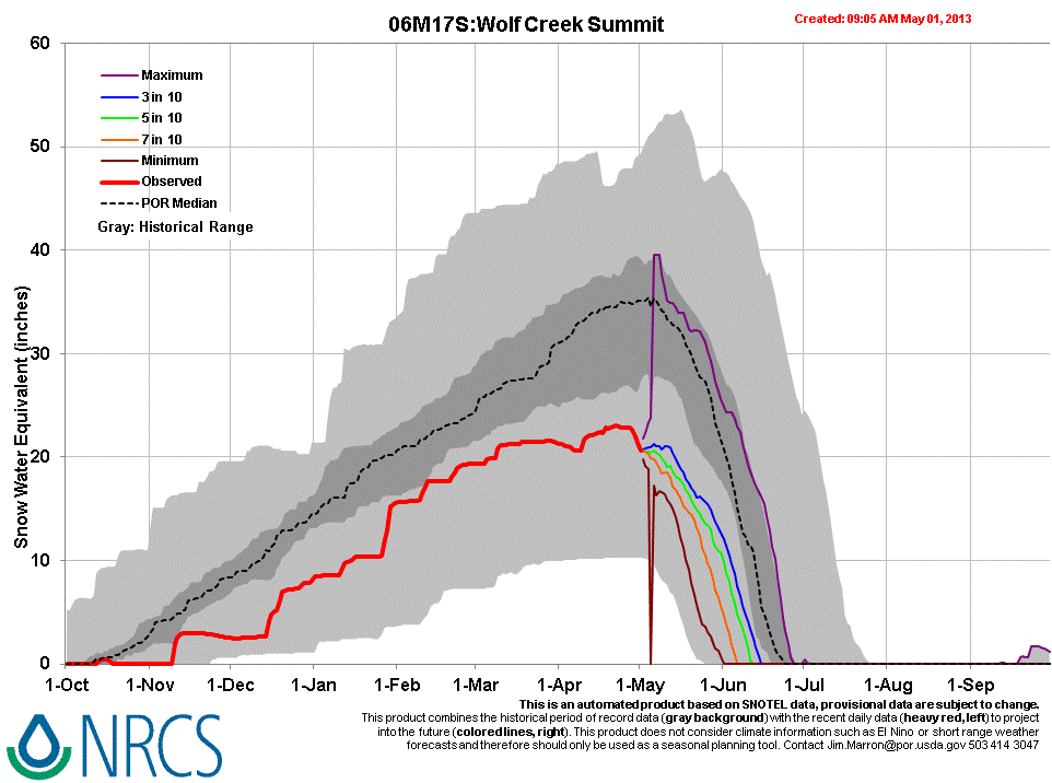
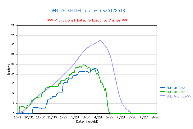
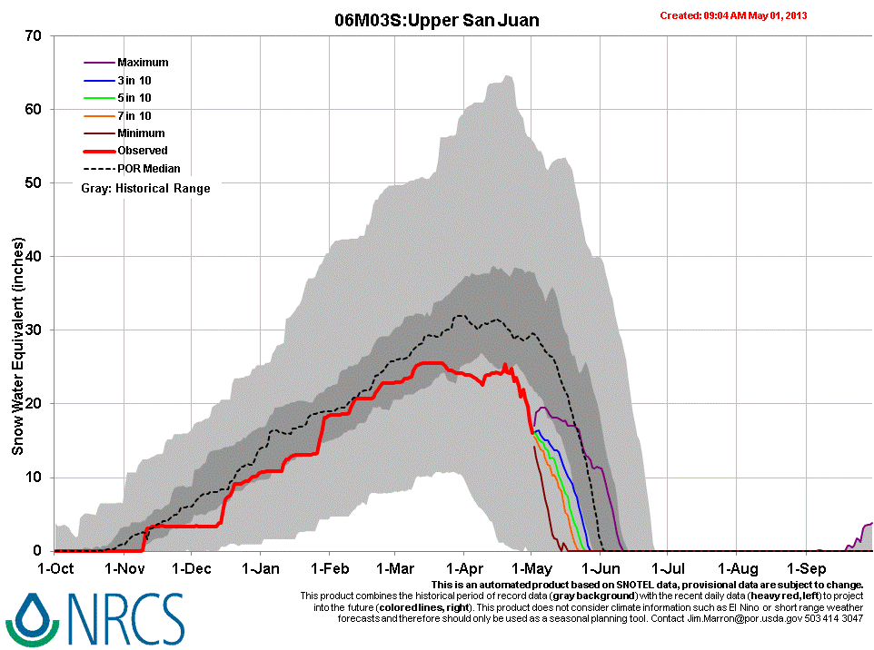
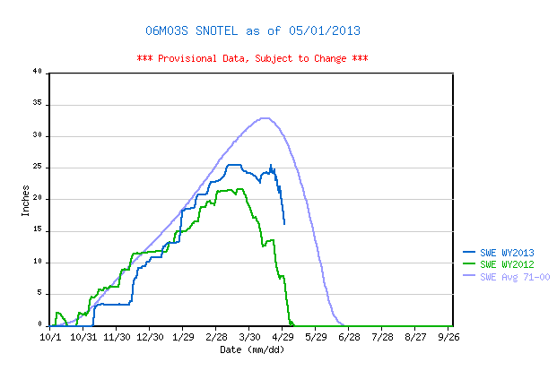
Our May 1, 2013 snow profile at the Wolf Creek Pass CODOS site found 32” of remaining snowcover at the CODOS plot, containing 14.6” (370 mm) SWE. According to the Wolf Creek Summit Snotel, snow cover SWE peaked at 23.1” SWE on April 22, somewhat less but also later than the Water Year 2012 Peak SWE and well below the 1971-2000 average date of Peak SWE. Just a few miles to the west, and lower on the west side of the Pass, the Upper San Juan Snotel peaked at 25.5” SWE in mid-March, well above the WY 2012 peak but still short of the 1971-2000 mean.
Our last Wolf Creek Pass snow profile, on April 12, 2013 found a fresh D6 dust layer buried 9” below the surface of an effectively isothermal snowpack containing 22.3” (567 mm) of SWE. Subsequently, dust events D7 and D8 were deposited and, despite mid-April storms, the snowpack began to rapidly melt. Snow surface reductions in albedo observed on May 1st, and produced by merged dust layers D8-D2, rivaled that observed at Red Mountain Pass the day before.
Aside from north facing slopes, snowcover was essentially absent along the approaches to Wolf Creek Pass along Highway 160, in the upper Rio Grande and San Juan River drainages, and entirely gone on the valley floor of the San Juan at the foot of Wolf Creek Pass. Distant views of the alpine terrain on the south flanks of the San Juan Mountains revealed scant snowcover, but extensive exposure of D8/D7/D6 dust where snow was present.
| April 12th Snow Profile | May 1st Snow Profile | |
 |
 |


Melt Rate
Snowmelt rates recently accelerated at both the well-shaded Wolf Creek Summit Snotel and at the much sunnier Upper San Juan Snotel as dust layers D8/D7/D6 emerged and merged in late April. Melt rates at the Wolf Creek Summit Snotel reached 0.8” SWE loss, per day, just prior to our May 1 site visit. Farther west, the Upper San Juan Snotel recorded SWE losses of up to 2.0” per day prior to our site visit, enhanced by all much stronger solar radiation absorbed by all dust layers merged at the surface. Both Snotel sites may now be on a trajectory, given continued generally dry and sunny weather, to reach “snow all gone (SAG) at a date close to their respective dates of SAG in WY 2012, in early May.
Stream Flow
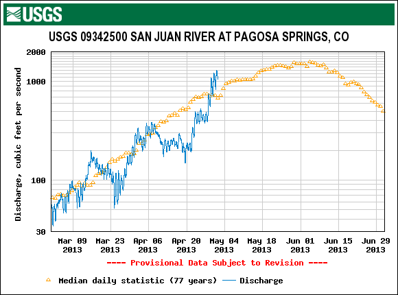
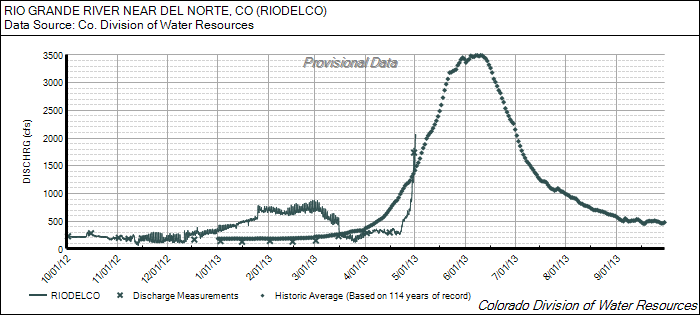
The rapid acceleration of snowmelt rates in the final days of April, as dust layers D8/D7/D6 rapidly emerged and merged at the surface, helped produce significant surging in runoff at the Rio Grande at Del Norte and San Juan at Pagosa Springs gauges. Both sites were reporting much below-average discharge in mid-April before surging at the end of the month to above-average levels. The San Juan River data shows a two-step surge with the initial increase immediately following dust-on-snow event D8 (April 15-17). By the time of our May 1st site visit, San Juan River flows had exceeded the daily median value and were approaching levels near the median peak discharge.
These late April surges in streamflows subsequently paused, during a subsequent change in weather. However, flows may quickly begin to climb again under sunny skies yesterday and today (Thursday and Friday, May 2 and 3. Unsettled weather in the coming several days may result in somewhat less radiative forcing and flows may not achieve the same rate of daily increase seen in late April, thereby prolonging this runoff cycle somewhat. However, given the scant remaining snowcover in these watersheds, this season seems likely to produce yet another case study in early and “flashy” runoff behavior, particularly in the Rio Grande watershed, with a rapid decline in flows after ‘peak’ flows several weeks ahead of the median peak date, and significantly sub-par total runoff volume.
Forecast
As of this writing, Friday, May 3, 2013 the National Weather Service expects clear, sunny skies today, but a period of unsettled weather ahead during the weekend and coming week with often partly sunny skies and daily shower activity including the possibility of rain at Wolf Creek Pass on Saturday and Sunday. This cloudier weather may inhibit a full restoration of the late April discharge rates, even with the dust remaining exposed at the surface. No significant accumulations of snow are anticipated over the weekend but a system on the horizon may result in significant snowfall mid-week, briefly restoring a higher snow albedo (unless accompanied by additional dust).