November 30, 2012: Dry Start to Water Year 2013
Greetings from Silverton -
Like the rest of the state, it's been dry, dry, dry here in the western San Juan Mountains and at Senator Beck Basin. Although we do have shallow snow cover at our two study plots, left over from our first and only winter storm on November 9-11, much of the south-facing terrain in Senator Beck Basin has reverted to bare ground again.

At the Swamp Angel Study Plot (shown above), our Water Year 2013 precipitation total at the end of November will be just 3.4", and we've logged only one 'numbered' winter storm so far this season. In contrast, our WY 2012 precipitation total on Nov 30, 2011 was 7.8" and we had already logged 8 separate numbered winter storms. Our ten-year period of record, including this fall, has a mean of 7.5" of precipitation for Oct/Nov and 5.1 winter storms. On average, we've experienced 21.5 days with some precipitation between October 1 and the end of November; this year we've had just 8 days with precip. Altogether, this start to winter 2012/2013 is the driest in our period of record.
Further, despite the dearth of precipitation and winter storms, this season has already logged nearly 21,000 total miles of wind (Oct-Nov) at our Putney Study Plot. Last season we logged 22,251 total miles of wind from October 1 through November 30, and two dust events. This October 2012 was especially windy, the 2nd windiest in our record, even with only 5 precip days and our lowest-ever total precipitation for the month. Thus far this season, our single winter storm also delivered the only dust-on-snow event to-date. That layer remains well-covered at our Swamp Angel Study Plot but did emerge at the snowpack surface and hasten the melt-off of southern aspects over the past weeks. We also observed this 'drought with wind' behavior last spring, with numerous 'dry' wind (only) storms delivering dust (only).
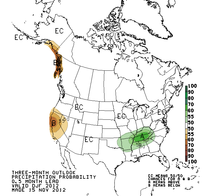
The Climate Prediction Center precipitation outlook for Dec/Jan/Feb for Colorado (below) remains "Equal Chances", but their temperature outlook indicates a 60-70% probability for "above average" temps in the Colorado mountains (see temperature outlook at: http://www.cpc.ncep.noaa.gov/products/predictions/long_range/t01.2c.gif.

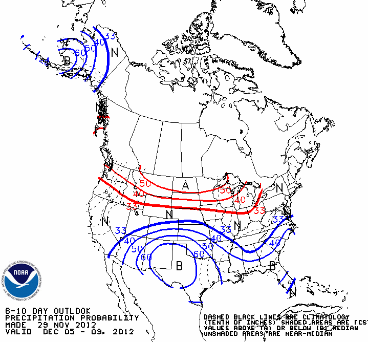
Their short range forecast for early December shows an active storm track to the north of Colorado, perhaps glancing the northern mountains, but not much hope for the remainder of the state. The current "atmospheric river" storms impacting the west coast (formerly known as "pineapple express" storms) seem unlikely to spill across the Great Basin and into Colorado.

Thus far, our "No Niño" winter weather has verified as "persistent drought" for the Colorado mountains. A dry start doesn't necessarily preclude a wet finish to the winter, and we will hope the climatology eventually enables our Senator Beck Basin storm count to resume.
More soon,
Chris
Chris Landry, Executive Director
clandry@snowstudies.org
Center for Snow and Avalanche Studies
PO Box 190, Silverton, CO 81433 USA
(970) 387-5080
www.snowstudies.org

![]()


