Greetings from Silverton -
We have received our second dust deposition of the season here in the western San Juan Mountains, event D2-WY2013, during an overnight dust storm. D2 arrived with very strong S’ly and SSW'ly winds measured at our Putney Study Plot early in Storm #13, entrained in new snow that continues to accumulate. Storm #13 may stretch into early Monday morning but winds have abated and swung to the west as of mid-day today, Saturday (Feb 9th). We collected two very good samples of the D2 dust this morning, at the Swamp Angel Study Plot - a 0.5 m2 sample, for mass loading analysis, and a concentrated sample for the USGS, for chemical and other analyses.
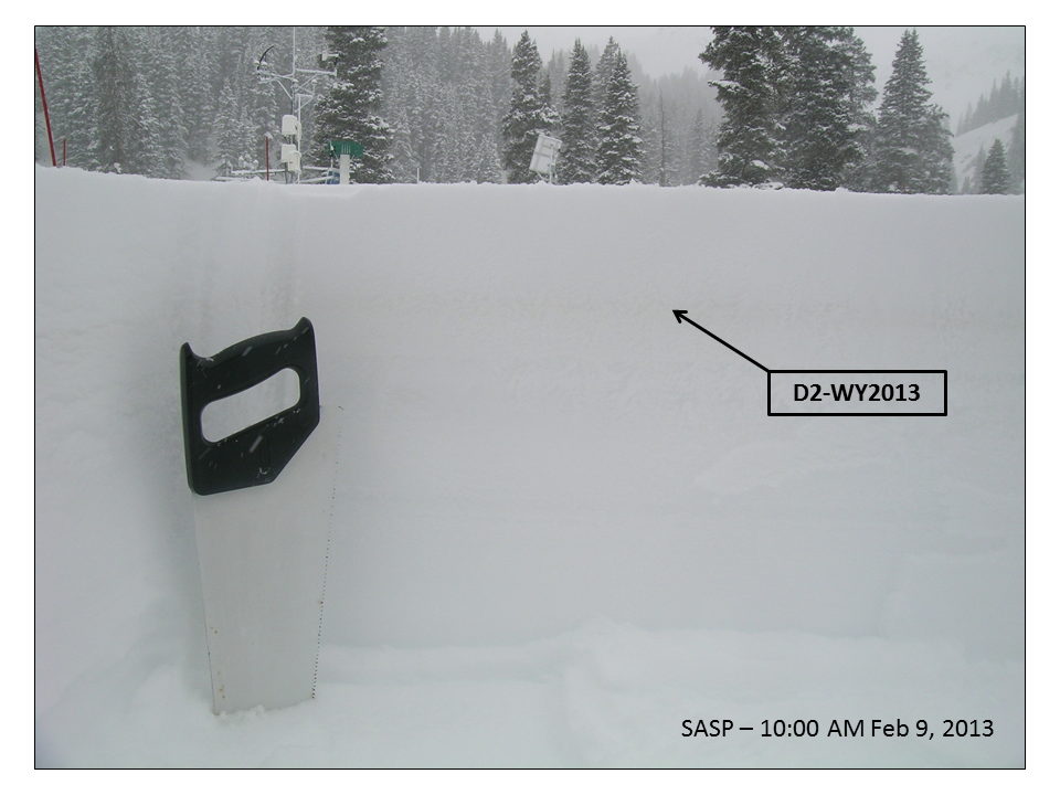
Setting aside fall dust depositions (Oct-Dec), this event is the second earliest mid-winter dust layer in our WY2003-WY2013 period of record (Feb 3, 2003 was the earliest), and the seventh February event in that period. (We’ve never recorded a January dust-on-snow event). The strong wind field delivering this dust from the southern Colorado Plateau to the western San Juan Mountains was well predicted by the National Weather Service but it wasn’t clear, in advance, that those winds would find available dust in the source area, given recent precipitation in the Colorado Plateau. Eventually, the National Weather Service did issue a Wind Advisory for blowing dust along the I-40 corridor and, clearly, some source areas in northwestern New Mexico or northeastern Arizona were sufficiently dry to emit enough dust to reach southwest Colorado. Wind speeds at the Winslow, AZ airport averaged 25-40 mph from the S and SW throughout the day Friday, February 8th, and gusted to 51 mph before rapidly declining during the night. Then, between 5 AM and 6 AM this Saturday morning, February 9th, Winslow reported 0.04” of precipitation, as snow. NWS predicts 1-3” of new snow at Kayenta, AZ today, and some new snow throughout northeastern Arizona and northwestern New Mexico. Winds have resumed blowing 20-25 mph from the SW at Winslow, as of this writing mid-day Saturday, but today’s new snow may preclude further dust emission. We will, of course, monitor for and report any subsequent dust events from this large and prolonged storm system.
As of this writing we have not yet received or obtained any reports of dust from other Colorado locales, but we will be contacting other observers over the coming days and update you at a later date.

