CODOS Dust Alert - D8 event finally over
After sustained dust in the air on Monday and Tuesday, here in Silverton, dust-on-snow event D8 finally fizzled out yesterday (Wednesday) morning, as Storm #21 made a major wind shift from SW to N'ly, around noon. Reports and photos of D8 have come from as far to the northeast as Fort Collins and Boulder, and from numerous mountain locations.
We've estimated that the D8 dust storm lasted 61 hours at Senator Beck Basin, based on our visual observations, wind and precipitation data, and evidence in the snowpack. The final wind rose for this event is very impressive for the duration, intensity, and 'pegged' direction of the delivering winds. We saw averages over 50 mph for several consecutive hours and in coming days we will assess whether this was a 'record' wind storm in our period of record at the Putney Study Plot.

We've also received numerous images from satellites of the D8 event in progress, emitting from multiple source areas, that are quite impressive. First, a MODIS-Aqua image from around noon Tuesday.
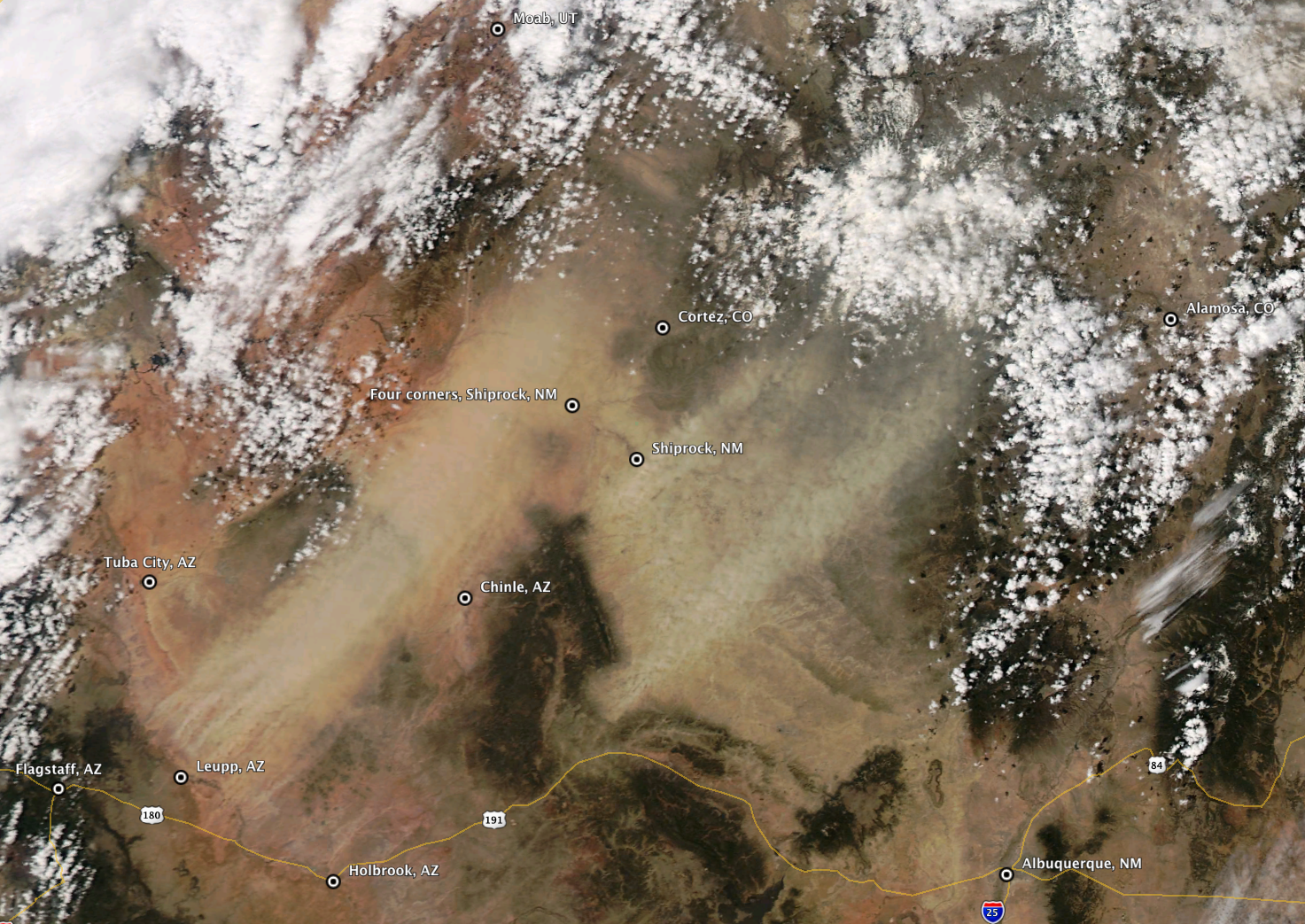
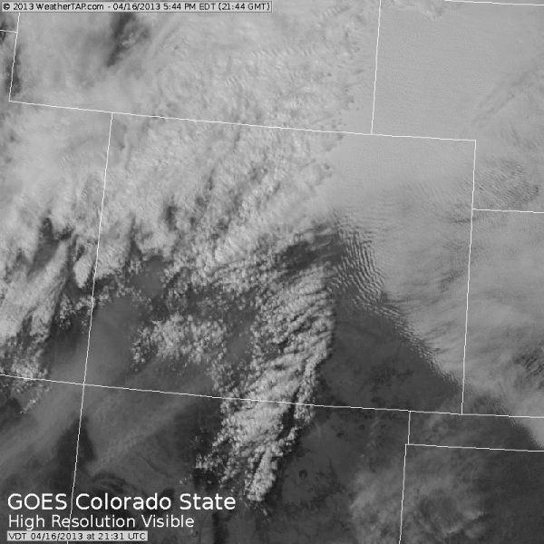
Second, a movie of GOES images from Tuesday evening. The GOES image illustrates how and why we experienced really major intensification of D8 in the evening and as darkness fell on Tuesday, as sources near Shiprock erupted. Farther south of Shiprock, another source area is producing a sustained plume aimed toward the San Luis Valley and the Sangre de Cristo range, which is clearly seen in the last image. Fields of standing wave clouds over the eastern plains are also quite dramatic.
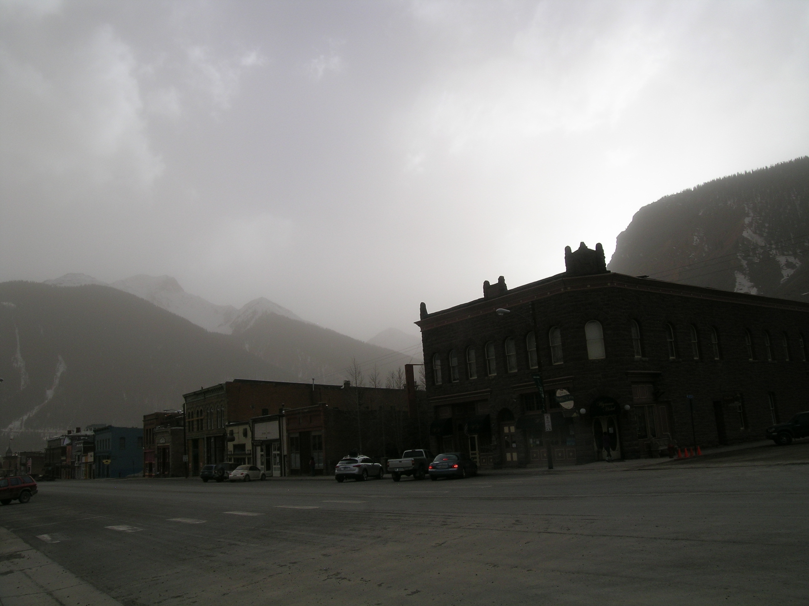
The photo below shows conditions near sunset in Silverton on Tuesday evening,as event D8 intensified. The reduction in visibility is entirely due to dust ... there was no precipitation until late around 1 AM Wednesday morning.
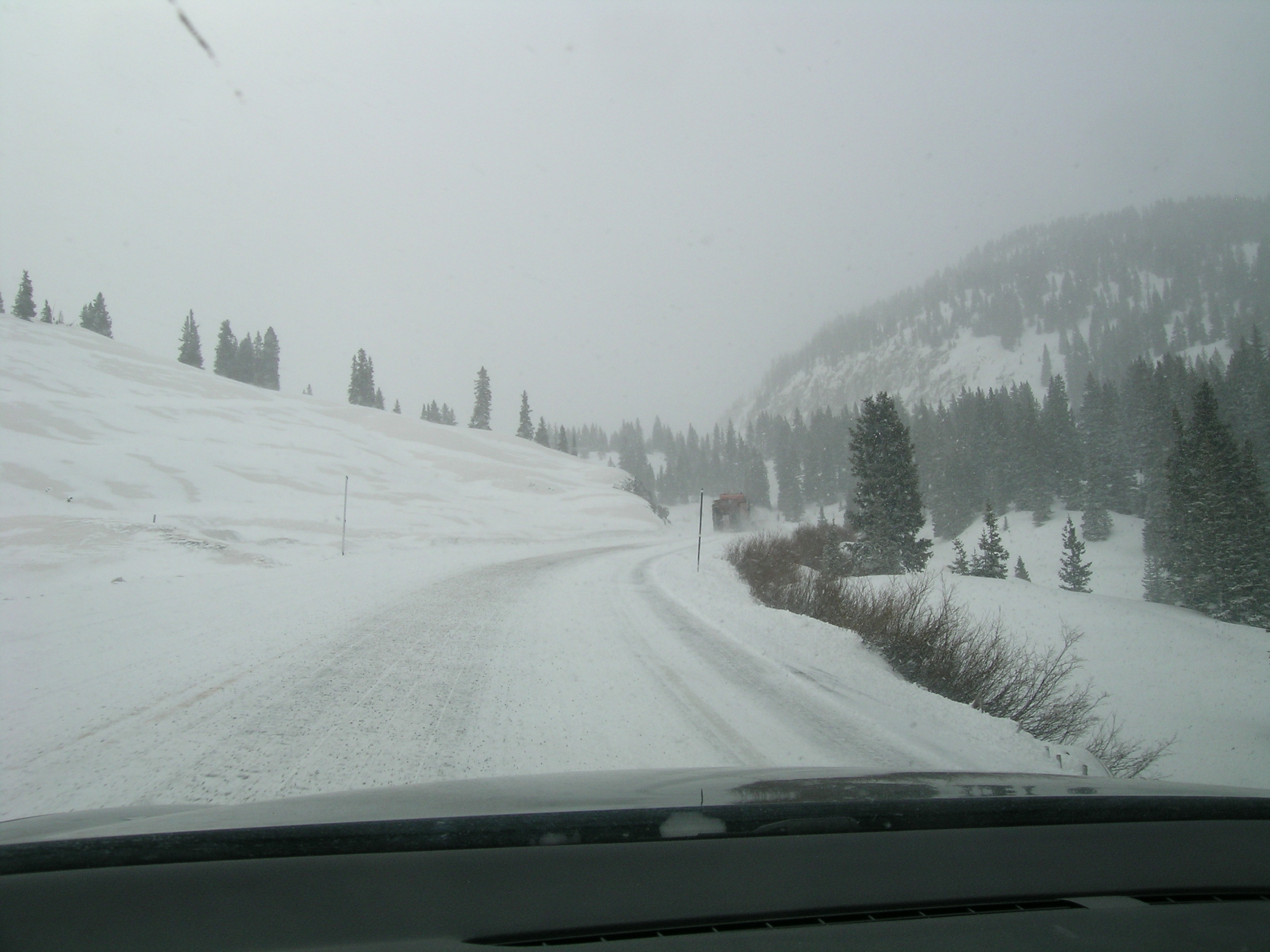
And, our last good photo of event D8's effects before subsequent burial under Storm #21 new snow, as I drove over Red Mountain Pass early Wednesday morning. The patches of D8 dust (perhaps already merged with D7) to the left of the road remained stripped of the early snows in Storm #21 at that hour, but not much longer.
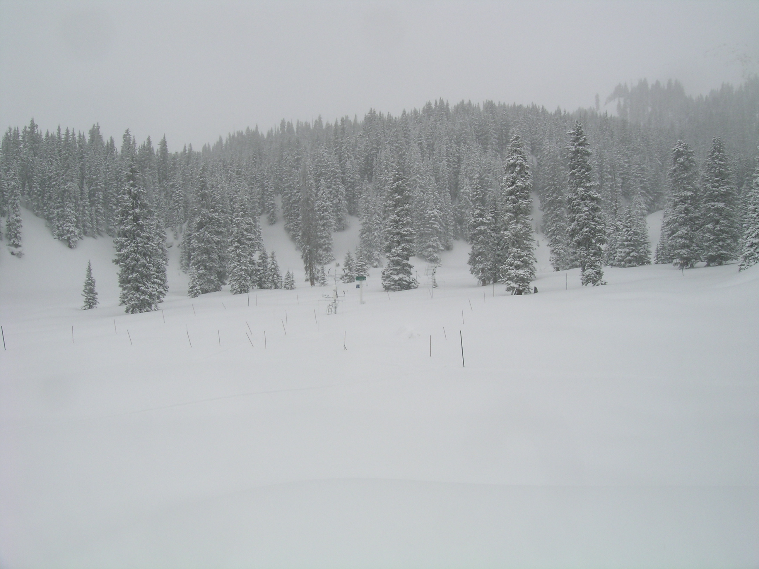
This (Thursday) morning, the scene at Red Mountain Pass and at our Swamp Angel Study Plot is of pristine, white snow (some 6-8" deep), completely belying what lies underneath.
That's the latest from Silverton, where it's cool, calm, and partly sunny today ... we'll hope for a reprieve from these SW winds and dust storms during the generally more N'ly flow expected for Colorado in coming days.
More soon,
Chris
Chris Landry, Executive Director
clandry@snowstudies.org
Center for Snow and Avalanche Studies
PO Box 190, Silverton, CO 81433 USA
(970) 387-5080
www.snowstudies.org

