CODOS Update - D10, North to South Variation in Snowmelt
Greetings from Silverton on Friday, May 24, 2013
Event D10 – WY2013
Yesterday afternoon, May 23, 2013 we logged dust event D10 of WY2013 here in Silverton and at the Senator Beck Basin Study Area, under sustained SSW’ly winds. However, where snowcover remains here in the western San Juan Mountains, D10 was an inconsequential dust-on-dust-on-snow deposition since intense dust layers are already merged and exposed on all but the highest, shadiest, north-facing terrain. Or, D10 fell onto bare ground. If this event extended farther north and east it may have made a slight contribution to the dust emergence already in progress.
North/South Variation in Dust Emergence
As previously reported, the Colorado mountains are experiencing the effects of dust events D8 (April 15-17) and D6 (April 8) on very different timetables. Thanks to late winter and spring snowfalls, snowpacks grew and the snowmelt cycle has been significantly prolonged in northern and Front Range watersheds.
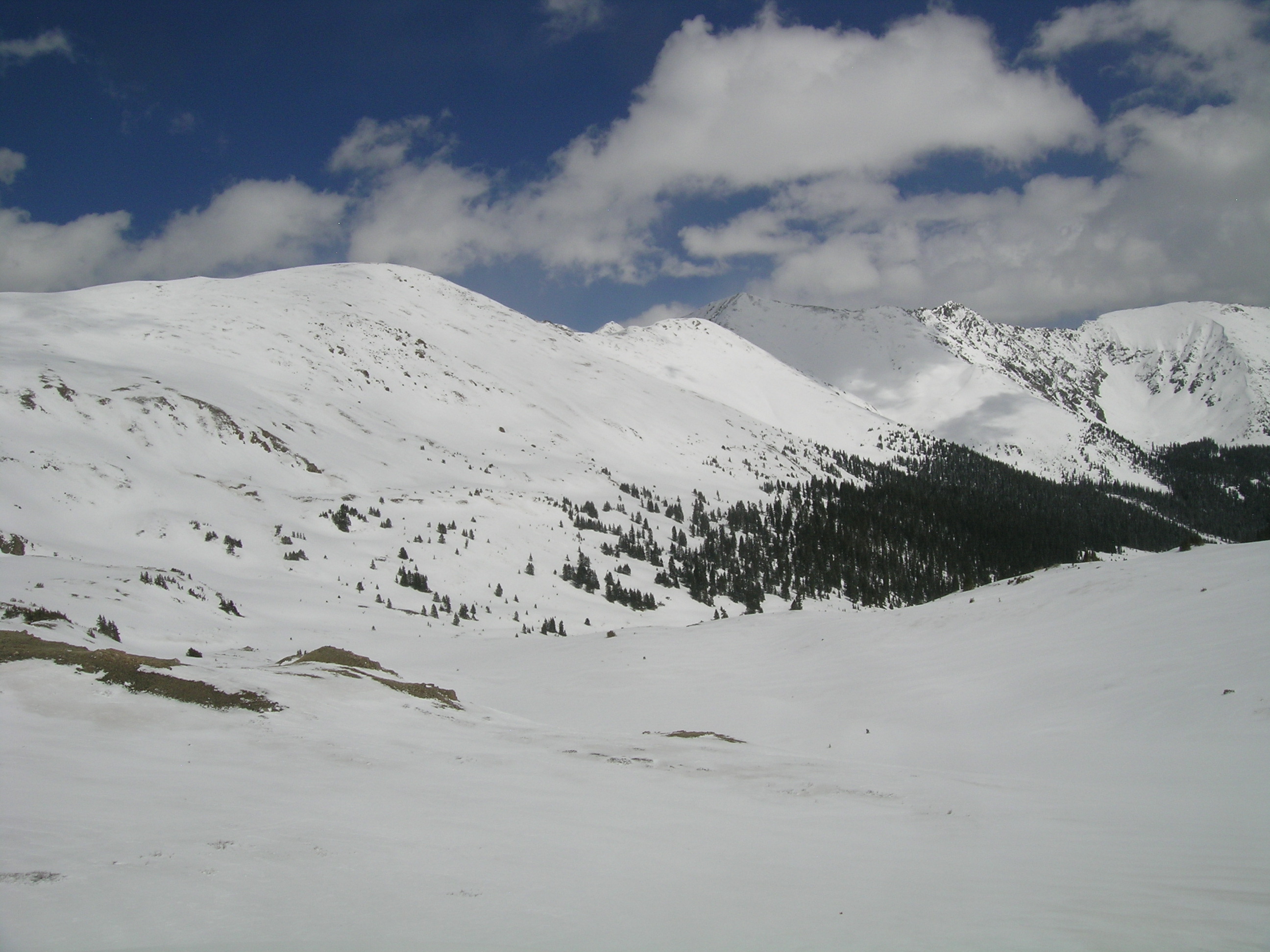
The familiar view looking southeast from the summit of Loveland Pass on May 21, 2013 with
Grizzly Peak in the distance (shaded). Except for a few wind-stripped patches,
some 3-6” of fresh snow overlayed the recently merged D8/D6 dust layer. |
As seen in the photo above, a just-completed visit to Front Range CODOS sites was, once again, immediately preceded with yet more spring snowfall. Nonetheless, although higher terrain was covered in a few inches of fresh, clean snow obscuring the underlying D8 and D6 dust, snowpits at the Hoosier Pass, Grizzly Peak, and Berthoud Summit CODOS sites presented evidence that the D8 and D6 layers had recently been exposed to direct solar radiation and emerged and merged at the snowpack surface. Recent surging in the local hydrographs also indicate that snowmelt had accelerated sharply. At the lower margins of snowcover, the merged D8/D6 layer was rapidly re-emerging during this site circuit. Barring additional snowfalls, that emergence process will quickly consume the overlying clean snow and reveal dust over the remaining terrain. At the Grand Mesa CODOS site, also visited on May 21st, only 1” of fresh snow had fallen. That fresh snow was quickly being melted under sunny skies, with merged D8/D6 dust immediately underneath, absorbing solar energy.
Here in the western San Juan Mountains, where we did not receive as much spring snow in March, April, and May, snowcover ablation and the snowmelt cycle is much further advanced. Here at Senator Beck Basin, and in the Red Mountain Pass locale, we have experienced several periods of extensive dust exposure, with most or all of this season’s dust layers merged or merging at the surface (see below). Swamp Angel Study Plot recorded “snow all gone” (SAG) on May 18, 2013, just seven days later than in spring 2012 (May 11) and the second earliest date of SAG in our period of record.
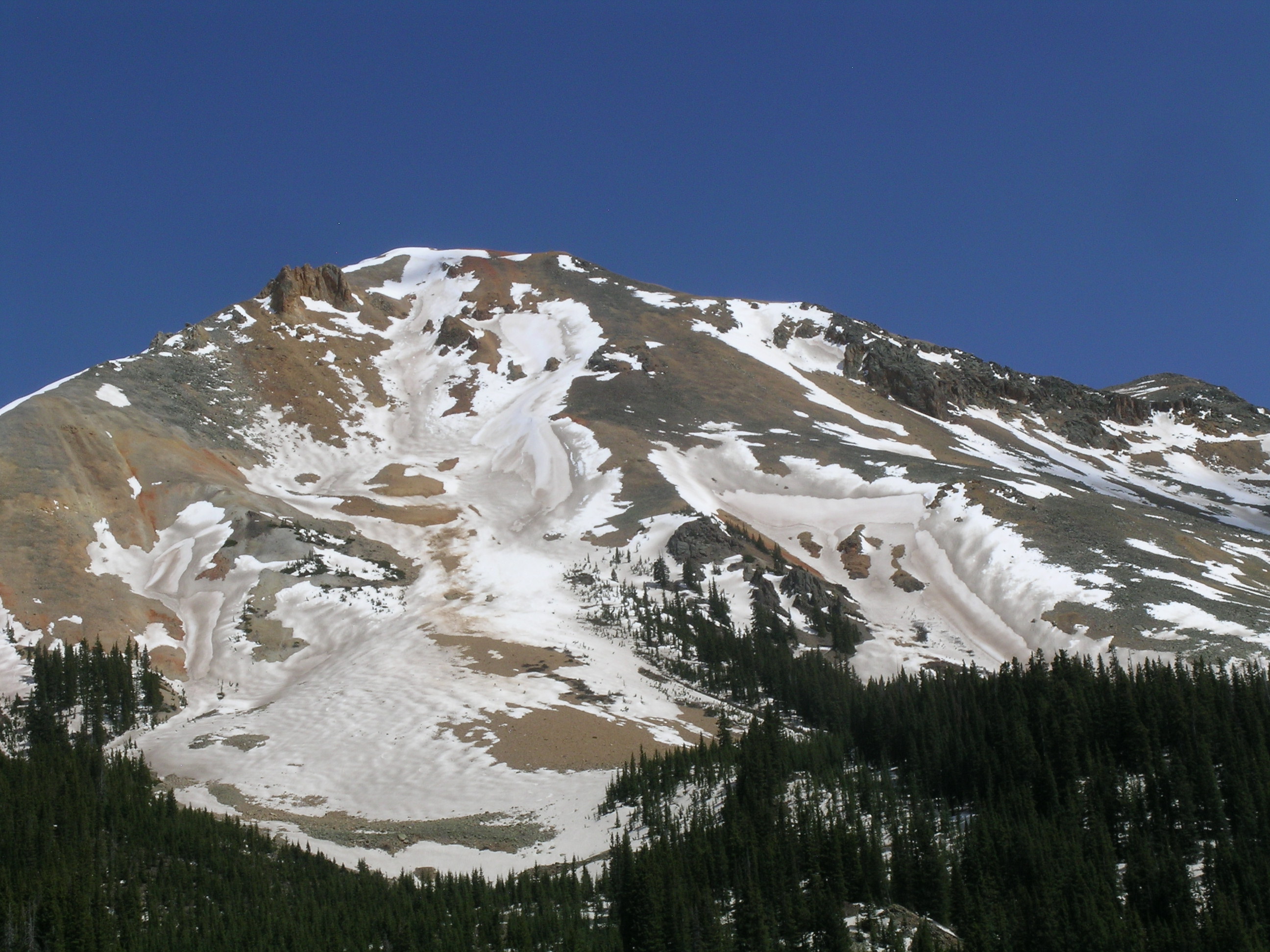
A view of the west face of Red Mountain #3, at Red Mountain Pass, on May 23, 2013 showing extensive loss of snowcover. The dust seen in the snowpack surface is not ‘local’ dust from the adjoining bare ground – this is Colorado Plateau dust. Where snowcover remains, dust layers D8 (reddish) and D6 (blacker) show dramatic variations in emergence and merging stages, largely the result of blowing snow during storms thickening the snowpack in lee locations and delaying the emergence of underlying dust layers. Wind “duning” of dust and snow is seen on the lower-angled alluvial fan at the base of the west face. |
All-Layers-Merged Sampling Completed
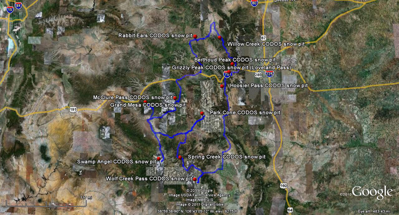
As it happens, D10 coincided with returning from the Front Range where “all layers merged” (ALM) dust samples could finally be collected at the Grizzly Peak, Berthoud Summit, and Hoosier Pass CODOS sites, and also on Grand Mesa. Those samples complete the first such set of samples collected. These concentrated ALM samples contain substantial amounts of material from most or all of the dust layers present at all eleven CODOS monitoring sites (including Swamp Angel Study Plot). Over the coming weeks and months, USGS will evaluate the samples for similarity or differences in mineral composition (chemistry, magnetism, etc.) and for variations in particle sizes. Through this collaboration between CODOS and USGS, we hope to learn more about the spatial patterns of dust deposition in the Colorado mountains. We’ll look forward to sharing those findings as those analyses are completed.
Forecast
As of this writing on Friday, May 24, the National Weather Service expects Colorado to enjoy a sunny, warm, and dry Memorial Day weekend. Slight chances of precipitation on Tuesday and Wednesday will be followed by a return to sunny, dry conditions later next week. Snowmelt runoff has resumed surging, following a short decline earlier this week, either under extensive dust exposure and radiative forcing already in progress, here in the southwest, or increasing radiative forcing as dust layers D8/D6 re-emerge farther to the north and east. During coming days many watersheds are likely to experience the highest discharge levels observed since spring 2011. Given the comparatively advanced state of dust-enhanced snowpack ablation, hydrographs here in the southern mountains could begin recording an early and steep descending limb much sooner than occurs in northern and Front Range watersheds. However, even those northern watersheds could also eventually experience steeper than normal descending limbs due to dust-enhanced snowmelt rates.
Chris Landry, Executive Director
clandry@snowstudies.org
Center for Snow and Avalanche Studies
PO Box 190, Silverton, CO 81433 USA
(970) 387-5080
www.snowstudies.org

