 CODOS Update for Spring Creek pASS:
Visited April 9, 2012
Summary | Snowpack | Melt Rate | Stream Flows | Previous Update
Summary
Sustained periods of unseasonably warm air temperatures and exposed dust at the snowpack surface during late March and early April 2012 have, together, initiated accelerating rates of snowmelt and SWE loss at some, but not all, CODOS Snotel sites. Some CODOS Snotel sites report significant declines in SWE approaching the lowest values in the period of record (for a given date) or even falling outside of the historic range. Those sites may have experienced Peak SWE for WY 2012 in early or mid-March. Recent CODOS snowpits near those CODOS sites mirror those losses of SWE.
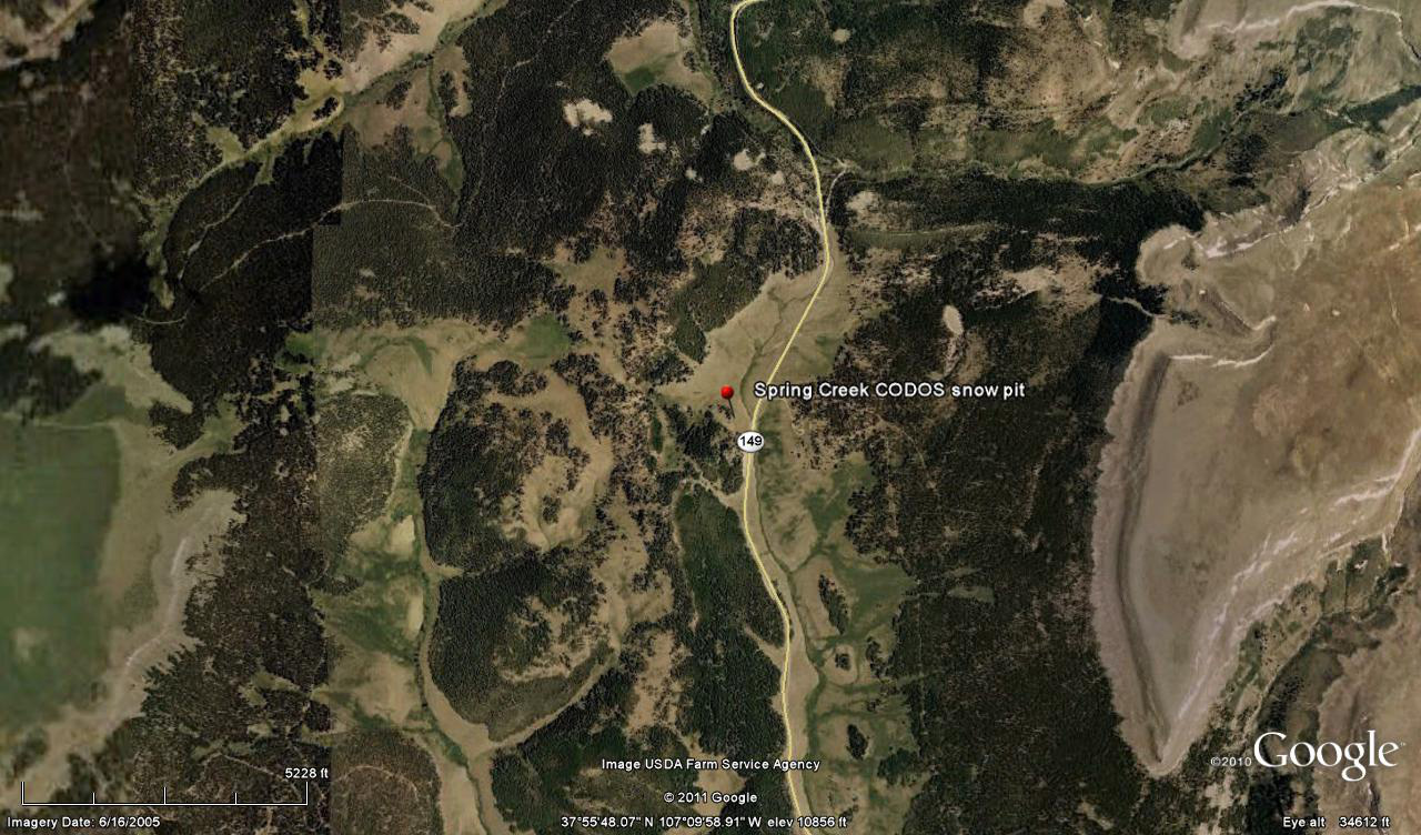
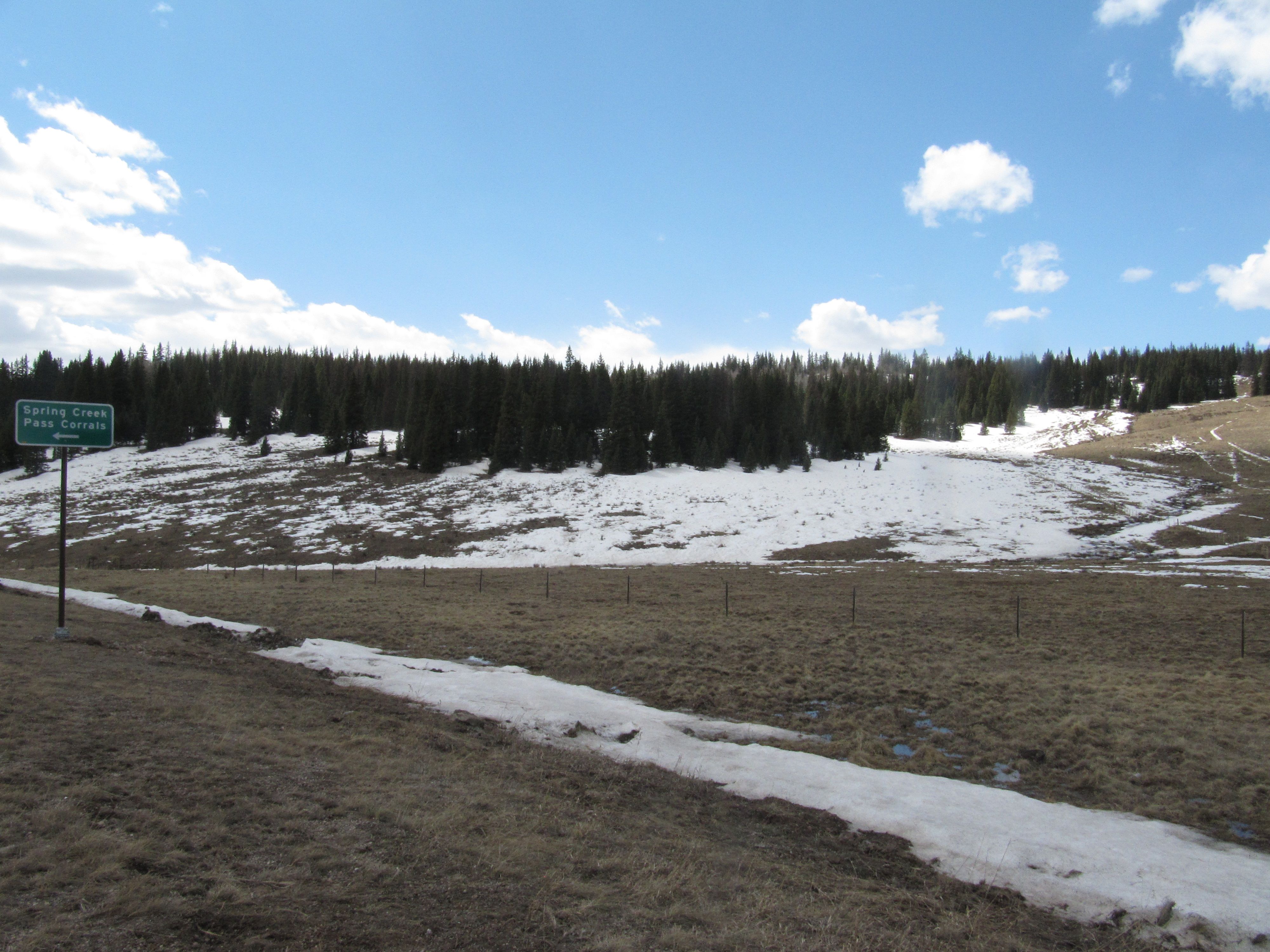
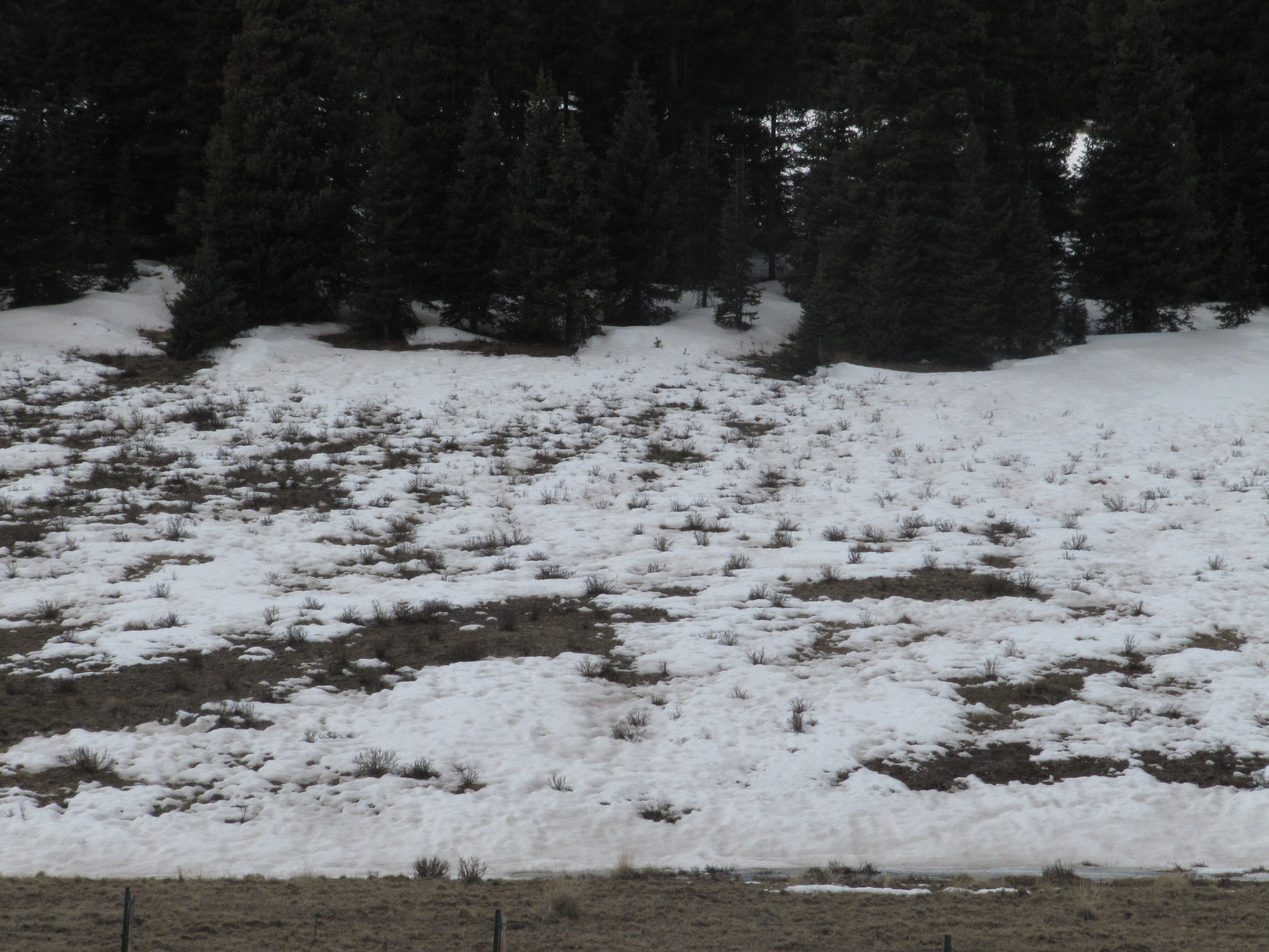
In contrast, other CODOS Snotel sites and CODOS snowpits show only small losses of SWE. At those sites, energy inputs from warm air and direct absorption of solar energy by dust at the snowpack surface was consumed in warming the snowpack towards an isothermal state at 0° C, as a precursor to the loss of SWE and onset of snowmelt runoff. As of our site visit on April 9, and since our prior site visit on March 17, snowcover has disappeared from the Spring Creek Pass CODOS site, while the nearby Slumgullion Pass Snotel was reporting 11.8” of SWE and 38” of snowpack depth.
[This forecast discussion is current as of Thursday, April 12] Strong SW’ly winds and showers developed on Wednesday afternoon ahead of a cooler airmass bringing unsettled and cooler weather for the remainder of this week, with chances for snow showers each day and temperatures below seasonal norms. Chances increase for more significant snow amounts over the weekend and may result in state-wide restoration of higher snow albedo. Showers may continue into the early work week but high pressure is expected to return to the State by mid-week with dry and warmer weather.
SnowPack Discussion
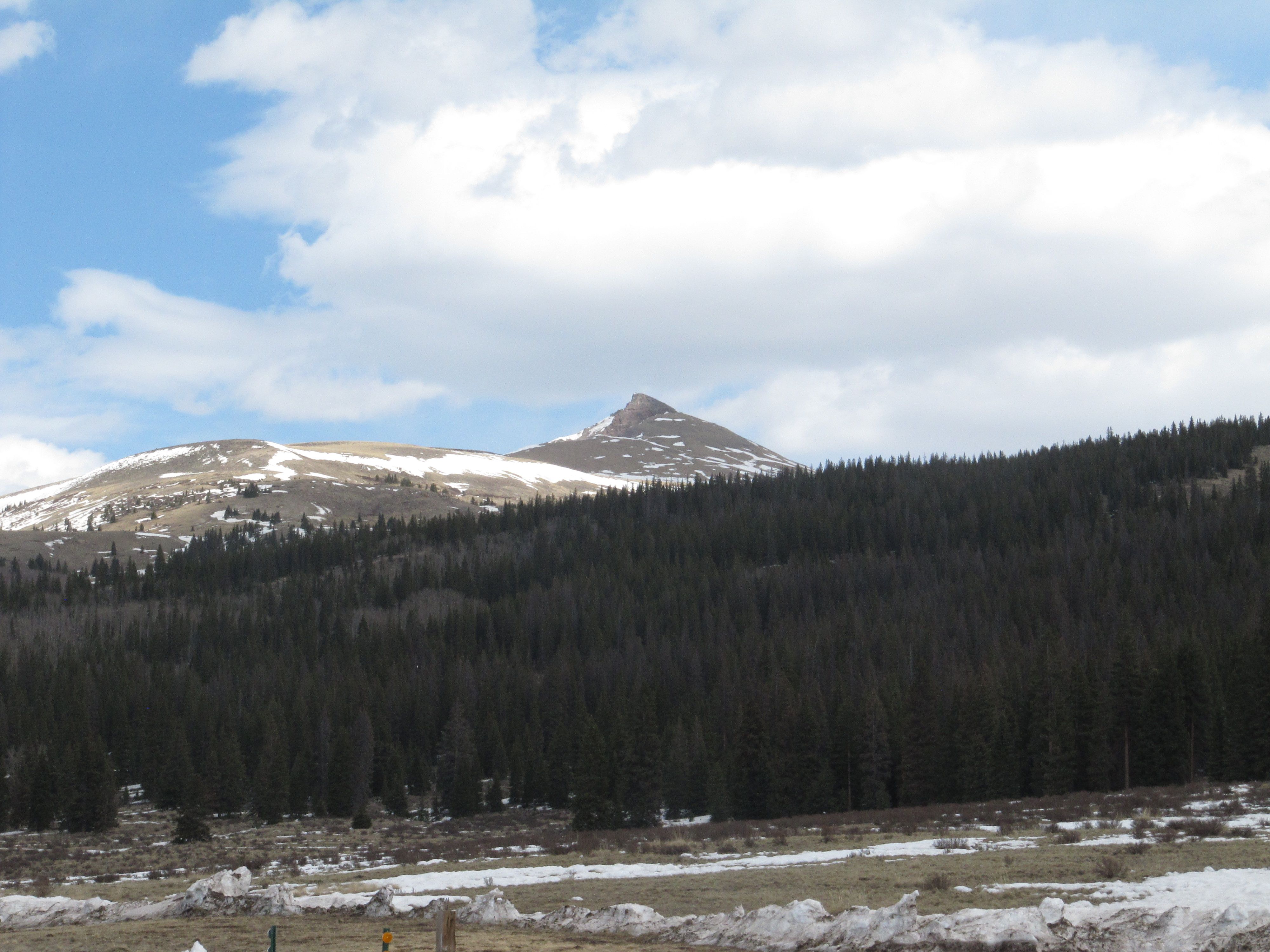
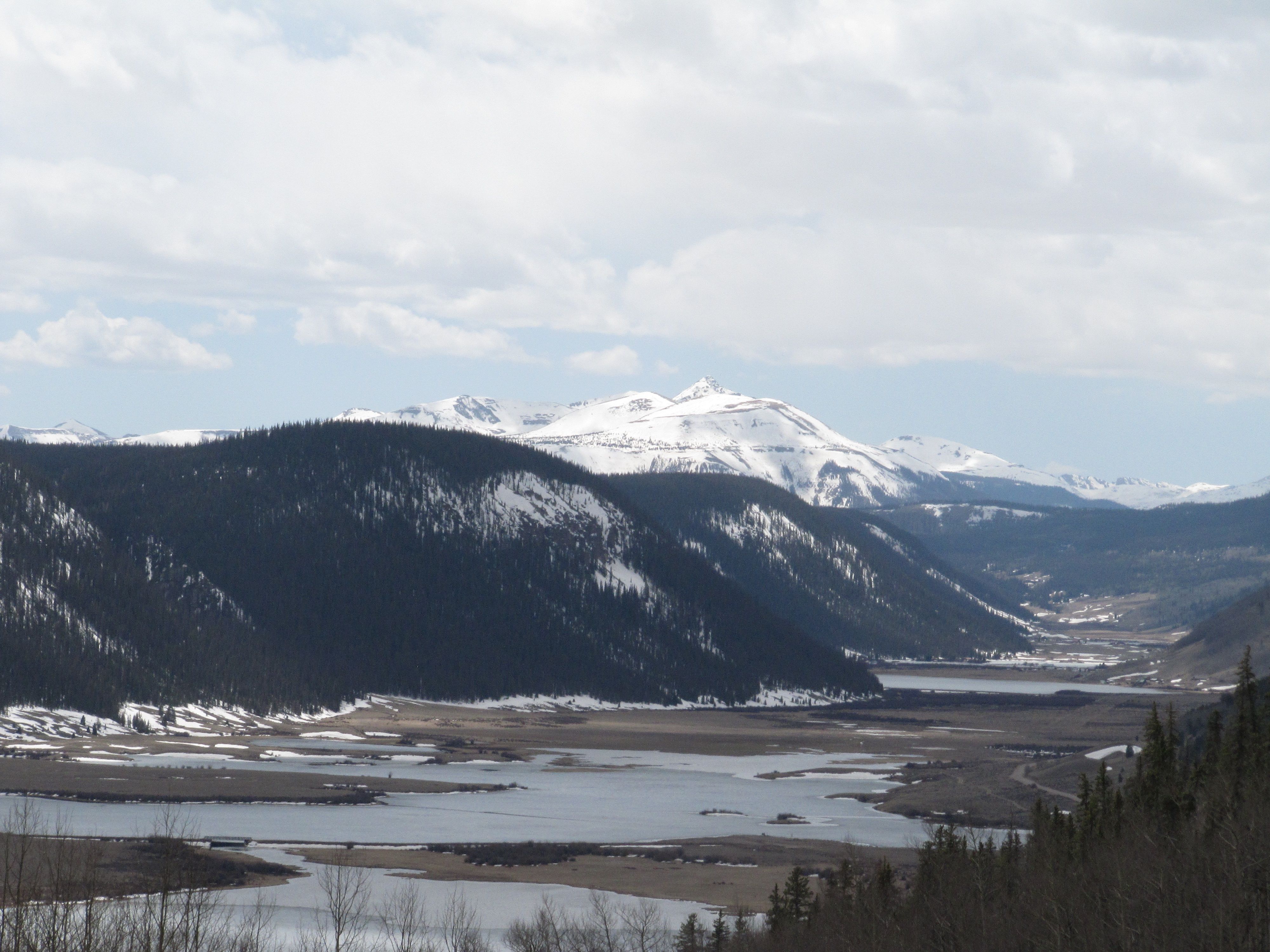
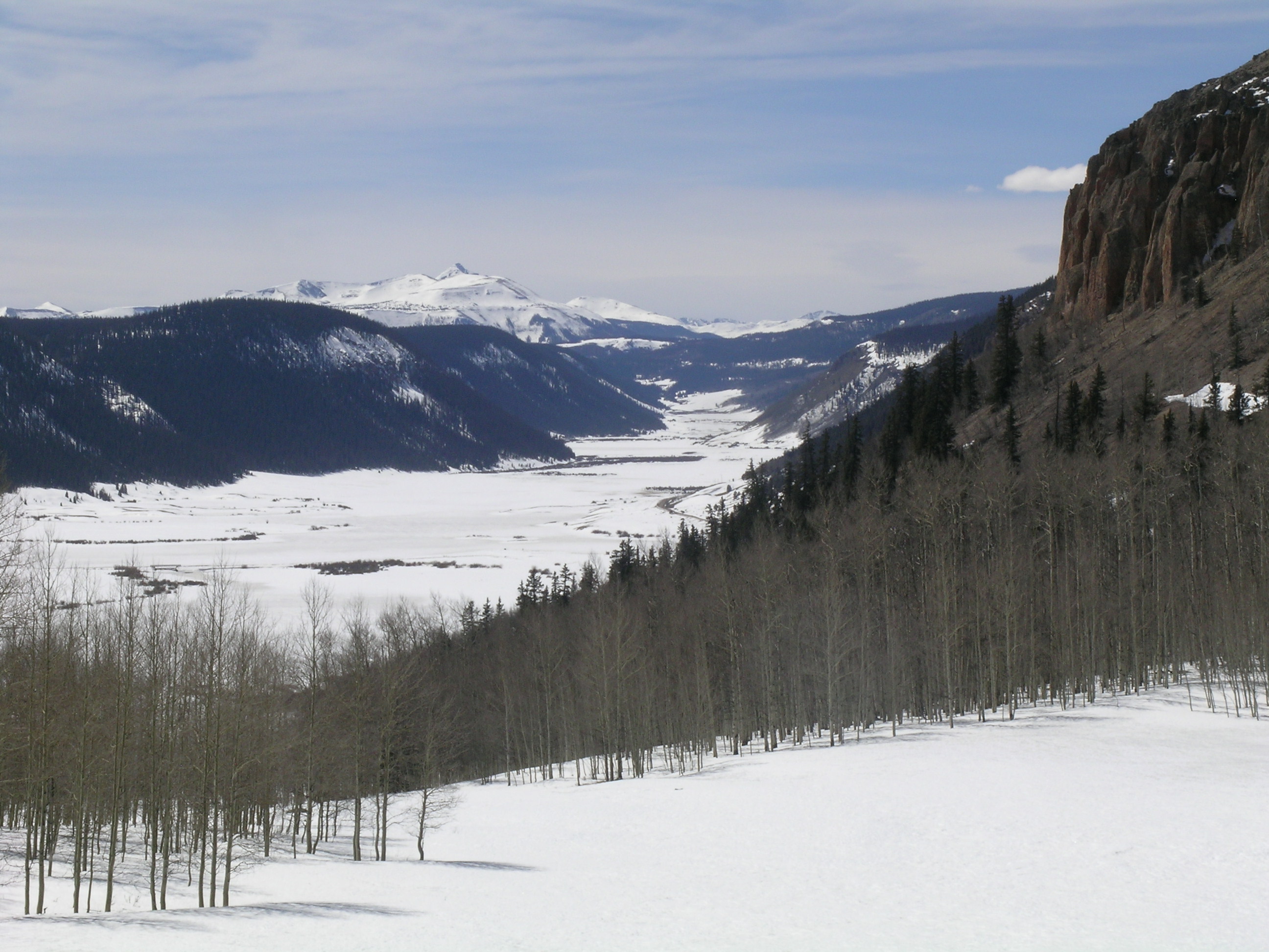
As of April 9th, snowcover has almost disappeared from the CODOS Spring Creek Pass snowpit site, with only small patches of very thin and very dirty snow scattered among large patches of bare ground. Almost no other snowcover remains along the valley corridor leading to Spring Creek Pass from Creede. Snowcover in the higher alpine terrain of the upper Rio Grande valley appeared, from a long distance, to present reduced albedo comparable to that seen in the western San Juan Mountains the day prior. Meanwhile, as of April 9th, the Slumgullion Pass Snotel reported nearly 12” of SWE. Based on confirmation of dust events D5, D6, D7, and D8 in the San Luis Valley, and in our Wolf Creek Pass profile on April 9, we are confident that the Spring Creek CODOS site also received these additions to the D4 dust that we observed at the snowpack surface on March 17. Clearly, the snowpack at our CODOS site became isothermal in the interim since our March 17 visit and then rapidly melted.
| April 9, 2012: | |||||
 |
 |
 |
 |
||
No Pit (Snow All Gone) |
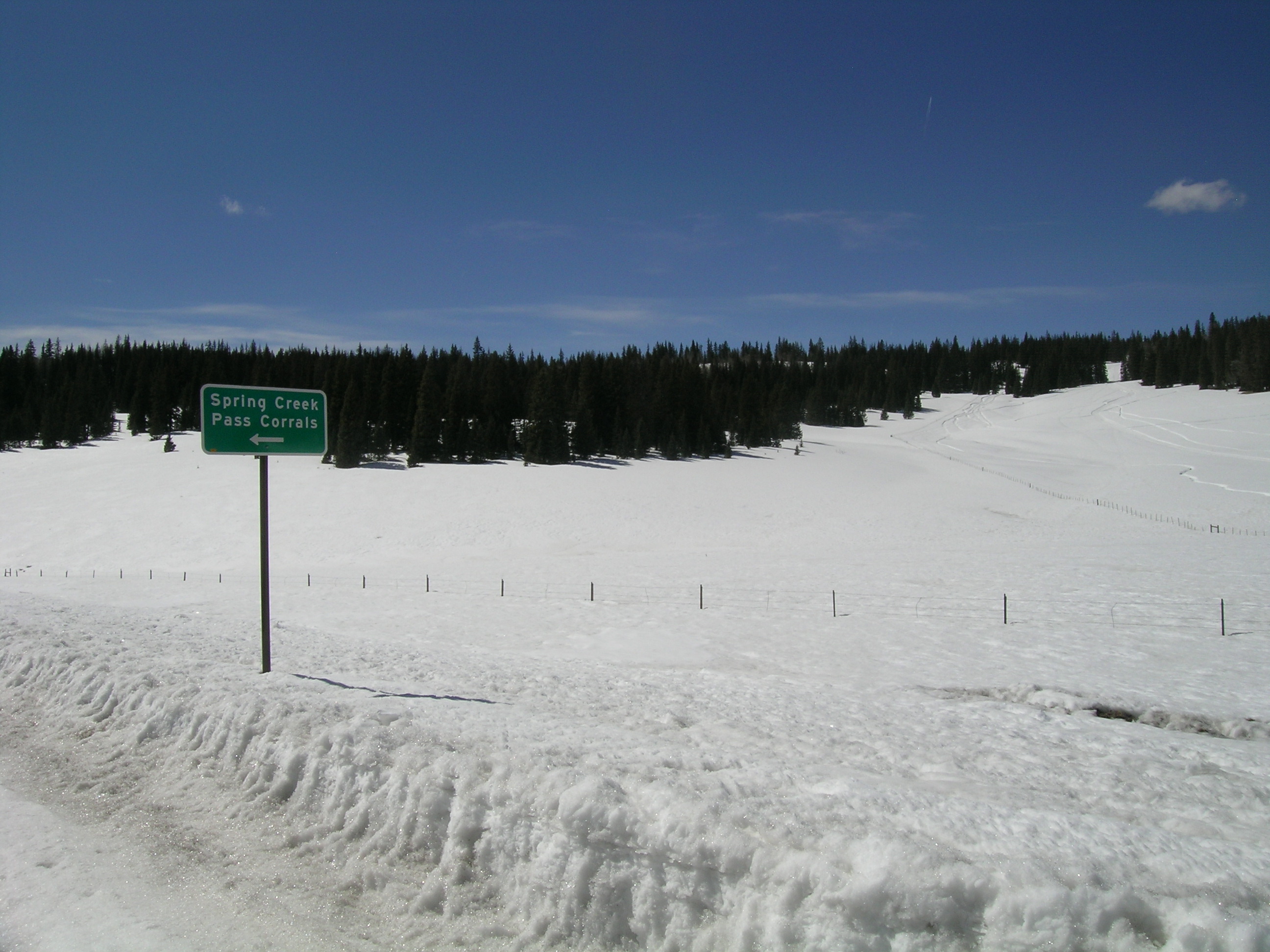
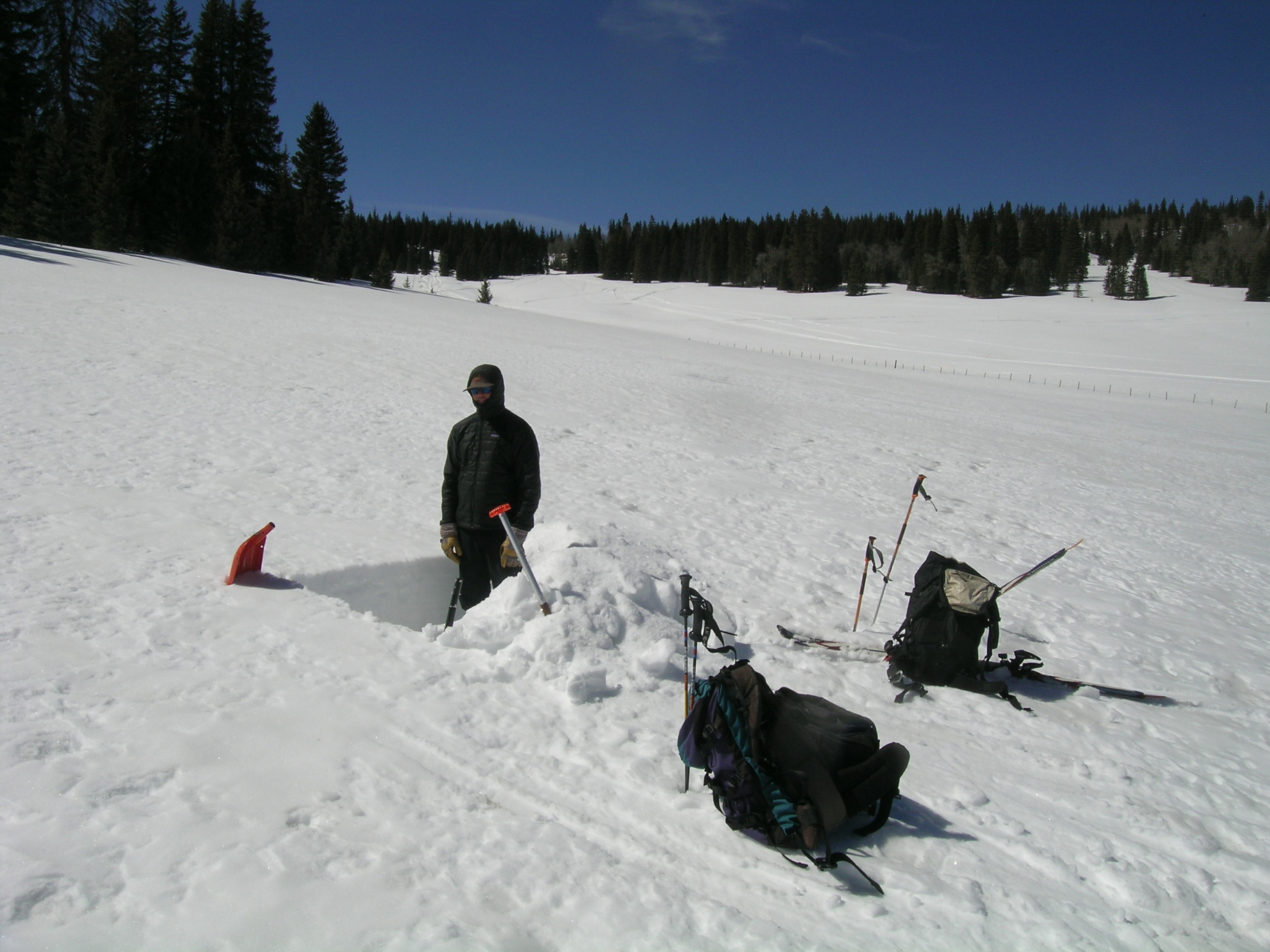
view of pit site | Spring Creek pit site | Baldy Cinco | Rio Grande headwaters | |
| March 17, 2012: | |||||
 |
 |
 |
 |
 |
|
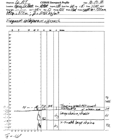
| Pit profile | view of pit site | March 17th pit | Rio Grande headwaters | ||
Melt Rate
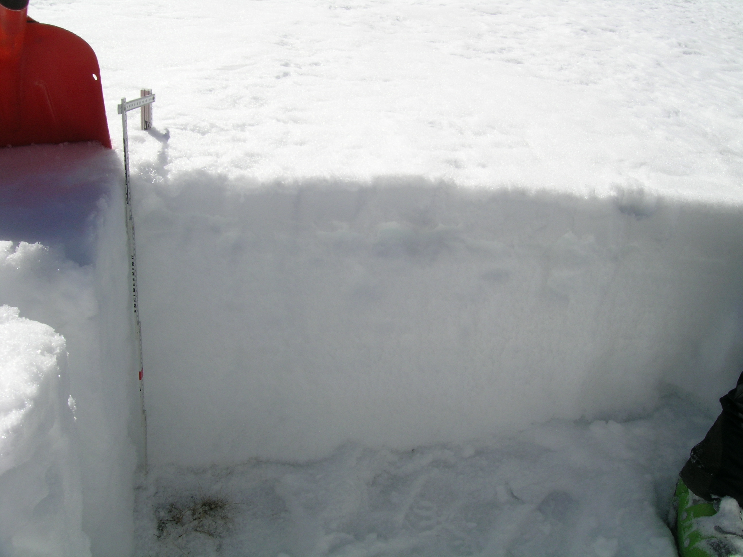
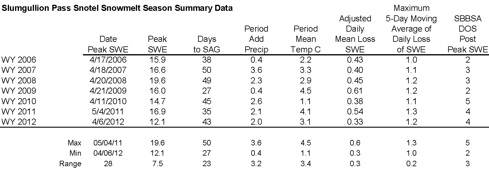
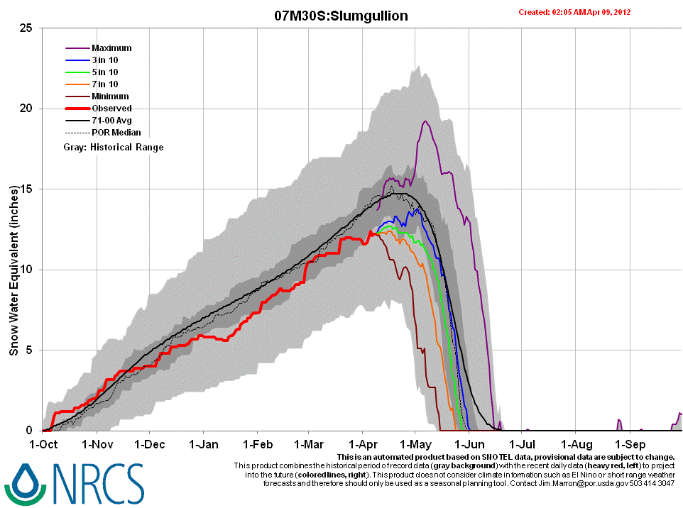
[This discussion is current as of Thursday, April 12, 2012] On March 17 we measured 27.5” of snow containing 6.8” of SWE at our Spring Creek Pass snowpit site; mean snowpack temperature on that date was -1.6° C. Just a few days later, Peak SWE of 12.0” occurred on/about March 22nd at the Slumgullion Snotel (elev. 11,440’), the closest Snotel to our Spring Creek Pass CODOS site, almost a month earlier than normal. That Peak SWE value was produced by the storm that delivered dust event D5, the last significant snowfall in this locale. Since Peak SWE, melt rates have been slow at this Snotel, as seen below. (Small increases in SWE up to 12.4” in late March were reported on days with no precipitation and may reflect rapid settlement of wet snow.) However, as at other CODOS sites, melt rates in the open meadow where our Spring Creek Pass CODOS snowpits are dug were higher and the snowpit plot has just reached snow all gone (SAG), losing almost 7” of SWE after becoming isothermal during the warm and sunny weather of late March.
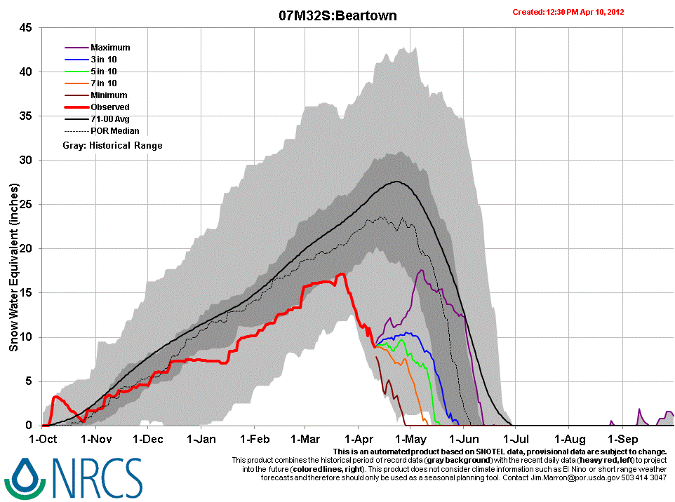
Meanwhile, during this period, the Beartown Snotel station (see snowmelt analysis table and Snotel graph), at 11,600’, has reported considerable loss of SWE since March 21st, losing almost 10” of SWE since peaking almost a month early at 17.1” after the storm delivering dust event D5.
Farther south, the somewhat lower elevation Wolf Creek Summit Snotel (11,000’) (see snowmelt analysis table and Snotel graph) has characteristically recorded a slower snowmelt rate, losing only 3” SWE since peaking on March 23rd at 24.8”. Dust loading at our Wolf Creek CODOS site is comparable to our Senator Beck Basin site, and our Wolf Creek CODOS snowpit on April 9 found 12.6” of SWE, a loss of 9.3” of SWE since our March 17 snowpit at that site.
Stream Flows
[This discussion is current as of Thursday, April 12, 2012] Streamflow at the Rio Grande at Del Norte gauge have been sustained at levels well above daily median discharge rates since mid-March, surging during the prolonged period of dry, very warm, and sunny weather of late March, with multiple dust layers merged at the snowpack surface. Since our site visit on April 9, a significant surge produced discharge reaching 2,000 cfs at that gauge on the night of April 11/12, almost 4x the median flow for that date, at the same time that dust event D8 has fully emerged in the western San Juan Mountains (Senator Beck Basin is only 18 miles NW of the Beartown Snotel) and with very high temperatures earlier this week.
