 CODOS Update for Willow Creek Pass:
April 27, 2012
Summary |
Snowpack |
Melt Rate |
Stream Flows |
Forecast |
Previous Update
Summary
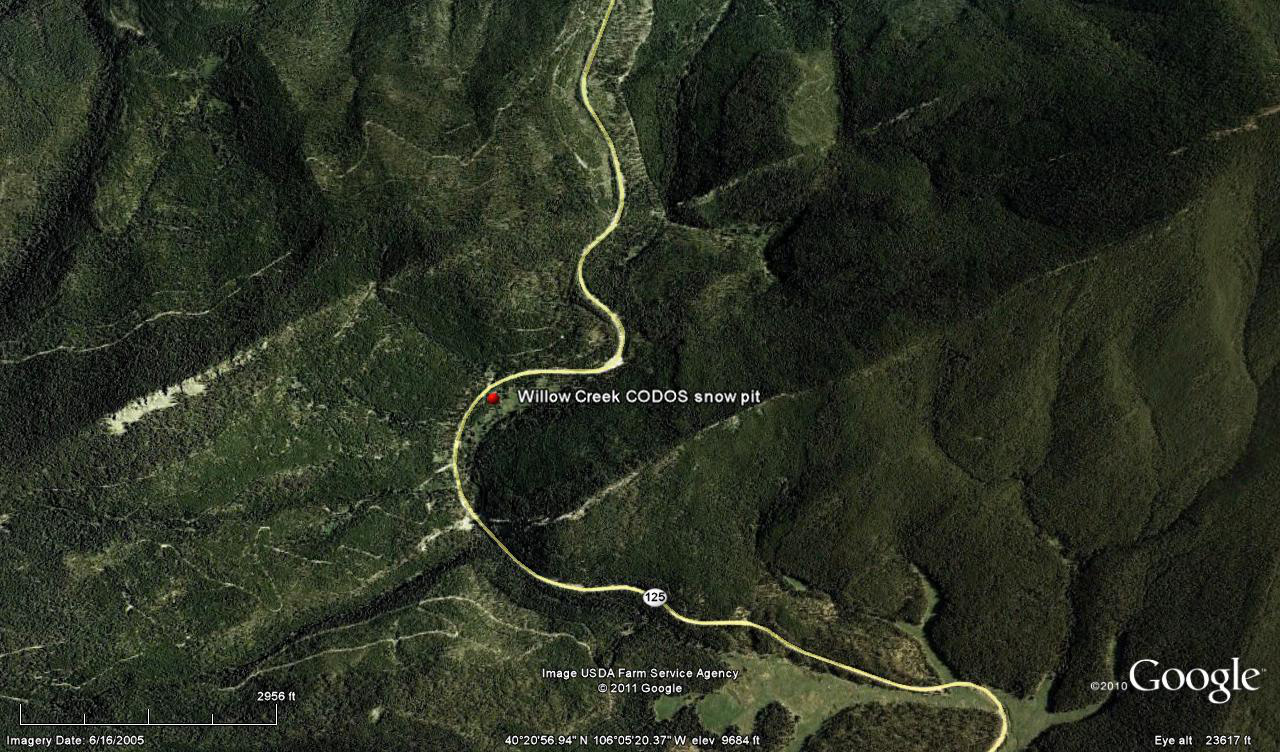
The Willow Creek CODOS snowpit site, in an open meadow adjacent to the Willow Creek Pass Snotel site, had reached “snow all gone” (SAG) by April 10th, our last site visit. After periods of modest snowmelt rates, followed by small additions of new snow and SWE in mid-April, snowmelt at the Willow Creek Pass Snotel has begun to accelerate again.
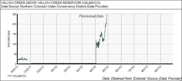
Snowmelt runoff in this watershed is now dependent on snowcover remaining in the highest sub-alpine and alpine terrain. As observed during our early April CODOS circuit, desert dust is present in the snowpack in this locale, at concentrations similar to those observed at Berthoud Pass and Grizzly Peak. Recent data showing surging in streamflows at the Willow Creek above Willow Creek Reservoir gauge included the influence of re-emergent dust as clean new snow deposited in mid-month was ablated by very warm and generally sunny weather. Recent unsettled, showery, and cooler weather, perhaps with some fresh snow, has not yet slowed that surge in runoff. A return to sunny and dry weather will sustain or produce a more-or-less quick return to accelerating streamflows, depending on the depth of burial by clean new snow of the dust layer.
SnowPack Discussion
All snowcover is gone from the Willow Creek Pass CODOS snowpit site. Our previous Willow Creek Pass Update presents this season’s single snow profile and snow cover photos.
Melt Rate
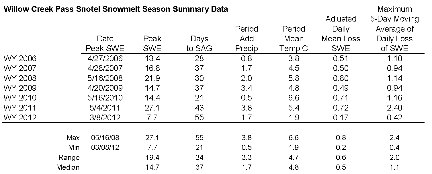
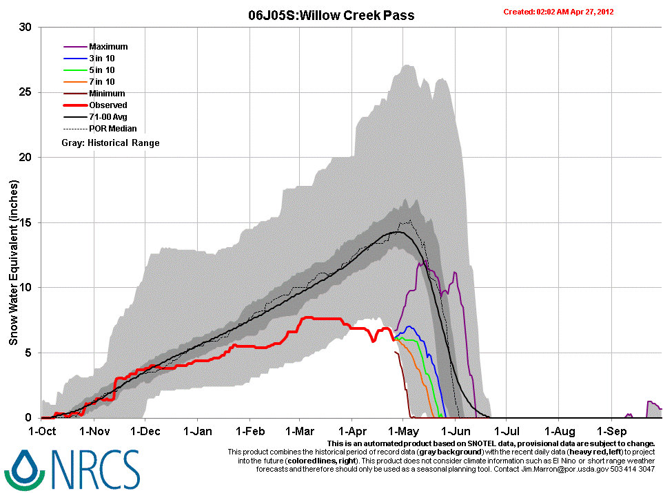
Following Peak SWE of 7.7” from March 4-8th, static or very gradual loss of SWE, and even some small gains in SWE, prevailed at the Willow Creek Pass Snotel until very recently. SWE losses have just begun to slowly increase, enhanced by the re-emergence of dust and some 6” of SWE remain at this forested Snotel site.
STREAM FLOWS
Following a modest surge in discharge ending soon after our April 11th site visit, declining local streamflows in mid-April at the Willow Creek above Willow Creek Reservoir gauge corresponded with a period of unsettled, cooler weather and small snowfalls, and a restoration of higher snow albedo. Beginning on/about April 20, under a very strong high pressure regime bringing very warm and generally sunny weather, recent (clean) new snow was ablated, re-exposing the dust, and melt rates accelerated in response to all of those factors. We understand that effects on snowmelt runoff caused by interactions between dust-on-snow and forest die-off are under investigation.
As of this writing Friday, April 27th, that recent upward ratcheting in discharge shows little effect from the return to unsettled, cloudy, and cooler weather in the past 24 hours. The next episode of sustained sunny and dry weather will, depending on the depth of any clean new snow recently deposited on the remaining snow covered terrain, more-or-less quickly re-expose the old, low-albedo snow surface, sustaining or resuming enhanced snowmelt runoff rates.
Forecast
The National Weather Service Grand Junction office expects cooler and drier air to replace scattered snow and rain showers by later today. Another comparatively dry system passes through Colorado on Sunday as near-normal temperatures return. Then, partly or mostly sunny weather brings a return to above-average temperatures under zonal, westerly flow early in the week, but with some continued chances for scattered showers. A system from the Pacific Northwest may deliver additional precipitation to northern Colorado from mid-day Tuesday into Wednesday.