
Dust-induced Snow Surface Roughness
CSAS has observed dust-induced snow surface roughness for several seasons. We are interested in exploring whether this surface roughness is affecting snowmelt runoff yields by increasing the opportunity for sublimation and/or evaporative losses of snowcover water content. This season (Spring 2013) we've begun to more intensively document dust-induced snow surface roughness in still photographs and video.
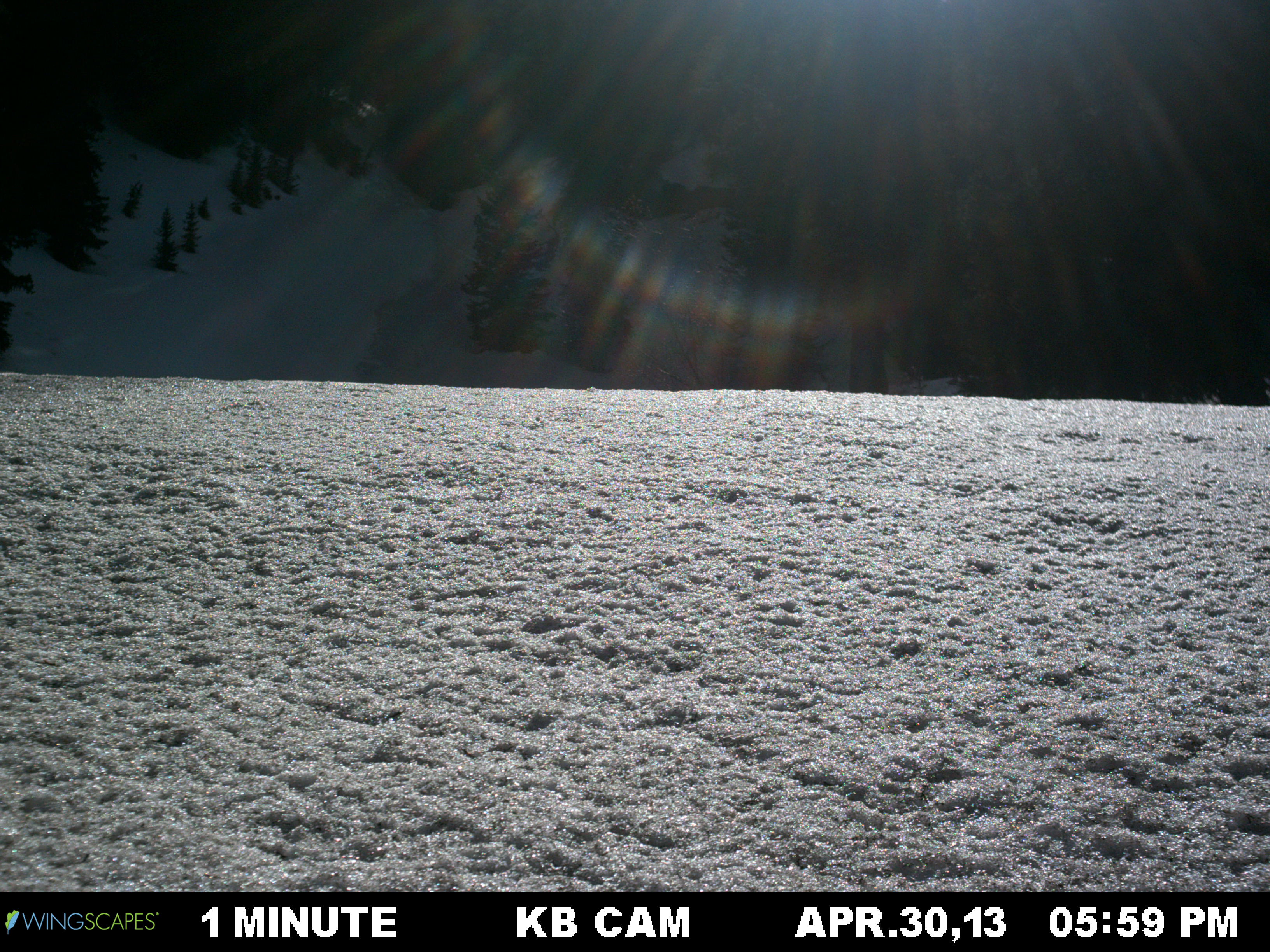


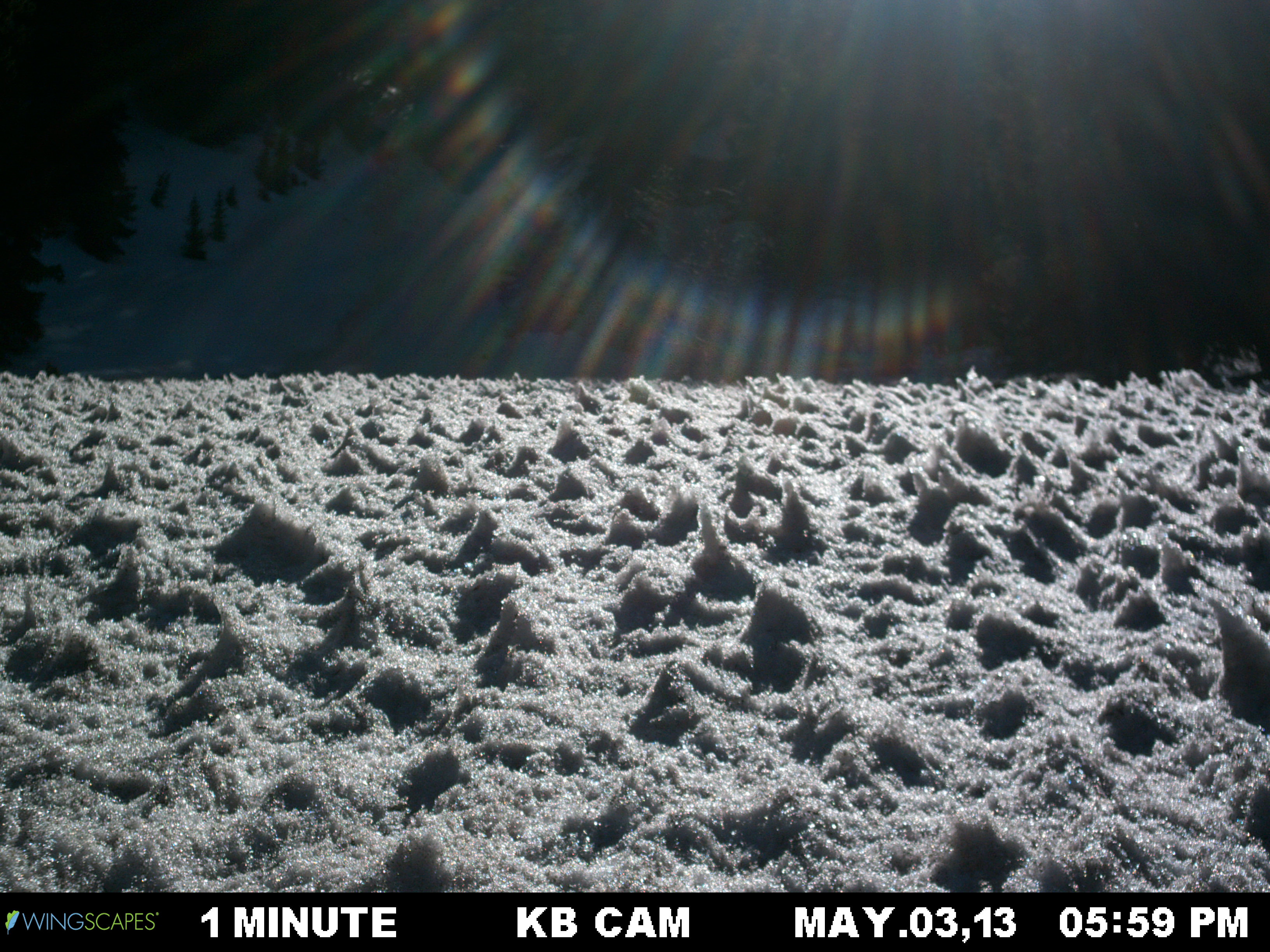
April 30-May 18, 2013: Two time lapse videos (close-up and long view) at the same location showing the formation and collapse of dust-induced snow penitentes, followed by new snow accumulation, and later, full melt to the ground.
April 30 - May 4, 2013: Two time lapse videos of a rapidly changing snow surface, showing the formation and collapse of dust-induced snow penitentes
- Where: On the southern edge of Swamp Angel Study Plot in Senator Beck Basin Study Area near Red Mountain Pass, Colorado, USA (Google Map).
- How: The upper timelapse video was photographed with a Wingscapes Timelapse 8.0 camera at a rate of one photo per minute. The camera faces due west. The lower video is from a different camera (Brinno TLC200) mounted on the same stake with the same photo rate. It is pointed looking downward within a foot of the snow surface. A ruler at the beginning of the video and pine needles in the snow (less than 2mm thick) provide scale.
- When: Both videos begin April 30, 1600 hrs. Both cameras experienced outages resulting in different end times for the two videos.

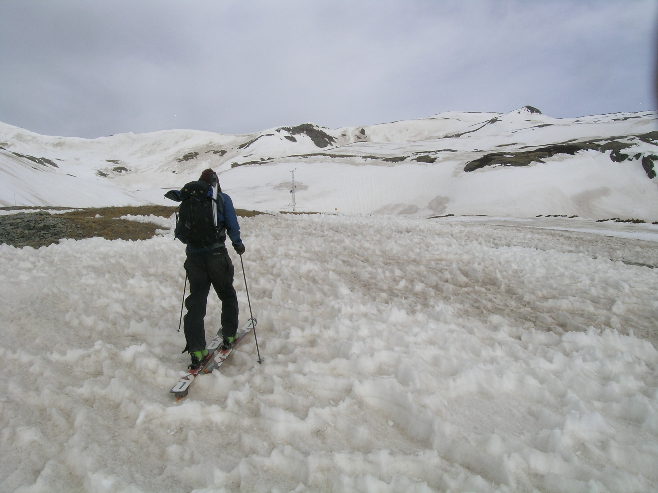
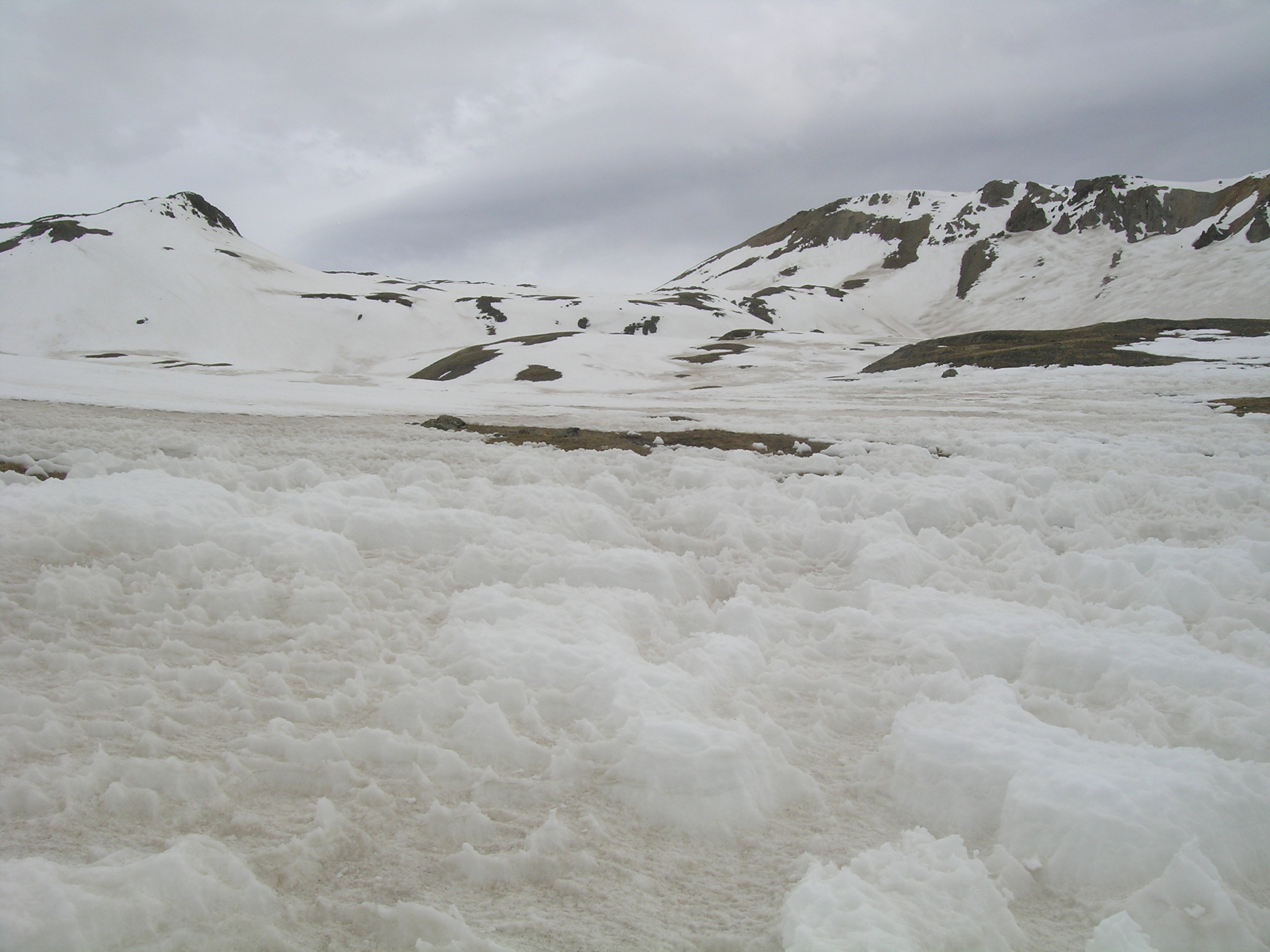
May 5, 2013: Surface roughness at Senator Beck Basin Study Plot
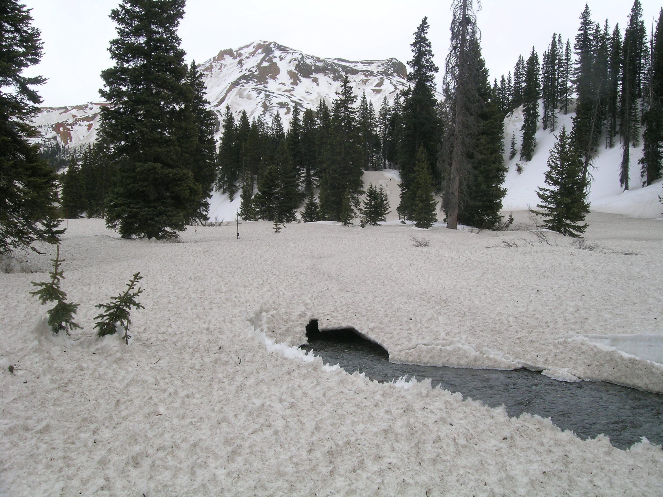
On May 5, 2013 surface roughness near the Senator Beck Study Plot was ‘extreme’, making uphill travel difficult and skiing down quite treacherous. In the photo of Andrew Temple, approaching the SBSP mast, ‘fins’ (or perhaps more properly described, at this stage of development, as small penitentes) reached boot-top heights. Dust layer D6 is visible as the ‘floor’ of these fins. In the second photo, taken adjacent to the tower, a cluster of steep-sided, mini mesas of comparatively clean snow remained above the D6 ‘floor’ showing differential erosion of that (relatively) cleaner snow layer. The final photo may show the end stage of the process, with stranded columns of comparatively clean snow on bare ground, after the exposed D6 had fully ablated the ‘floor’ to the ground. We found these conditions throughout the alpine portion of Senator Beck Basin, all the way to the summit at Peak 13,510’ seen in the distance (see our panoramic photos taken from that summit).

 April 26, 2013 - Snow Surface Photo Transect: Smooth and Clean to Rough and Dirty
On Friday, April 26, the CSAS crew captured a series of 50 closeup photos of snow surface roughness along a 9 meter transect at Red Mountain Pass. Kim Buck is seen photographing the far end of the transect, where recent clean snow remained comparatively smooth. At the near end, in this photo, dust layers D6, D7 and D8 have fully merged and accelerated snowmelt while also increasing surface roughness. We are interested in whether dust-induced surface roughness could result snowpack SWE losses, due to evaporation and/or sublimation. CSAS and CODOS will present the complete photo transect produced during this session, and other imagery of surface roughness effects, in coming months.
![]()
April 25-26, 2013 - This series of photos captures the development of extensive ‘fin’ structure during the final hours of snowcover in a small meadow on Red Mountain Pass, on April 25 and 26, 2013. As seen in previous seasons, these fins seemed to be oriented toward the sun’s position at the time of day when solar radiation was strongest at this site. This snowcover was largely gone within 24 hours. Where some snow remained the next day, much of the fin structure seen the day before had ‘wilted’ and smoothed.
April 25, 2013:


April 26, 2013:


May 28, 2012 - In spring of 2012 we once again reported development of considerable, dust-enhanced surface roughness (link to SBB Season Summary 2012). This series of photos on May 28, 2012 show a semi-regular ‘dimple’ structure within the snowpack surface in alpine terrain at Senator Beck Basin, with comparatively clean ‘centers’, surrounded by fins containing concentrations of dust. At this late date, all dust layers were merged at the snowpack surface, along with the complete winter’s accumulation of vegetation debris.


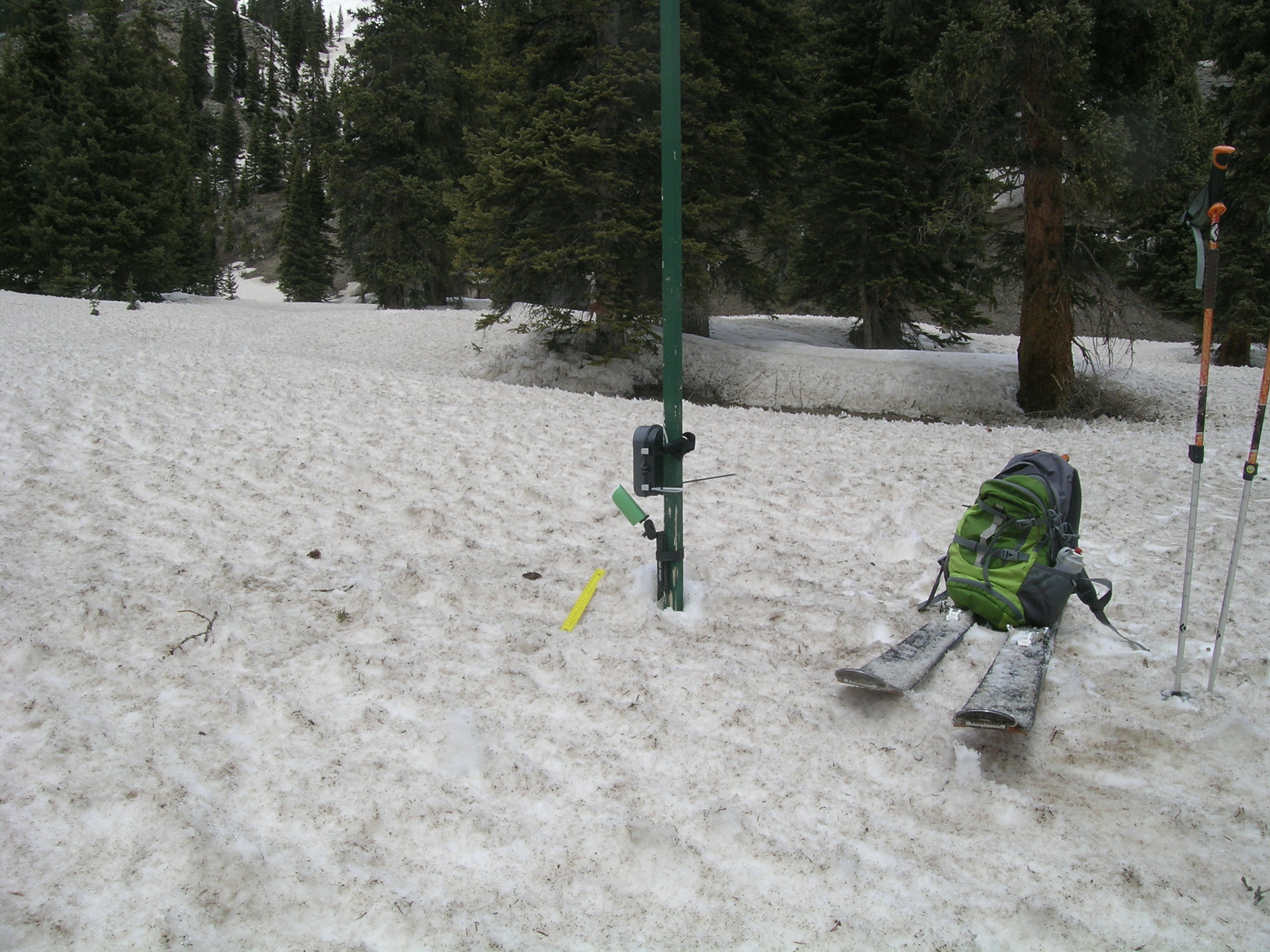
 April 2008 - Following dust-on-snow event D5, on April 21, 2008, we observed complex structure in the upper snowpack on April 28, as snow containing D5 dust emerged at the snowpack surface and absorbed solar radiation. These photos illustrate three distinct patterns of structure: 1) the development of standing ‘fins’ in the snowpack surface, at regular intervals, oriented toward the solar maximum (the direction of maximum solar radiation, at a specific spot), 2) rilling in the fin structure, oriented along the slope “fall line” and created by free water moving downslope within the upper snow structure, and 3) distinct horizontal structure within the fins, representing either or both snow layering, as it fell, or re-frozen wetting fronts, as the snow surface melted and free water percolated into the snowpack. These three forms of structure developed in different degrees in open, sunny locations than in shadier, forest locations. Our skis offer a reference, for scale.


