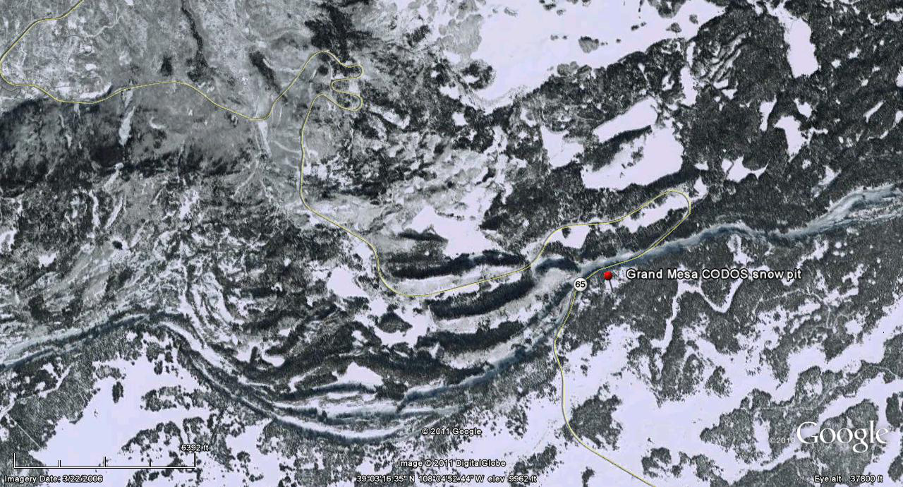
 CODOS Update for Grand Mesa:
visited March 16, 2012
Summary | Snowpack | Melt Rate | Forecast | Earlier Updates | pdf
Summary
Dust layer D4 (March 6) was easily observed, with its characteristic brown/pink color, at the snowpack surface at our Grand Mesa CODOS site and on surrounding terrain. Grand Mesa rivaled Rabbit Ears Pass for the heaviest concentrations of D4 observed during this circuit. The snowpack was nearly isothermal and was wet or moist throughout. Deep runneling and other wet snow features characteristic of a late spring snowpack were observed on the south flank of Grand Mesa. Since our site visit, a new D5 dust layer (March 18) has landed on the D4 surface, entrained in just a few inches of new snow. With the merged D5/D4 layer at the surface, dust-enhanced radiative forcing of snowpack warming will resume later this week and the snowpack will quickly become fully isothermal. Given continued sunny and dry weather, snowmelt rates will then accelerate.
SnowPack Discussion
Total snow depth in this snow profile (pdf) was 57” and mean density of the snowpack was 346 kg/m3 (34.6% water content). The upper two-thirds of this snowpack consisted of strong layers of wetted, round grains, and the remainder of wetted “depth hoar” and other weak snow. The coldest snow temperature in this profile was -0.9° C, in the depth hoar, and the mean snow temperature was -0.3° C. Dust layer D4 was present at the snow surface and two additional dust layers were observed near the bottom of the snowpack.


Melt Rate
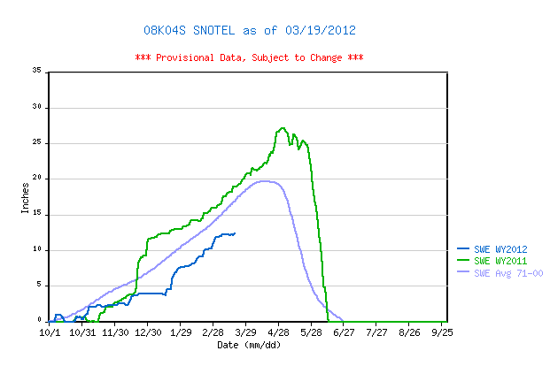
Mesa Lakes Snotel, the nearest Snotel to our site, has reported a slow decline in SWE since the D4 event, March 6, until a very small increase in SWE on Sunday, March 18, in association with D5. Any new snow associated with D5 dust will rapidly settle and enable D5 to merge with D4 and rapidly bring the snowpack throughout the Grand Mesa to isothermal, enabling snowmelt rates to accelerate.
Forecast
The National Weather Service expects sunny skies and unseasonably warm temperatures to return soon after the current storm clears (Tuesday, March 20). Under the combination of strong solar radiation and warm air temperatures later this week, settlement of any new snow containing D5 will be very rapid and D5 will quickly merge with the D4 layer. Where the Grand Mesa snowpack is already isothermal, solar energy absorbed by the merged D4/D5 dust will accelerate snowmelt rates and SWE losses. Where the snowpack retains some cold content, free water percolating down from the D5/D4 dust will quickly warm the highest elevation snowcover to isothermal.