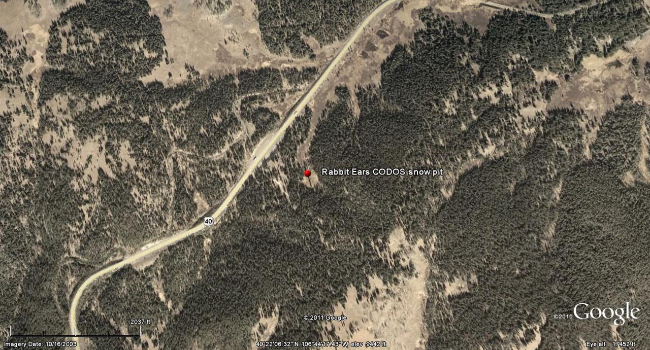
 CODOS Update for Rabbit Ears Pass site:
visited April 12, 2013
Summary | Snowpack | Melt Rate | Stream Flows | Forecast
Summary
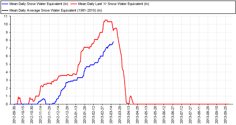
This field session at the Rabbit Ears Pass CODOS site, our first of the WY 2013 season, found 2.6” more SWE than observed a year earlier, but a still very sub-par snowpack. Weak D4 dust was found near the snow surface, but no other discernible dust layers were found. The snowpack still retains cold content and will require additional warming to become isothermal.
SnowPack Discussion
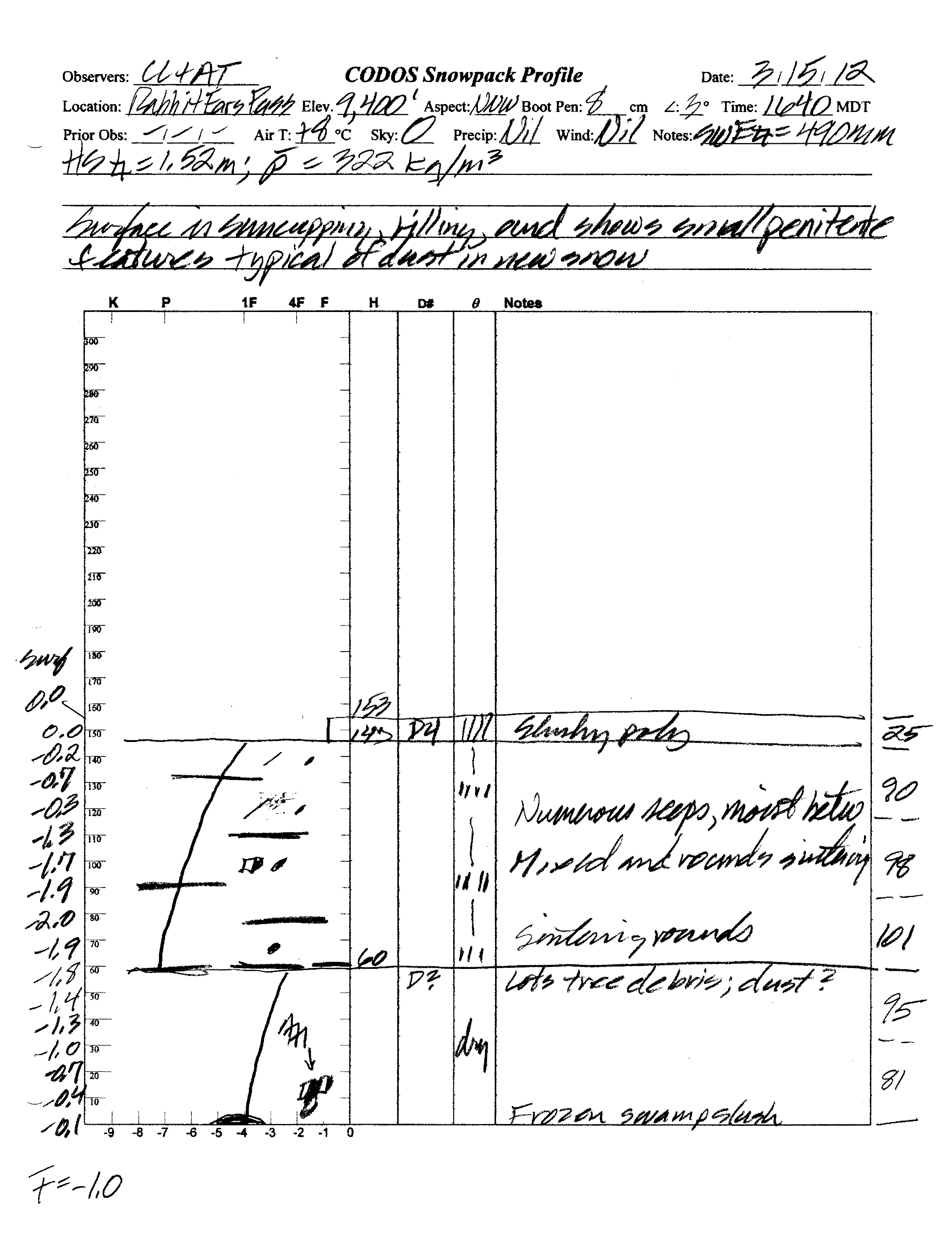
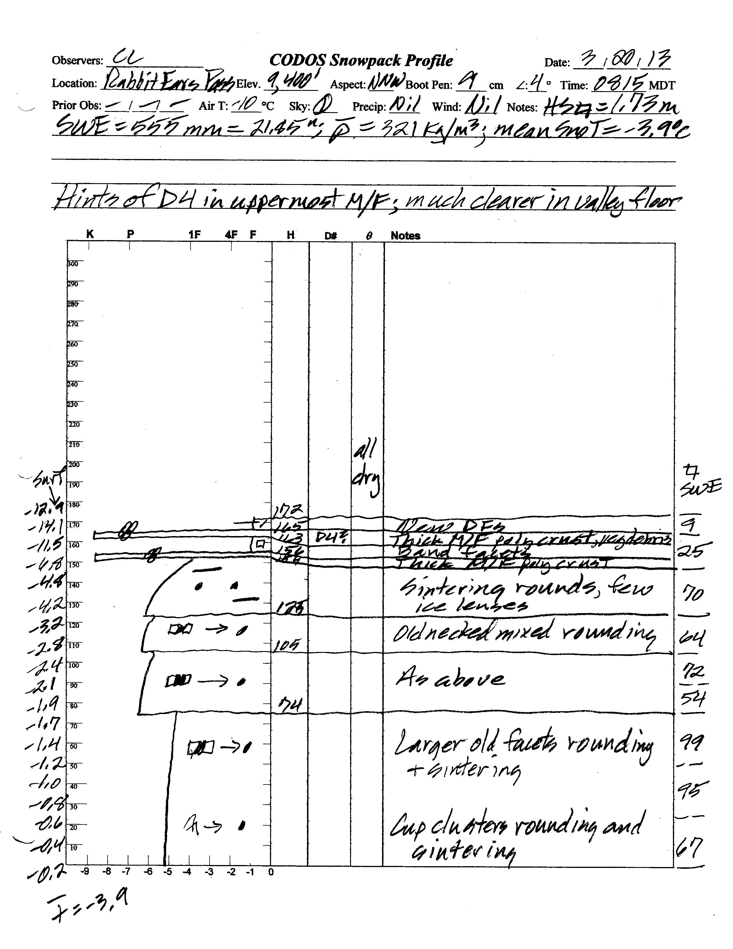
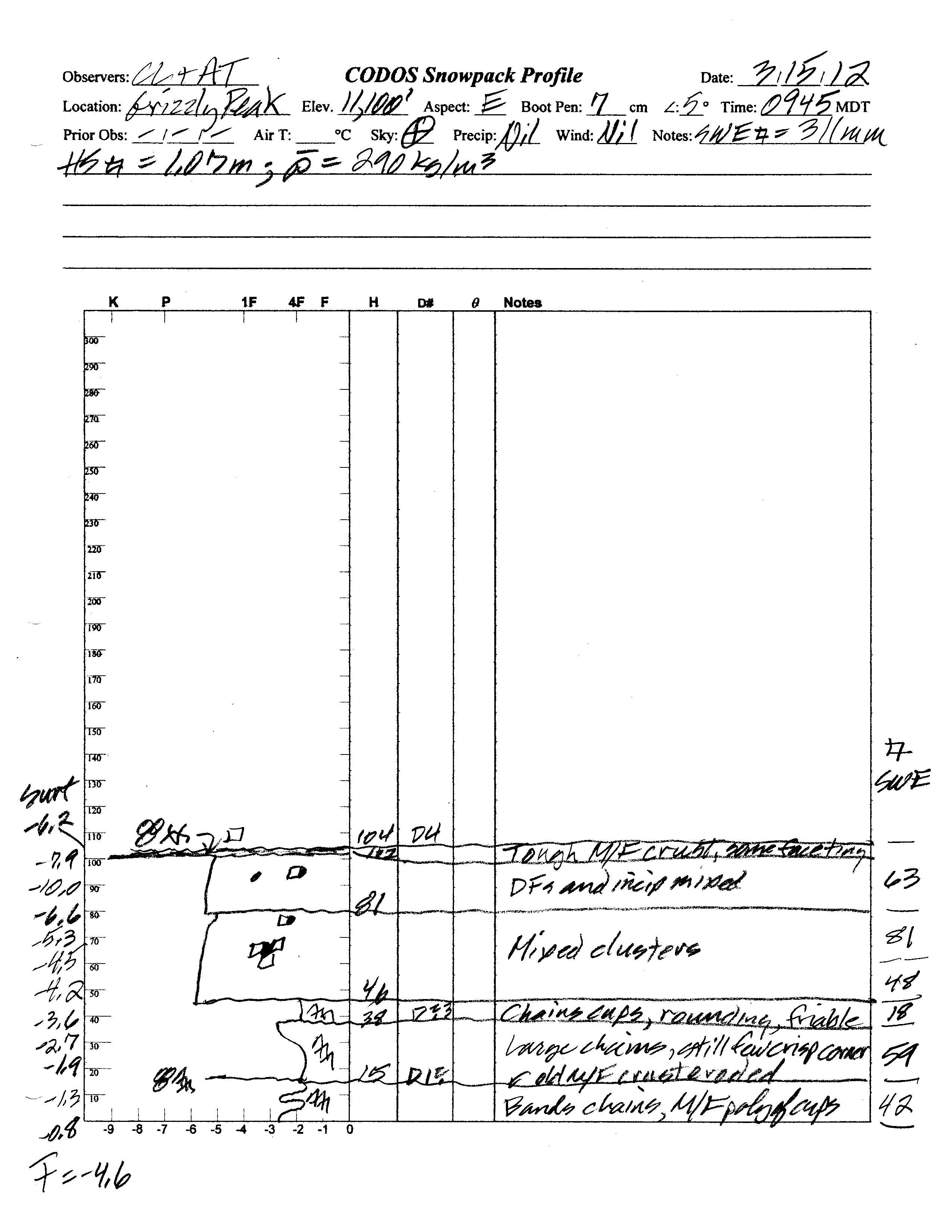
Total snow depth in the March 20, 2013 Rabbit Ears Pass CODOS site snow profile was 68”, almost 8” more than a year before. Total SWE in this profile was 21.85”, almost 2.6” more SWE than measured at the same site a year earlier, on March 15, 2012. Mean density of this snowpack was 321 kg/m3 (32.1% water content), virtually identical to the 322 kg/m3 measured a year before.
Some melt-freeze had occurred in the upper snowpack at the CODOS site in preceding days and weeks, then refrozen as thick crusts. A combination of vegetation debris and D4 dust may have enhanced melt the preceding day, but new, overnight snow was thinly covering that melt crust on the morning of March 20 (D4 dust was readily observed at the snowcover surface in the Yampa valley later in the morning). On March 20 the snowpack was once again completely dry and cold. Mean snowpack temperature in this profile was -3.9° C, versus -1.0° C a year earlier. Aside from the very weak D4 layer near the surface, no additional dust-on-snow layers were observed within the snowpack.
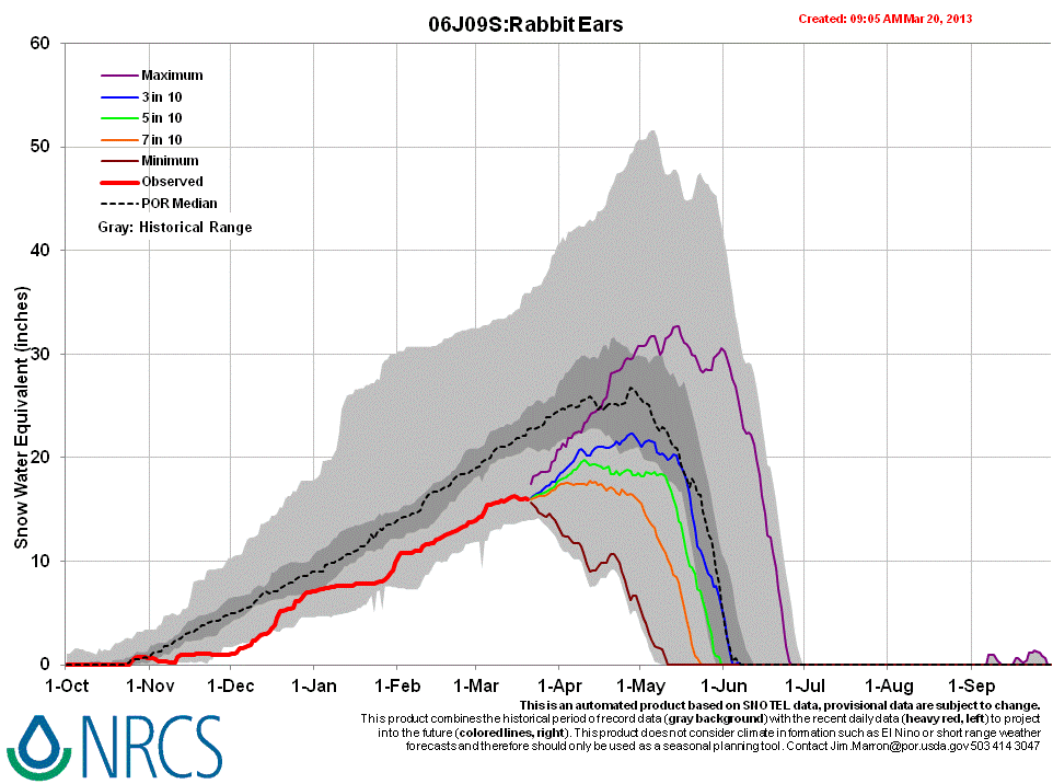
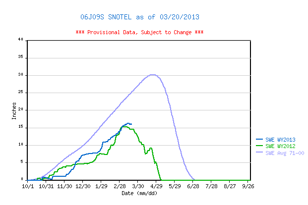
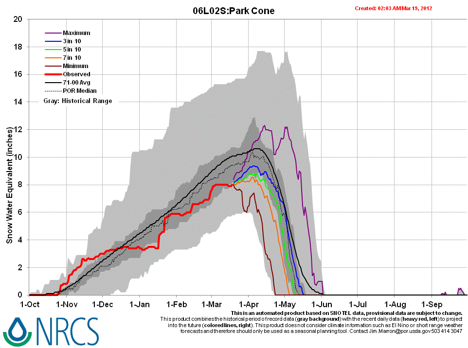
Rabbit Ears Snotel data for WY 2013 place current SWE in the low end of the lowest quartile of values for the period of record, slightly higher than same-date values in WY 2012, but still well below the 1971-2010 30-year mean.
 |
 |
|
| 2012 Pit Profile | 2013 Pit Profile |
 |
 |
|
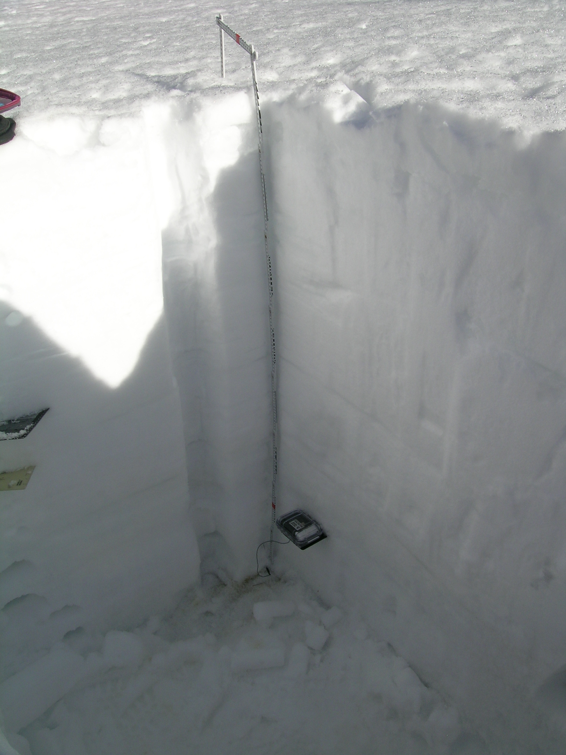
| 2012 Pit Photo | 2013 Pit Photo |
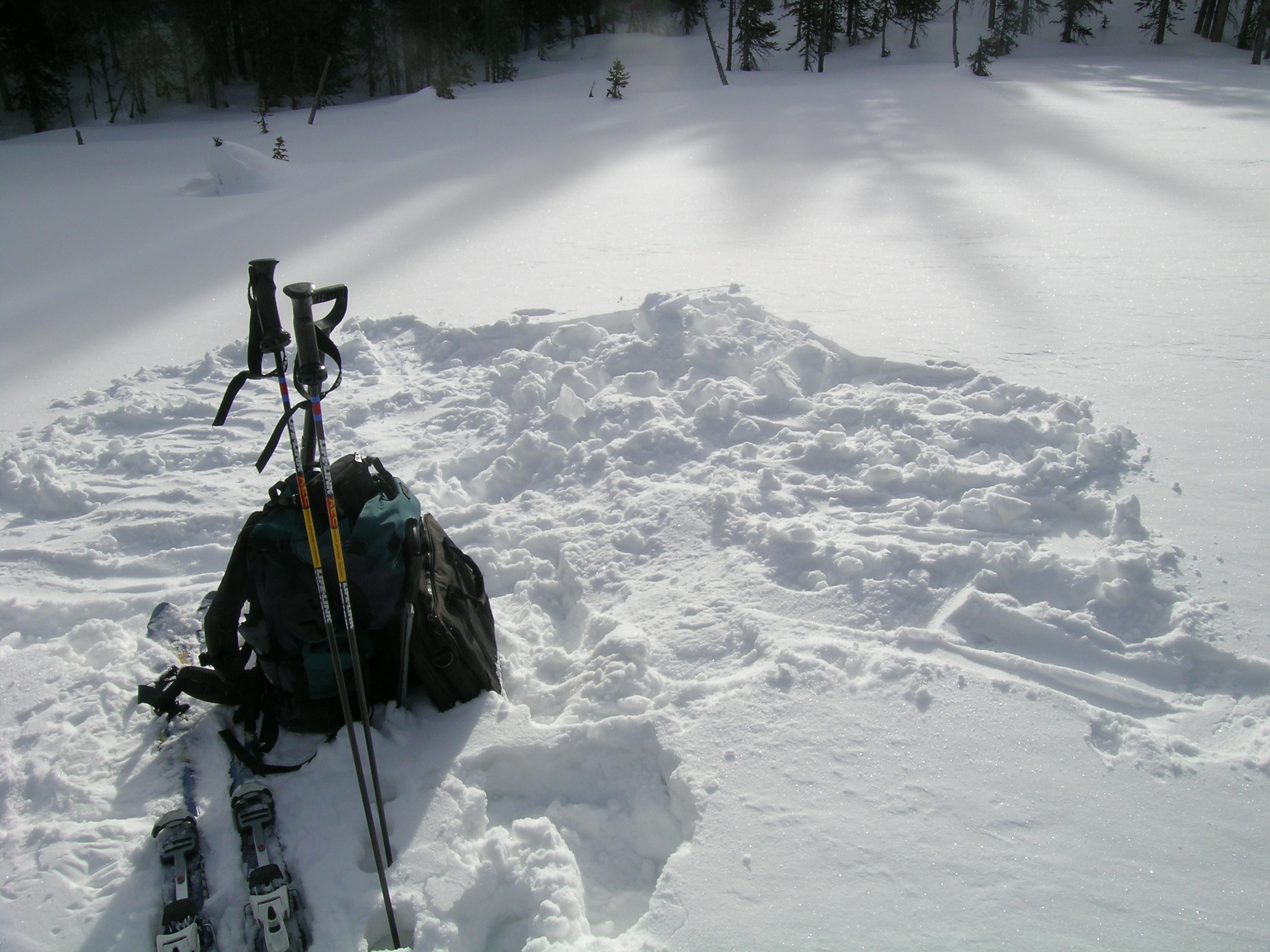 |
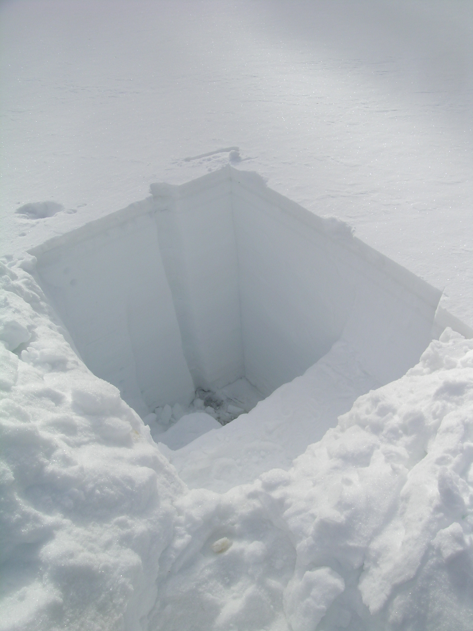
| After completing our CODOS profiles, we refill the snow pit as a safety measure. This also reduces the lateral migration of warm air temperatures that an open snowpit would enable, conserving the site's remaining snowpack for additional snow pits later in the spring. |
Melt Rate
The Rabbit Ears Snotel site continues to accumulate SWE and reports no significant losses of SWE, to-date. Surface snowmelt had recently occurred in the snowpack at the slightly northwest-facing CODOS snow profile site. This snow profile showed that melt water had percolated a short distance into the snowpack and then re-frozen, as “lenses” of clear ice, but no indications that free water had reached the bottom of and exited the snowpack, as runoff.
Forecast
Given the very weak concentration of event D4, and the absence of any additional dust layers in the snowpack, snowmelt processes at the Rabbit Ears Pass CODOS site and locale could proceed with significantly less dust-on-snow enhancement of radiative forcing than observed in recent seasons unless/until subsequent dust is deposited later this spring. The National Weather Service anticipates continued W’ly winds shifting to NW leading into the weekend of March 23/24, with additional snowfalls favoring the northern mountains.
As of March 20, 2013 only NRCS’s “maximum” projection of future snowpack accumulation would result in peak SWE at or above the median at the Rabbit Ears Snotel site. NRCS projects only a 3 in 10 chance that complete snowcover ablation (snow all gone, or SAG) will occur near the median date, and higher probabilities that SAG will be earlier than the median date.