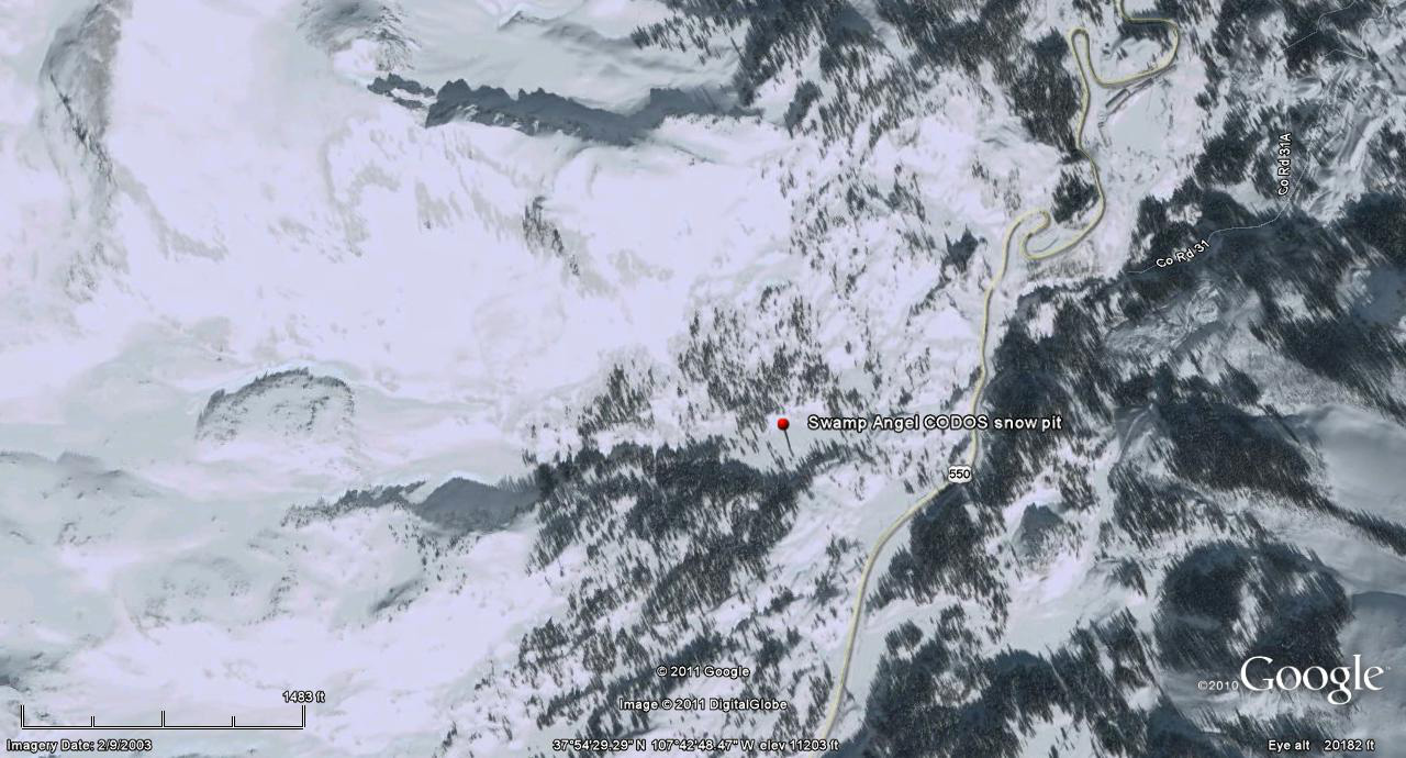
 CODOS Update for Swamp Angel:
March 5-16, 2012
Summary | Snowpack | Melt Rate | Stream Flows | Forecast |
Wind Behavior | Earlier Updates | pdf
Summary
Immediately after our last formal snow profile at Swamp Angel Study Plot, on March 5, dust event D4 (March 6) was deposited “dry” (without associated precipitation) and immediately reduced snow albedo, increasing radiative forcing at the snow surface. However, the snowpack on March 5th retained considerable cold content. D4 remained fully exposed until Sunday, May 18, when the first precipitation since March 2nd delivered dust event D5 entrained in a foot of new snow. Snowpack warming which occurred as a result of D4 radiative forcing of snowmelt at the snowpack surface will be largely conserved, insulated by this new snow layer. A sustained return to sunny skies and warm temperatures beginning Tuesday, March 20 will rapidly settle this new snow, revealing the D5 dust, quickly merge it with D4, and resume the warming of the snowpack, now approaching isothermal at 0° C throughout.
SnowPack Discussion
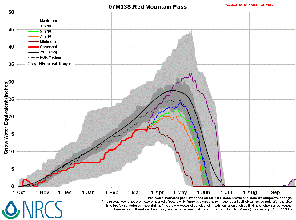
Total snow depth in our March 5 snow profile (pdf) was 69”. Total SWE was 19.45” (compared to 16.2” at the Red Mountain Pass Snotel) and mean density of the snowpack was 282 kg/m3 (28.2% water content). The middle of this snowpack consists of stronger, mid-winter layers, deposited since mid-January. Recent new snow layers topped the snowpack, and much weaker “depth hoar” snow comprised the lower 26” of the pack. The coldest snow temperature was –14.3° C, a few inches below the snow surface; the mean snow temperature was still cold, at -5.1° C. The only clearly discernible dust layer visible in this snow pit was layer D1, four inches above the ground; previously observed layers D2 and D3 had faded from faintly visible to not clearly visible. An unusual episode in preceding days of heavy local haze from Grand Valley pollution had not produced deposition that we could definitively identify at the time, but a very weak deposition became apparent the following day, prior to the deposition of event D4 on March 6 (which began that night). Since March 5, this snowpack has warmed and, until the D5 storm, had shown gradual settlement. This snowpack may become isothermal during the expected period of prolonged sunny and warm weather beginning Tuesday (March 20).


Melt Rate
The nearby Red Mountain Pass Snotel reported virtually static SWE from the date of our snow profile, March 5, until the 15th, when a very slow decline in SWE began. Then, the storm bearing dust event D5 added 15” of new snow containing 1.7” of SWE to the snowpack at the Snotel site (14” of snow containing 1.5” of SWE at Swamp Angel Study Plot). Dust was entrained in the new snow during the beginning of this storm but snow during the latter portion of this storm was clean. This clean, new snow surface will initially restore and high snow albedo to the surface but settlement will be rapid and solar energy will soon reach the dust-contaminated snow underneath, rapidly ablating the clean snow and merging the D5 with D4. Snowpack warming will then resume and, if sunny weather and unseasonable warm temperatures are sustained, higher rates of SWE loss will commence.
Stream Flows
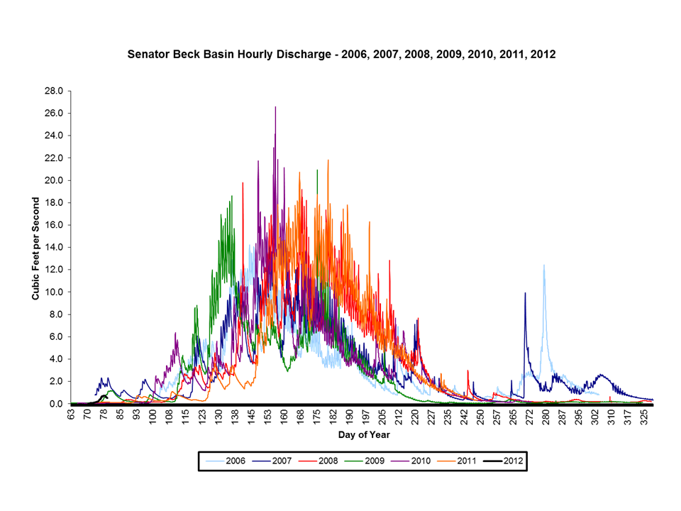
The Senator Beck Basin Stream Gauge was returned to operation on March 11, under very low (base) flows (0.05 cfs). Our timing was good since flows subsequently increased during the next several days reaching a daily average of 0.70 cfs on March 18, then dropped as the storm delivering dust event D5 arrived. During that period both the Animas (at Durango) and Uncompahgre (at Ridgway) rivers showed diurnally ratcheting flow increases matching, in pattern, those at our gauge. That rise in flows at the Senator Beck Stream Gauge was driven by initial snowmelt on the lowest elevation sunny slopes in our study area; low elevation snowmelt in the lowest snowcovered areas in the Animas and Uncompahgre watersheds, enhanced by D4 at the surface, also contributed to those increasing flows.
Wind Behavior
The following graphs show wind behavior during the Water Year 2012 dust-on-snow events at our Putney Study Plot (best wind data for Senator Beck Basin Study Area and Red Mountain Pass). We have estimated beginning and end times of each event based on observations from Silverton, CO. For more on this wind analysis, see the CODOS dust log and wind rose table.
D1: Nov 5, 2011 |
D2: Nov 13, 2011 |
D3: Dec 3, 2011 |
D4: March 6, 2012 |
D5: March 18, 2012 |
 |
 |
 |
 |
 |
Forecast
The National Weather Service expects sunny skies and unseasonably warm temperatures to return soon after the current storm clears (Tuesday, March 20). Under the combination of strong solar radiation and warm air temperatures later this week, settlement of the new snow containing D5 will be very rapid and D5 will quickly merge with the D4 layer. Where snowpacks in western San Juan Mountains are already at or very near isothermal temperatures, solar energy absorbed by the emerging D4/D5 dust will accelerate snowmelt rates and SWE losses. Where the snowpack retains cold content, energy absorbed by that dust will continue to accelerate warming of the snowcover to isothermal at 0° C. As always, the lowest elevation snowpacks (now generally isothermal) will most rapidly respond to radiative forcing and quickly contribute to increased streamflows.