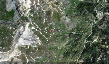
 CODOS Update for Senator Beck Basin Study Area:
Visited March 22, 2013
CODOS Update for Senator Beck Basin Study Area:
Visited March 22, 2013
Summary | Snowpack | Melt Rate | Forecast
Summary
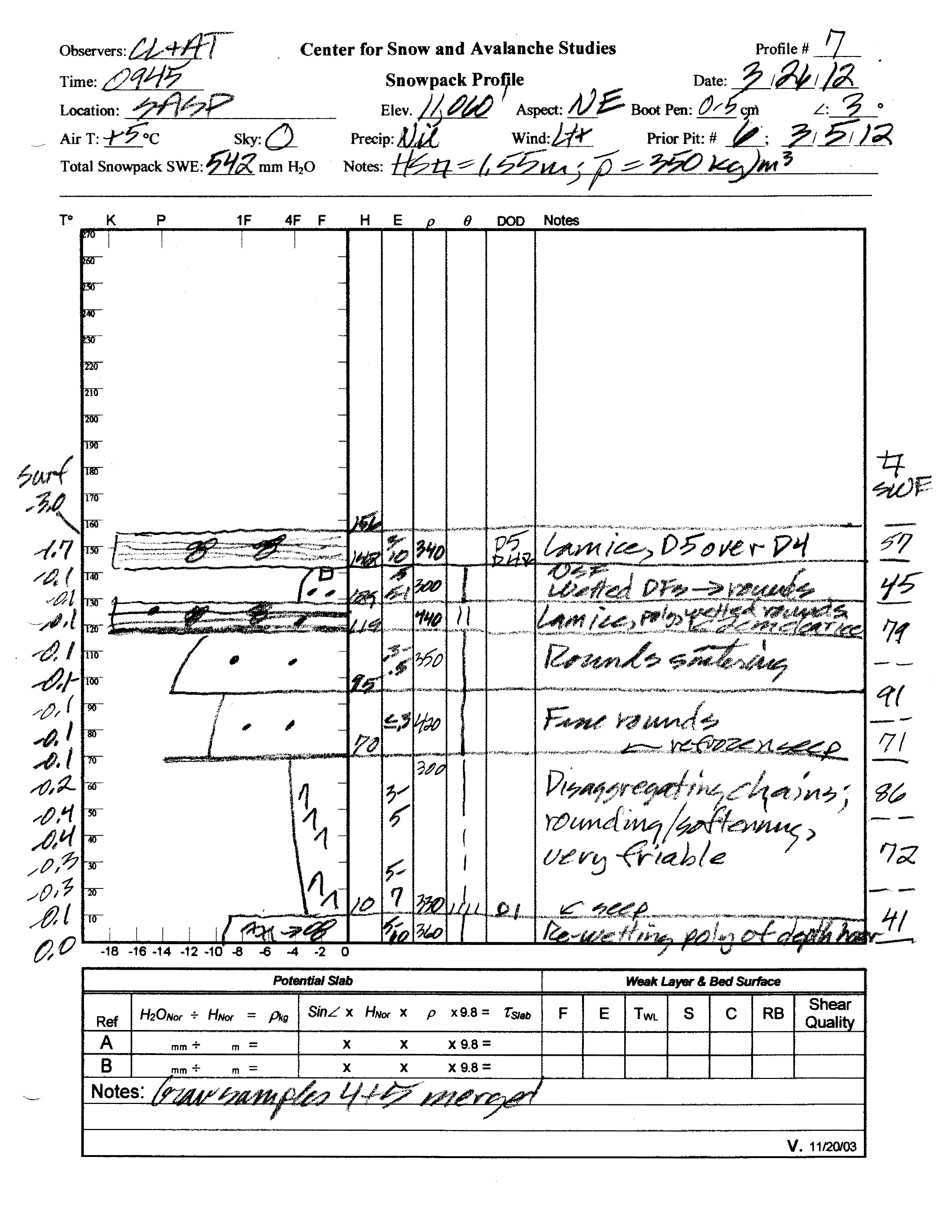
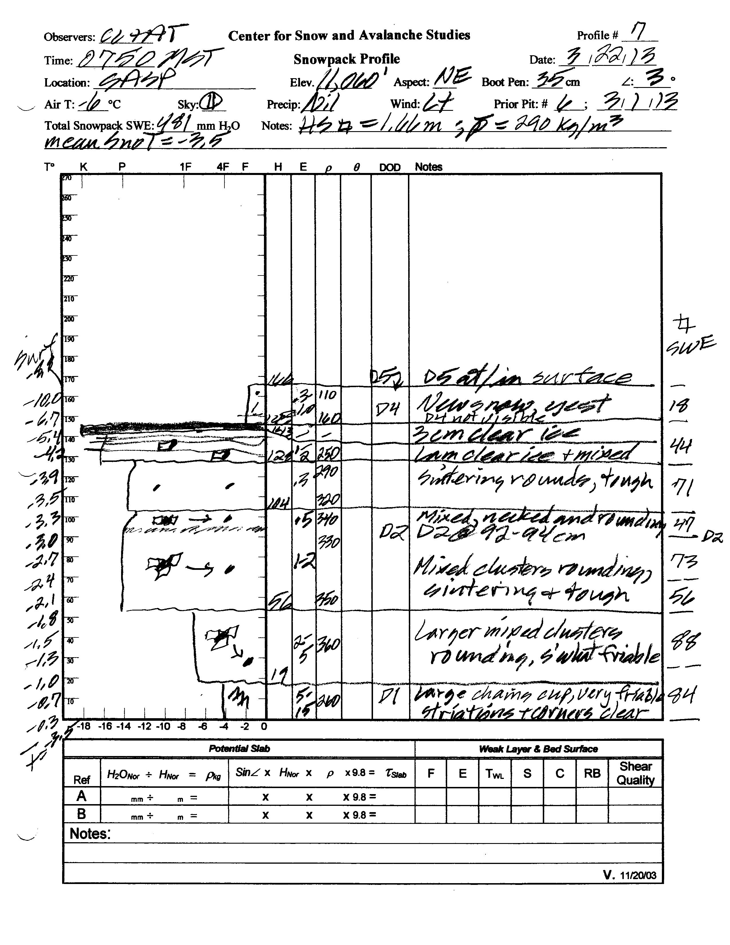
This March 22, 2013 field session at the Swamp Angel Study Plot site at Senator Beck Basin found less SWE than observed a year earlier, on March 26, 2012, in slightly deeper snowcover. Fresh dust was observed at/in the snowpack surface (event D5) and deposition may have been ongoing throughout the remainder of the day. Two prominent dust layers were clearly visible within the snowpack, but two additional, very minor layers were not readily apparent in the snow profile. Despite recent surface melt, the snowpack at SASP still retains cold content and will require additional warming to become isothermal. Our SASP snow profile contained more total SWE than the nearby Red Mountain Pass Snotel site was reporting that day.
SnowPack Discussion
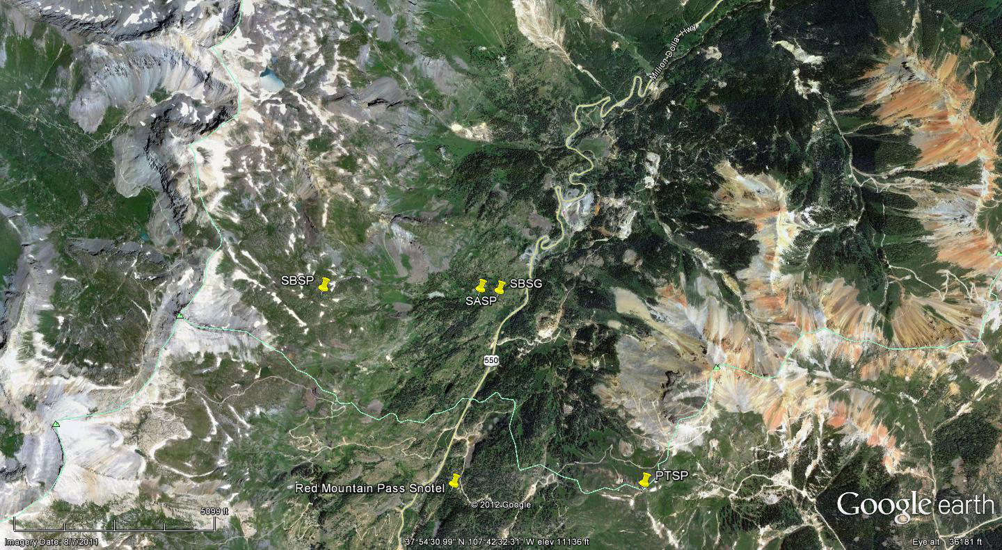
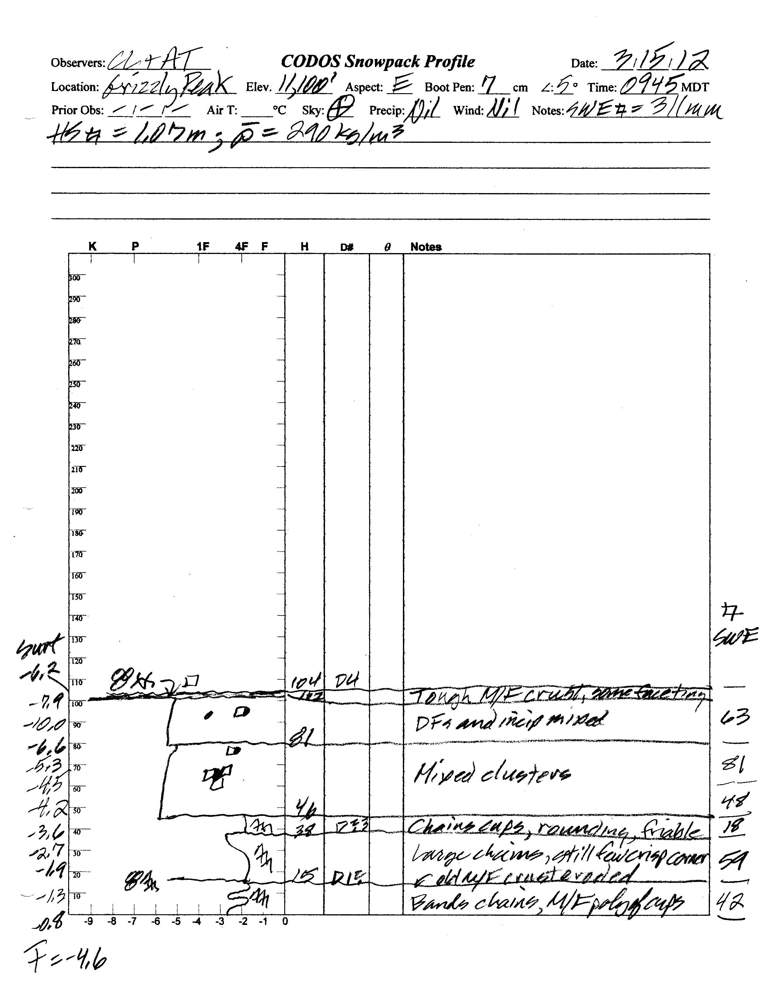
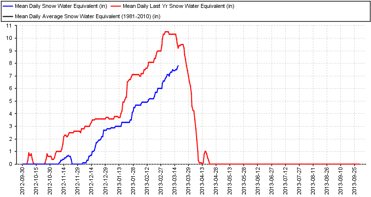
Total snow depth in our March 22, 2013 Swamp Angel Study Plot snow profile was 65”, 4” more than observed at the site a year before, on March 26, 2012. Total SWE in this profile was 18.9”, 2.4” less SWE than measured at SASP year earlier. Mean density of this snowpack was 290 kg/m3 (29.0% water content), substantially lower than the 350 kg/m3 mean density measured a year before. The nearby Red Mountain Pass Snotel, 1 mile to the south and at a similar elevation, reported 16.9” of SWE that morning, 2.2” less than measured at SASP.
Significant surface melt episodes had occurred at SASP site in the preceding week of March 11-16, 2013 represented by a series of clear ice layers interspersed with dry snow. Subsequent fresh snow buried those refrozen ice layers and by March 22 the snowpack was once again completely dry and cold; no wet snow was observed. Mean snowpack temperature in this profile was -3.5° C, as compared to -0.4° C a year earlier, when the entire snowpack exhibited some degree of wetness.
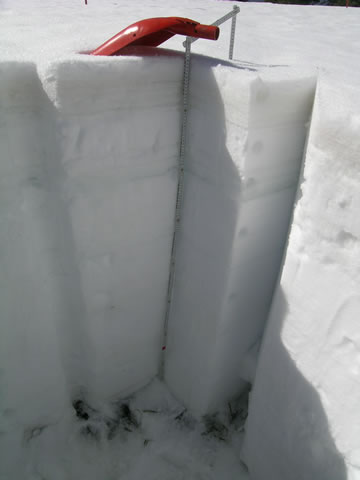
Dust-on-snow layer D5-WY2013 (March 21) was within the thin layer of new snow at the surface in our snow profile, and ongoing deposition was very likely in progress, given the significant dust observed later that morning in the air over the Uncompahgre Valley, en route to Grand Mesa. Two additional dust layers were clearly observed within the snowpack, corresponding to events D2 (February 8) and D1 (November 9). The more recent, but very minor D3 (March 8) and D4 (March 18) dust layers, first detected while at the snowpack surface, were not visible in the snow pit wall. Almost 7” of overlying SWE (containing D4 and D3) covered the D2 (February 8) layer, so considerable snowmelt will be required to expose layer D2, the heaviest single deposition of the season, to-date. Dust layer D5 will accelerate snowpack ablation, merging fairly quickly with minor layers D4 and D3, and eventually with layer D2. Dust layer D1 will play only a very minor role in snowmelt, just before “snow all gone” (SAG).
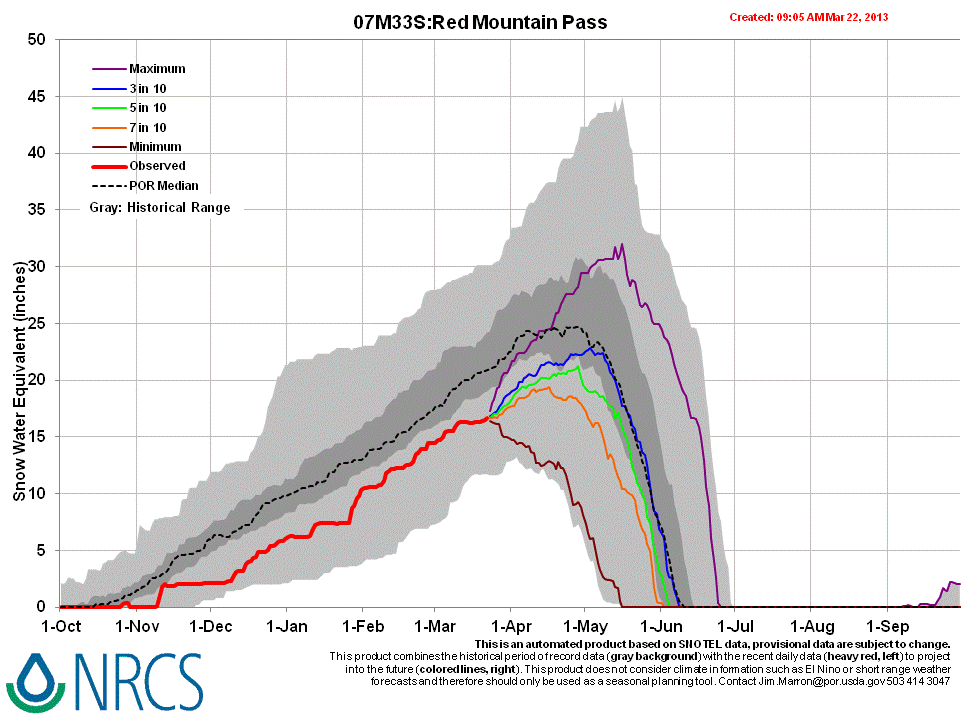
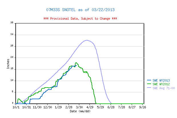
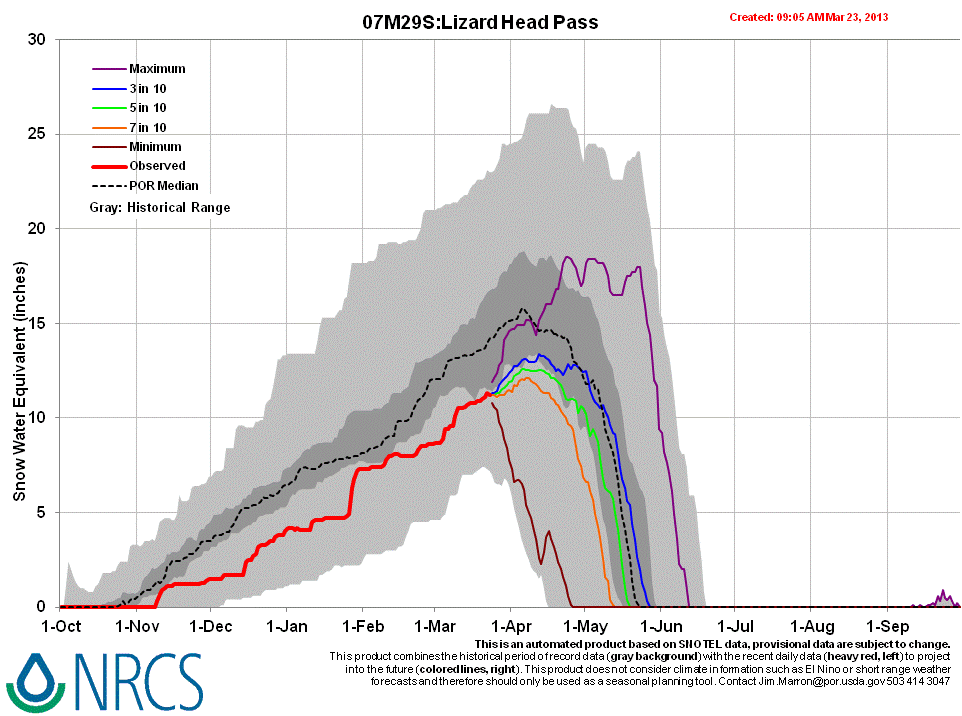
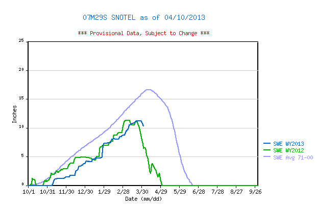
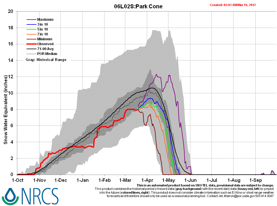
The Red Mountain Pass Snotel data places current SWE near the top of the lower quartile of SWE values for the period of record and very close to the same-date value recorded in WY 2012, but still well below the 1971-2000 mean for that site. Data at the Lizard Head Pass Snotel, located 14 miles to the southwest of Red Mountain Pass, show slightly better conditions, but still well below the 1971-2000 mean for that site.
 |
 |
|
| 2012 Pit Profile | 2013 Pit Profile | |
 |
 |
|
| 2013 Pit Photo | ||
 |
||
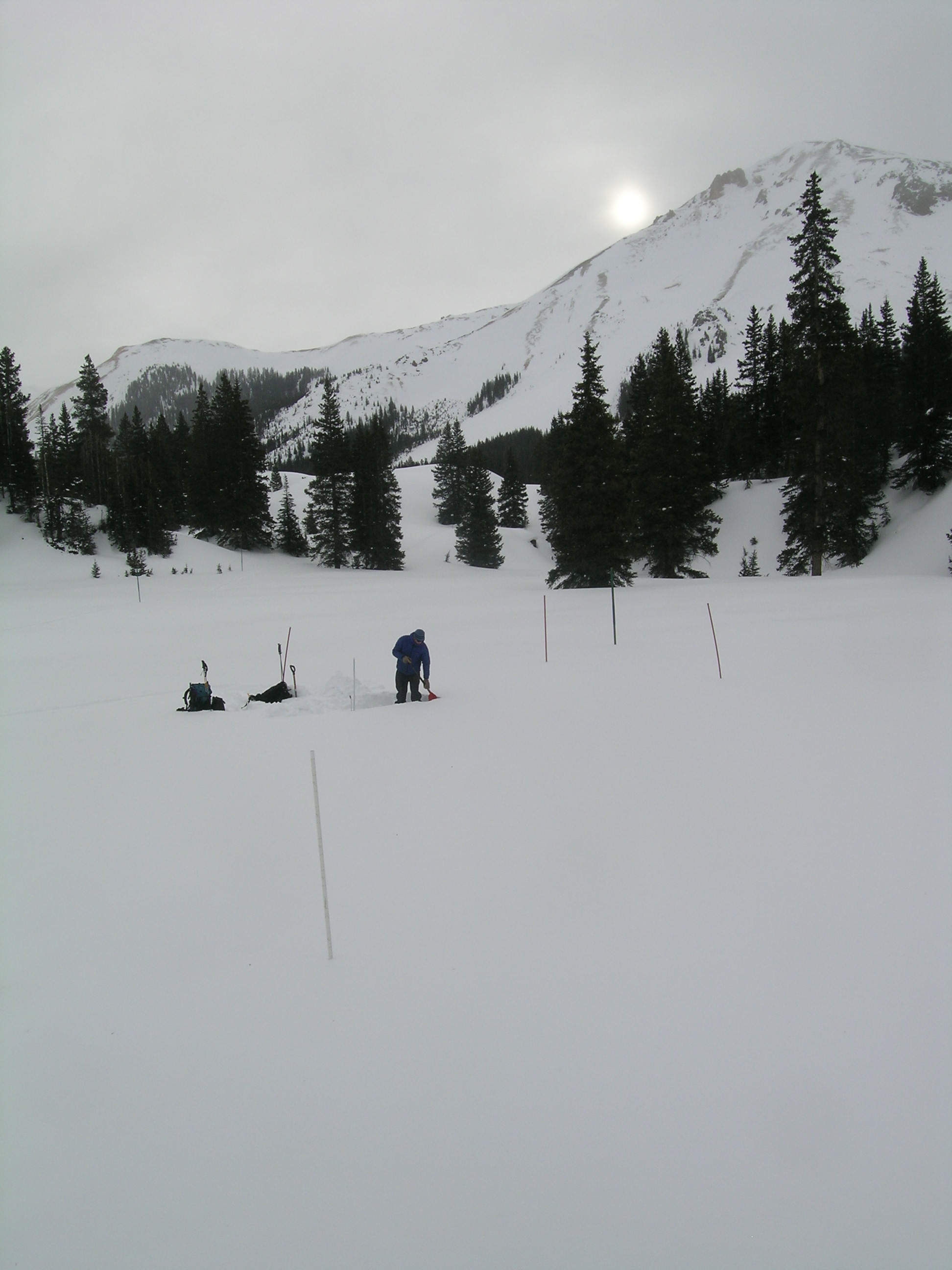
| CSAS field assistant Andrew Temple prepares the Swamp Angel Study Plot snow pit as the sun rises over Red Mountain #3. | ||
Melt Rate
The Red Mountain Pass Snotel site continues to accumulate SWE and reports no significant losses of SWE, to-date. Episodes of surface snowmelt had occurred in the snowpack at the slightly northeast-facing SASP site but we observed no indications that free water had yet percolated to the bottom of and exited the SASP snowpack, as runoff. Further, the Senator Beck Stream gauge just below the SASP site is recording only base flow, to-date.
Upon renewed surface melt conditions in coming days, cold snow temperatures within the snowpack will still refreeze percolating free water, as ice layers and “flow fingers”. Nonetheless, that process, enhanced by dust layer D5 (and eventually by the merger of D5, D4, D3, and D2), will consume cold content and accelerate snowpack warming to isothermal temperature, at 0 C throughout. As always, snowmelt runoff will begin on the southerly-facing, lowest elevation portion of Senator Beck Basin, already near isothermal, and progress to higher and shadier terrain over time. At the lowest snow covered elevations of the western San Juan Mountains, solar energy absorbed by D5 (perhaps already merged with other dust layers) will result in accelerating snowmelt runoff (or absorption into soils) and snowcover ablation, to “snow all gone” (SAG).
Forecast
The National Weather Service anticipates partly-to-mostly sunny weather for the western San Juan Mountains for the remainder of March, with only slight chances for snow and/or rain showers (rain even at Red Mountain Pass elevations), and seasonable temperatures rising to the 40’s. Given the D5 dust-on-snow layer at/near the snowpack surface, and with minor accumulations of new snow since our site visit, Senator Beck Basin will soon be experiencing some reduction in snow albedo by D5 and additional, dust-enhanced absorption of solar energy. Initially, that extra increment of absorbed solar energy will accelerate snowpack warming, as infiltrating melt water forces the snowpack toward isothermal temperatures, at 0° C throughout. Once isothermal, and as/when layers D5, D4, D3, and D2 merge and remain exposed, snowmelt runoff (or absorption by soils) will commence, beginning on the lower, sunnier slopes of Senator Beck Basin, and snowpack ablation and snowmelt runoff will accelerate. Those snowmelt processes are more advanced, in much thinner snowcover, at the lowest snowcovered elevations of the San Juan Mountains.
As of March 23, 2013 only NRCS’s “maximum” projection of future snowpack accumulation would result in peak SWE at/above the median at the Red Mountain Pass and Lizard Head Pass Snotel sites. NRCS projects between either a 3 in 10 chance or a 5 in 10 chance that complete snowcover ablation (snow all gone, or SAG) will occur near the median date at those sites, but higher probabilities that SAG will be earlier than the median date. Those projections are made based on historical snowpack behavior but without direct, season-specific estimations of dust enhanced snowmelt rates.