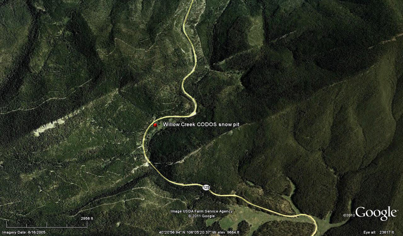
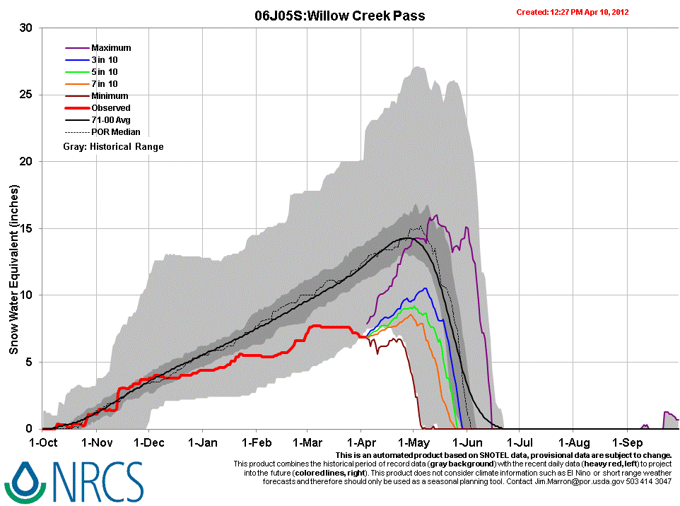
 CODOS Update for Willow Creek Pass:
Visited April 10, 2012
Summary | Snowpack | Melt Rate | Stream Flows | Previous Update
Summary
Sustained periods of unseasonably warm air temperatures and exposed dust at the snowpack surface during late March and early April 2012 have, together, initiated accelerating rates of snowmelt and SWE loss at some, but not all, CODOS Snotel sites. Some CODOS Snotel sites report significant declines in SWE approaching the lowest values in the period of record (for a given date) or even falling outside of the historic range. Those sites may have experienced Peak SWE for WY 2012 in early or mid-March. Recent CODOS snowpits near those CODOS sites mirror those losses of SWE.
In contrast, other CODOS Snotel sites and CODOS snowpits show only small losses of SWE. At those sites, energy inputs from warm air and direct absorption of solar energy by dust at the snowpack surface was consumed in warming the snowpack towards an isothermal state at 0° C, as a precursor to the loss of SWE and onset of snowmelt runoff. Since our prior site visit on March 15, the snowcover has disappeared from the Willow Creek Pass CODOS site, but the nearby Snotel still retains some snowpack.
The National Weather Service expects warming weather in the Colorado mountains through Wednesday with strong SW’ly winds developing on Wednesday afternoon ahead of a cooler but largely dry airmass. Unsettled and cooler weather will finish the week and run through the weekend, including chances for rain and/or snow showers each day.
SnowPack Discussion
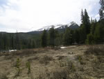
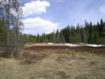
Snow has completely disappeared from the CODOS Willow Creek Pass site, located in an open meadow adjoining the Willow Creek Pass Snotel site. The adjoining forest, where the Willow Creek Pass Snotel and snow course are located, retains shallow and patchy snowcover, now isothermal. That Snotel has been reporting SWE only intermittently, with the last report 7 days ago (April 3) at 6.9" of SWE.
| April 10, 2012: | |||
 |
 |
||
no pit (Snow All Gone) |
Looking SW from snow pit site |
Looking NE towards snow pit site |
|
| March 15, 2012: | |||
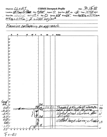 |
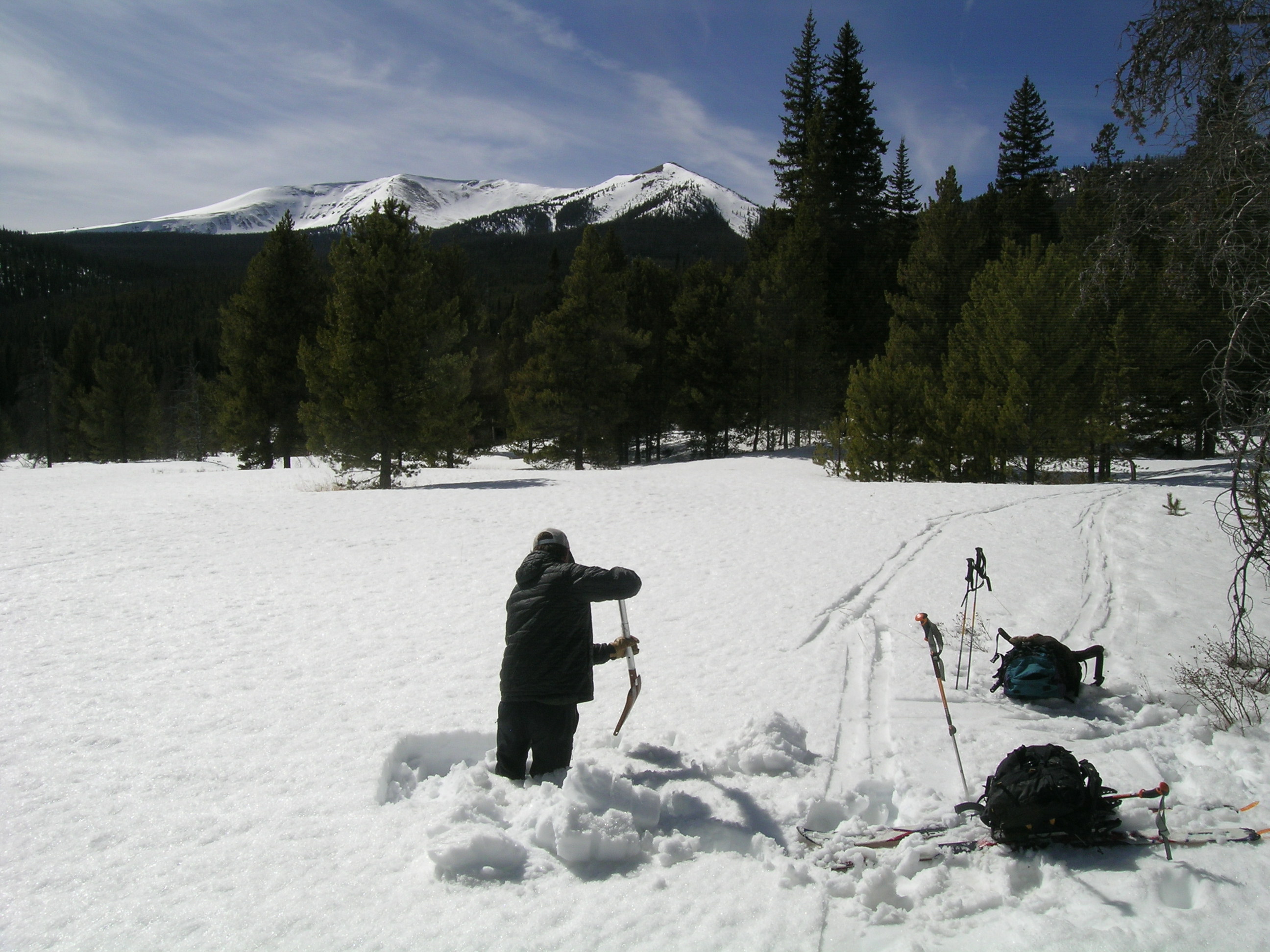 |
 |
|
Melt Rate
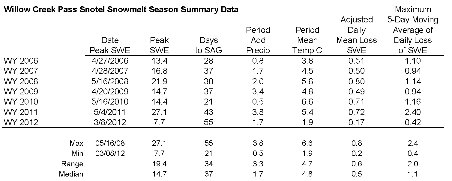
Barring a currently unexpected major winter storm, Peak SWE of 7.7" has already occurred, in early March, about six weeks early, and current SWE values have dropped below the lowest quartile in this Snotel's period of record for this date. Recently reported melt rate at this Snotel fall well short of the mean daily loss rates shown in the table below, and very far short of the maximum SWE loss rate last Spring of 2.40” per day, over a 5-day period ending June 11, 2011. However, as at other CODOS sites, the melt rates in the open meadow where CODOS snowpits are dug have been higher to reach 'Snow All Gone' (SAG) than at the shaded Willow Creek Pass Snotel site.
STREAM FLOWS
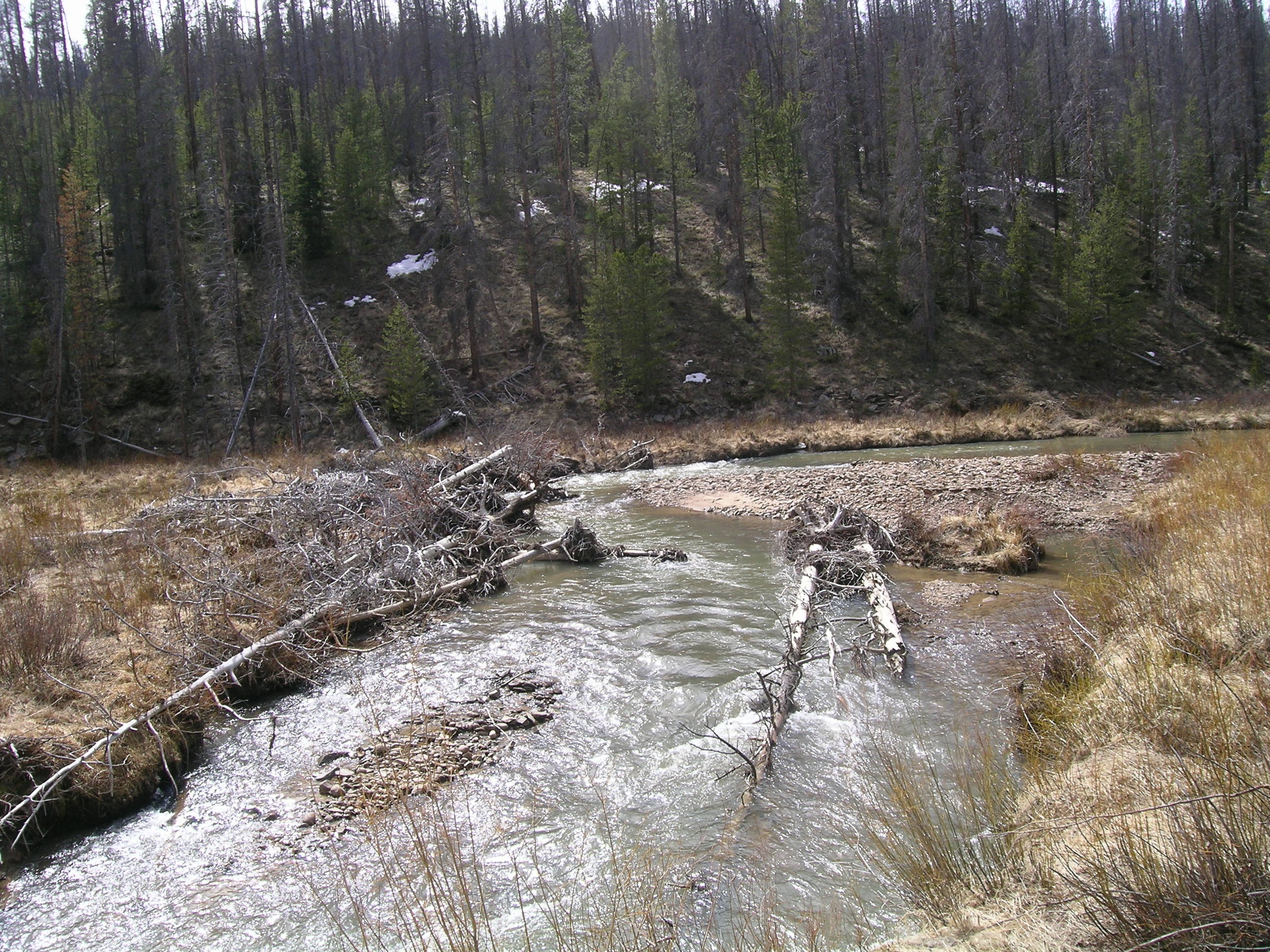
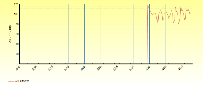
The following graph of Willow Creek Above Willow Creek Reservoir provided by the Northern Colorado Water Conservancy District began reporting in the past week; no historic flow data are provided in this graphic. However, our observations of Willow Creek on April 10 found the stream well below bank full as seen in the photo below. This photo also shows the results of last spring's very intense runoff, moving very large woody debris down the channel and causing siginifcant alterations to the channel bed and banks.