March 28, 2012 CODOS Update
Greetings from Silverton -
Since our March 19 Update the Colorado mountains have experienced another prolonged period of largely dry, sunny, and unseasonably warm weather and an additional dust event – D6, March 26th. In the absence of new precipitation, SWE levels continue to fall behind 30-year averages, placing current SWE levels in the lowest quartile of values for the period of record at many Snotel stations, and some sites are beginning to show SWE losses.
Dust-on-snow is affecting snowpacks statewide. The D4 (March 6) dust layer observed at the snowpack surface at all CODOS sites during our first circuit (see March 14-17 Update) was only thinly covered by new snow in most Colorado mountain ranges on Sunday, March 18, but that new snow also delivered dust layer D5. Here in the San Juan Mountains D5 was associated with as much as 14” of new snow. We’ve received confirmations of D5 from as far north as Steamboat Springs. New snow associated with D5 just has now largely been ablated and D5 had merged with the underlying D4 layer at the snowpack surface by the weekend of March 24-25. Then, on Monday, March 26th, a new dust layer – D6-WY2012 – was deposited as “dust-on-dust” during the afternoon and evening hours. Thus, the snow surface here in the Senator Beck Basin Study Area now consists of three, effectively merged, dust layers. We are quickly receiving verification of the D6 event from observers in other locales.
As discussed in the March 19th Update, direct absorption of solar energy by these merged dust layers has been either hastening the ‘ripening’ of the snowpack to isothermal at 0° C throughout, or, if already isothermal, is now enhancing snowmelt rates. While streamflow data reflect a variety of processes influencing runoff rates, recent streamflow data do include the influence of reduced snow albedo by D4 from March 7-17, a restoration of higher snow albedo (with cooler weather) on March 18 for a brief period, followed by warmup and additional reduction in snow albedo as D5 merged with D4. Still further reduction in albedo, by D6, will also soon be integrated into these hydrographs, as long as these merged dust layers remain exposed at the snowpack surface.
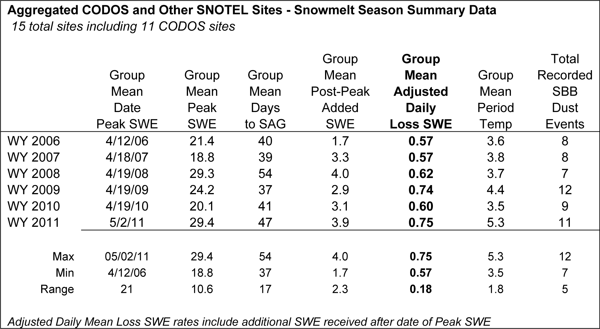
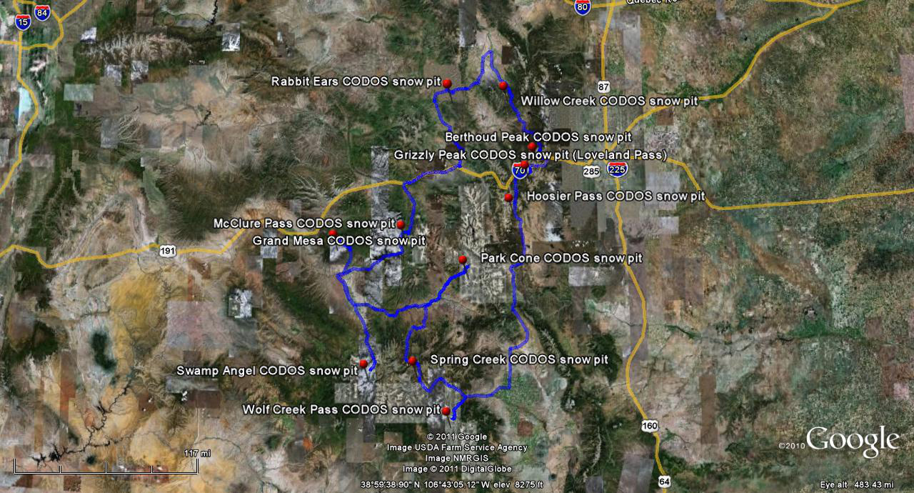
This Update presents current, site-specific Snotel data and presents our analyses of past-season snowmelt rates at 15 Snotel sites, prepared by CODOS in spring 2011 (complete set of Excel workbooks). These site-by-site Snotel station analyses explore snowmelt behavior beginning with Water Year 2006, as CODOS’s rigorous dust-on-snow monitoring began at CODOS sites around the state. For each site, the date of Peak SWE and subsequent number of days to “snow all gone” (SAG) are shown for each Water Year. Then, the amount of additional SWE received after the date of Peak SWE is added to Peak SWE to calculate an “adjusted daily mean loss [of] SWE” rate during the snowmelt season that Year. Finally, the mean air temperature, as measured at the Snotel site, during the period from Peak SWE to SAG is shown for each Water Year.
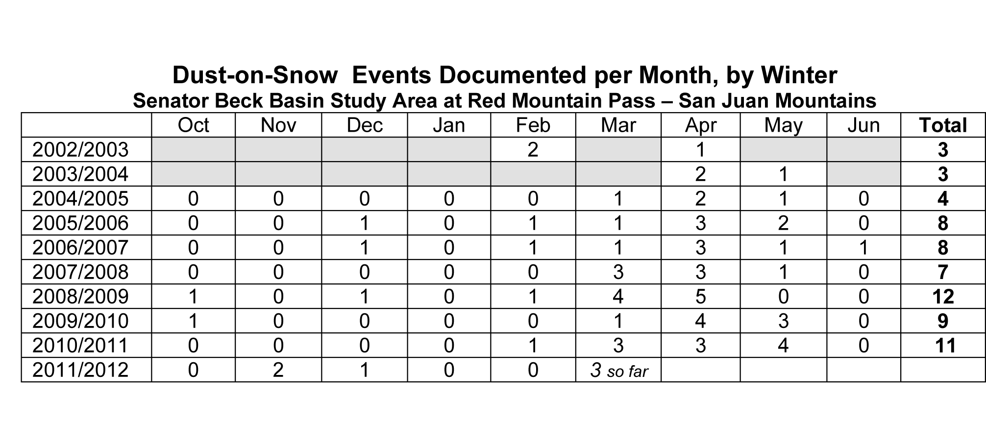
The CODOS Log of Dust-on-Snow events (above) provides a broad context for these melt rate analyses. However, this Log tallies dust-on-snow events observed at Senator Beck Basin and, as those who have received our CODOS Update products over that period know, seasonal variations in the geography of deposition of dust in Colorado’s mountains, and in the impact of dust during snowmelt season (strongly influenced by spring weather), constrains making direct correlations between the number of dust events in a particular season and snowmelt rates at a particular Snotel site. This variability is reflected in the “adjusted daily mean loss [of] SWE” rate data presented in the site-specific tables and in the table below.
Comparison of those site-specific melt rate analyses shows that none of the past six Water Years produced the maximum melt rates observed at all or even most of the 15 Snotel sites analyzed, not even WY 2009. However, when all 15 sites are analyzed together, WYs 2009 and 2011 did produce the highest “group mean adjusted daily [rate of] loss SWE” rates, at 0.74” and 0.75” respectively, as seen in the Summary table below.
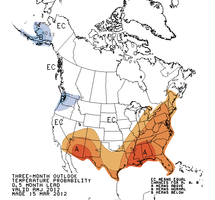
Since Snotel stations are the primary source of continuous snowpack formation and snowmelt rate data, the intent of these analyses is to refresh memories of snowmelt timing and rates experienced during these runoff seasons at these Snotel stations, most of which adjoin CODOS monitoring sites. Spring 2011 demonstrated the impact that late winter weather can have on Colorado snow-based water supplies, delaying the date of Peak SWE to as late as the end of May, producing record-setting SWE totals, and producing high melt rates just as solar inputs were maximizing. However, current NOAA Climate Prediction Center forecasts for April-May-June temperature and precipitation do not favor a repeat of Spring 2011 (below).
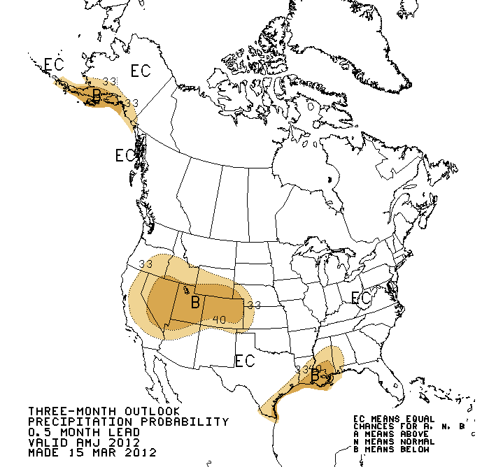
Rather, in striking contrast to last spring, Colorado’s substantially sub-par reservoir of SWE must be considered vulnerable to continued prolonged periods of dry, sunny weather combined with substantially reduced snow albedo. Should dry weather continue to dominate this spring season, and dust-enhanced snowmelt rates simply match or approach those observed during the past several seasons (see the above summary table and site-specific tables for each CODOS site), SAG may occur early at many of these Snotel sites producing early peak runoff flows, early passage of runoff center of mass, and steep descending limbs on regional hydrographs.
As of Tuesday afternoon forecasters at the Grand Junction National Weather Service anticipate continued warm and generally dry weather through the remainder of this week, with the warmest temperatures of the week on Saturday. The northern mountains may experience some light showers and more cloudiness than the southern half of the state. Snowmelt rates are likely to continue to increase through Saturday.
By Saturday afternoon an approaching trough and associated cold front are expected to generate another episode of strong pre-frontal SW’ly winds for the State. Winds will sustain and become W’ly on Sunday. Dust source areas in the Colorado Plateau may yield to these SW’ly and W’ly winds and produce another dust event beginning Saturday afternoon. This weekend’s cold front may, once again,
not deliver a significant winter storm. However, a return to cooler, more seasonable temperatures by Sunday/Monday does seem likely. In the absence of new snow with this weekend's cold front, a dry D7 event, should it occur, would generally fall directly onto already exposed and merged D6/D5/D4 dust, further reducing snowpack albedo throughout the Colorado mountains.
More soon,
Chris
Updates by Site:
Berthoud Summit |
Grand Mesa |
Grizzly Peak |
Hoosier Pass |
McClure Pass |
Park Cone |
Rabbit Ears Pass |
Senator Beck Basin |
Spring Creek Pass |
Willow Creek Pass |
Wolf Creek Pass
Combined Updates from all sites (pdf)
Chris Landry, Executive Director
clandry@snowstudies.org
Center for Snow and Avalanche Studies
PO Box 190, Silverton, CO 81433 USA
(970) 387-5080
www.snowstudies.org

