 CODOS Update for Grand Mesa:
VISITED May 1, 2012
Summary |
Snowpack |
Melt Rate |
Stream Flows |
Forecast |
Previous Update
Summary
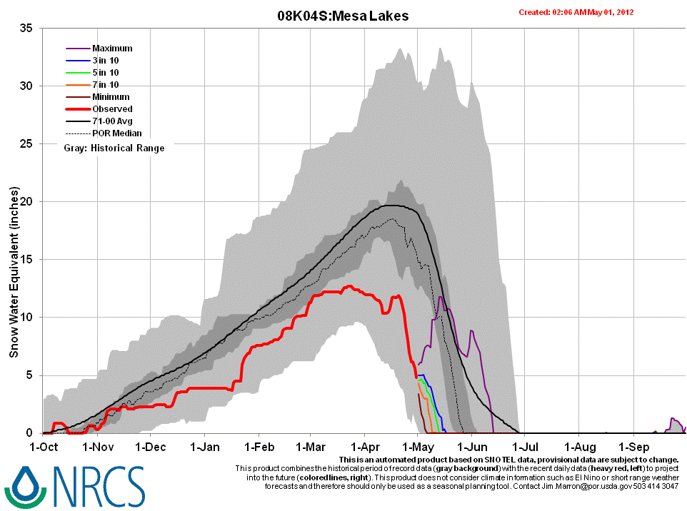
Since our prior site visit, on April 4th, Grand Mesa received additional snowfalls totaling some 2” of SWE at the Mesa Lakes Snotel and one additional dust deposition, D8 on April 6th, as dust-on-dust. Two significant storms in mid-month and several other small snowfalls resulted in periodic restoration of higher snow albedo, quickly followed by a return to dust-reduced albedo values. As of today, May 1, the Grand Mesa CODOS study site, in an open meadow at 10,630’, has, nonetheless, experienced a net loss of some 7” (179 mm) of SWE since April 4, but still retains 12.8” (325 mm) of SWE, in 32” (82 cm) of isothermal snow. Dust layers D8-4 were merged at the snowpack surface and a layer corresponding to layer D3 remains buried 20” below the surface. Dust concentrations and albedo reductions were comparable to those recently observed at Senator Beck Basin.
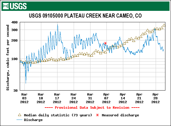
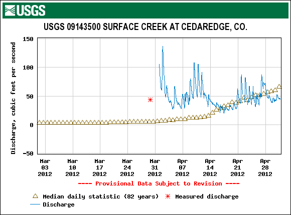
Given the early loss of this season’s scant low elevation snowcover on the flanks of Grand Mesa, snowmelt runoff is now dependent on similarly scant snowcover remaining on the Mesa’s top, where substantial areas of open ground are emerging. Streamflow data for Surface Creek began during a period of unusually high flows and is now in decline, back to sub-median levels. Plateau Creek experienced well above-average flows for most of March but is also now reporting flows well below median values.
SnowPack Discussion
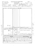
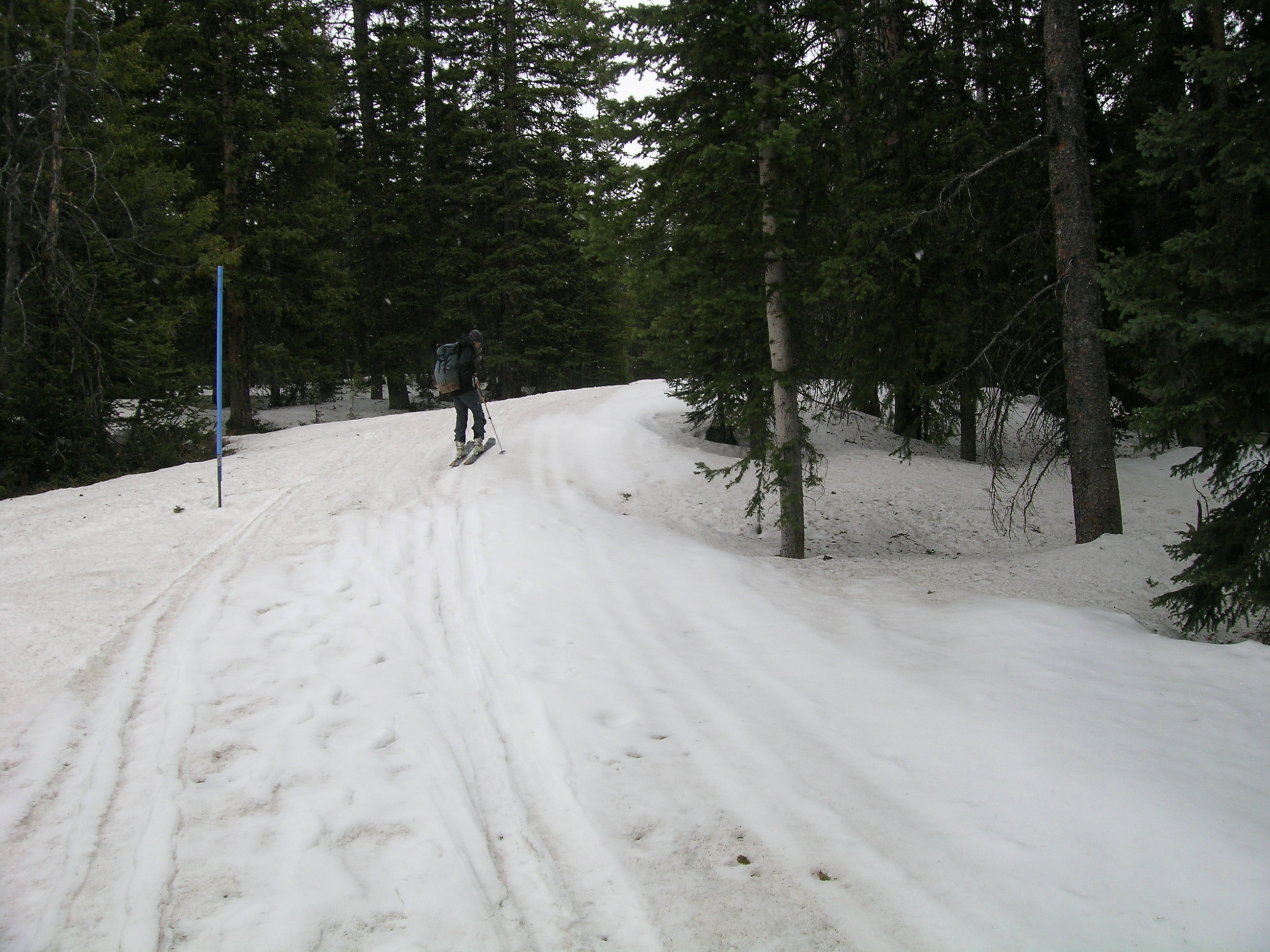
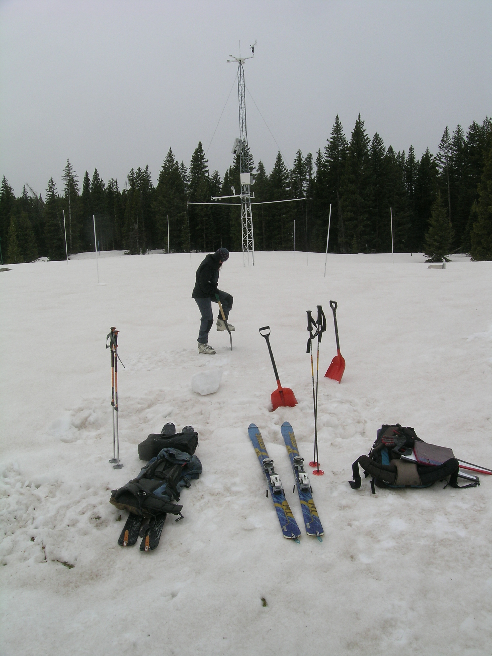
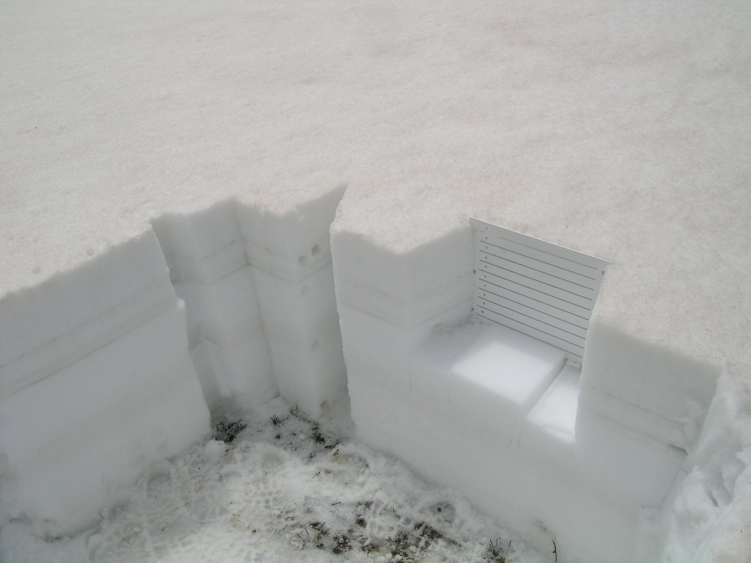
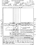
Our formal snow profile performed today, May 1, found a completely isothermal and wetted snowpack with a substantial, merged layer of dust fully exposed throughout the open meadow at our Grand Mesa CODOS site. On the nordic ski trail used to approach the study site, some small remnants of recent clean snow highlighted the contrast in albedo. Dust concentrations on the snowpack surface on Grand Mesa were as dark as or perhaps even slightly darker than those observed at Swamp Angel Study Plot on Monday, April 30th. A prominent dust layer corresponding to event D3-WY2012 is seen some 20” below the surface.
Since our prior April 4th snowpit, total snowcover depth and snowpack SWE had decreased by 16” and 7”, respectively, despite additions of some 2” of SWE and corresponding amounts of new snow during April. This snowpit plot still retains 32” of snow containing over 12” of SWE, but spatial variation of snowcover and SWE is substantial in the meadow containing our study site, and on the Grand Mesa at large, due to wind redistribution of snow. Our snow profiles are performed in close proximity to minimize wind-caused variability from pit to pit.
| May 1, 2012: | |||
 |
 |
 |
 |
| April 4, 2012: | |||
 |
|||
Melt Rate
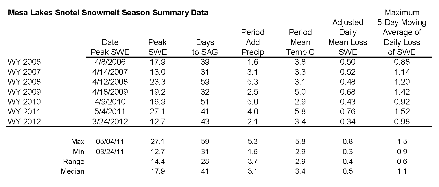
Following Peak SWE of 12.7” on March 24th, moderate melt rates of 0.2-0.4” per day, and even some small gains in SWE, prevailed at the nearby Mesa Lakes Snotel before SWE losses began to accelerate on April 20th, enhanced by the re-emergence of dust. Melt rates recently exceeded 1.0”/day and the Mesa Lakes site is rapidly approaching "snow all gone" (SAG) with only some 3.6” of SWE remaining, as of midnight April 30th.
Stream Flows
WY2012 streamflow data for the USGS Surface Creek at Cedaredge gauge began during a period of unusually high flows in early April. Flows moderated back to normal levels during the unsettled weather in mid-April before showing a weak surge later in the month. Given the advanced ablation of the sub-par snowpack , Surface Creek is now in decline, back to sub-median levels, despite low snow albedos and warm weather. On the north side of the Grand Mesa, the USGS Plateau Creek near Cameo gauge was reporting median flow levels on March 1st but soon surged to up to 3x median flows at times and remained well above median levels throughout March. After a short surge in early April, flows fell and have remained generally below median levels ever since, perhaps in part due to increasing withdrawals and storage upstream.
Forecast
The National Weather Service Grand Junction office expects unsettled conditions with chances of rain and snow showers and thunderstorms through Wednesday before a drier, warmer, southwesterly flow regime arrives on Thursday. Increasing winds and reduced humidity will increase fire danger late this week. Then, by the weekend, models are beginning to converge on a solution showing a large system now in the Gulf of Alaska splitting as it enters the western US, with the southerly element tracking through the desert southwest. However, some uncertainty remains on the impacts of that system on temperature trends and precipitation chances for the Colorado mountains next week.