 CODOS Update for Grizzly Peak:
visited April 10, 2012
Summary |
Snowpack |
Melt Rate | Stream Flows |
Earlier Updates
Summary
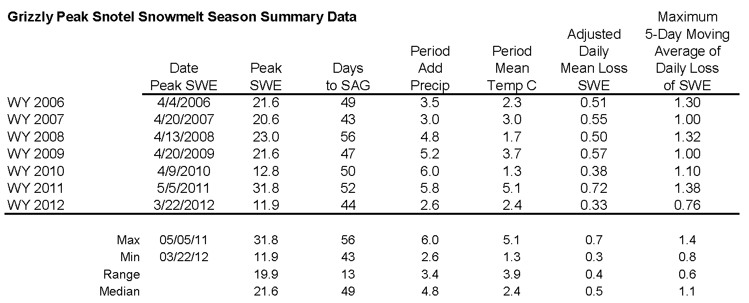
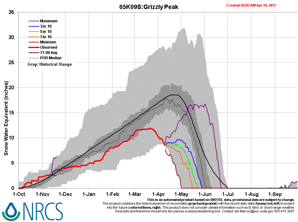
Sustained periods of unseasonably warm air temperatures and exposed dust at the snowpack surface during late March and early April 2012 have, together, initiated accelerating rates of snowmelt and SWE loss at some, but not all, CODOS Snotel sites. Some CODOS Snotel sites report significant declines in SWE approaching the lowest values in the period of record (for a given date) or even falling outside of the historic range. Those sites may have experienced Peak SWE for WY 2012 in early or mid-March. Recent CODOS snowpits near those CODOS sites mirror those losses of SWE.
In contrast, other CODOS Snotel sites and CODOS snowpits show only small losses of SWE. At those sites, energy inputs from warm air and direct absorption of solar energy by dust at the snowpack surface was consumed in warming the snowpack towards an isothermal state at 0° C, as a precursor to the loss of SWE and onset of snowmelt runoff. Since our prior site visit on March 15 the snowpack at the Grizzly Peak CODOS site has lost all cold content and is now isothermal.
The National Weather Service expects warming weather in the Colorado mountains through Wednesday with strong SW’ly winds developing on Wednesday afternoon ahead of a cooler but largely dry airmass. Unsettled and cooler weather will finish the week and run through the weekend, including chances for rain and/or snow showers each day.
SnowPack Discussion
The snowcover at the Grizzly Peak Pass CODOS site has undergone complete warming to 0°C thoughout since our March 15 snowpit and is rapidly melting. We walked to this site on dry ground for much of the approach. Dust loading at Grizzly Peak Pass is more intense than at Hoosier Pass, but still less intense than at our Senator Beck Basin study sites. Reduction in snow surface albedo has been sufficient to absorb additional solar energy at the snowpack surface and contribute to warming and ablation of the snowcover. Again, as noted in prior discussions, considerable open ground may be contributing ‘local’ dust and vegetation debris to the snowpack in these Front Range locales, compounding the effects on albedo produced by Colorado Plateau dust.
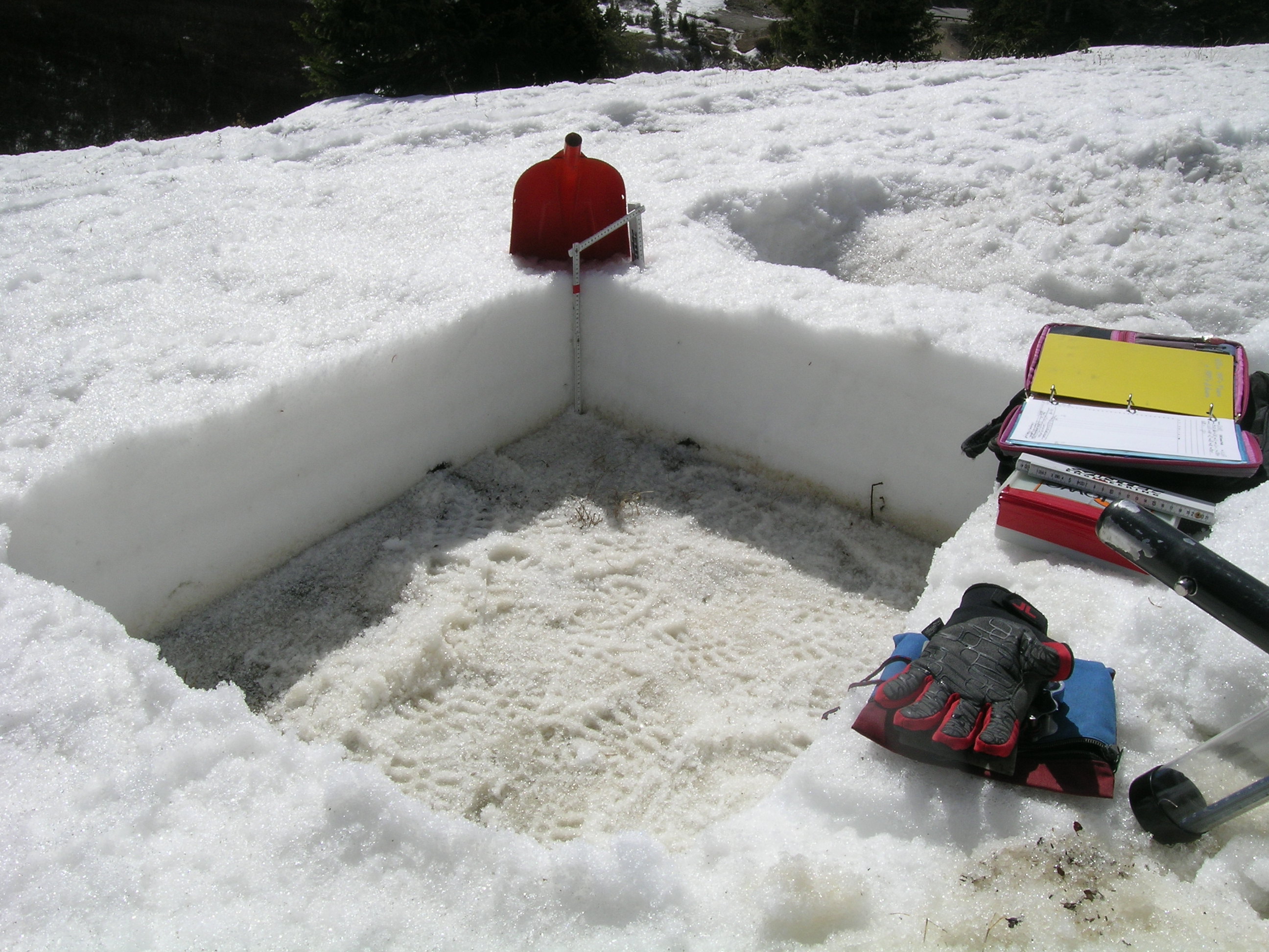
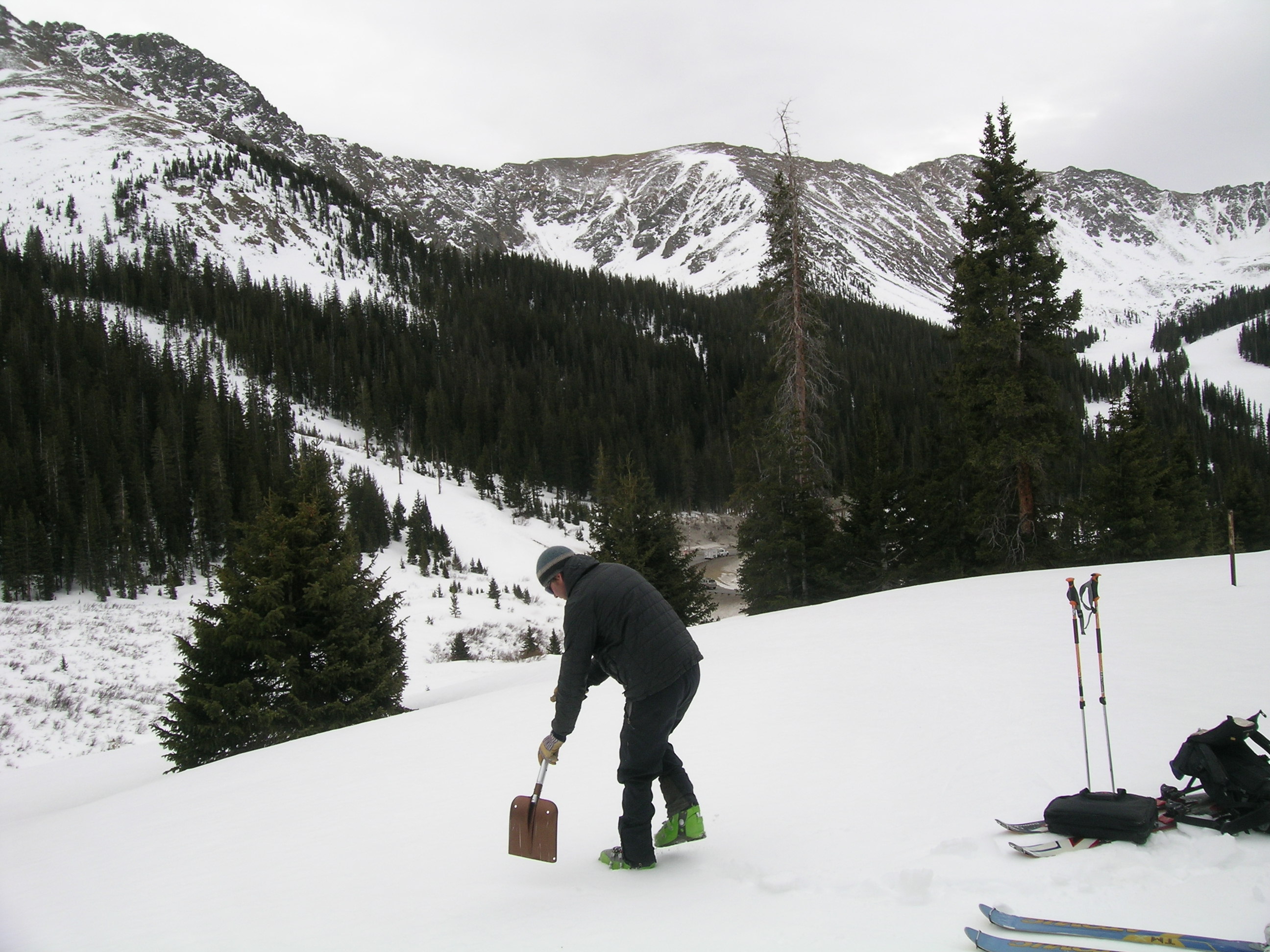
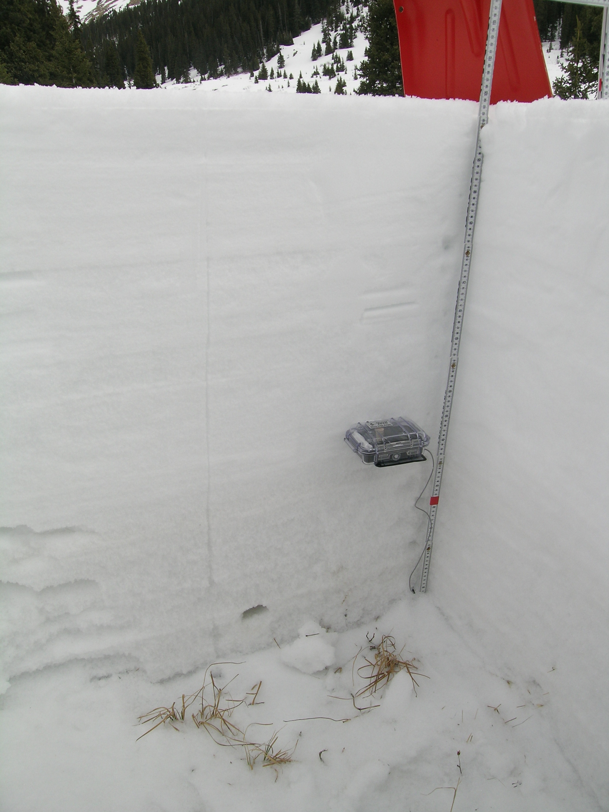
On March 15th the snowpack at our Grizzly Peak CODOS snowpit site was 41” (104 cm) deep and most of the snowpack consisted of very weak “depth hoar” grains; mean snowpack temperature was -4.6 C. Dust event D4 was clearly evident on the snow surface at the snowpit and in terrain around Loveland Pass. SWE content in the snowpit was 12.2” (311 mm) and mean density of the snowpack was 290 kg/m3 (29.0% water content). As a result of the subsequent, prolonged period of warm, dry, and sunny weather, and some additional small reductions in snow albedo from additional dust events, the snowpack on April 10th was fully isothermal (0°C), with wet or very wet snow throughout. Total SWE in this pit was only 5.7” (144 mm), a loss of 6.6" (167 mm) since March 15th; total snow depth was down to 14” (35 cm) and density had risen to 379 kg/m3 (37.9% water content).
| April 10, 2012: | |||
 |
 |
 |
 |
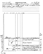
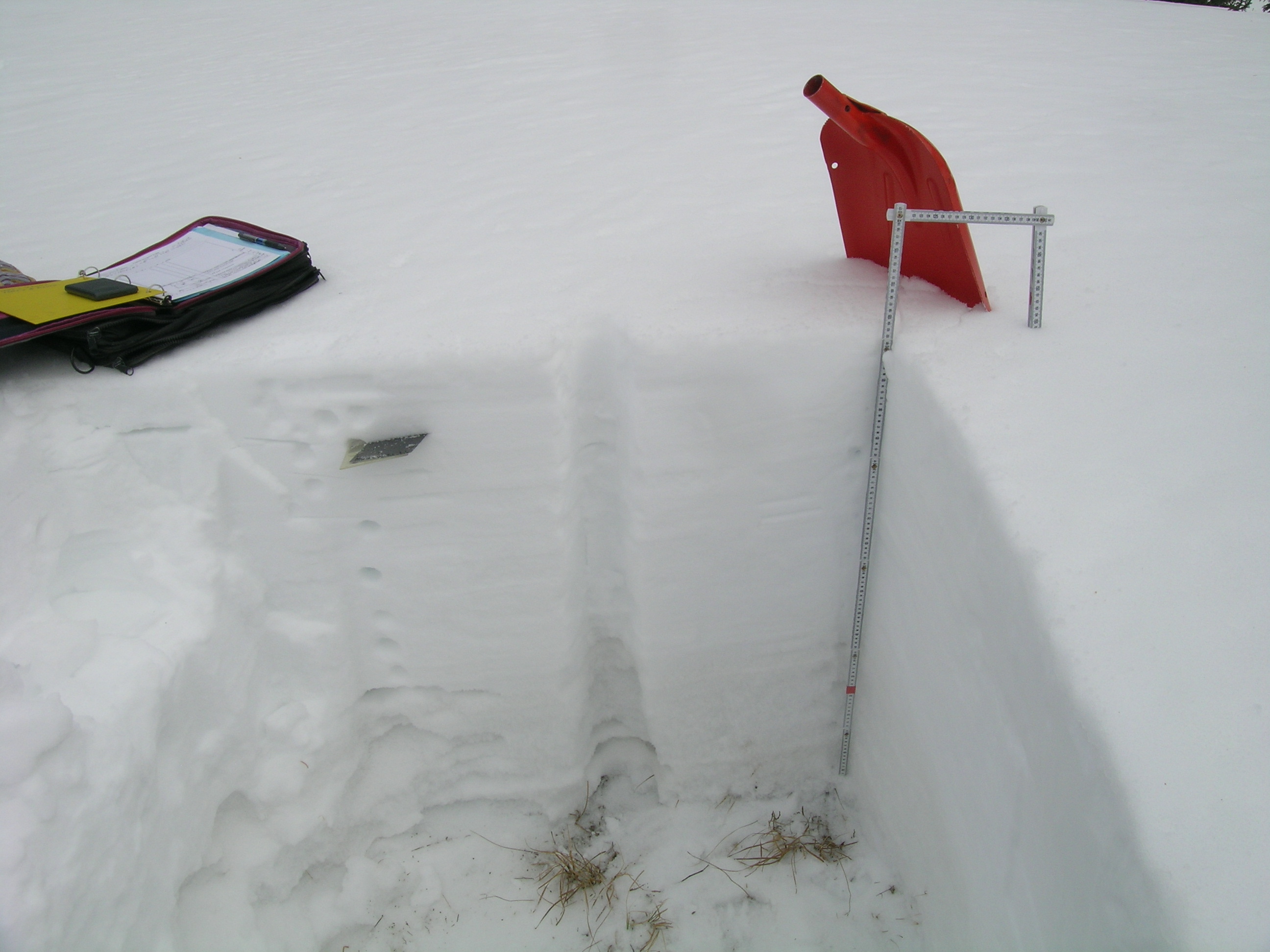
Pit profile |
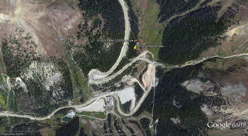
Grizzly Peak Snotel |
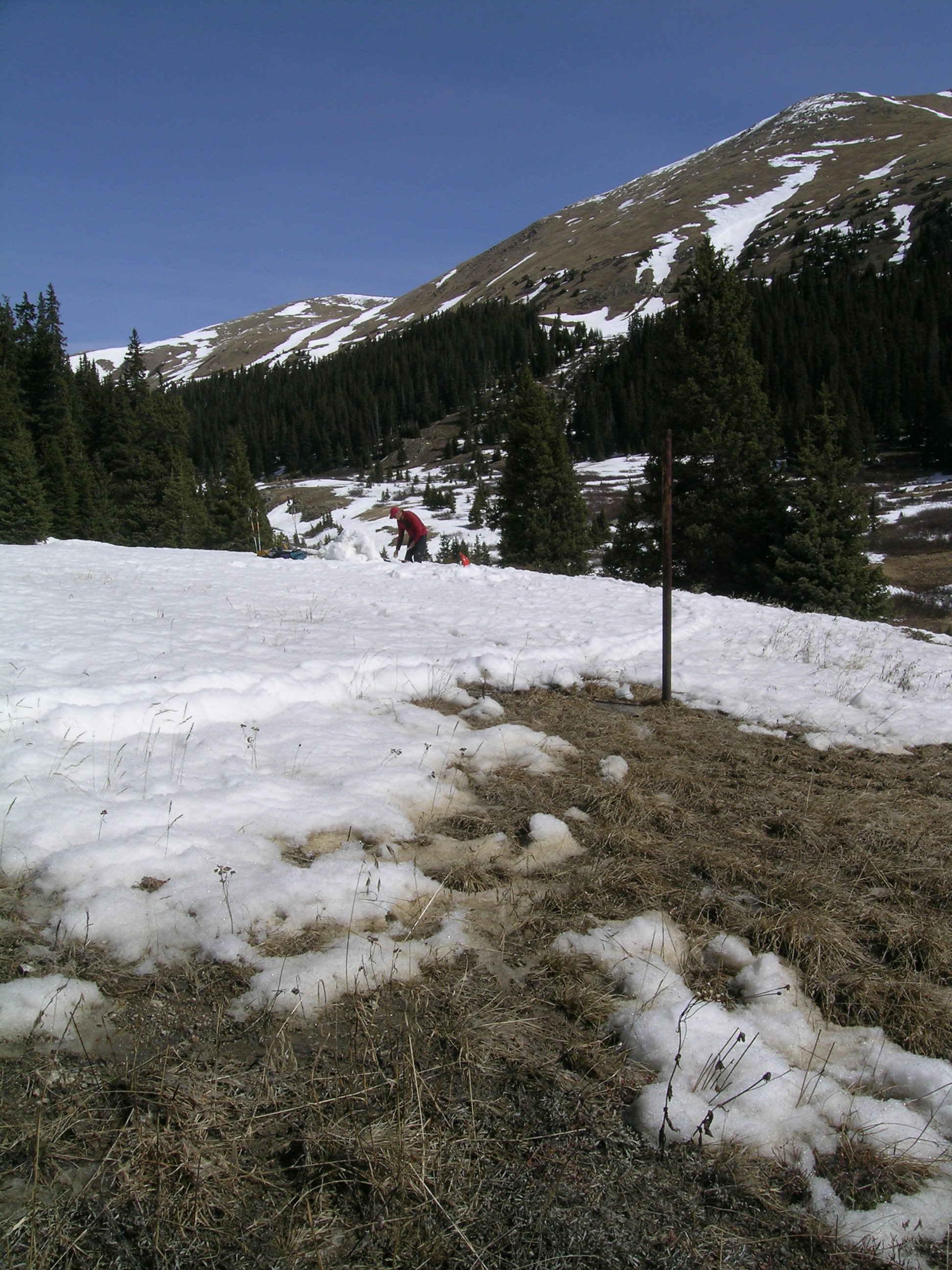
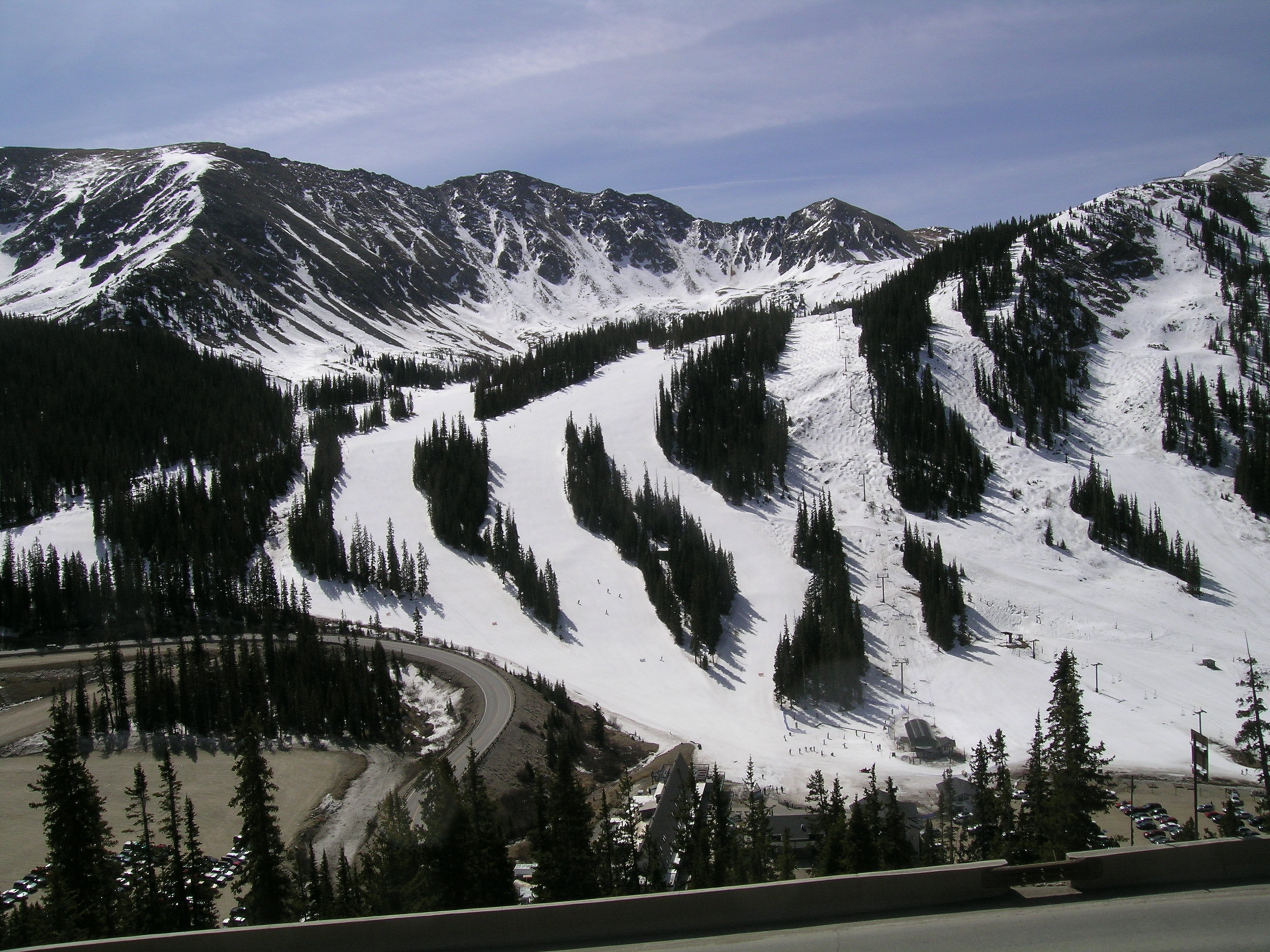
Pit with A-Basin in Background |
Completed pit |
 |
 |
 |
|
Patchy ground near pit site |
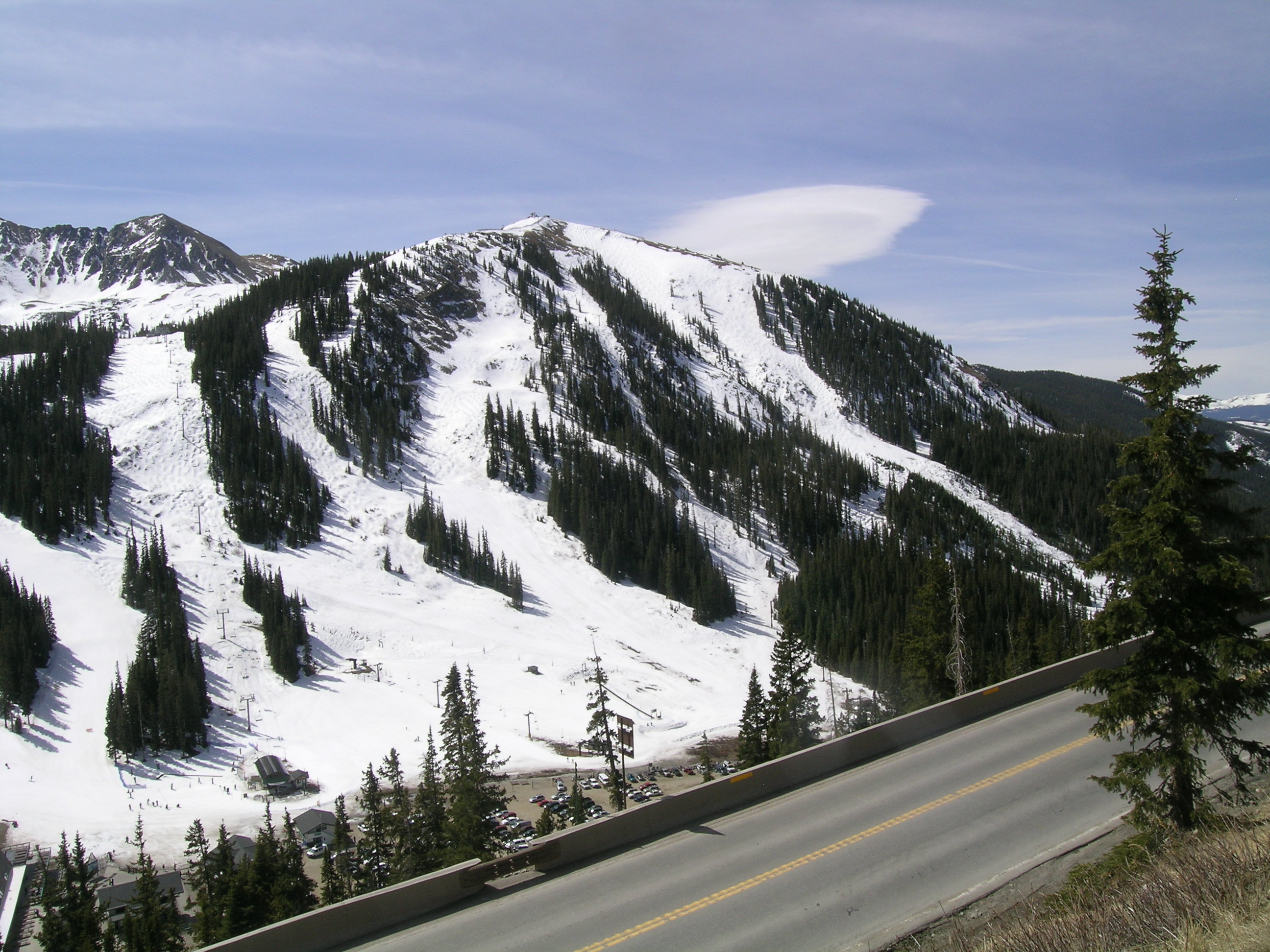
A-Basin from road above pit area |
||
| March 15, 2012: | |||
 |
 |
 |
 |
Melt Rate
Grizzly Peak Snotel has reported a loss of almost 4"of SWE since our last site visit on March 15, 2012. Recent data shows melt rates approaching the 2010 mean daily SWE loss rate. As discussed above, at a loss of 6.6" of SWE, melt rates in the open meadow where we dig our CODOS snowpits. This differential between a tree-shaded Snotel site and a nearby open meadow is typical. If melt rates at the Grizzly Peak Snotel continue their recent acceleration, SWE values may fall below the lowest quartile inthe period of record.
Stream Flows
We cannot interpret currently posted streamflow data for Blue River.