 CODOS Update for McClure Pass:
Visited April 11, 2012
Summary | Snowpack | Melt Rate | Stream Flows | Previous Update
Summary
Sustained periods of unseasonably warm air temperatures and exposed dust at the snowpack surface during late March and early April 2012 have, together, initiated accelerating rates of snowmelt and SWE loss at some, but not all, CODOS Snotel sites. Some CODOS Snotel sites report significant declines in SWE approaching the lowest values in the period of record (for a given date) or even falling outside of the historic range. Those sites may have experienced Peak SWE for WY 2012 in early or mid-March. Recent CODOS snowpits near those CODOS sites mirror those losses of SWE.
In contrast, other CODOS Snotel sites and CODOS snowpits show only small losses of SWE. At those sites, energy inputs from warm air and direct absorption of solar energy by dust at the snowpack surface was consumed in warming the snowpack towards an isothermal state at 0° C, as a precursor to the loss of SWE and onset of snowmelt runoff. As of our site visit on April 11, and since our prior site visit on March 16, snowcover has disappeared from the McClure Pass CODOS site, and the nearby Snotel has lost snowcover over a portion of the pillow.
Strong SW’ly winds and showers developed on Wednesday afternoon ahead of a cooler airmass bringing unsettled and cooler weather for the remainder of this week, with chances for snow showers each day and temperatures below seasonal norms. Chances increase for more significant snow amounts over the weekend and may result in state-wide restoration of higher snow albedo. Showers may continue into the early work week but high pressure is expected to return to the State by mid-week with dry and warmer weather.
SnowPack Discussion
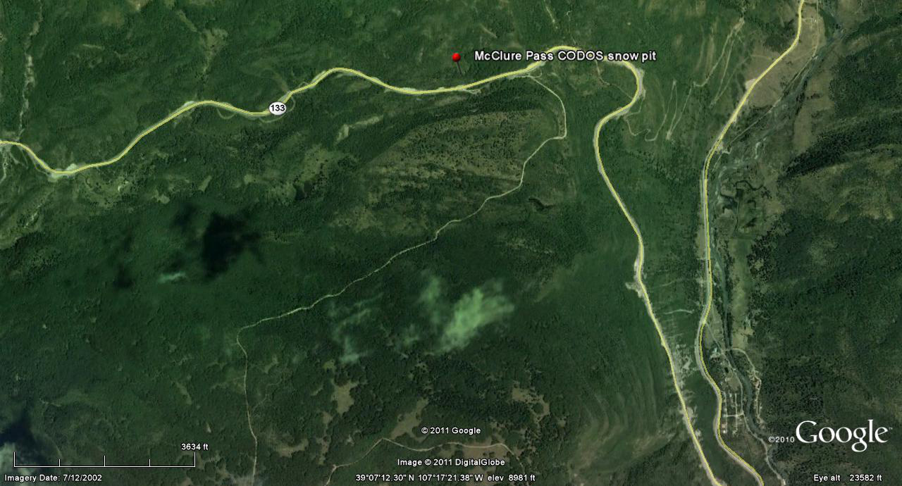
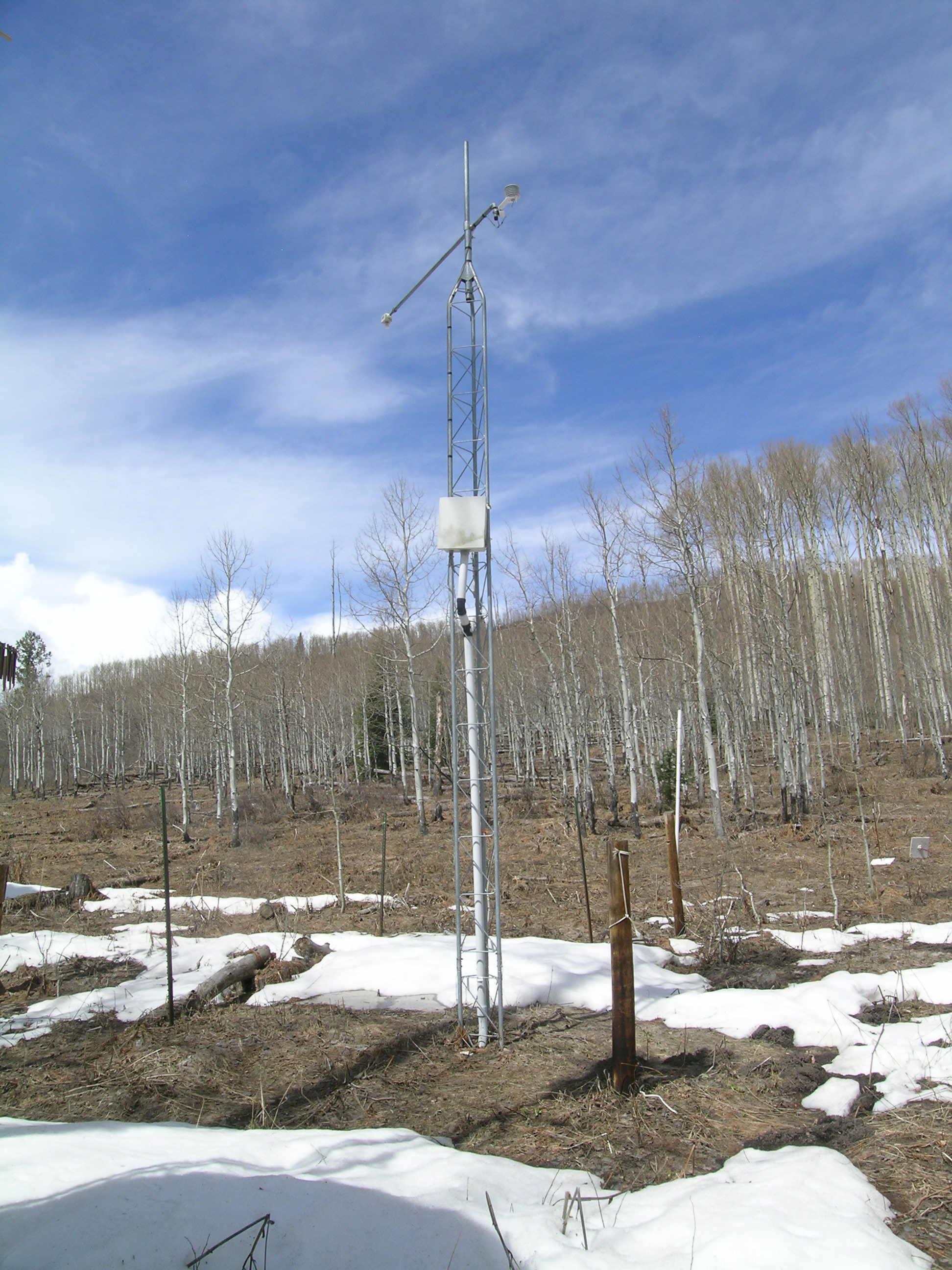
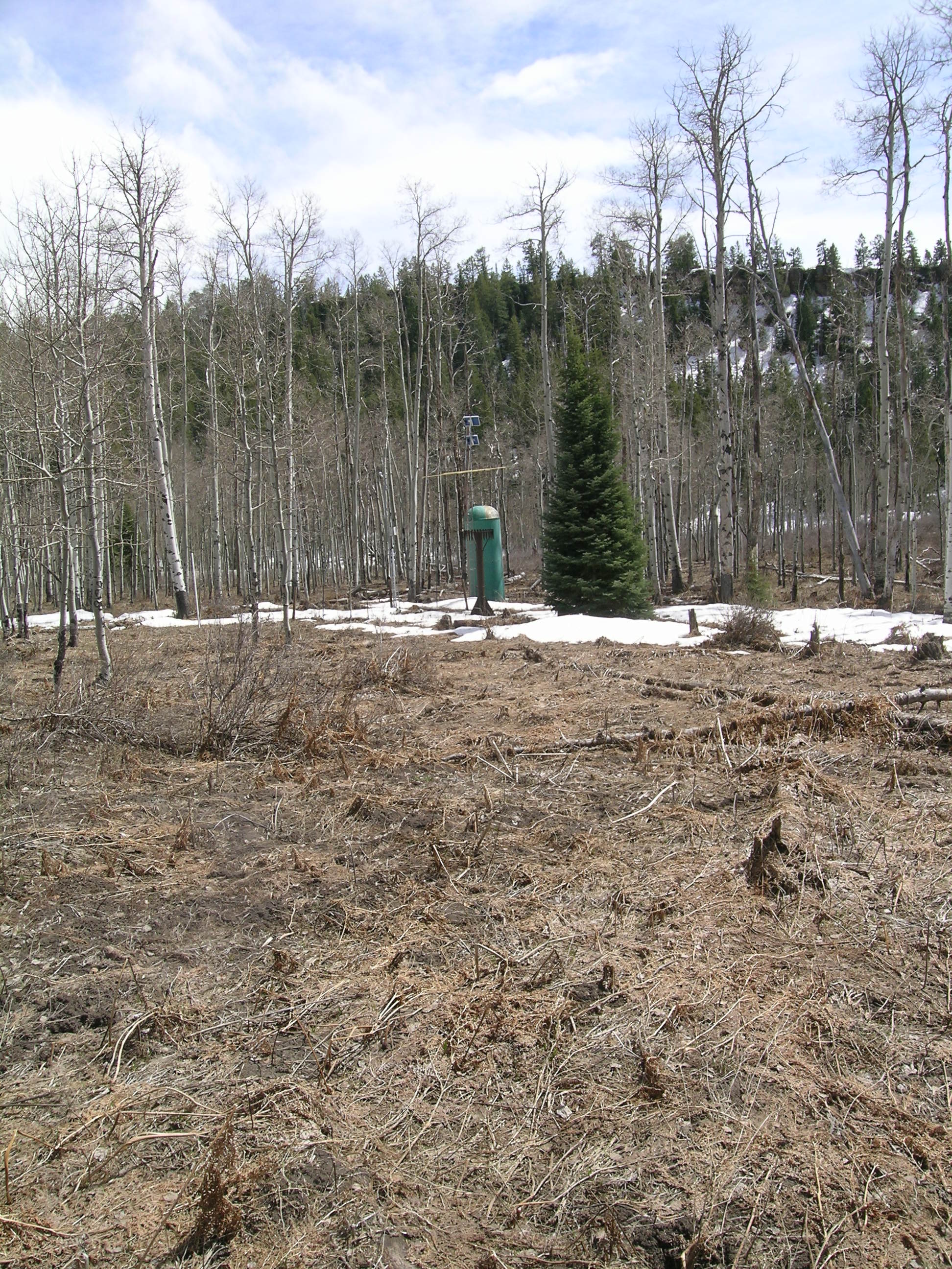
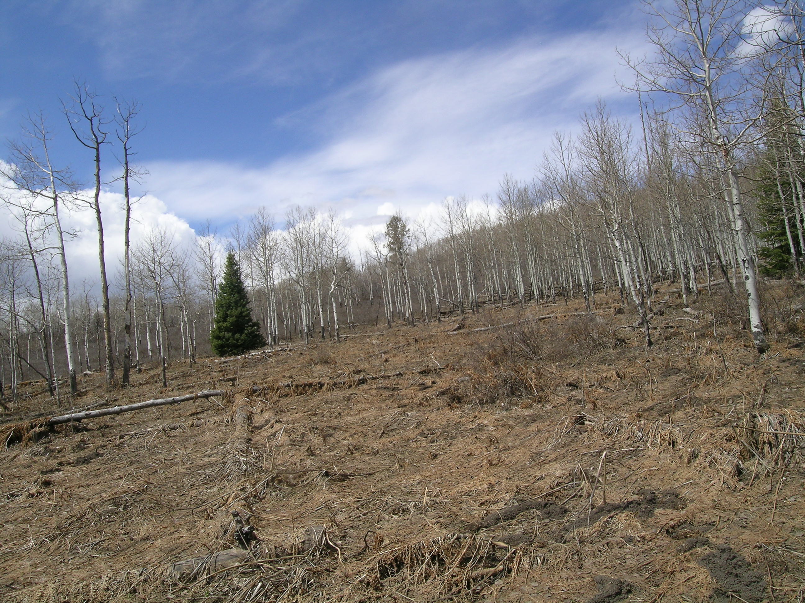
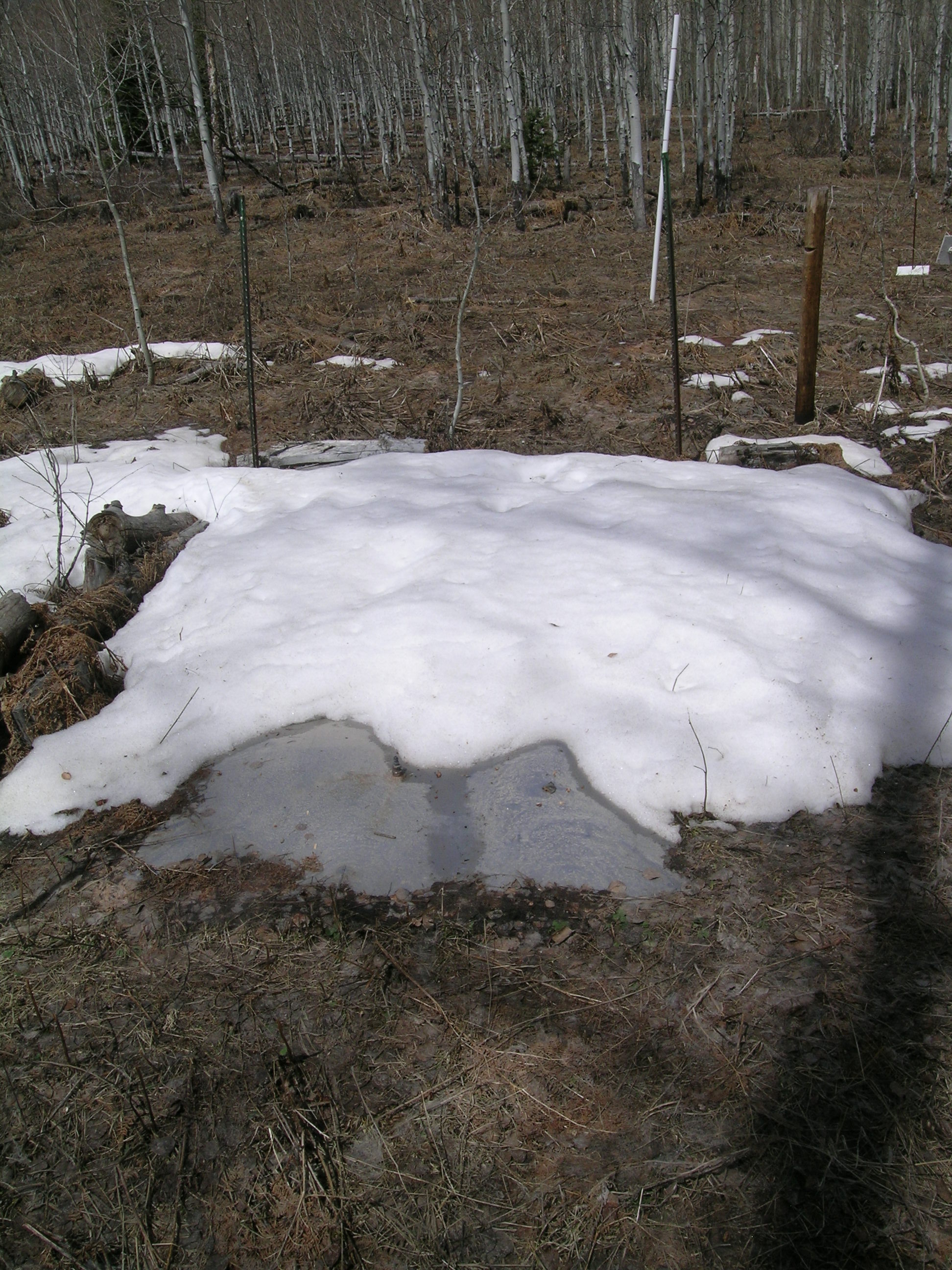
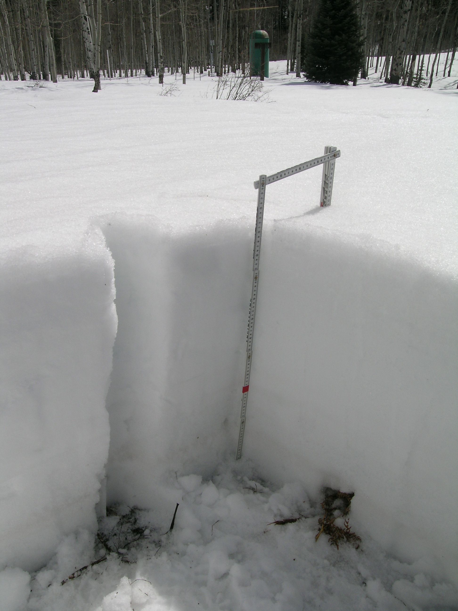
Snowcover has completely disappeared from the CODOS McClure Pass snowpit site, located in an open meadow adjoining the McClure Pass Snotel site, itself in an aspen grove. As of our site visit on April 11th, virtually the only snow in this immediate vicinity was within the Snotel site itself, which was reporting 6” of snow containing 3.5” of SWE at the time of our visit. Even then, the snowcover has melted off of the southern edge of the snow pillow, as seen in the photo below, and this Snotel site will report “snow all gone” in a day or two, absent a significant winter storm. Snowcover in the higher alpine terrain of the upper Crystal River valley appeared, from a long distance, to present reduced albedo comparable to that observed on Grand Mesa – less reduction than observed in Senator Beck Basin, but more than observed at the dustier Front Range sites.
| April 11, 2012: | |||||
 |
 |
 |
 |
 |
 |
McClure Snotel |
McClure CODOS pit site with 'Snow All Gone | Snotel SWE pillow | Near McClure Pass | Muddy Creek Reservoir | |
| March 16, 2012: | |||||
 |
 |
 |
 |
 |
|
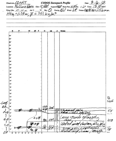
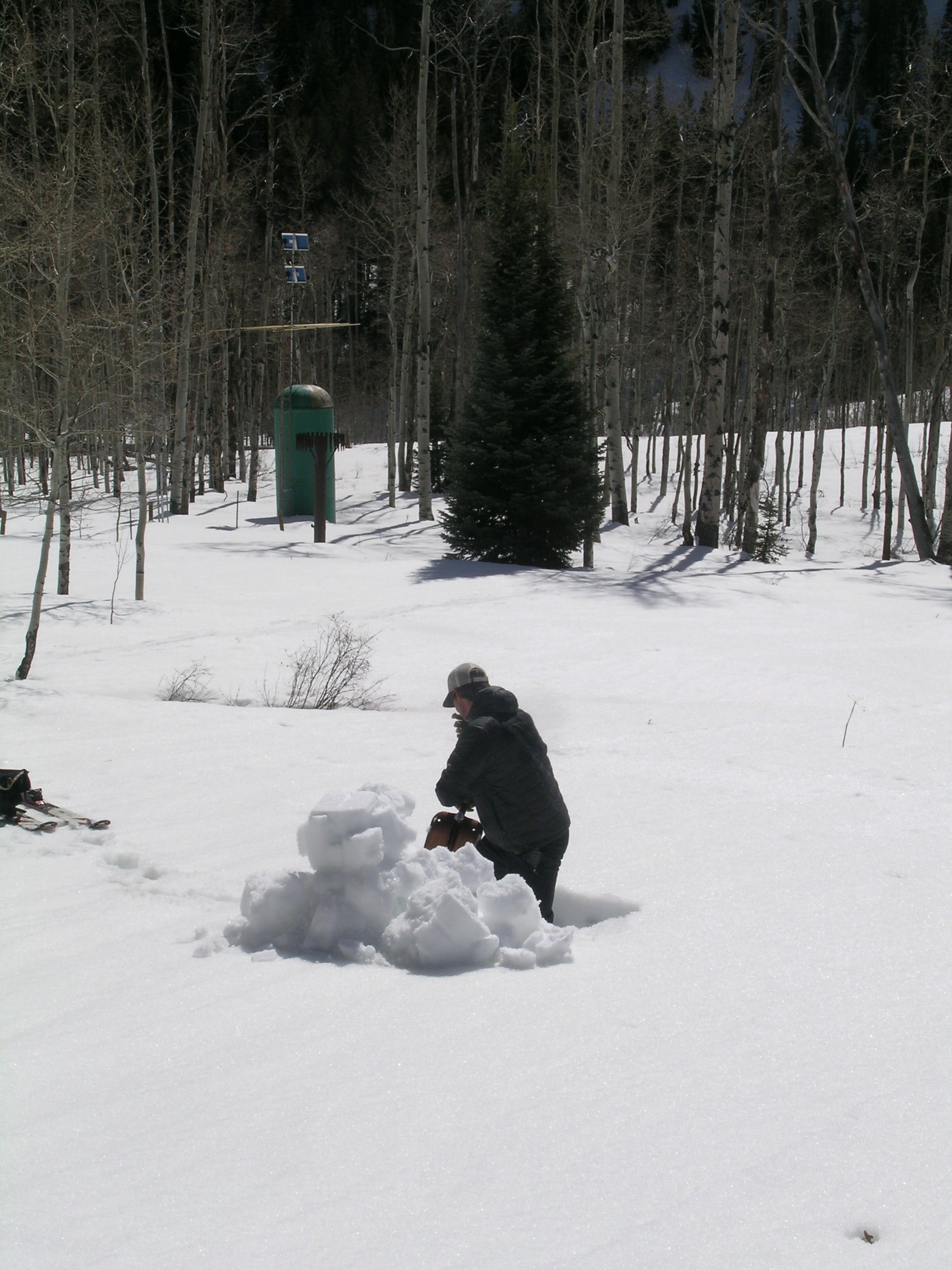
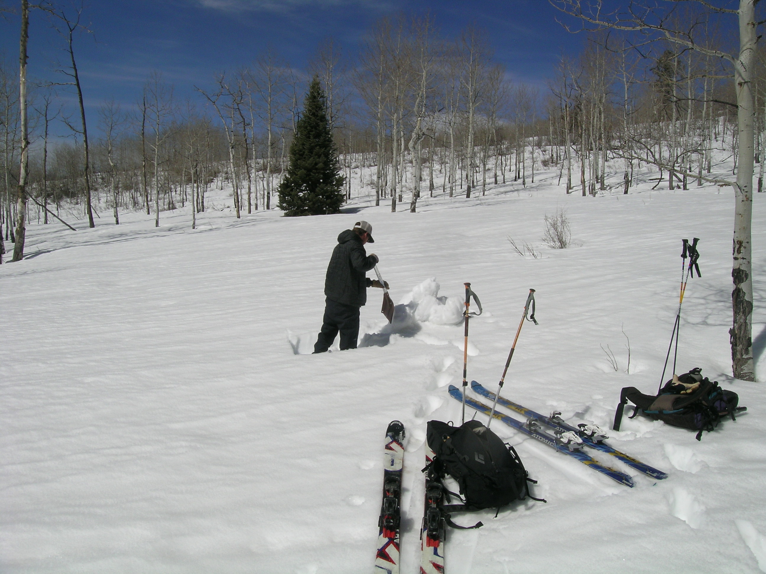
| Pit profile from March 16 | Digging March 16 pit | Near McClure Pass | |||
Melt Rate
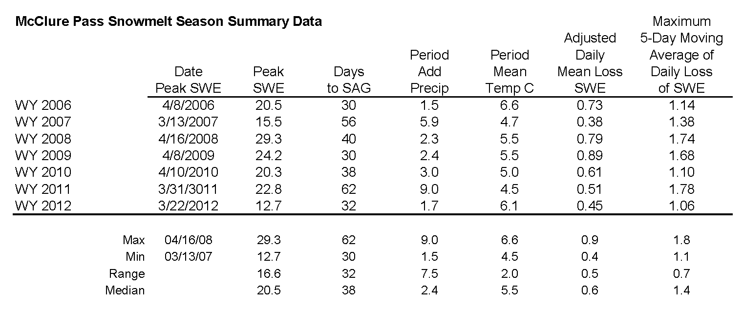
Peak SWE of 12.7" occurred a few weeks earlier than normal at the McClure Pass Snotel, on March 20th, as a result of the snowfall that delivered dust layer D5. That storm was the last significant snowfall at this site and, barring a major winter storm in the next few days, snow all gone (SAG) is imminent or has already occurred (no valid SWE data and only 1” of snow depth reported on the morning of April 12). Since early April, SWE values have fallen below the lowest values reported in the period of record at this Snotel. Since Peak SWE melt rates have averaged 0.42” per day but reached rates as high as 1.0” per day in recent days. Rain on the afternoon of April 11 may have hastened the ablation of the very wet snow remaining on the snow pillow. However, as at other CODOS sites, even though the McClure Pass Snotel site is only weakly shaded by aspen trees, the melt rates in the open meadow where CODOS snowpits are dug were higher and the snowpit plot reached SAG earlier than the Snotel site, by some unknown number of days prior to our visit on April 11th.
Melt rates at the higher elevation Schofield Pass Snotel in the Crystal River headwaters (see snowmelt analysis table and SNOTEL graph) have been slower (but no SWE data has been reported since April 8th), since the snowpack at that elevation may have only recently become isothermal or remains just short of isothermal.
Farther east, at the headwaters of the Roaring Fork River, the Independence Pass Snotel (see snowmelt analysis table and SNOTEL graph) has reported substantial snowmelt since mid-march, losing more than 2.5” of SWE since peaking at just 9.9” on March 19th during the storm that delivered dust event D5. Average date of Peak SWE is April 11th. Although no valid SWE data have been posted since April 9th, prior recent data fall well below the lowest values for the period of record at this site. Observers in the Aspen area verified most/all dust events logged at Senator Beck Basin, although the intensity of those events in the Aspen area, relative to Senator Beck Basin, is not known.
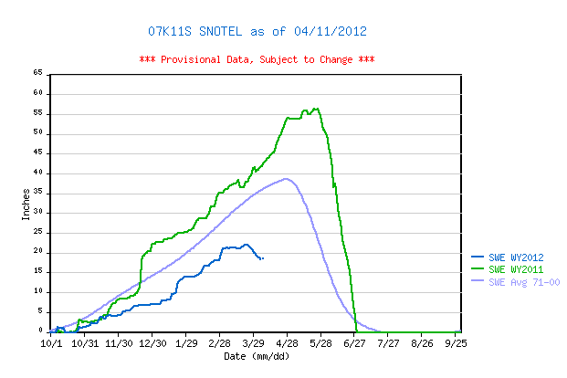
Finally in the Eagle River headwaters, the Vail Mountain Snotel (see SNOTEL graph) is already reporting SAG, well ahead of the average date of Peak SWE. Peak SWE of only 11.3” occurred in early March and was entirely ablated by early April (data currently show negative SWE values).
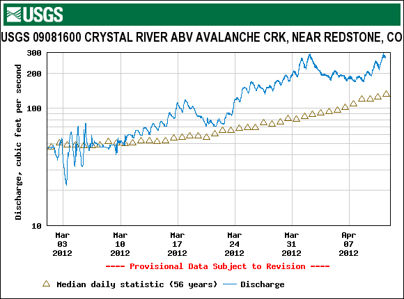
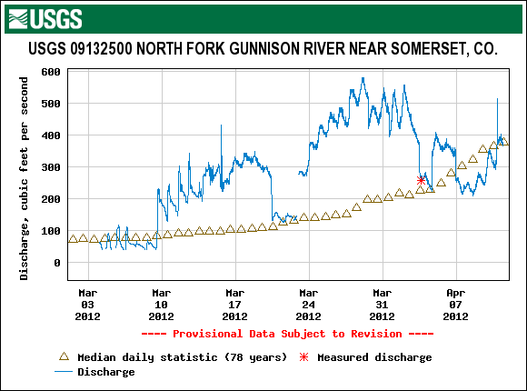
Stream Flows
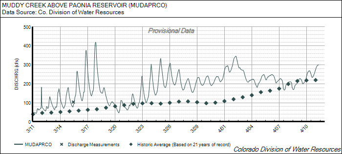
The following hydrographs of Muddy Creek, the Crystal River, and the North Fork of the Gunnison show very similar patterns of surge and retreat in recent weeks. Following a decline in flows after the mid-March storm delivering dust layer D5, significant surging in late March produced high flows at all three gauges, compared to median levels for that period. Unsettled weather in early April brought cooler temperatures, small amounts of new snow that briefly increased snow albedo, and frequently cloudy skies, dampening the late March surges. Then, a return to sunny and warm weather initiated a new surge, once again producing flows well above median values. Flows are likely to decline again, during the period of unsettled weather later this week and weekend, and new snow may delay the re-emergence of the merged dust layers observed at the old snowpack surface during our site visit on April 11th resulting in an initially slowly accelerating surge thereafter.
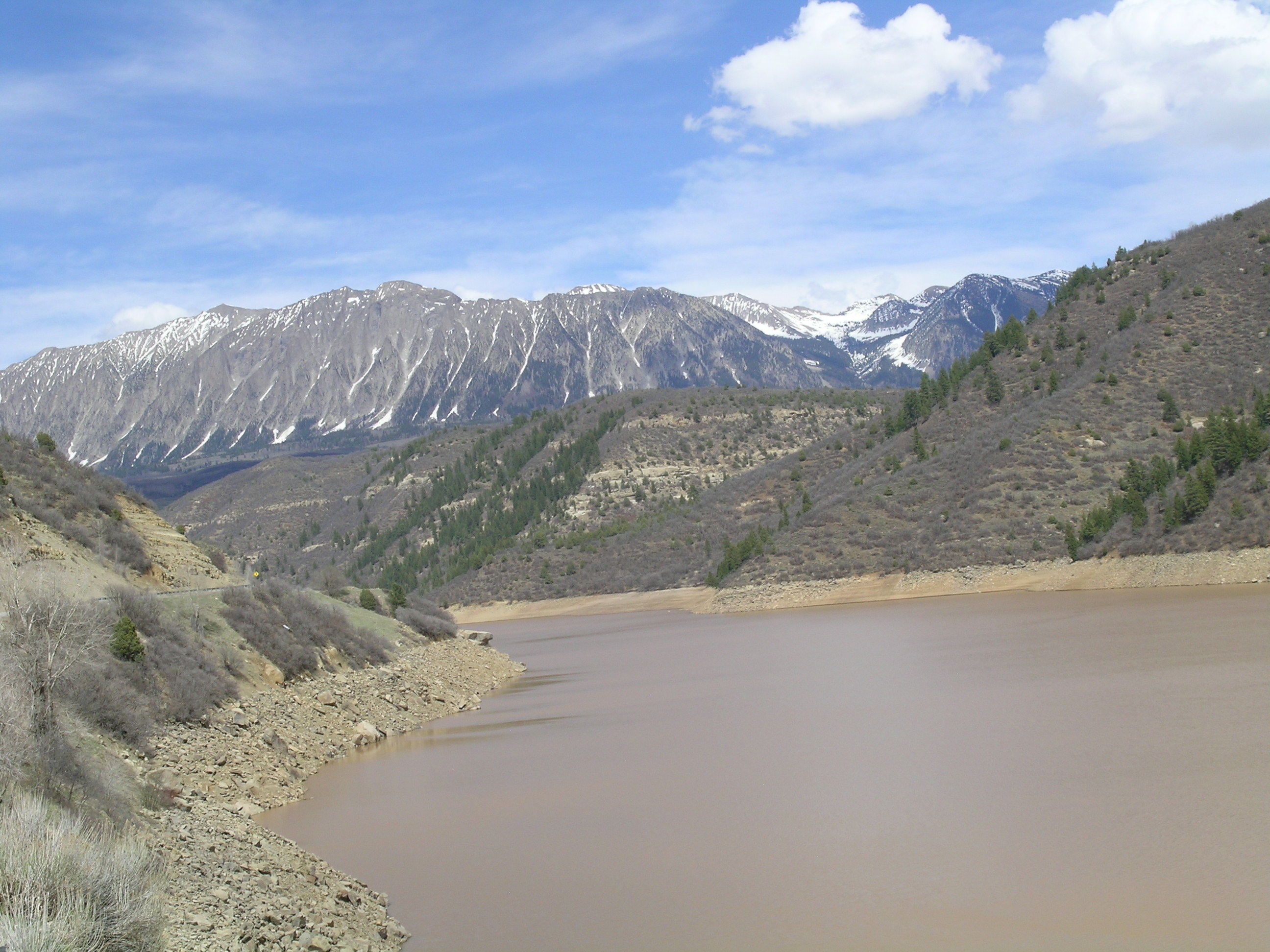
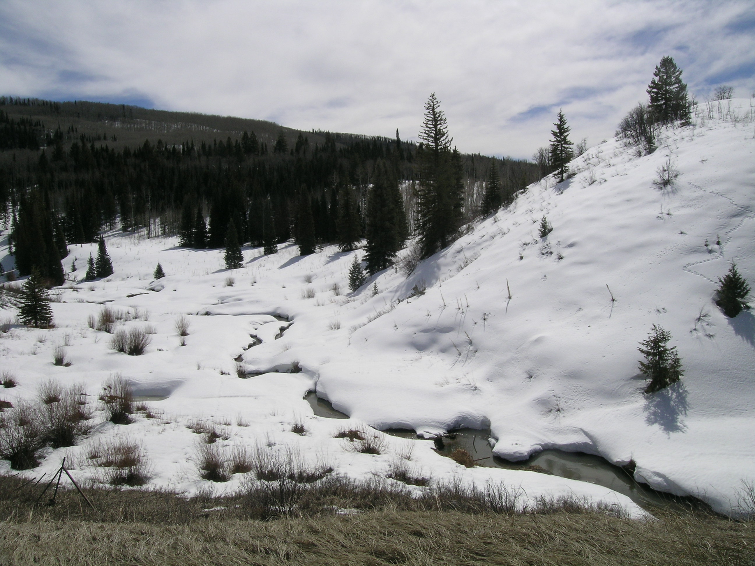
The Bureau of Reclamation reports that Muddy Creek Reservoir was 29% full as of April 10th, 99.3% of average storage for this date. The photo above shows the reservoir pool at mid-day on April 11th with the western aspects of the alpine Ragged Mountains in the distance. Snowcover on those western aspects is virtually gone, but more northerly aspects do retain a high percentage of snowcover above treeline, albeit thin snowcover. Given the very early onset of snowmelt in this watershed (our snowpit on March 16 at McClure Pass showed that the snowpack on that slightly south-facing slope had been isothermal for some time), and scant remaining snowcover in the comparatively low-elevation, generally west-facing Muddy Creek watershed, it does seem possible that runoff center of mass has passed or will very soon pass through the Muddy Creek stream gauge. The Crystal River and North Fork of the Gunnison will benefit from more extensive remaining snowcover in their larger and higher-elevation headwaters containing a larger proportion of north-facing terrain than Muddy Creek.
Hydrograph for past 30 days (Feb 26 - March 27) on Muddy Creek