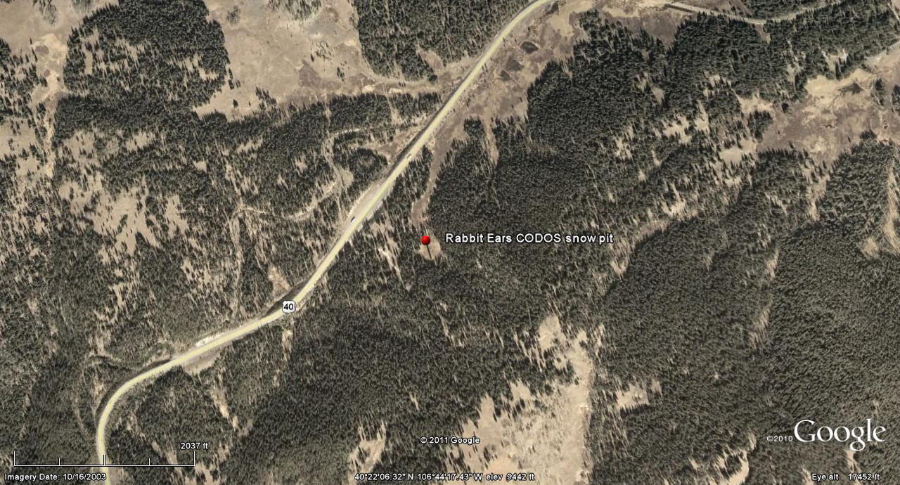
 CODOS Update for Rabbit Ears Pass:
Visited APril 10, 2012
Summary | Snowpack | Melt Rate | Stream Flows | Previous Update
Summary
Sustained periods of unseasonably warm air temperatures and exposed dust at the snowpack surface during late March and early April 2012 have, together, initiated accelerating rates of snowmelt and SWE loss at some, but not all, CODOS Snotel sites. Some CODOS Snotel sites report significant declines in SWE approaching the lowest values in the period of record (for a given date) or even falling outside of the historic range. Those sites may have experienced Peak SWE for WY 2012 in early or mid-March. Recent CODOS snowpits near those CODOS sites mirror those losses of SWE.
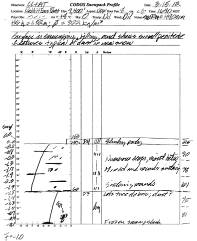
In contrast, other CODOS Snotel sites and CODOS snowpits show only small losses of SWE. At those sites, energy inputs from warm air and direct absorption of solar energy by dust at the snowpack surface was consumed in warming the snowpack towards an isothermal state at 0° C, as a precursor to the loss of SWE and onset of snowmelt runoff. Since our prior site visit on March 14 the snowpack at the Rabbit Ears Pass CODOS site has lost its remaining cold content and is now fully isothermal.
The National Weather Service expects warming weather in the Colorado mountains through Wednesday with strong SW’ly winds developing Wednesday afternoon ahead of a cooler but largely dry airmass. Unsettled and cooler weather will finish the week and run through the weekend, including chances for rain and/or snow showers each day.
SnowPack Discussion
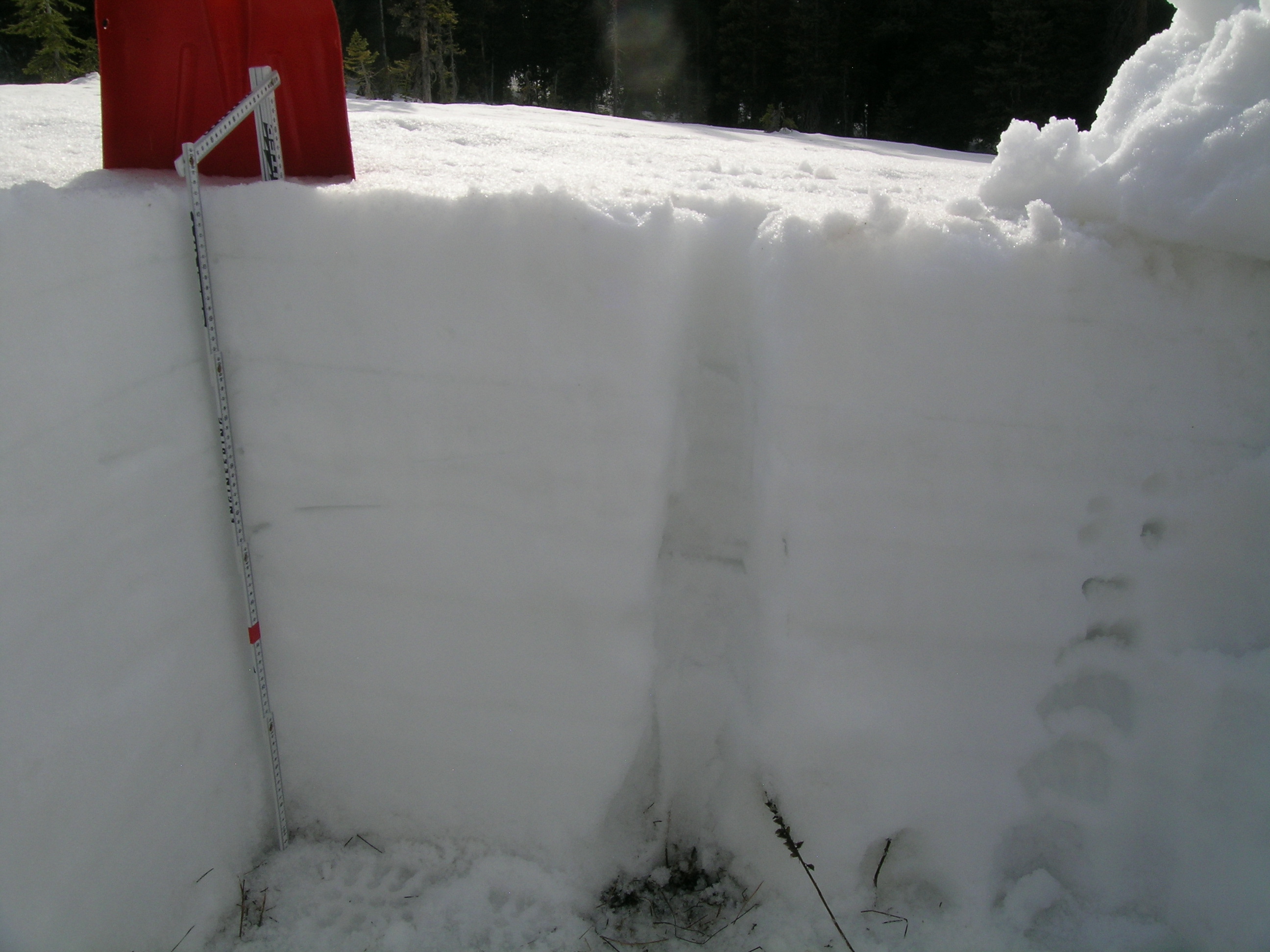
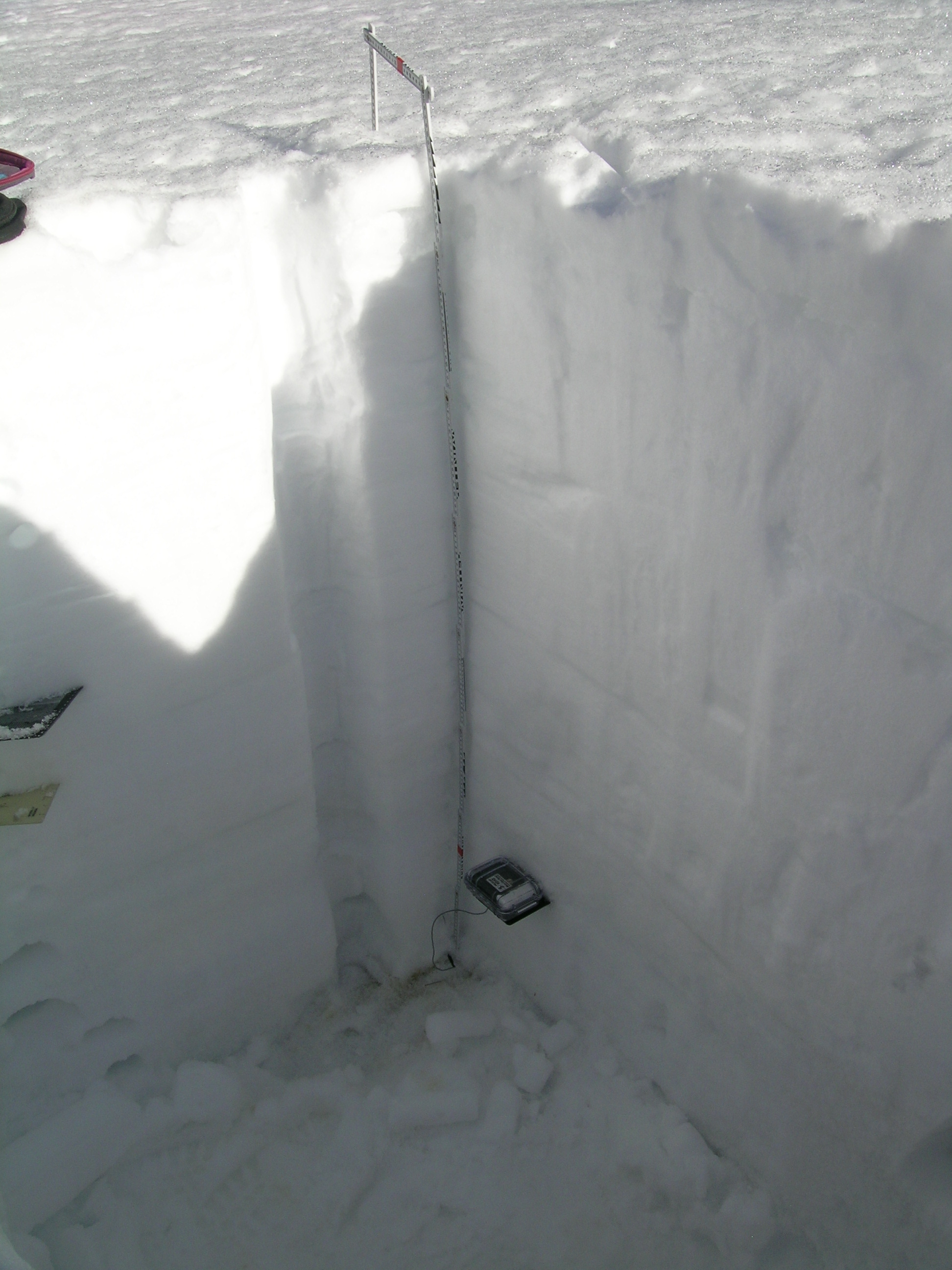
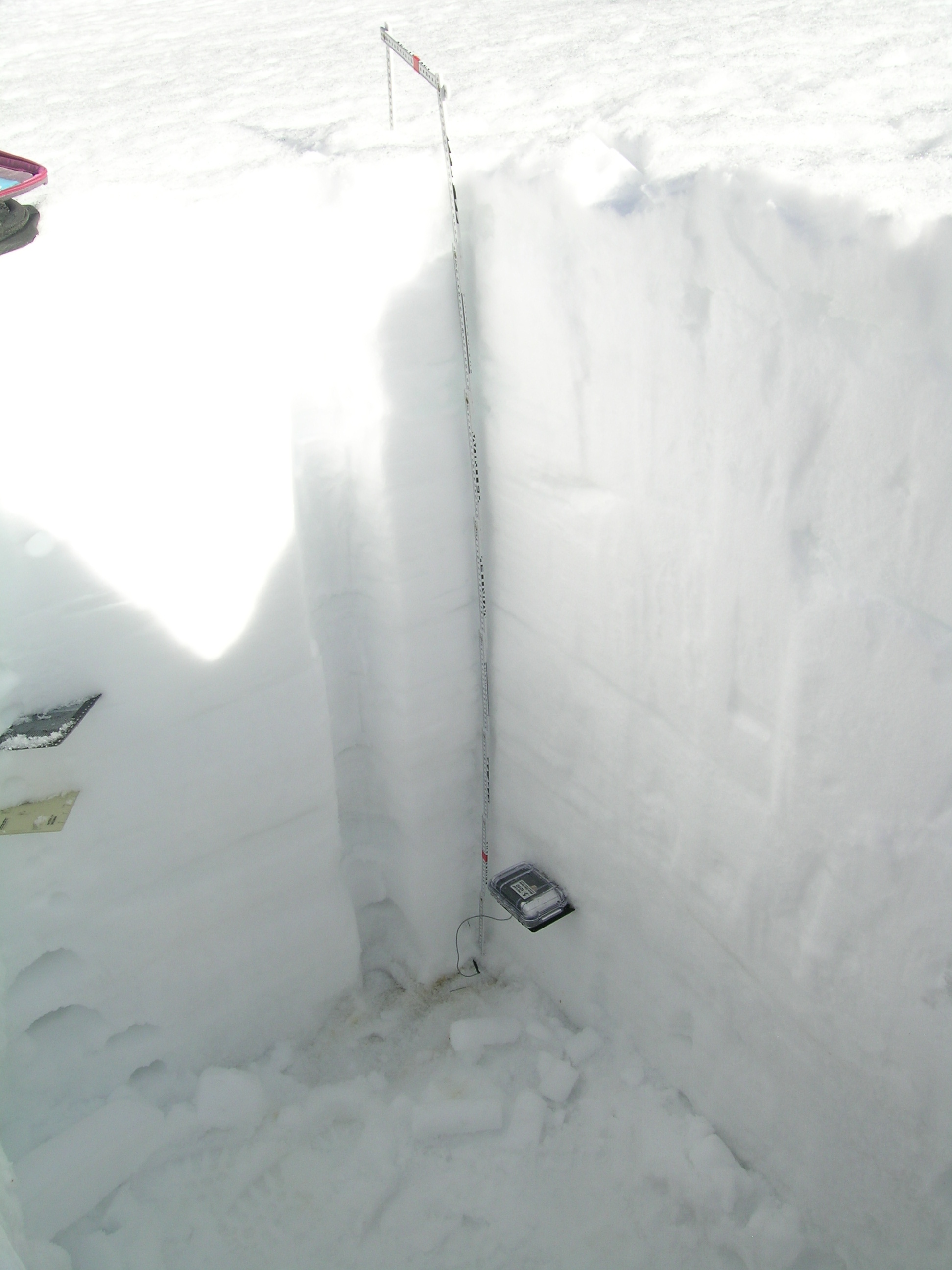
The snowcover at the Rabbit Ears Pass CODOS site has undergone complete warming since our March 14 snowpit and is now fully isothermal. As was observed during our March field work, dust loading seems stronger on the eastern side of the Rabbit Ears Pass plateau than at our CODOS site farther west, where it is comparable to that observed at Grizzly Peak, Berthoud Pass and Willow Creek Pass. While spatially variable, albedo reduction throughout this locale has been sufficient to absorb additional solar energy at the snowpack surface and contribute to ablation of the snowcover.
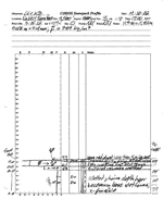
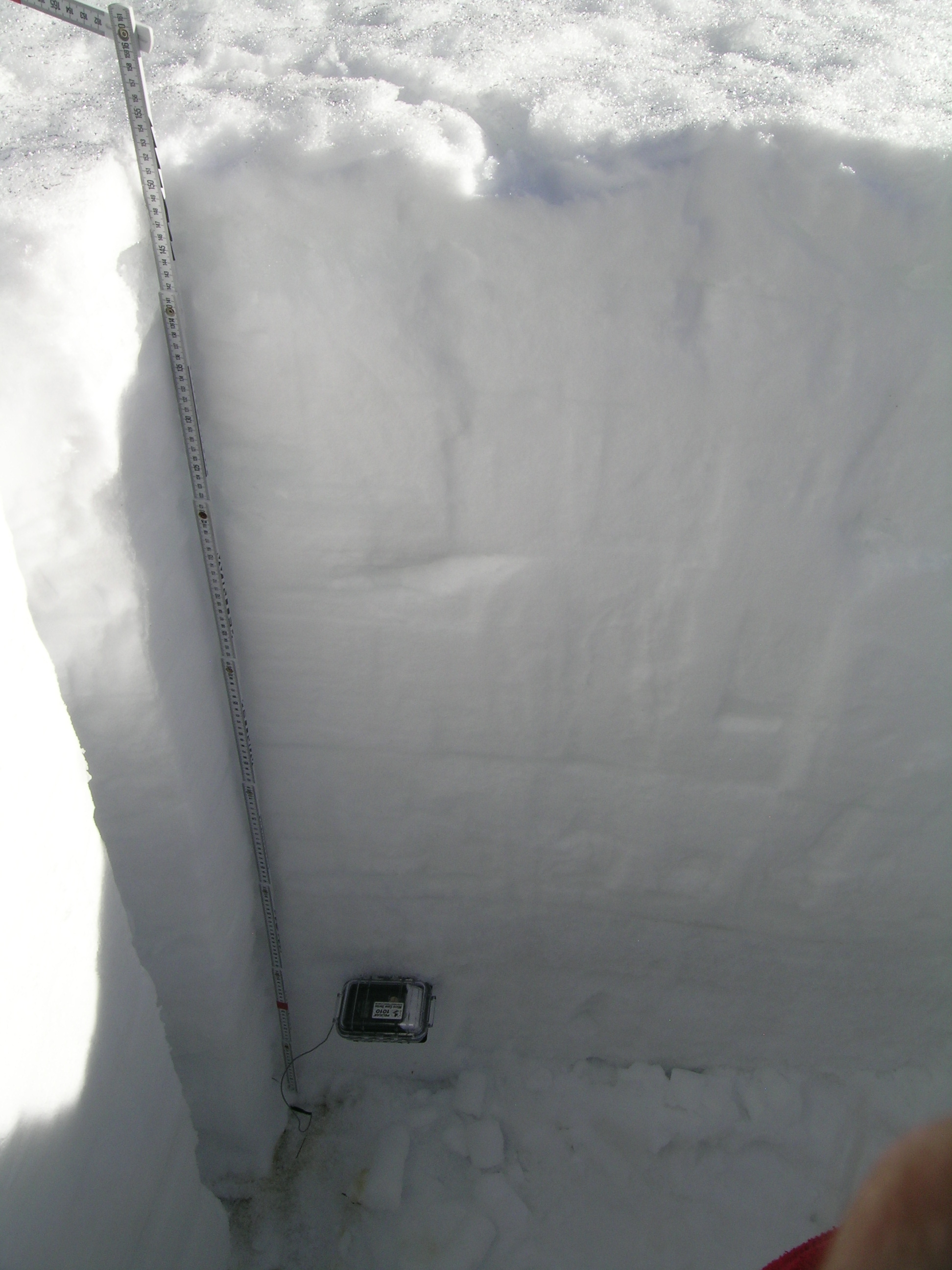
On March 15th the snowpack at our Rabbit Ears Pass CODOS snowpit site was 60” (153 cm) deep and mean snowpack temperature, at -1.0 C, was approaching isothermal. Dust event D4 was clearly evident on the snow surface at the snowpit and in terrain around Rabbit Ears Pass. SWE content in the snowpit was 19.3” (490 mm) and mean density of the snowpack was 322 kg/m3 (32.2% water content). As a result of the subsequent, prolonged period of warm, dry, and sunny weather, and further reductions in snow albedo from additional dust events, the snowpack on April 10th was fully isothermal at 0°C and wet or very wet snow throughout. Total SWE had fallen to 12.6” (319 mm), a loss of 6.7” (171 mm) since March 15; total snow depth was down to 30” (77 cm) and density had risen to 389 kg/m3 (38.9% water content).
| April 10, 2012: | |||
 |
 |
 |
 |
Pit profile |
|||
| March 15, 2012: | |||
 |
 |
 |
 |
Melt Rate
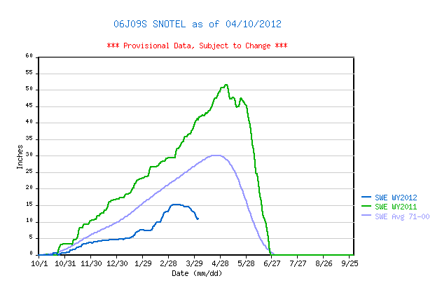
The Rabbit Ears Pass Snotel site, despite being shaded by adjoining trees, has also recorded significant snowmelt losing more than 4” of SWE since mid-March. SWE data have been interrupted since April 3rd but melt rates were up to 0.6” of SWE loss per day at that time and accelerating.
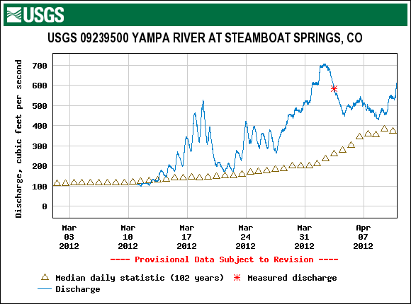
Stream Flows
Streamflow behavior at the USGS Yampa River at Steamboat Springs gauge shows significant surging in late March reaching very high flows compared to median levels at that gauge, for that period. Unsettled weather in early April brought cooler temperatures, small amounts of new snow that briefly increased snow albedo, and frequently cloudy skies, dampening the late March surge in streamflow back down to near-median values. The recent return to sunny and warm weather has initiated a new surge, once again producing flows well above median values.