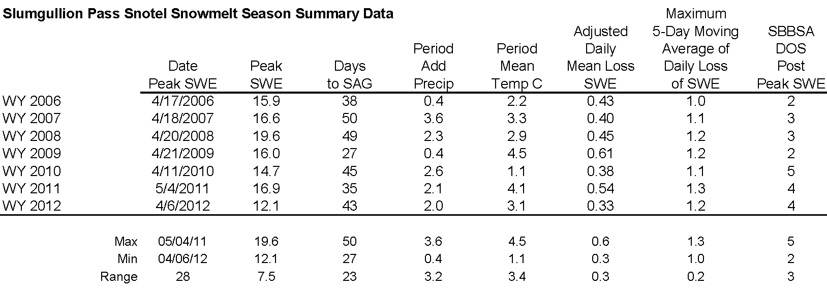
 CODOS Update for Spring Creek pASS:
April 27, 2012
Summary |
Snowpack |
Melt Rate |
Stream Flows |
Forecast |
Previous Update
Summary
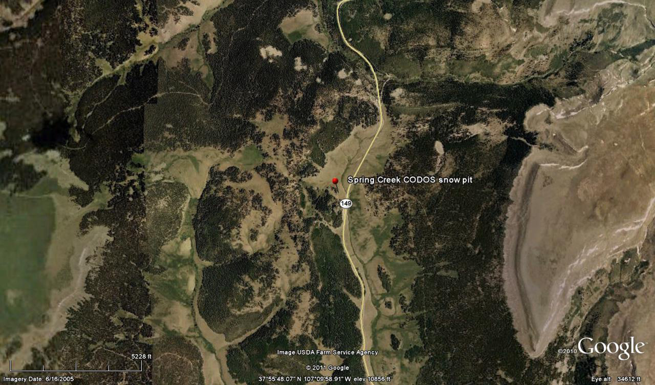
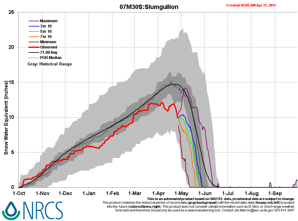
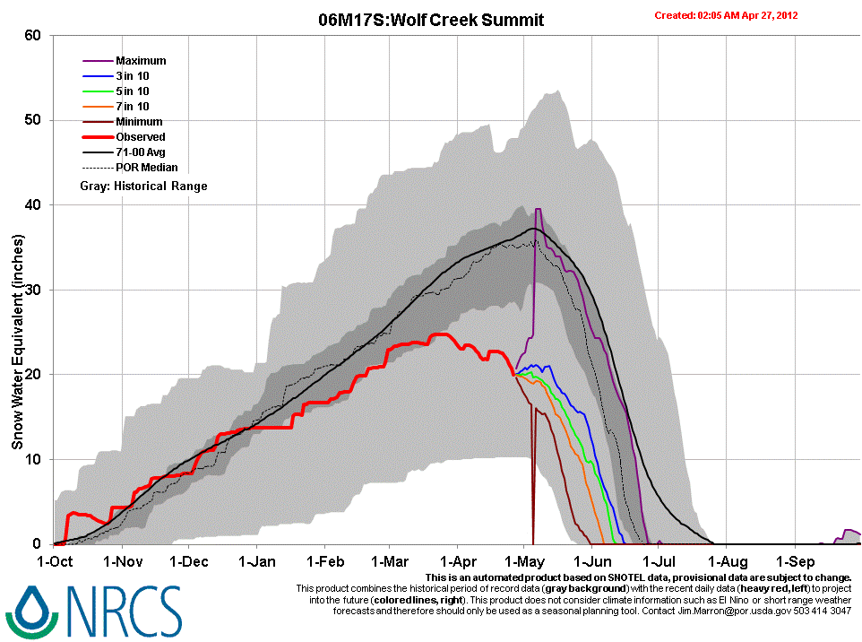
The Spring Creek Pass CODOS snowpit site, in an open NE-facing meadow, was rapidly approaching “snow all gone” (SAG) on April 9 and lost snowcover soon thereafter. All dust layers were merged at the snowpack surface and dust concentrations and albedo reductions were comparable to those observed at Senator Beck Basin the day before. After some small additions of new snow and SWE in mid-April, the nearby Slumgullion Pass Snotel has just begun losing SWE. Farther south, the Wolf Creek Summit Snotel shows similar data, with current SWE well within the lower quartile of values for the period of record. Meanwhile, despite a small gain in SWE in mid-April, the Beartown Snotel is rapidly approaching SAG and could reach SAG at a date preceding the earliest prior SAG date at Beartown, set in 2009.
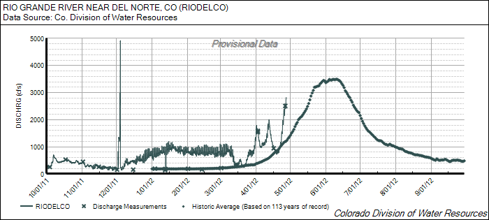
Given the early loss of this season’s scant low elevation snowcover in the Rio Grande and Gunnison watersheds, snowmelt runoff is now dependent on the snowcover remaining largely above the Snotel network, in sub-alpine and alpine terrain. As observed during our early April CODOS circuit, desert dust is present, in varying concentrations, in the snowpack at those elevations throughout the State. A late April surge in Rio Grande and Lake Fork (of the Gunnison) streamflows included the influence of re-emergent dust as clean new snow deposited in mid-month was ablated by very warm and generally sunny weather. Recent unsettled, showery, and cooler weather, with some fresh snow, has not yet substantially slowed that surge in runoff. A return to sunny and dry weather will produce a more-or-less quick return to accelerating streamflows, depending on the depth of burial by clean new snow of the merged D8-D4 dust layer, locale by locale.
SnowPack Discussion
All snowcover is gone from the Spring Creek Pass CODOS snowpit site. Our previous Spring Creek Pass Update presents this season’s single snow profile and snow cover photos.
Melt Rate
Gradual melt rates, and even small gains in SWE, prevailed at the Slumgullion Pass Snotel before SWE losses began to accelerate on April 21st, enhanced by the re-emergence of dust. Melt rates have averaged 0.45”/day since April 21st with a maximum rate of 0.7”/day (for one 24-hour period). From Peak SWE at Beartown, at 17.1” on March 23rd, to April 25th (when valid SWE data stop at 1.2”), the mean daily rate of snowmelt to near-SAG was 0.46”/day. At the Wolf Creek Summit Snotel, which also reported only gradual melt rates and even small gains in SWE in mid-April, SWE loss has recently begun to accelerate as dust re-emerges and melt rates have been as high as 0.7”/day, with nearly 20” of SWE still remaining.
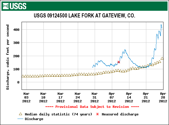
Stream Flows
Following an early April surge ending soon after our site visit, declining local streamflows in mid-April at the Rio Grande at Del Norte gauge corresponded with a period of unsettled, cooler weather and small snowfalls, and a restoration of higher snow albedo. Beginning on/about April 20, under a very strong high pressure regime bringing very warm and generally sunny weather, recent (clean) new snow was ablated by heating at the surface and, as the clean snow layer thinned and radiation penetrated that clean snow, by direct absorption of solar radiation in the dust underneath. As a result of that combination of very warm weather and reduced snow albedo, melt rates accelerated and discharge surged well above median levels. The same behavior is reported on the Lake Fork at Gateway USGS stream gauge, in the Gunnison basin.
As of this writing Friday morning, April 27th, that recent upward ratcheting in discharge shows little effect from the return to unsettled, cloudy, and cooler weather in the past 24 hours. There may be a delayed effect due to travel time from the snowmelt source area, and/or precipitation at lower elevations may have contributed to discharge. The next episode of sustained sunny and dry weather will, depending on the depth of any clean new snow recently deposited on the remaining snow covered terrain, more-or-less quickly re-expose the old, low-albedo snow surface, resuming enhanced snowmelt runoff rates.
Forecast
The National Weather Service Grand Junction office expects cooler and drier air to replace scattered snow and rain showers by later today. Another comparatively dry system passes through Colorado on Sunday as near-normal temperatures return. Then, partly or mostly sunny weather brings a return to above-average temperatures under zonal, westerly flow early in the week, but with some continued chances for scattered showers. A system from the Pacific Northwest may deliver additional precipitation to northern Colorado from mid-day Tuesday into Wednesday.