 CODOS Update for Berthoud Summit:
visited April 10, 2012
Summary | Snowpack | Melt Rate | Stream Flows | Earlier Updates
Summary
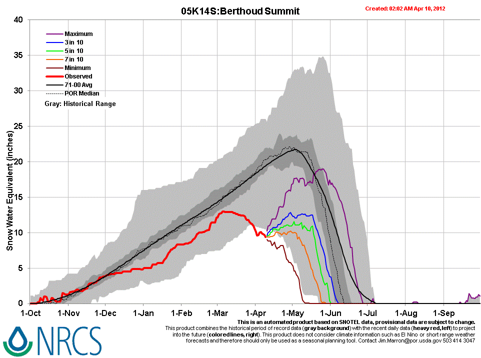
Sustained periods of unseasonably warm air temperatures and exposed dust at the snowpack surface during late March and early April 2012 have, together, initiated accelerating rates of snowmelt and SWE loss at some, but not all, CODOS Snotel sites. Some CODOS Snotel sites report significant declines in SWE approaching the lowest values in the period of record (for a given date) or even falling outside of the historic range. Those sites may have experienced Peak SWE for WY 2012 in early or mid-March. Recent CODOS snowpits near those CODOS sites mirror those losses of SWE.
In contrast, other CODOS Snotel sites and CODOS snowpits show only small losses of SWE. At those sites, energy inputs from warm air and direct absorption of solar energy by dust at the snowpack surface was consumed in warming the snowpack towards an isothermal state at 0° C, as a precursor to the loss of SWE and onset of snowmelt runoff. Since our prior site visit on March 14 the snowpack at the Berthoud Summit CODOS site has lost all cold content and is now isothermal.
The National Weather Service expects warming weather in the Colorado mountains through Wednesday with strong SW’ly winds developing on Wednesday afternoon ahead of a cooler but largely dry airmass. Unsettled and cooler weather will finish the week and run through the weekend, including chances for rain and/or snow showers each day.
SnowPack Discussion
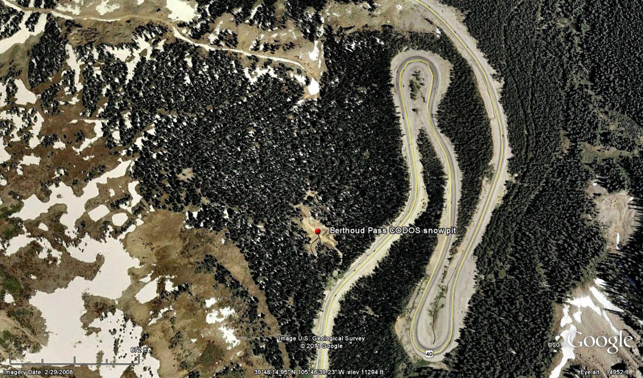
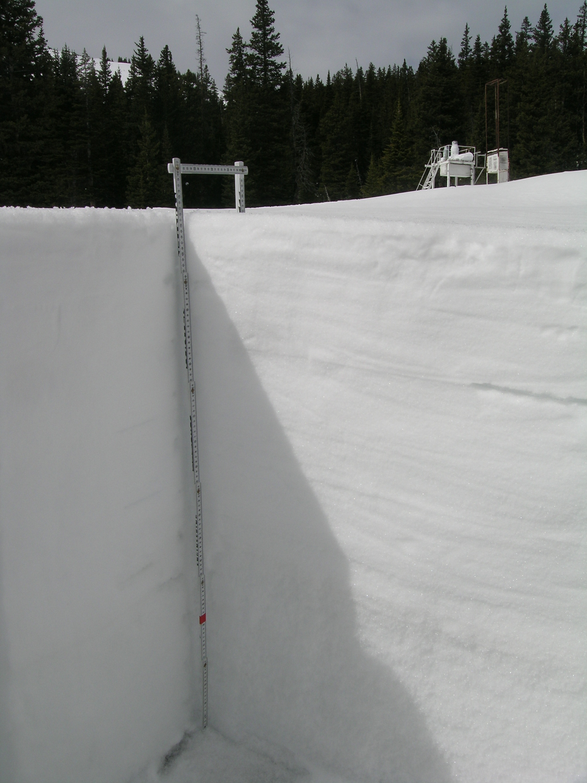
The snowcover at the Berthoud Summit CODOS site has undergone complete warming to 0°C thoughout since our March 15 snowpit and is beginning to more rapidly melt. We walked to this site on dry ground for much of the approach. Dust loading at the Berthoud Summit site is similar to that observed at Grizzly Peak - more intense than at Hoosier Pass, but still less intense than at our Senator Beck Basin study sites. Reduction in snow surface albedo has been sufficient to absorb additional solar energy at the snowpack surface and contribute to warming and ablation of the snowcover. As previously discussed, the Berthoud Summit Snotel site is in an open meadow, unshaded by the adjoining forest. As a consequence, Snotel snowmelt rate and snowpack depth data fully capture the influence of direct radiative forcing when snow albedo is lowered by dust, in contrast to other, shaded Snotel sites. Our CODOS snowpit site is located immediately in front of the Snotel station, in the same open meadow.
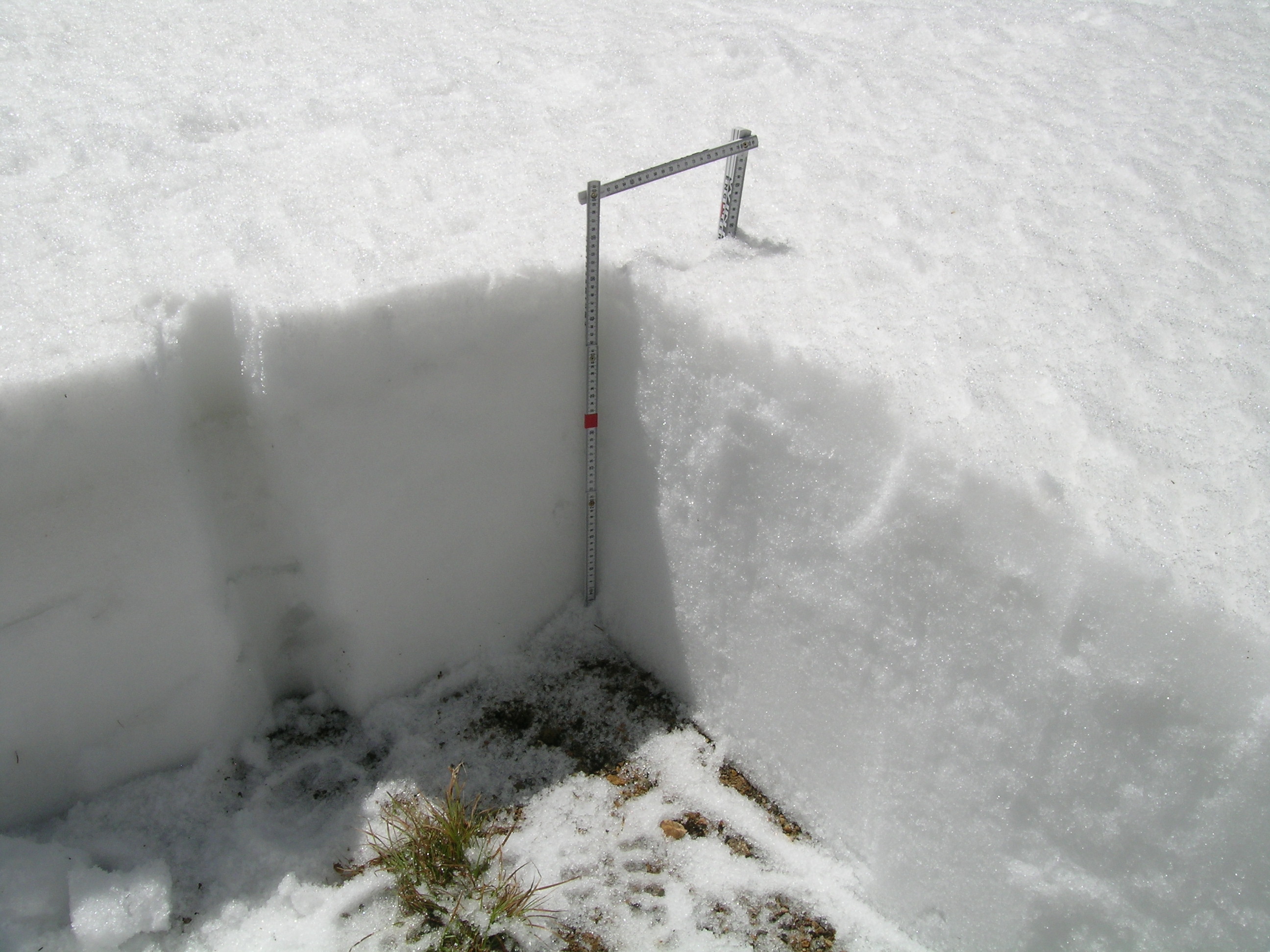
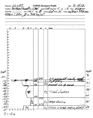
On March 15th the snowpack at our Berthoud Summit CODOS snowpit site was 44” (112 cm) deep and most of the snowpack consisted of very weak “depth hoar” grains; mean snowpack temperature was -2.6°C. Dust event D4 was clearly evident on the snow surface at the snowpit and in terrain around Berthoud Pass. SWE content in the snowpit was 13.2” (336 mm) and mean density of the snowpack was 308 kg/m3 (30.8% water content). As a result of the subsequent, prolonged period of warm, dry, and sunny weather, and some additional small reductions in snow albedo from additional dust events, the snowpack on April 10th was fully isothermal (0°C), with wet or very wet snow throughout. Total SWE in this pit was 8.7” (220 mm), a loss of 4.6" (116 mm) since March 15th; total snow depth was down to 20.5” (52 cm) and density had risen to 393 kg/m3 (39.3% water content).
| April 10, 2012: | |||
 |
 |
 |
|
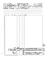
Pit profile |
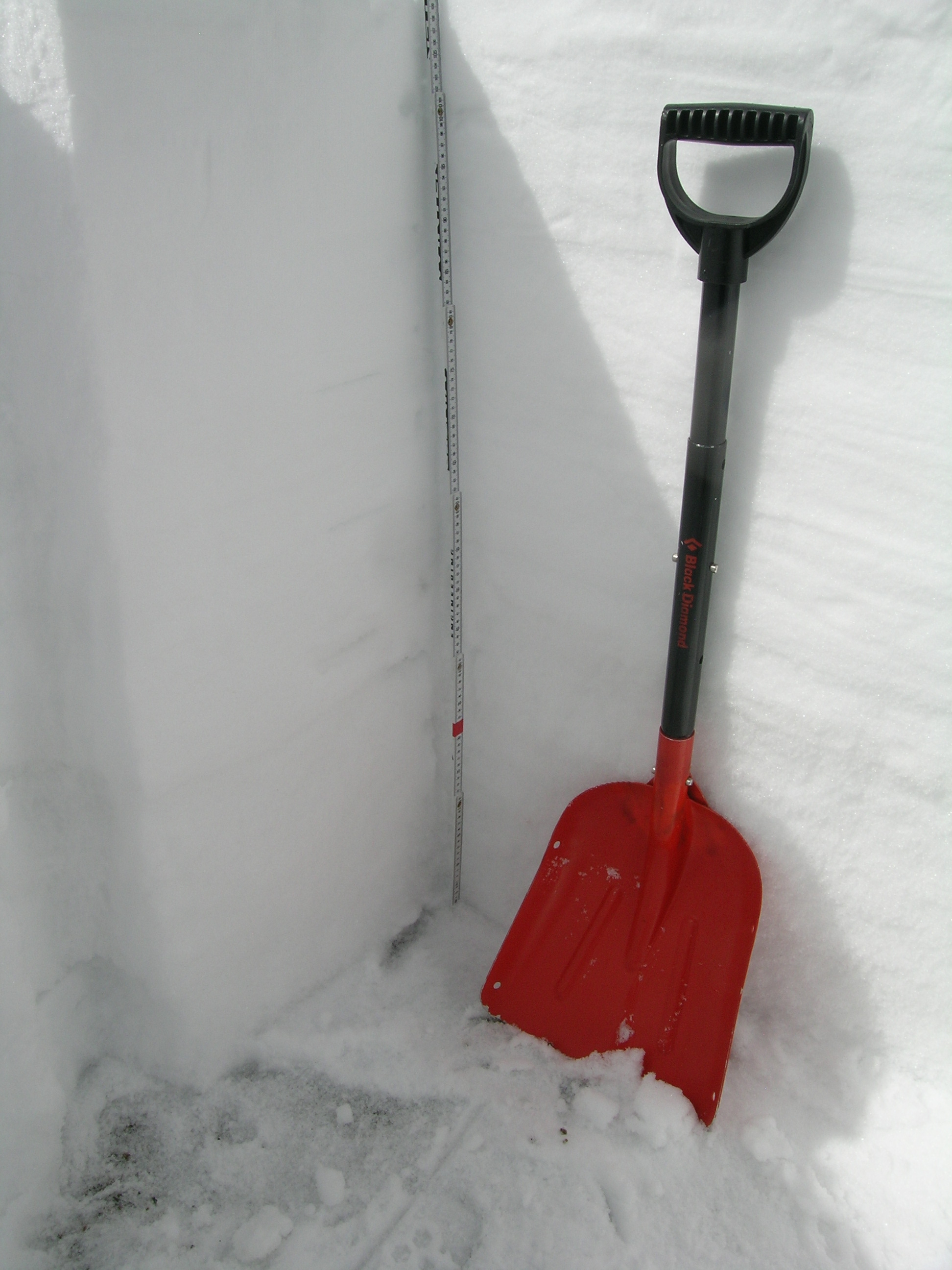
Completed pit |
Pit with Snotel in background |
|
| March 15, 2012: | |||
 |
 |
 |
|
Melt Rate
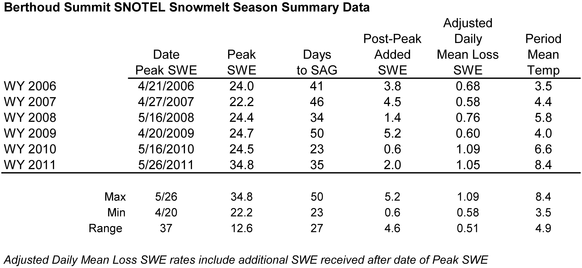
Berthoud Summit Snotel has reported a loss of 3.8" of SWE since our last site visit on March 15, 2012, not long after what may have been Peak SWE for WY 2012. This melt rate falls well short of the mean daily loss of SWE at Berthoud Summit observed in prior snowmelt seasons, as shown in the table below. However, even at current melt rates, SWE values may remain below the lowest quartile for the duration of WY 2012.
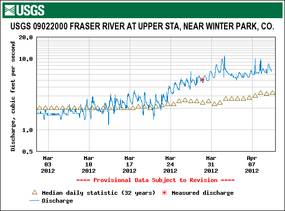
Stream Flows
Streamflow behavior at the USGS Fraser River Upper Staion near Winter Park gauge reports a brief decline in discharge in early April, after a significant surge in late March. Flows in late March were high, compared to median levels at that gauge, for that period. Unsettled weather in early April ushered in cooler air and cloudier skies for the following several days. Interestingly, flows stabilized during that period at more than double the median values.