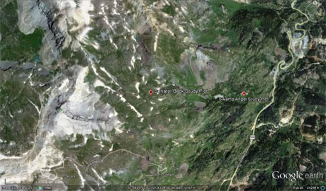
 CODOS Update for Senator Beck Basin Study Area:
Visited April 23, 2012
CODOS Update for Senator Beck Basin Study Area:
Visited April 23, 2012
Summary | Snowpack | Melt Rate | Stream Flows |
Forecast | Previous Update
Summary
Two winter storms, on April 14-15 and April 19, recently delivered more than a foot of clean new snow to Senator Beck Basin (and comparable amounts throughout the Colorado Mountains). That new snow buried the fully merged and exposed D8-D4 dust, restoring a bright, white snow snowpack surface, with high albedo. Bare ground was also well covered by this new snow.
In just the past few days, under very warm air temperatures and generally sunny skies, the merged D8-D4 dust has begun to re-emerge in Senator Beck Basin and the western San Juan Mountains, initially at lower elevations and on sunny aspects. Terrain that had become snow-free prior to those winter storms is also presenting extensive bare ground once again. Senator Beck Basin and Uncompahgre River streamflow is currently surging under these warm air temperatures and with declining snowcover albedo. A similar process is occurring throughout the Colorado mountains and may continue for another few days. Then, streamflows may moderate by the end of April, given the unsettled weather later this week and into early next week.
SnowPack Discussion
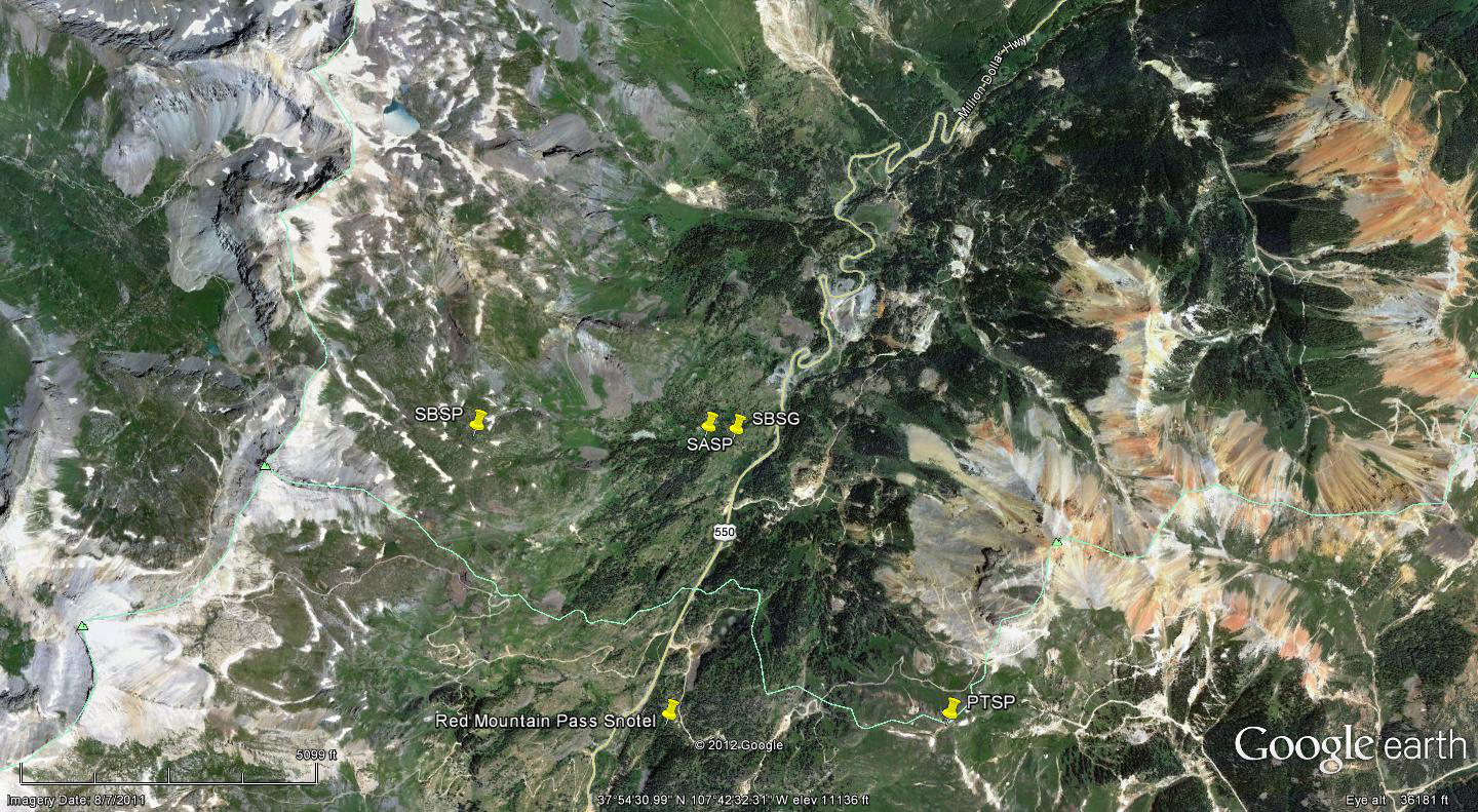
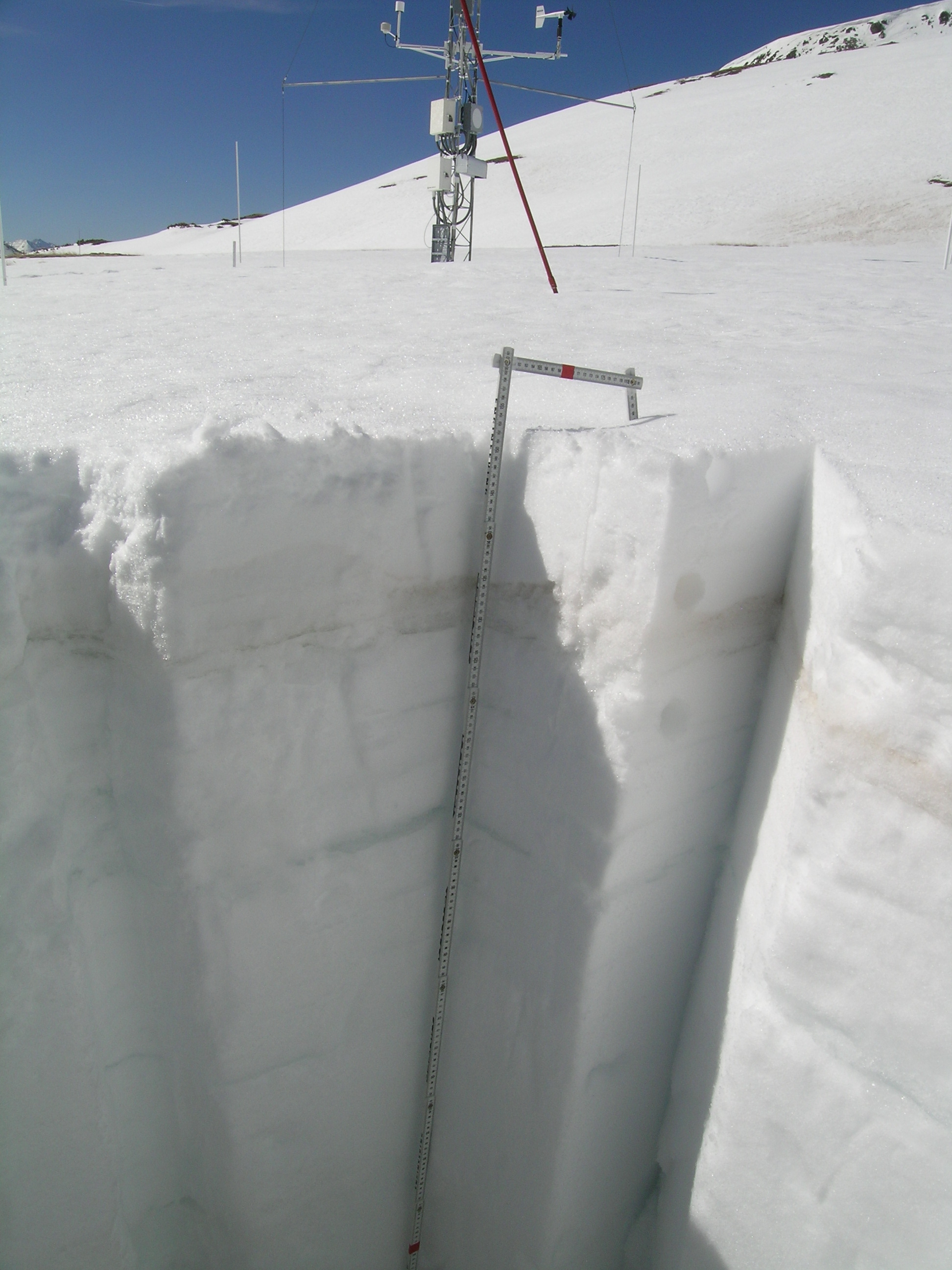
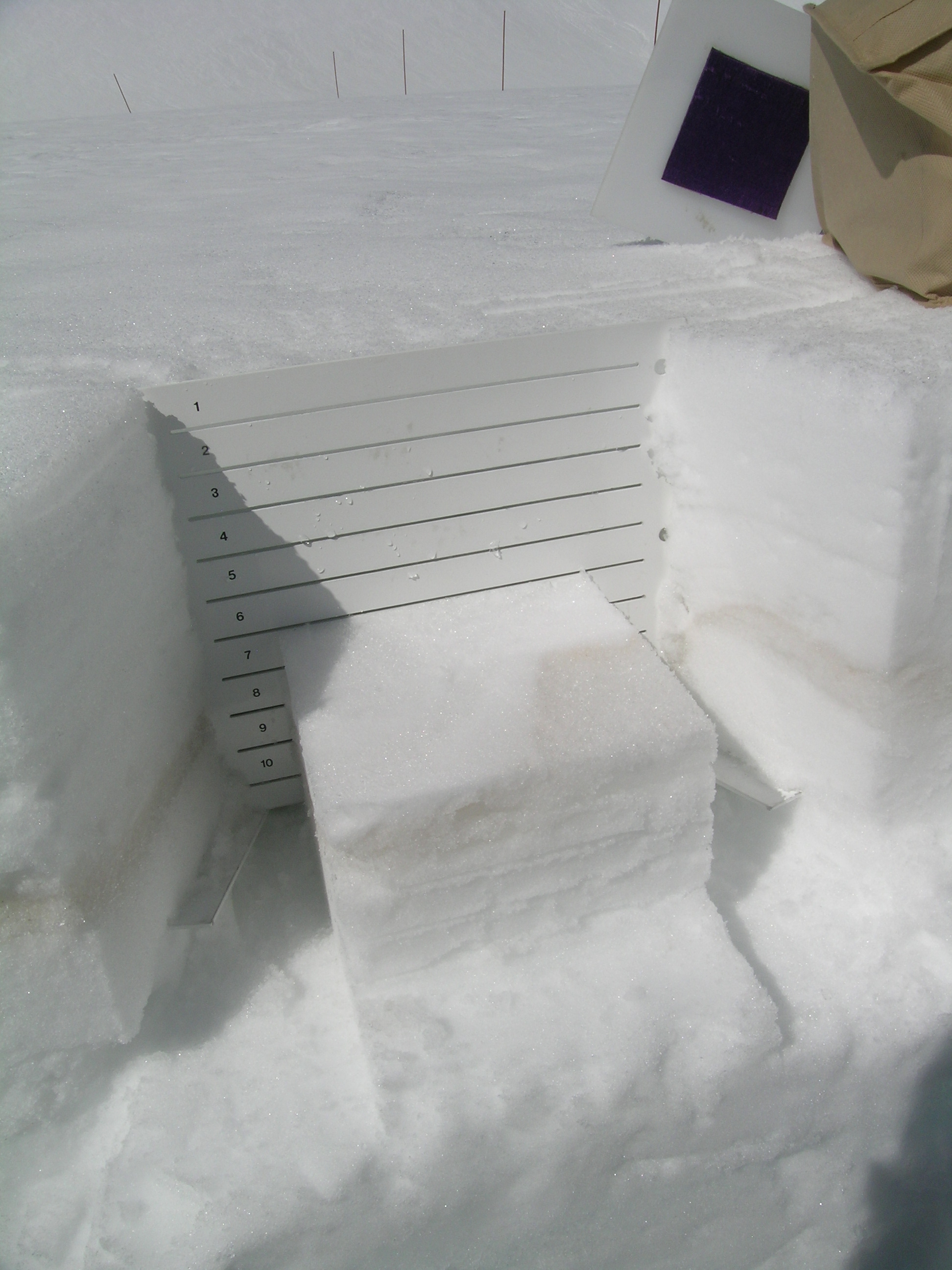
Snow profiles performed at both the Senator Beck Study Plot (SBSP) and Swamp Angel Study Plot (SASP) yesterday, April 23rd, show different stages of ablation of the recent April 14-15 (Storm 21) and April 19 (Storm 22) new snow overlying merged D8-D4 dust. At and around the Senator Beck Study Plot (12,186’), several inches of dense and clean snow continue to substantially shield the D8-D4 dust layer from incoming radiation. As a result of those two April storms, that site has gained SWE since the April 7 profile. The snowpack at SBSP remains effectively isothermal at 0° C throughout the lower meter of depth, and near-zero in the snow closer to the surface, cooled by the emission of long-wave energy overnight, under clear skies (despite above freezing temperatures all night).
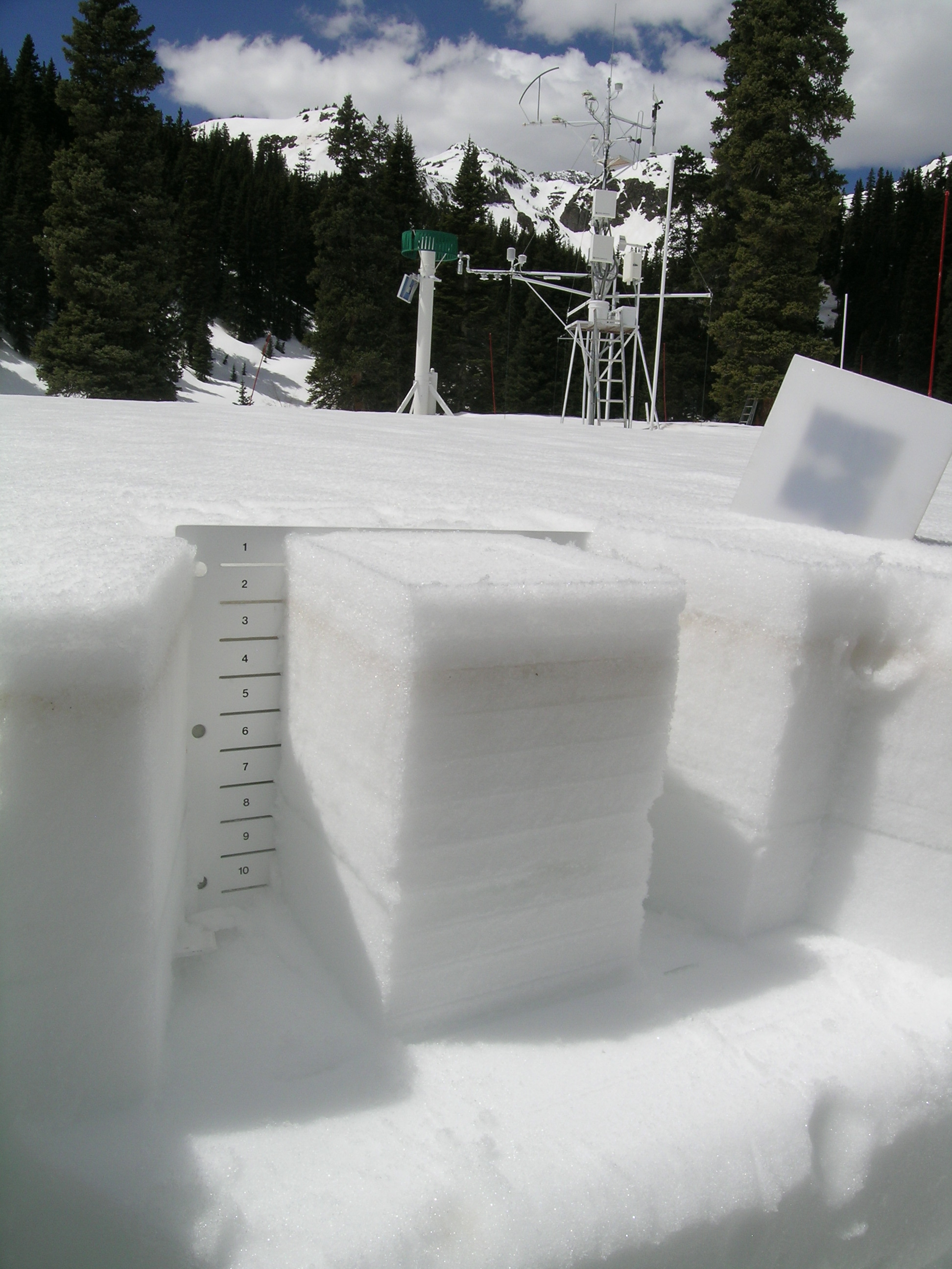
At Swamp Angel Study Plot, in our April 23rd profile, the Storm 21 and 22 new snow layer was just 2” (6 cm) thick and solar radiation was reaching the underlying D8-4 dust layer comparatively unimpeded. Even with the addition of almost 2” of SWE (50 mm) by Storms 21 and 22, SASP shows a net decline in SWE since the April 8 profile. The snowpack at SASP is fully isothermal at 0° C throughout.
| Senator Beck Study Plot: | |||
 |
 |
 |
|
SBSP pit profile April 23, 2012 |
SBSP pit April 23, 2012 |
Gravimetrics sampling April 23, 2012 |
|
| Swamp Angel Study Plot: | |||
 |
 |
 |
|
SASP pit profile April 23, 2012 |
D8 - D4 near surface on April 23, 2012 |
Gravimetrics sampling April 23, 2012 |
|
Melt Rate
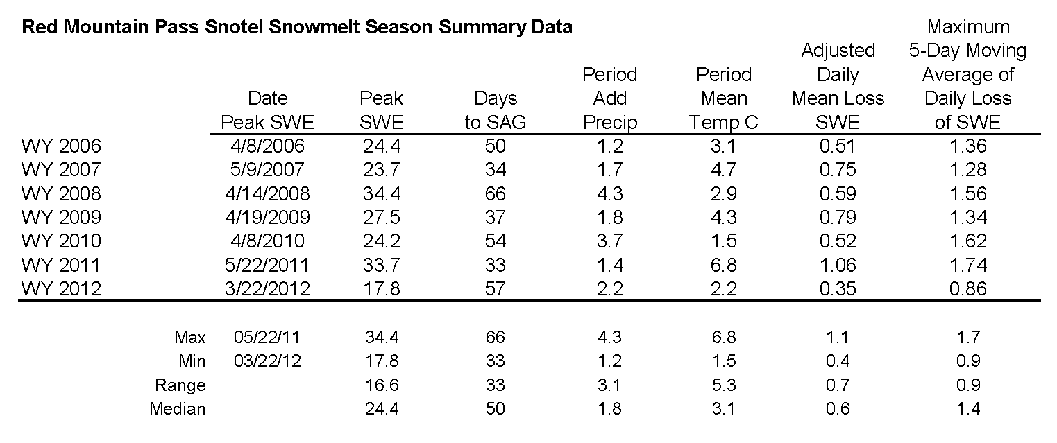
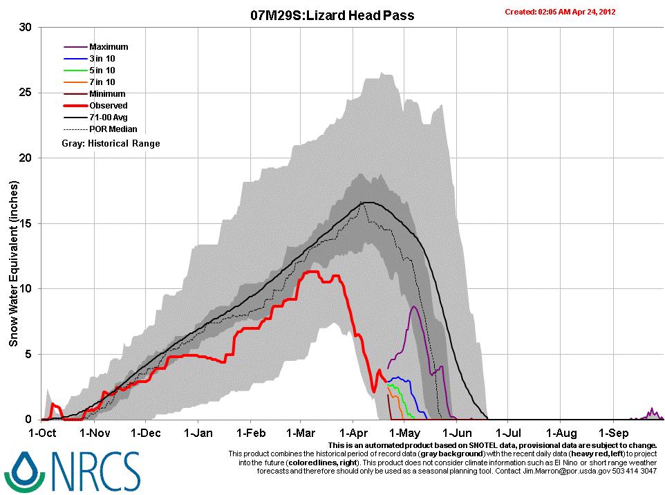
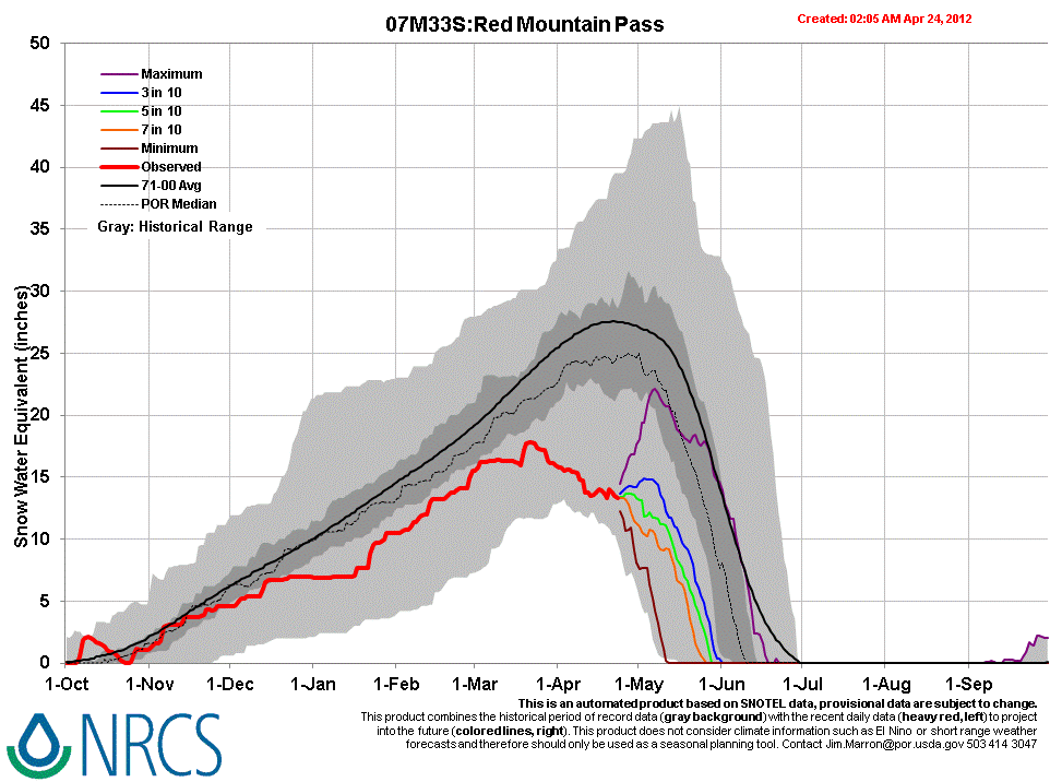
Between April 8th and April 23rd the Red Mountain Pass Snotel, at 11,200’, reports a net loss of 2.2” of SWE despite the additions during that period of 1.9” of precipitation by Storms 21 and 22, for a total loss of 4.1” of SWE over 15 days, or 0.27” per day. This is more than the net loss of 2.75” (70 mm) SWE loss measured at the Swamp Angel Study Plot from April 8th to April 23rd (including the 2” of SWE added by Storms 21 and 22), or 0.18” per day. Both sites experienced some rainfall during Storm 22, on April 19th. Farther west, the Lizard Head Pass Snotel, at 10,200’, may have lost as much as 6” of SWE (net) during this period, or 0.4” per day, and may have reached snow all gone during the past four days (no recent SWE data reported).
Stream Flows
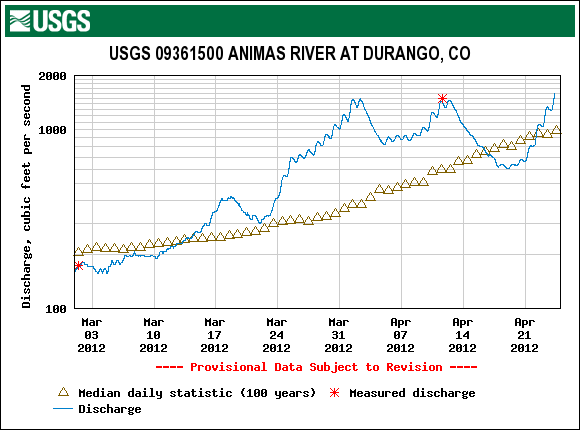
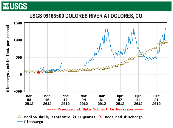
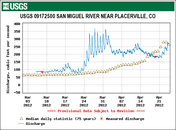
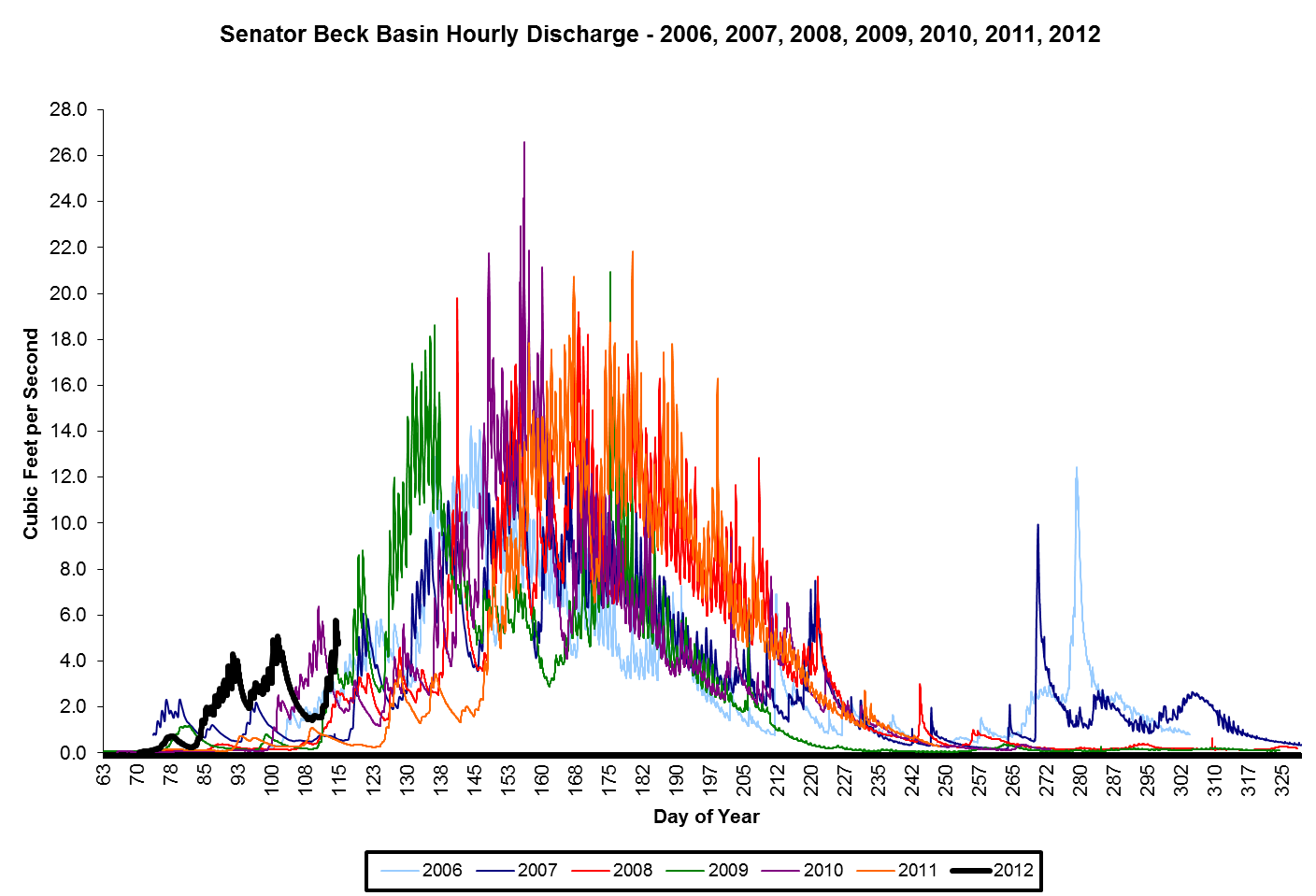
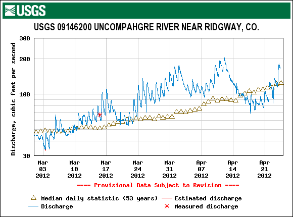
Streamflow behavior at the CSAS’s Senator Beck stream gauge and the USGS Uncompahgre at Ridgway gauge show similar declines during and following Storms 21 and 22, followed by substantial surging in flows in recent days. The USGS gauge data from the Animas River at Durango, Dolores River at Dolores, and San Miguel River near Placerville show very similar patterns.
FORECAST
Very warm temperatures continue, with increasing chances for afternoon showers culminating with “likely” snow and rain showers Thursday. Then, although models currently disagree on where a new disturbance will track into Colorado from the west, more seasonable temperatures and chances for light snow seem likely throughout the Colorado mountains over the weekend, and a cold front dropping down the east slope on Saturday/Sunday may increase chances for up-slope snowfall near the Continental Divide. Although that system will likely move east on Monday, low pressure lingering over the Great Basin may sustain unsettled and cooler weather for the Colorado mountains into next week and the beginning of May.