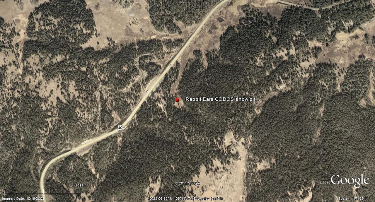
 CODOS Update for Rabbit Ears Pass:
Visited May 2, 2012
CODOS Update for Rabbit Ears Pass:
Visited May 2, 2012
Summary |
Snowpack |
Melt Rate |
Stream Flows |
Forecast |
Previous Update
Summary
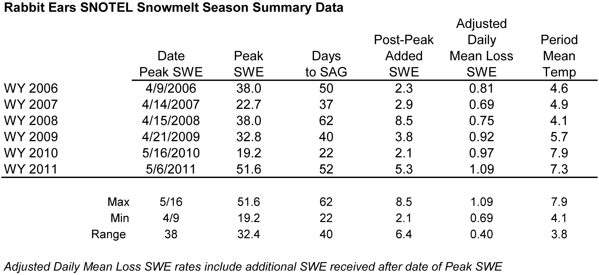
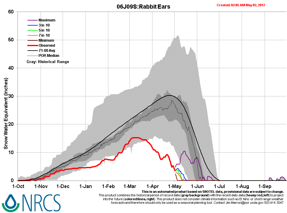
Since our prior site visit, on April 10th, Rabbit Ears Pass received additional precipitation totaling some 3.8”, largely as snow but including some rain. Two significant storms in mid-month and several other small snowfalls resulted in periodic restoration of higher snow albedo, quickly followed by a return to dust-reduced albedo values. As of today, May 2, the Rabbit Ears Pass CODOS study site has experienced a net loss of 3.4” (86 mm) of SWE since April 10th, but still retains 9.2” (233 mm) of SWE in 22” (56 cm) of wet, isothermal snow. Dust layers D8-4 were merged at the snowpack surface at lower concentration, and somewhat less albedo reduction, than those recently observed at Senator Beck Basin.
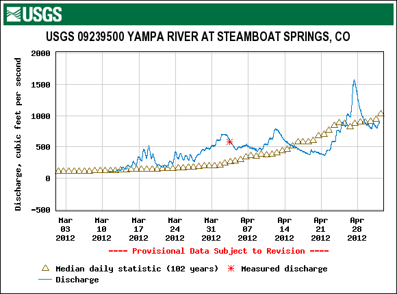
Given the early loss of this season’s scant low elevation snowcover in the Yampa River watershed, snowmelt runoff is now dependent on similarly scant snowcover remaining at the highest elevations and substantial areas of open ground are present on the Rabbit Ears Pass plateau. Streamflow data for the Yampa at Steamboat Springs show one substantial surge above median flows in late April, influenced by the re-emergence of dust, but flows have since fallen below median values, perhaps signaling that peak runoff has already occurred.
SnowPack Discussion
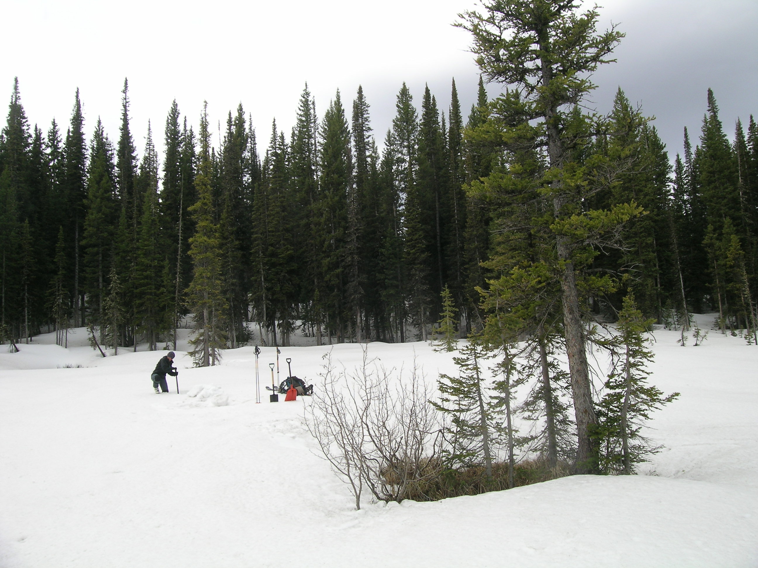
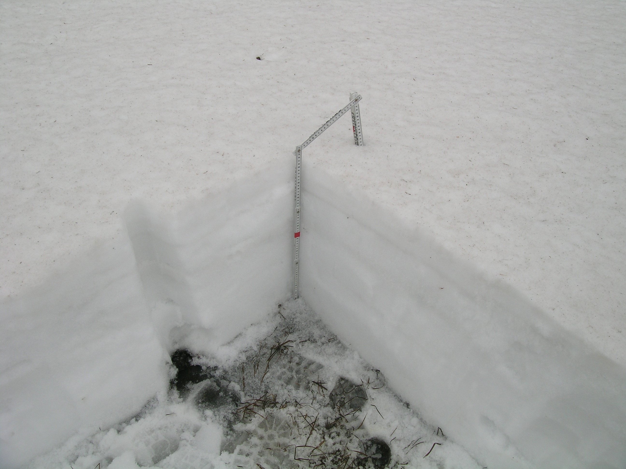
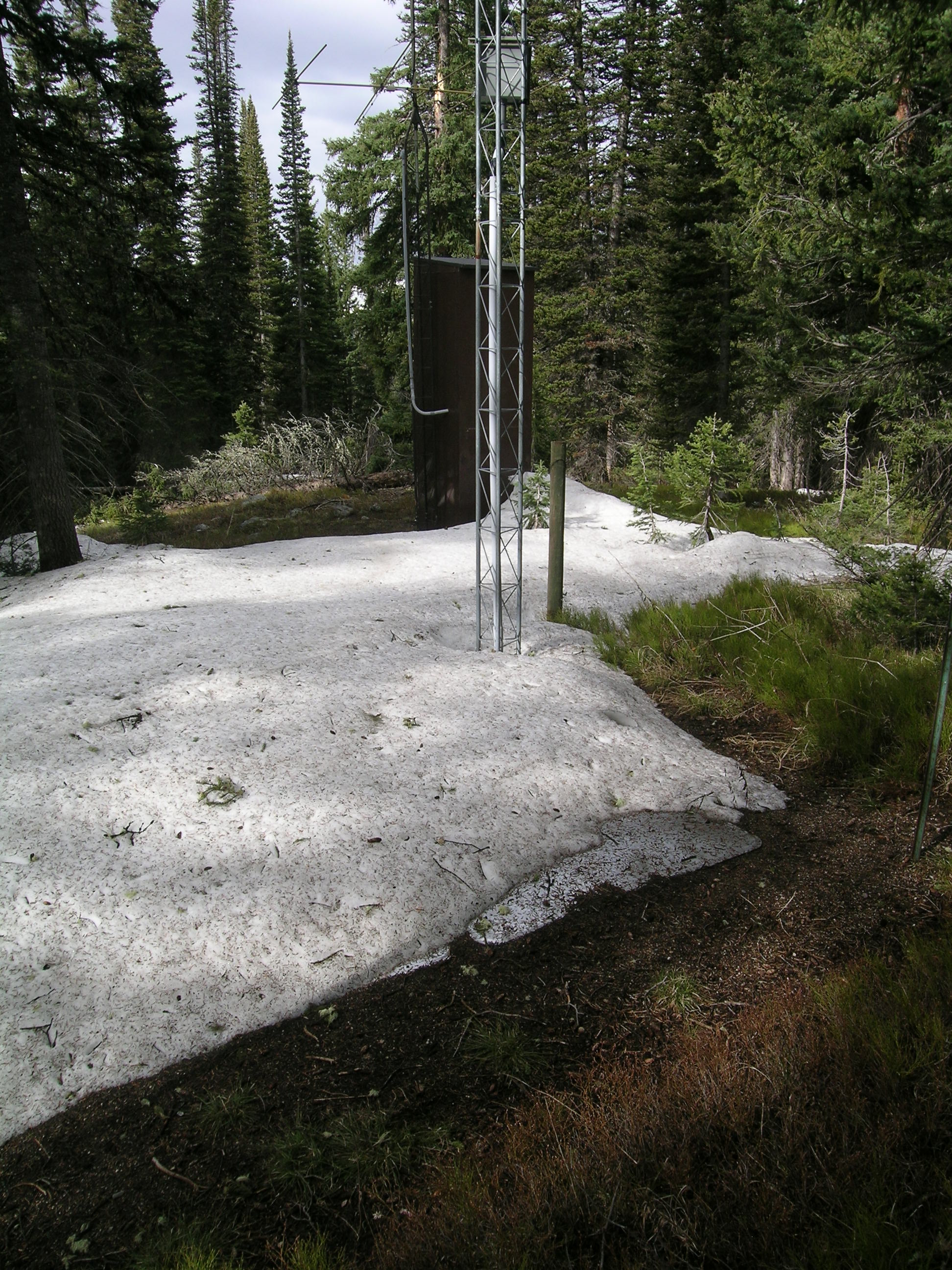
A snow profile performed today, May 2nd, at our Rabbit Ears Pass CODOS site found a completely isothermal and wetted snowpack with merged dust fully exposed throughout this open clearing, actually a wetland. Rain, rather than new snow, fell at this site the day and evening before, and overnight cloud cover had prevented any overnight re-freezing at/near the surface. Dust concentrations on the snowpack surface at this site and elsewhere on Rabbit Ears Pass are not as high as those observed at Swamp Angel Study Plot on Monday, April 30th, or on Grand Mesa on Tuesday, May 1st, but are certainly sufficient to absorb additional radiation and hasten the remainder of the snowmelt cycle.
Since our prior April 10th snowpit, total snowcover depth and snowpack SWE decreased by 8” and 3.4”, respectively, despite additions of nearly 4” of precipitation from new snow during mid-late April and rain as recently as the night before our visit. This snowpit plot still retains 22” of snow containing over 9” of SWE, but small patches of open ground are emerging at this site.
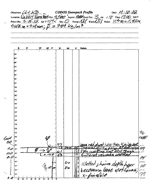
| April 10, 2012: | |||
 |
 |
 |
 |
Pit profile |
Rabbit Ears Snotel |
||
| April 10, 2012: | |||
Melt Rate
Following Peak SWE of 15.2” on March 6th -13th, melt rates slowly accelerated up to 0.9” SWE per day, coinciding with deposition of dust layers D6, D7, and D8, through mid-April. Some additions of SWE followed and restored higher snow albedo, in mid-late April, before the re-emergence of the merged D4-D8 dust to the snowpack surface and resumption of snowmelt rates of 0.8-1.0” per day for several days at the end of the month. At current melt rates, the remaining snow on the Rabbit Ears Pass Snotel pillow, part of which is already exposed, will be short-lived and this site will experience its earliest date of SAG in its period of record.
Stream Flows
WY2012 streamflow data for the USGS Yampa River at Steamboat Springs gauge began in March with a sequence of small surges at and above daily median levels. Flows moderated back to median levels during the unsettled weather in mid-April before showing a strong surge later in the month. Given the advanced ablation of the sub-par snowpack in the Yampa River watershed, officials with the Colorado Basin River Forecast Center, National Weather Service, and Natural Resource Conservation Service – Snotel program have expressed concern that the Yampa River may have already experienced its runoff peak flows (Steamboat Today – May 1st headline: Yampa Likely Peaked).
Forecast
Although models provide differing scenarios, the National Weather Service Grand Junction office currently expects a somewhat drier and warmer southwesterly flow Thursday, possibly producing critical fire weather by Friday afternoon, mainly over the southwestern corner of the state. Then, over the weekend, a trough in the Pacific Northwest may begin ejecting a series of relatively dry disturbances, with best chances for afternoon showers in the northern part of the state. Uncertainty remains about how that trough may split and pass through, or around, Colorado early next week.