Avalanche Information
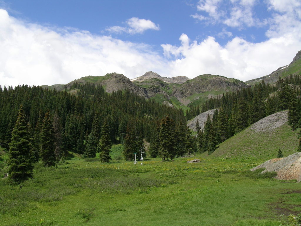
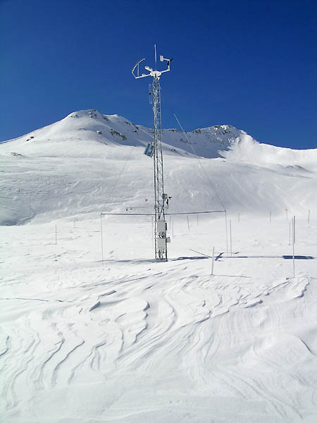
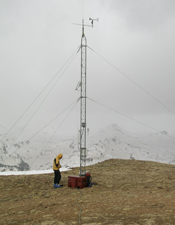
The Center for Snow and Avalanche Studies serves the international mountain science community and regional water resource managers by hosting and conducting mountain system research and collecting integrative, real time, year-round mountain system observations. Mountain system research includes monitoring regional climate trends influential to snow melt, remote sensing of snowpack, snow and ice microstructure, and The Colorado Dust on Snow Program. Mountain system observations are collected remotely from three weather stations at Senator Beck Study Plot, Swamp Angel Study Plot, and Putney Study Plot. Data includes information about weather, snowpack, radiation, soil, and hydrologic signals. By incorporating this research and information we are able to contribute to the understanding of water resource availability, from mountain snow, on a regional and global scale.
CSAS does not forecast for avalanche hazard nor do we provide avalanche instruction. However, our resources and research do support avalanche science, forecasting, and education. Researching snow microstructure, and impacts of dust on snow, is valuable for the science of slab and weak layer formation. In addition, the Senator Beck Basin weather stations are a valuable tool for avalanche forecasters, human powered and mechanized ski operations, as well as backcountry travelers; all of who need to have an understanding and awareness of weather and snowpack trends for messaging, safety, and route planning. Data from these weather stations can be found at Colorado Avalanche Information Center’s Weather Stations website (CAIC), and at CSAS’s website under the data tab. We are pleased to support the avalanche community through these resources. We encourage you to seek further avalanche information through your regional avalanche forecast center such as the CAIC, or by taking an avalanche education course with one of your local avalanche education providers such as Silverton Avalanche School.
CSAS’ roots are tied to the San Juan Avalanche Project (1971-1975) that included avalanche researchers like Edward LaChapelle and Don Bachman. Former CSAS board member and pioneering avalanche forecaster Don Bachman is attributed with saying ‘Silverton is the center of the avalanche universe.’ This statement comes from the fact that the town of Silverton and its surrounding roads are significantly exposed to avalanche hazard. This is due to the abundance of high elevation and complex avalanche terrain coupled with the weak continental snowpack. Avalanche terrain is classified using Parks Canada Avalanche Terrain Exposure Scale. Complex terrain is defined as exposure to multiple overlapping avalanche paths and starting zones with terrain traps below. As one travels through the San Juan Mountains it becomes evident that avoiding avalanche terrain is difficult, with avalanche paths often threatening from multiple aspects and terminating in forests, deep gullies or cliffs magnifying the consequence of a slide. A continental snowpack is a consequence of climate conditions in the interior of a land mass where snow depth tends to be shallow and temperatures can have extreme lows. This is typical of the San Juan Mountains. These conditions promote water vapor movement from snow crystal to snow crystal forming sugar-like faceted grains. The facets can range from small angular grains to large striated depth hoar, can persist for entire winters, and lack cohesion. When a slab of more dense and cohesive snow forms, by way of snowfall or wind deposition, on top of these angular persistent grains there is a recipe for avalanches: A poor structure of strong snow on top of weak snow.
The complex terrain combined with a fragile snowpack structure has been a challenge for visitors and residents in this region since mountain settlement century and a half ago. Betsy Armstrong came to Silverton in the 1970s to work on the Institute of Alpine and Arctic Research San Juan Avalanche Project, and proceeded to study the history of humans and avalanches dating back to the mining rush of the 1870s. This is documented in her research Century of Struggle against Snow: A History of Avalanche Hazard in San Juan County, Colorado. In more recent history Colorado is the state with the highest number of avalanche fatalities, since 1951, with 287 followed by 158 in Alaska. Of most note is the Historic Colorado Avalanche Cycle of March 2019 in which much of the state was under Extreme Avalanche Hazard, avalanche paths were redefined, and avalanche size was at its greatest in approximately 300 years. The San Juan Mountains and the state of Colorado are known for excellent powder snow and wonderful access to mountain landscapes. These circumstances bring numerous visitors and new residents to the state to enjoy winter recreation opportunities. However, it is important to be aware that these same conditions are conducive to the formation and release of avalanches. For this reason, the San Juan Mountains have been a formative location for avalanche forecasting and avalanche science, since the formation of the San Juan Avalanche Project in the 1970s.
It cannot be over stressed that if you wish to recreate or work in this landscape it is critical that you get proper training on avalanche risk management, recognition of unstable snow, carry proper rescue equipment, and learn how to carry out an avalanche rescue. Know Before You Go Avalanche Awareness is an excellent starting point. If you want to know more take a Recreational Level 1 Avalanche Course and an Avalanche Rescue Course. If you want to pursue a career in the snowy mountains look into the American Avalanche Associations Professional Training Program. Remember to also review and understand the publicly available avalanche forecast before you head out.
Below are a few avalanche links that are worth checking out:
Everybody who travels in snowy mountains needs to know about avalanches. The place to start is with a free Know Before You Go avalanche awareness program. These presentations take place regularly in mountain communities, so keep an eye out. The website is loaded with great information as well. https://kbyg.org
The AvalancheGuys YouTube channel from Gallatin National Forest Avalanche Center, based in Montana, is an excellent resource for snowpack assessment how to videos, avalanche discussions, and recorded lectures from Professional Development Workshops. You don’t have to live in Montana to get something out of this resource. https://www.youtube.com/user/AvalancheGuys
The American Avalanche Association (A3) helps keep people safe in avalanche country through education, outreach and publication; by setting proficiency and guidelines for professional and recreational courses, supporting regional Snow and Avalanche Workshops, and producing ‘The Avalanche Review’ and ‘The Snowy Torrents’. Everybody interested in snow should consider becoming an A3 Member to support and stay up to date with the avalanche industry.
https://www.americanavalancheassociation.org
SnowPilot is a free software platform to record and view snow profiles from across the world. By using this resource, you can keep track of the snowpack in your home mountains or in a region you plan to visit. By recording your snowpits you will be contributing to a database of snow and avalanche information. https://snowpilot.org
Colorado Avalanche Information Center (CAIC) should be bookmarked on your computer. The website not only has avalanche info but tons of weather station data, forecast models, and education links.
Silverton Avalanche School has been providing publicly available avalanche education since the 1960s and continues to offer recreational, professional, tactical and custom avalanche courses. http://avyschool.com/
Avalanche.org tutorial: https://avalanche.org/avalanche-tutorial/get-the-forecast/
The International Snow Science Workshop is the world’s largest conference for snow and avalanche related topics. It happens every two years and alternates locations from Europe to North America. Montana State University Library holds International Snow Science Workshops (ISSW) Proceedings of Professional Papers and Poster Talks. Through the MSU library you can access decades worth of snow and avalanche science research.
The American Institute for Avalanche Research & Education (AIARE) released some new videos online on how to practice avalanche rescue for both skiers and snowmobiles:
How to Practice Avalanche Rescue:
https://www.youtube.com/watch?v=T2LnkU0ZCU0&t=193s
How to Practice Avalanche Rescue: Snowmobile Edition
https://www.youtube.com/watch?v=2ML499MMDfM&t=182s
There are also videos built for folks practicing for their A3 Pro 1 Rescue Exam, here:
Preparing for your A3 Pro 1 Rescue Exam: Snowmobile Edition: https://www.youtube.com/watch?v=q0gbQewjJ-o&t=42s
Preparing for your A3 Pro 1 Rescue Exam: https://www.youtube.com/watch?v=85dscc2oYiQ&t=84s
Avalanche Cycle 2019
In March 2019 Colorado saw an avalanche cycle not witnessed in our lifetimes. The 9.4” of water from 4 storms at the CSAS Senator Beck study plot at Red Mountain Pass and a lot of inclement weather, that fell in the first 23 days of the month made the SNOTEL data plots increase sharply. Most of the Colorado Mountains received 150%-300% of normal precipitation during these storms. The early March storms brought wind gusts upwards of 80 mph and our second dust-on-snow event of the season. The March 13 storm was associated with a bomb cyclone, a rapid drop in pressure, that brought an equivalent to that a category 2 hurricane at its central pressure. The March 20 storm brought two feet of snow in portions of the San Juan Mountains and gusts of up to 60 mph.
However, the rapid loading of an already loaded snowpack (sitting on a weak early season basal layer) resulted in an epic avalanche cycle that made March so historic. The relatively dense, strong, dry storm slab that formed in March propagated fractures as long as 2,800m (~9,000 feet). Large-volume, high-density historic avalanches, occurred, many with return periods of 100-300-years. Large avalanches fell from various exposures, unlike more typical avalanche cycles that may favor certain exposures. See this nice article from the Aspen Times about a huge avalanche in Conundrum Creek near Aspen, Art Mears, avalanche consultant and a CSAS Board member, commented that this was “the largest Colorado avalanche I know of in my 46 years consulting”. Also see this article by AAA in The Avalanche Review issue 38.3 for an engineer’s perspective about the uniqueness of the period. Colorado Avalanche Information Center (CAIC) reported over 600 slides just in the first half of March, that being likely only 25% of the total over that period. Please see a small subset of photos below of avalanches in March. CAIC has an archive of documented slides that are necessary reading for any winter backcountry enthusiast. Driving in the Colorado Mountains in summer one sees a transformed landscape with substantial forest removed and existing avalanche paths widened and extended.
How can climate change influence avalanches? See the Aspen Times article here.
The below pictures are general pictures of the avalanche cycle
Ed LaChapelle Archive and Library
Edward Randle “Ed” LaChapelle (May 31, 1926–February 1, 2007) was a renowned avalanche researcher, glaciologist, mountaineer, skier, author, solar power enthusiast and professor. He was a pioneer in the field of avalanche research and forecasting in North America. Ed LaChapelle’s collection is housed at the San Juan County Historical Society Archive Building. For an inventory of the collection see this spreadsheet.
U.S. Mountain and Bird Brain Avalanche
Rick Trujillo from Ouray put together documentation of the U.S. Mountain Slide, a snow avalanche situated some five miles SW of Ouray. This avalanche has run only twice in recorded history, in March of 1906 and in January of 1974. Both times it affected the surface facilities of the lower level of the Camp Bird mine some five miles southwest of Ouray.
Rick worked as a geologist at the Camp Bird mine in the 1970s and was there when the U.S. Slide came very close to destroying the mill in January 1974, something that this very same avalanche had done in March 1906. Although, this avalanche did not run in the heavy avalanche winter of 2018-19. Rick figured that since he took what are probably the only first-hand photographs of the 1974 aftermath, that these might be of historical interest to avalanche researchers.
Also documented is the Bird Brain Couloir avalanche which destroyed a recently built house and surrounding forest some four miles up Canyon Creek, southwest of Ouray. What makes this avalanche unusual is that it has essentially no catchment area for snow to accumulate, all source snow areas being very steep. Perhaps one could say that Bird Brain is more like a bank slide, though big enough to destroy a forest and a building.
Click here to download U.S Mountain & Bird Brain Avalanche zip file